308 walks in The Lake District
Three hundred eight easy-to-follow, hand-crafted walks including routes from Ambleside, Keswick, Langdale, Brothers Water, Grasmere, Ennerdale, Derwent Water, Loweswater, Patterdale, Ullswater, Buttermere, Honister, Eskdale, Coniston, Ennerdale, Thirlmere, Seatoller, Hawkshead, Glenridding, Braithwaite, Kentmere, Wasdale Head & Windermere that climb Scafell Pike (the highest point), Helvellyn, Skiddaw, Great Gable, Loughrigg, Hay Stacks, Cat Bells & all the major fells. More details about each walk can be found below the map.
The Lake District National Park is located in North West England, wholly within the county of Cumbria.
Interactive Map of Walks in The Lake District
 How to Load this interactive map: Due to usage restrictions, you must be Registered and Logged-On to go4awalk.com to view and use the interactive Google Map below. You do not need to purchase any credits, but you must be Registered and Logged-On.
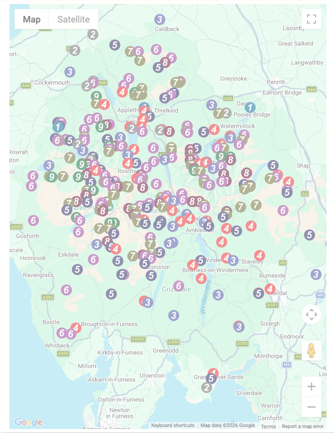
You can use these checkboxes to show only the grades of walk you are interested in:-
Three hundred eight easy-to-follow, circular, walk route maps in The Lake District in Walk Grade Order
See this list of walks, routes & maps in:
Grade Order | Length Order | Time Order | Walk Number or Start Location Order
NB. To reverse (toggle) this order, click Grade Order again
Scroll down the list of walks below & click on each walk title (in blue) to locate it on the map above.

   |
Vital Statistics:
| Length: | 10.25 miles (16.5 km) |
| Ascent: | 3,585 ft (1,093 m) |
| Time: | 7½ hrs |
| Grade: |  |

Route Summary:
Hawes End - Derwent Water - Skelgill Bank - Woodford's Path - Cat Bells (Catbells) - Maiden Moor - High Spy (North Top) - High Spy - Dalehead Tarn - Dale Head (Newlands) - Hindscarth - High Crags - Scope End - Low Snab Farm - Newlands Church - Little Town - Newlands Valley - Hawes End - Derwent Water.


|
Vital Statistics:
| Length: | 11 miles (17.5 km) |
| Ascent: | 4,782 ft (1,457 m) |
| Time: | 8.75 hrs |
| Grade: |  |

Route Summary:
Wasdale Head - Mosedale Beck - Black Sail Pass - Looking Stead (Pillar) - High Level Route - Robinson's Cairn - Pillar - Wind Gap - Black Crag (Pillar) - Scoat Fell (Little Scoat Fell) - Steeple - Red Pike (Wasdale) - Dore Head - Yewbarrow (North Top) - Yewbarrow - Dropping Crag - Bell Rib - Over Beck - Wasdale Head - Wast Water.

|
Vital Statistics:
| Length: | 7.5 miles (12 km) |
| Ascent: | 2,519 ft (768 m) |
| Time: | 5.25 hrs |
| Grade: |  |
Route Summary:
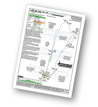
Ambleside - Snarker Pike - Red Screes - Scandale Pass - High Sweden Bridge - Ambleside

|
Vital Statistics:
| Length: | 7.25 miles (11.5 km) |
| Ascent: | 1,247 ft (380 m) |
| Time: | 3.75 hrs |
| Grade: |  |

Route Summary:
Windermere - Orrest Head - Moorhowe - Dubbs Road - Garburn Road - Longmire Road - Far Orrest Farm - Orrest Head - Windermere

|
Vital Statistics:
| Length: | 4.5 miles (7.5 km) |
| Ascent: | 1,296 ft (395 m) |
| Time: | 3 hrs |
| Grade: | |

|
Vital Statistics:
| Length: | 9.5 miles (15 km) |
| Ascent: | 2,140 ft (652 m) |
| Time: | 5½ hrs |
| Grade: | |
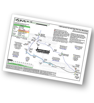
Route Summary:
Stone Ends Farm - Apronful of Stones - Rake Trod - Further Gill Sike - Scurth - The Trough - Carrock Fell - Round Knott (Caldbeck) - Miton Hill (Caldbeck) - Red Gate (Track) - High Pike (Caldbeck) - Hare Stones - Great Lingy Hill - Miller Moss - Lingy Hut - Grainsgill Beck - The Cumbria Way - River Caldew - Swineside - Mosedale (Mungrisdale) - Stone Ends Farm

|
Vital Statistics:
| Length: | 4.75 miles (7.5 km) |
| Ascent: | 945 ft (288 m) |
| Time: | 2.75 hrs |
| Grade: |  |

Route Summary:
Witherslack Hall School - Black Yews Scar - Flodder Allotment - Lord's Seat (Whitbarrow Scar) - Farrar's Allotment - Whitbarrow Scar - Buckhouse Wood - Beck Head (Witherslack) - Witherslack Hall School

|
Vital Statistics:
| Length: | 7.75 miles (12.5 km) |
| Ascent: | 2,770 ft (844 m) |
| Time: | 5.75 hrs |
| Grade: | |

Route Summary:
Great Langdale - Old Dungeon Ghyll - Stool End - Oxendale Beck - Browney Gill - Red Tarn (Langdale) - Great Knott - Crinkle Crags (South Top) - Crinkle Crags (Long Top) - Crinkle Crags (Gunson Knott) - Shelter Crags - Shelter Crags (North Top) - Three Tarns - Earing Crag - White Stones - The Band - Oxendale - Stool End Farm - The Old Dungeon Ghyll - Great Langdale

|
Vital Statistics:
| Length: | 10 miles (16 km) |
| Ascent: | 3,428 ft (1,045 m) |
| Time: | 7 hrs |
| Grade: | |

Route Summary:
Eskdale - Wha House Farm - Hare Crag - Quagrigg Moss - Slight Side - Sca Fell - Symonds Knott - Foxes Tarn - Cam Spout Crag - River Esk - Great Moss - Lingcove Bridge - Brotherilkeld - Hardknott Pass - Eskdale

|
Vital Statistics:
| Length: | 14 miles (22.5 km) |
| Ascent: | 6,009 ft (1,832 m) |
| Time: | 9 hrs |
| Grade: |  |

Route Summary:
Eskdale - Wha House Farm - Hare Crag - Quagrigg Moss - Slight Side - Sca Fell - Symonds Knott - Mickledore - Scafell Pike - Broad Crag - Ill Crag - Great End - Esk Hause - Esk Pike - Ore Gap - Bow Fell (Bowfell) (North Top) - Bow Fell (Bowfell) - Bowfell Buttress - Cambridge Crag - Flat Crag - Climbers' Traverse (optional) - Three Tarns - Great Moss - Brotherikeld - Eskdale

|
Vital Statistics:
| Length: | 6.25 miles (10 km) |
| Ascent: | 3,187 ft (971 m) |
| Time: | 5½ hrs |
| Grade: | |

Route Summary:
Wasdale Head - Lingmell Gill - Brown Tongue - Hollow Stones - Mickledore - Scafell Pike - Mickledore - Lingmell Beck - Wasdale Head - Wast Water.

|
Vital Statistics:
| Length: | 11.25 miles (18 km) |
| Ascent: | 2,736 ft (834 m) |
| Time: | 6.75 hrs |
| Grade: | |

Route Summary:
St Peter's Church (Martindale) - Howtown - Swarthbeck Gill - White Knott - Barton Fell - Whinny Crag - Arthur's Pike - Swarth Beck - Bonscale Tower - Bonscale Pike - Loadpot Hill - Wether Hill - Wether Hill (South Top) - Keasgill Head - Steel Knotts (Pikeawassa) - Steel End - St Peter's Church (Martindale) - Howtown

|
Vital Statistics:
| Length: | 8.75 miles (14 km) |
| Ascent: | 3,296 ft (1,005 m) |
| Time: | 6½ hrs |
| Grade: | |

Route Summary:
The Swirls Car Park Thirlmere - Browncove Crags - Lower Man (Helvellyn) - Helvellyn - White Side - Raise (Helvellyn) - Sticks Pass - Sticks Gill - Stanah Gill - Legburthwaite - Thirlmere - Thirlspot - The Swirls Car Park Thirlmere.

|
Vital Statistics:
| Length: | 14.5 miles (23 km) |
| Ascent: | 3,364 ft (1,025 m) |
| Time: | 8½ hrs |
| Grade: | |
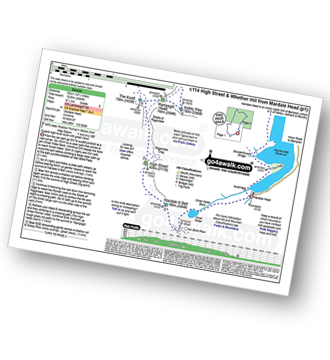
Route Summary:
Mardale Head (Haweswater Reservoir) - Small Water - Nan Bield Pass - Mardale Ill Bell - High Street - Straits of Riggindale - The Knott - Rampsgill Head - Kidsty Pike - High Raise (Mardale) - Raven Howe - Red Crag - Keasgill Head - Wether Hill (South Top) - Wether Hill - Bampton Common - Low Kop - Measand Beck - Haweswater Reservoir - Wainwright's Coast to Coast Walk - Bowderthwaite Bridge - The Rigg - Mardale Head

|
Vital Statistics:
| Length: | 8.25 miles (13 km) |
| Ascent: | 1,031 ft (314 m) |
| Time: | 4 hrs |
| Grade: | |
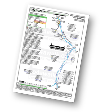
Route Summary:
Rosthwaite - Wainwright's Coast to Coast Walk - Stonethwaite - Stonethwaite Beck - Galleny Force - Langstrath Beck - The Cumbria Way - Greenup Gill - Stonethwaite - Rosthwaite

|
Vital Statistics:
| Length: | 9 miles (14.5 km) |
| Ascent: | 2,402 ft (732 m) |
| Time: | 5.75 hrs |
| Grade: | |
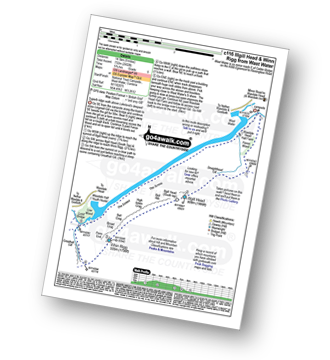
Route Summary:
Wasdale Head - (National Trust Campsite) - Wast Water - Lingmell Gill - Illgill Head - Whin Rigg - Greathall Gill - Wasdale Hall Youth Hostel - Wast Water - Wasdale Head

|
Vital Statistics:
| Length: | 6.25 miles (10 km) |
| Ascent: | 2,565 ft (782 m) |
| Time: | 4.75 hrs |
| Grade: | |

Route Summary:
Scales - Mousthwaite Comb - Scales Fell - Brunt Knott - Scales Beck - Scales Tarn - Sharp Edge - Atkinson Pike - Blencathra or Saddleback (Hallsfell Top) - Gategill Fell Top - Knowe Crag (Blease Fell) - Scales

|
Vital Statistics:
| Length: | 6 miles (9.5 km) |
| Ascent: | 2,845 ft (867 m) |
| Time: | 5 hrs |
| Grade: | |

Route Summary:
Seathwaite (Borrowdale) - Stockley Bridge - Styhead Tarn - Sty Head - Great Gable - Westmorland Cairn - Windy Gap - Green Gable - Mitchell Cove - Blackmoor Pols - Base Brown - Gillercomb - Sour Milk Gill (Borrowdale) - Seathwaite (Borrowdale)

|
Vital Statistics:
| Length: | 18.75 miles (30 km) |
| Ascent: | 7,309 ft (2,408 m) |
| Time: | 14.75 hrs |
| Grade: | |

Route Summary:
Bowness Knott Car Park Ennerdale - Low Gillerthwaite Field Centre - High Gillerthwaite Yourth Hostel - Red Pike (Buttermere) - High Stile - High Crag (Buttermere) - Seat (Buttermere) - Scarth Gap - Hay Stacks (Haystacks) - Innominate Tarn - Blackbeck Tarn - Black Beck - Green Crag (Buttermere) - Great Round How - Brandreth - Gillercomb Head - Green Gable - Windy Gap - Great Gable - Westmorland Cairn - Beck Head - Beckhead Tarn - Kirk Fell (East Top) - Kirk Fell - Black Sail Pass - Looking Stead (Pillar) - High Level Route - Robinson's Cairn - Pillar - Wind Gap - Black Crag (Pillar) - High Beck - Low Beck - Ennerdale.

|
Vital Statistics:
| Length: | 6 miles (9.5 km) |
| Ascent: | 853 ft (260 m) |
| Time: | 3 hrs |
| Grade: | |

Route Summary:
Tom Gill - Tom Gill Waterfall - Tarn Hows - Rose Castle Plantation - Torver Intake - The Cumbria Way - Tom Heights - Iron Keld - Low Arnside - The Cumbria Way - Oxen Fell High Cross - Man Crag - Yew Tree Tarn - Harry Guards Wood - Yew Tree Farm - Glen Mary Bridge - Tom Gill

|
Vital Statistics:
| Length: | 7.75 miles (12.5 km) |
| Ascent: | 2,453 ft (748 m) |
| Time: | 5.25 hrs |
| Grade: | |
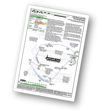
Route Summary:
Mungrisdale - Souther Fell - River Glendermackin - Bannerdale Crags - Bowscale Fell - Mungrisdale

|
Vital Statistics:
| Length: | 8.25 miles (13 km) |
| Ascent: | 2,778 ft (847 m) |
| Time: | 5.75 hrs |
| Grade: | |

Route Summary:
Coniston - Walna Scar Road - Goat's Water - The Old Man of Coniston - Brim Fell - Levers Hawse - Swirl Band - Swirl How - Prison Band - Levers Water - Walna Scar Road - Coniston

|
Vital Statistics:
| Length: | 10.5 miles (17 km) |
| Ascent: | 3,575 ft (1,090 m) |
| Time: | 7½ hrs |
| Grade: | |

Route Summary:
The Swirls Car Park Thirlmere - Browncove Crags - Lower Man (Helvellyn) - Helvellyn - White Side - Raise (Helvellyn) - Sticks Pass - Stybarrow Dodd - Watson's Dodd - Great Dodd - Legburthwaite - Thirlmere - Thirlspot - The Swirls Car Park Thirlmere.

|
Vital Statistics:
| Length: | 4.75 miles (7.5 km) |
| Ascent: | 1,292 ft (394 m) |
| Time: | 3 hrs |
| Grade: | |
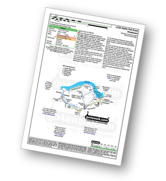
Route Summary:
Howtown - St Peter's Church - Hallin Fell - Geordie's Crag - Hallinhag Wood - Sandwick - Sandwick Beck - Howtown

|
Vital Statistics:
| Length: | 9.5 miles (15 km) |
| Ascent: | 1,250 ft (381 m) |
| Time: | 4.75 hrs |
| Grade: |  |

Route Summary:
Keswick - Friar's Crag - Borrowdale Road - Spring Farm - Brockle Beck - Castlerigg - High Nest Farm - Castlerigg Stone Circle - Naddle Bridge - Threlkeld - River Greta - Keswick

|
Vital Statistics:
| Length: | 10.5 miles (17 km) |
| Ascent: | 2,903 ft (885 m) |
| Time: | 6.75 hrs |
| Grade: | |

Route Summary:
Over Water Reservoir - Orthwaite - Orthwaite Bank - Uldale Fells - Great Cockup - Frozenfell Gill - Trusmadoor - Meal Fell - Little Sca Fell - Great Sca Fell - Knott (Uldale Fells) - Little Calva - Great Calva - Hause Gill - Burn Tod - Burntod Gill - Brockle Crags - Orthwaite - Over Water

|
Vital Statistics:
| Length: | 11.25 miles (18 km) |
| Ascent: | 3,843 ft (1,171 m) |
| Time: | 8 hrs |
| Grade: | |

Route Summary:
Cow Bridge - Brothers Water - Hartsop - Hartsop Dodd - Caudale Moor - Stony Cove Pike (Caudale Moor) - Caudale Head - Stony Cove Pike - Threshthwaite Mouth - Thornthwaite Crag - High Street - Straits of Riggindale - Rampsgill Head - Kidsty Pike - High Raise (Mardale) - The Knott - Hayeswater Reservoir - Hayeswater Gill - Hartsop - Cow Bridge - Brothers Water.

|
Vital Statistics:
| Length: | 11.25 miles (18 km) |
| Ascent: | 3,604 ft (1,098 m) |
| Time: | 7.75 hrs |
| Grade: | |

Route Summary:
Great Langdale - The Old Dungeon Ghyll - Stool End Farm - Oxendale - Oxendale Beck - Browney Gill - Red Tarn (Langdale) - Great Knott - Crinkle Crags (South Top) - Crinkle Crags (Long Top) - Crinkle Crags (Gunson Knott) - Shelter Crags - Shelter Crags (North Top) - Three Tarns - Climbers' Traverse (optional) - Flat Crag - Cambridge Crag - Bowfell Buttress - Bow Fell (Bowfell) - Bow Fell (Bowfell) (North Top) - Ore Gap - Angle Tarn (Langdale) - Rossett Pike - Rossett Beck - Mickleden - Mickleden Beck - The Cumbria Way - The Old Dungeon Ghyll - Great Langdale

|
Vital Statistics:
| Length: | 11.25 miles (18 km) |
| Ascent: | 3,275 ft (998 m) |
| Time: | 7½ hrs |
| Grade: | |

Route Summary:
Bowness Knott Car Park Ennerdale Water - Char Dub - Silver Cove Beck - Woundell Beck - Caw Fell - Little Gowder Crag - Haycock - Great Scoat Fell - Scoat Fell (Little Scoat Fell) - Steeple - Long Crag - Moss Dub - Lingmell Plantation - Bowness Knott Car Park Ennerdale Water.

|
Vital Statistics:
| Length: | 8.5 miles (13.5 km) |
| Ascent: | 1,644 ft (501 m) |
| Time: | 4.75 hrs |
| Grade: | |

Route Summary:
Far Sawrey - Mitchell Knotts - Low Pate Crag - Claife Heights (High Blind How) - The Heald - High Moss - Belle Grange Beck - Long Height - Latterbarrow - High Wray - Red Nap Car Park - Lake Windermere - Belle Grange Bay - Bark Barn Ferry - Slape Scar - Strawberry Gardens - Far Sawrey

|
Vital Statistics:
| Length: | 8.75 miles (14 km) |
| Ascent: | 1,884 ft (574 m) |
| Time: | 5 hrs |
| Grade: | |
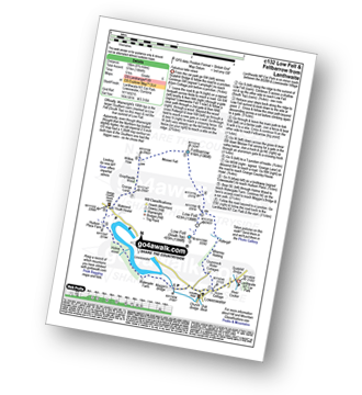
Route Summary:
Lanthwaite - Acorn Cottage - Crummockwater Cottages and Foulsyke - Pottergill - Raven Crag (Low Fell) - Low Fell - Low Fell (South Top) - Fellbarrow - Mosser Fell - Wilkes How - Waterend Youth Hostel - Hudson Place Farm - Holme Wood - Watergate Farm - Maggie's Bridge (Loweswater) - Loweswater - Lanthwaite

|
Vital Statistics:
| Length: | 11.25 miles (18 km) |
| Ascent: | 5,100 ft (1,554 m) |
| Time: | 9.25 hrs |
| Grade: | |

Route Summary:
Greendale Farm - Middle Fell (Wasdale) - Seatallan - Pots of Ashness - Gowder Crag - Haycock - Great Scoat Fell - Steeple - Scoat Fell (Little Scoat Fell) - Red Pike (Wasdale) - Dore Head - Yewbarrow (North Top) - Yewbarrow - Bell Rib - Dropping Crag - Overbeck Bridge - Wast Water - Greendale Farm

|
Vital Statistics:
| Length: | 7.5 miles (12 km) |
| Ascent: | 2,283 ft (696 m) |
| Time: | 5.25 hrs |
| Grade: | |

Route Summary:
Howtown - Steel Knotts (Pikeawassa) - Brownthwaite Crag - Keasgill Head - Wether Hill (South Top) - Wether Hill - Loadpot Hill - Bonscale Pike - Bonscale Tower - Swarthbeck Gill - Howtown

|
Vital Statistics:
| Length: | 5.5 miles (9 km) |
| Ascent: | 1,384 ft (422 m) |
| Time: | 3½ hrs |
| Grade: | |
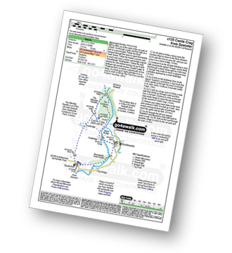
Route Summary:
Seatoller - The Allerdale Ramble - Longthwaite - Rosthwaite - New Bridge - The River Derwent - The Cumbria Way - Castle Crag - Seatoller

|
Vital Statistics:
| Length: | 8.25 miles (13 km) |
| Ascent: | 1,572 ft (479 m) |
| Time: | 4½ hrs |
| Grade: | |

Route Summary:
Huck's Bridge - Ashstead Fell - Mabbin Crag - Castle Fell - Whinfell Beacon - Low Borrowdale - Borrow Beck - High Borrowdale - Borrowdale - Huck's Bridge

|
Vital Statistics:
| Length: | 8.5 miles (13.5 km) |
| Ascent: | 3,840 ft (1,170 m) |
| Time: | 7 hrs |
| Grade: | |

Route Summary:
Braithwaite - Sleet How - Grisedale Pike - Hobcarton Crag - Hopegill Head - Sand Hill - Coldale Hause - Eel Crag - Crag Hill (Eel Crag) - Sail (Derwent Fells) - Long Comb - High Moss - Low Moss - Barrow Door - Braithwaite

|
Vital Statistics:
| Length: | 6.5 miles (10.5 km) |
| Ascent: | 643 ft (196 m) |
| Time: | 3 hrs |
| Grade: | |
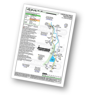
Route Summary:
Patterdale - Noran Bank Farm - Greenbank Farm - Lane Head - Deepdale Bridge - Low Wood - Cow Bridge - Brothers Water - Hartsop Hall - Sykeside - Brothers Water - Hartsop - Eden Beck - Hartsop Fold - Angletarn Beck - Beckstones - Crookabeck - Dubhow - Rooking - Patterdale

|
Vital Statistics:
| Length: | 10.5 miles (17 km) |
| Ascent: | 3,407 ft (1,038 m) |
| Time: | 7.25 hrs |
| Grade: | |

Route Summary:
Seatoller - Big Stanger Gill - Hanging Haystack Crag - Alisongrass Crag - Rosthwaite Fell (Bessyboot) - Tarn At Leaves - Rosthwaite Cam (Rosthwaite Fell) - Dovenest Top - Combe Door Top - Combe Head - Glaramara - Looking Steads (Glaramara) - Red Beck Top - High House Tarn Top - Allen Crags - Sprinking Tarn - Seathwaite Fell (South Top) - Seathwaite Fell - Grains Gill - The Allerdale Ramble - Stockley Bridge - Seathwaite (Borrowdale) - Thornythwaite Farm - Strands Bridge - The River Derwent - Seatoller

|
Vital Statistics:
| Length: | 4.75 miles (7.5 km) |
| Ascent: | 945 ft (288 m) |
| Time: | 2.75 hrs |
| Grade: | |
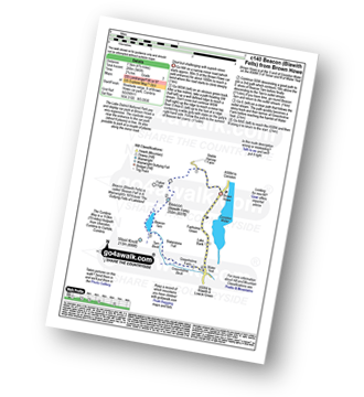
Route Summary:
Brown Howe Car Park - Coniston Water - Beacon (Blawith Fells) - Beacon Tarn - Tarn Beck - Slaterstone Fell - Greenholme Farm - Water Yeat - Lake Bank - Fairholme Green - Brown Howe - Coniston Water.

|
Vital Statistics:
| Length: | 11.25 miles (18 km) |
| Ascent: | 5,819 ft (1,773 m) |
| Time: | 10 hrs |
| Grade: | |

Route Summary:
Wasdale Head - Moses' Trod - Lingmell Beck - Gable Beck Bridge - Sty Head - Great Gable - Westmorland Cairn - Beck Head - Beckhead Tarn - Kirk Fell (East Top) - Kirk Fell - Black Sail Pass - Looking Stead (Pillar) - High Level Route - Robinson's Cairn - Pillar - Wind Gap - Black Crag (Pillar) - Scoat Fell (Little Scoat Fell) - Steeple - Red Pike (Wasdale) - Dore Head - Mosedale Beck - Wasdale Head - Wast Water.

|
Vital Statistics:
| Length: | 8.75 miles (14 km) |
| Ascent: | 3,073 ft (937 m) |
| Time: | 6.25 hrs |
| Grade: | |

Route Summary:
Little Town - High Snab Bank - Blea Crags - Robinson - Littledale Edge - Hindscarth - Hindscarth Edge - Dale Head (Newlands) - Dalehead Tarn - Newlands Valley - Newlands Church - Little Town

|
Vital Statistics:
| Length: | 6 miles (9.5 km) |
| Ascent: | 1,861 ft (567 m) |
| Time: | 4½ hrs |
| Grade: | |

Route Summary:
Rosthwaite - The Cumbria Way - Lingy End - Willygrass Gill - Dock Tarn - Great Crag - Puddingstone Bank - Jopplety How - Joppletyhow Moss - Grange Fell (Brund Fell) - King's How - Rosthwaite

|
Vital Statistics:
| Length: | 10 miles (16 km) |
| Ascent: | 2,936 ft (895 m) |
| Time: | 6½ hrs |
| Grade: | |
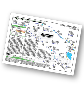
Route Summary:
Grasmere - Sour Milk Gill - Sourmilk Gill Falls - Tarn Crag (Easedale) - Sergeant Man - Blea Rigg - Great Castle How - Little Castle How - Raw Pike - Swinescar Pike - Lang How - Silver How - Spedding Crag - Dow Bank - Huntingstile Crag - Grasmere

|
Vital Statistics:
| Length: | 4 miles (6.5 km) |
| Ascent: | 1,651 ft (503 m) |
| Time: | 3.25 hrs |
| Grade: | |
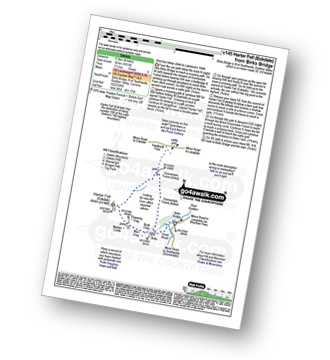
Route Summary:
Birks Bridge - Birks Farm - Harter Fell (Eskdale) - Dunnerdale Forest - River Duddon - Birks Bridge

|
Vital Statistics:
| Length: | 8.75 miles (14 km) |
| Ascent: | 2,129 ft (649 m) |
| Time: | 5½ hrs |
| Grade: | |

Route Summary:
Red Moss Nr Dockray - Matterdale Common - Wolf Crags - Bruts Moss - Randerside - Great Dodd - Watson's Dodd - Stybarrow Dodd - Green Side (White Stones) - Hart Side - Dowthwaitehead - Red Moss.

|
Vital Statistics:
| Length: | 8.5 miles (13.5 km) |
| Ascent: | 1,447 ft (441 m) |
| Time: | 4½ hrs |
| Grade: | |

Route Summary:
Elterwater - Elterwater Bridge - Little Langdale - Little Langdale Tarn - Bridge End - Fell Foot Bridge - Castle Howe - Blea Tarn (Langdale) - Great Langdale - Oak Howe - Chapel Stile - Elterwater

|
Vital Statistics:
| Length: | 11 miles (17.5 km) |
| Ascent: | 2,310 ft (704 m) |
| Time: | 6.25 hrs |
| Grade: | |
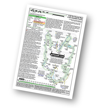
Route Summary:
Grizedale Forest Visitor Centre - Silurian Way - Priest Wood - Ridding Wood - Braithwaite Plantation - Potato Peg Plantation - Grisedale Tarn - The Connob - Low Scar Wood - Beck Side Intake - Great Wood - New South Wales Plantation - Breasty Haw - Lawrence Scar Wood - Dale Park Scar - Blind Lane Wood - Force Knott - Swainsley Hill - Force Beck - Farce Falls - Low Bowkerstead Hob Gill Plantation - Satterthwaite - Scale Green Wood - Scale Green Intake - Carron Crag - Park Plantation - Broad Piece - Grizedale Forest Visitor Centre

|
Vital Statistics:
| Length: | 7.75 miles (12.5 km) |
| Ascent: | 1,758 ft (536 m) |
| Time: | 4.75 hrs |
| Grade: | |
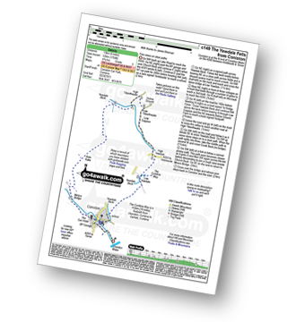
Route Summary:
Coniston - The Cumbria Way - Low Yewdale - Yewdale Beck - High Yewdale - Yew Band - Low Tilberthwaite - High Tilberthwaite - Low Coppice - Tilberthwaite Gill - Crook Beck - Hole Rake - Miners Bridge - Church Beck - Coniston

|
Vital Statistics:
| Length: | 8.75 miles (14 km) |
| Ascent: | 2,307 ft (703 m) |
| Time: | 5½ hrs |
| Grade: | |
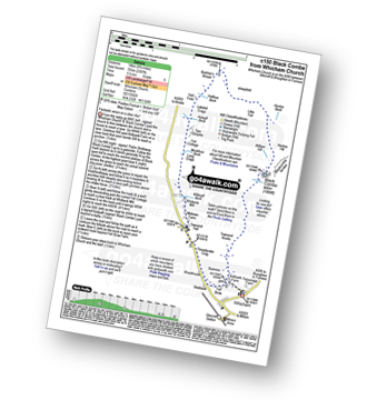
Route Summary:
Silecroft - Whicham Church - Kirkbank Farm - Townend Knotts - Black Combe - Blackcombe Screes - William Gill - Hentoe Hill - Butcher's Breast - Littlefell Crags - Tarn Dimples - Whitbeck Mill - Townend Hall - Whitebeck - Throstlerake Crag Fell Brow - Whicham Church - Silecroft

|
Vital Statistics:
| Length: | 8.5 miles (13.5 km) |
| Ascent: | 4,260 ft (1,298 m) |
| Time: | 7.25 hrs |
| Grade: | |

Route Summary:
Honister Pass - Honister Hause - Green Crag (Buttermere) - Black Beck - Blackbeck Tarn - Innominate Tarn - Hay Stacks (Haystacks) - Scarth Gap - Ennerdale - River Liza - Black Sail Hut (Youth Hostel) - Black Sail Path - Kirk Fell - Kirk Fell (East Top) - Beckhead Tarn - Beck Head - Great Gable - Westmorland Cairn - Windy Gap - Green Gable - Gillercomb Head - Brandreth - Grey Knotts - Honister Hause.

|
Vital Statistics:
| Length: | 8.75 miles (14 km) |
| Ascent: | 2,212 ft (674 m) |
| Time: | 5½ hrs |
| Grade: | |

Route Summary:
Grasmere - Goody Bridge - High Raven Crag - Helm Crag - The Lion and The Lamb - The Howitzer - Gibson Knott - Calf Crag - Wainwright's Coast to Coast Walk - Brownrigg Moss - Moor Moss - Far Easdale Gill - Goody Bridge - Grasmere

|
Vital Statistics:
| Length: | 12.25 miles (19.5 km) |
| Ascent: | 4,194 ft (1,278 m) |
| Time: | 8.75 hrs |
| Grade: | |
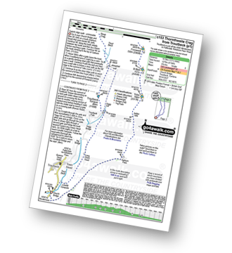
Route Summary:
Troutbeck Bridge - Garburn Pass - Yoke - Ill Bell - Froswick - Thornthwaite Crag - Stony Cove Pike (Caudale Moor) - Doup Crag - Trout Beck - Troutbeck Tongue - Hagg Gill - Lowther Brow - Long Green Head - Limefitt Campsite - Troutbeck - Troutbeck Bridge

|
Vital Statistics:
| Length: | 7 miles (11 km) |
| Ascent: | 945 ft (288 m) |
| Time: | 3½ hrs |
| Grade: | |
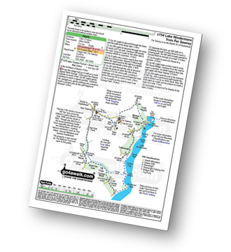
Route Summary:
Far Sawrey - Mitchell Knotts - Fellborough - Lake Windermere Shore - Rawlinson Nab - Low Cunsey Farm - Cunsey Wood - The Forge - Great Ore Gate - Cunsey Beck - Eel House Bridge - Dub How Farm - Near Sawrey - Hill Top (former Home of Beatrix Potter) - Wilfin Beck - Far Sawrey

|
Vital Statistics:
| Length: | 15.5 miles (25 km) |
| Ascent: | 4,293 ft (1,308 m) |
| Time: | 10 hrs |
| Grade: | |

Route Summary:
Patterdale - Rooking - Crookabeck - Beckstones - Dubhow - Hartsop - Hayswater Gill - Hayswater - The Knott - Brock Crags - Angle Tarn (Martindale) - Angletarn Pikes - Boredale Hause - Place Fell - High Dodd (Sleet Fell) - Sandwick - Long Crag - Silver Point - Ullswater - Blowick - Rooking - Side Farm - Patterdale

|
Vital Statistics:
| Length: | 8.5 miles (13.5 km) |
| Ascent: | 2,181 ft (665 m) |
| Time: | 5.25 hrs |
| Grade: | |

Route Summary:
Watendlath - High Tove - Cockrigg Crags - Thirlmere - Harrop Tarn - Blea Tarn (Watendlath Fell) - Brimming Knott - Robinbank Crag - Rough Knott - Watendlath

|
Vital Statistics:
| Length: | 12.5 miles (20 km) |
| Ascent: | 3,769 ft (1,149 m) |
| Time: | 8½ hrs |
| Grade: | |

Route Summary:
Christy Bridge - Martindale - Dale Head Farm - Heck Crag - Angle Tarn - Buck Crag - Brock Crags - Satura Crag - The Nab (Martindale) - Rest Dodd - The Knott - Rampsgill Head - Kidsty Pike - High Raise (Mardale) - Red Crag - Keasgill Head - Christy Bridge

|
Vital Statistics:
| Length: | 10.25 miles (16.5 km) |
| Ascent: | 4,611 ft (1,405 m) |
| Time: | 8½ hrs |
| Grade: | |

Route Summary:
Buttermere - Gatesgarth - Peggy's Bridge - Scarth Gap Pass - Scarth Gap - Black Sail Hut (Youth Hostel) - Black Sail Pass - Looking Stead (Pillar) - High Level Route - Robinson's Cairn - Pillar - Wind Gap - Black Crag (Pillar) - High Beck - Ennerdale - Scarth Gap Pass - Peggy's Bridge - Gatescarth - Buttermere

|
Vital Statistics:
| Length: | 7 miles (11 km) |
| Ascent: | 1,218 ft (371 m) |
| Time: | 3.75 hrs |
| Grade: | |

Route Summary:
Winster Church - Winster House - Birkett Houses Allotments - Ghyll Head Reservoir - Great Ludderburn Moss - Little Ludderburn Moss - Ludderburn Hill - The Oaks - Intake Wood - High Hartbarrow - Lound Cottage - Strawberry Bank - Hollins Farm - Great Hartbarrow - Wood Farm - River Winster - Bryan House Farm - Winster Church

|
Vital Statistics:
| Length: | 13.75 miles (22 km) |
| Ascent: | 5,501 ft (1,676 m) |
| Time: | 10½ hrs |
| Grade: | |
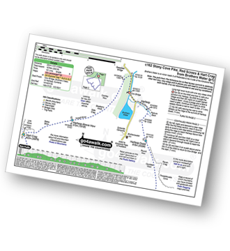
Route Summary:
Cow Bridge Car Park - Brothers Water - Hartsop - Hartsop Dodd - Caudale Moor - Stony Cove Pike (Caudale Moor) - Caudale Head - Pike How - St Raven's Edge - The Kirkstone Pass - Red Screes - Smallthwaite Band - Middle Dodd - Scandale Pass - Little Hart Crag - High Hartsop Dodd - Little Hart Crag - Scandale Head - Dove Crag - Hart Crag - Blake Brow - Hartsop Above How - Hoggill Brow - Gale Crag - Bleaberry Knott - Cockley How - Cow Bridge

|
Vital Statistics:
| Length: | 9 miles (14.5 km) |
| Ascent: | 2,624 ft (800 m) |
| Time: | 6 hrs |
| Grade: | |
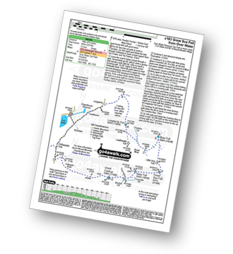
Route Summary:
Over Water - Orthwaite - Orthwaite Bank - Uldale Fells - Great Cockup - Trusmadoor - Meal Fell - Great Sca Fell - Little Sca Fell - Brae Fell - Broad Moss - Lowthwaite Fell - Longlands Fell - The Cumbria Way - Longlands - Lowthwaite - Over Water

|
Vital Statistics:
| Length: | 5.5 miles (9 km) |
| Ascent: | 1,706 ft (520 m) |
| Time: | 3.75 hrs |
| Grade: | |
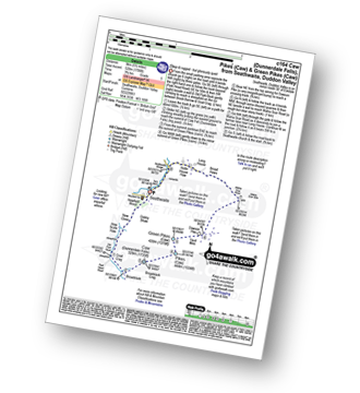
Route Summary:
Seathwaite (Duddon Valley) - Newfield Wood - Dobby Shaw - New Close - How Scale Haw - Old Park Beck - Broadslack - Caw (Dunnerdale Fells) - Pikes (Caw) - Green Pikes (Caw) - Dawson Pike - Walna Scar Road - Broad Haws - Hollin House Haw - Tarn Beck - Seathwaite (Duddon Valley)

|
Vital Statistics:
| Length: | 5.5 miles (9 km) |
| Ascent: | 893 ft (272 m) |
| Time: | 3 hrs |
| Grade: | |
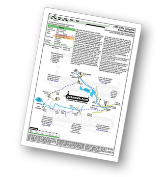
Route Summary:
Elterwater - The Cumbria Way - Elter Water - Skelwith Force - River Brathay - Skelwith Bridge - Low Park - High Park - High Colwith - Colwith Force - Stang End - Little Langdale - Slater Bridge - Little Langdale Tarn - Dale End - Elterwater

|
Vital Statistics:
| Length: | 13.75 miles (22 km) |
| Ascent: | 4,982 ft (1,519 m) |
| Time: | 10 hrs |
| Grade: | |

Route Summary:
Eskdale - Wha House Farm - Hare Crag - Quagrigg Moss - Slight Side - Sca Fell - Symonds Knott - Scafell Pike - Broad Crag - Ill Crag - Great End - Esk Hause - Lingcove Bridge - Great Moss - Eskdale

|
Vital Statistics:
| Length: | 8.75 miles (14 km) |
| Ascent: | 3,584 ft (1,092 m) |
| Time: | 6.75 hrs |
| Grade: | |

Route Summary:
Low Tilberthwaite - Above Beck Fells - Hole Rake - Red Gill Head Moss - Steel Edge - Lad Stones - Wetherlam - Red Dell Head Moss - Black Sails - Keld Gill Head - Swirl Hawse - Prison Band - Swirl How - Great Carrs - Little Carrs - Hell Gill Pike - Wet Side Edge - High End - Greenburn Beck - Low Tilberthwaite

|
Vital Statistics:
| Length: | 3 miles (5 km) |
| Ascent: | 1,145 ft (349 m) |
| Time: | 2½ hrs |
| Grade: | |


|
Vital Statistics:
| Length: | 6.5 miles (10.5 km) |
| Ascent: | 2,573 ft (784 m) |
| Time: | 5 hrs |
| Grade: | |
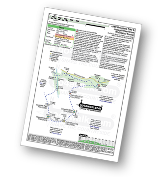
Route Summary:
Revelin Moss - Whinlatter Forest Park - Hobcarton End - Grisedale Pike - Hobcarton Crag - Hopegill Head - Ladyside Pike - Swinside Plantation - Whinlatter Pass - Hobcarton Plantation - Revelin Moss

|
Vital Statistics:
| Length: | 3.75 miles (6 km) |
| Ascent: | 2,398 ft (731 m) |
| Time: | 3.75 hrs |
| Grade: | |

Route Summary:
Threlkeld - Gategill Farm - Hall's Fell - Hall's Fell Ridge - Blencathra or Saddleback (Hallsfell Top) - Gategill Fell Top - Knowe Crags (Blease Fell) - Threlkeld

|
Vital Statistics:
| Length: | 5.75 miles (9 km) |
| Ascent: | 932 ft (284 m) |
| Time: | 3 hrs |
| Grade: | |
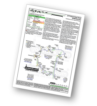
Route Summary:
Underbarrow - Hagg Cottage - Gambleshire Lane - Gambleshire Lane - Cunswick Fell - Scout Scar (Barrowfield) - Hodgeson's Leap - Bradleyfield - Helsington Barrows - Barrowfield Farm - Barrowfield Lot - Copeland Wood - Hollinwood - Cooper Tenement - Rockyfield - Underbarrow

|
Vital Statistics:
| Length: | 7.5 miles (12 km) |
| Ascent: | 3,218 ft (981 m) |
| Time: | 6 hrs |
| Grade: | |

Route Summary:
Wasdale Head - Lingmell Gill - Brown Tongue - Hollow Stones - Mickledore - Scafell Pike - The Corridor Route - Sty Head - Lingmell Beck - Gable Beck Bridge - Wasdale Head - Wast Water.

|
Vital Statistics:
| Length: | 6.25 miles (10 km) |
| Ascent: | 1,172 ft (357 m) |
| Time: | 3½ hrs |
| Grade: | |
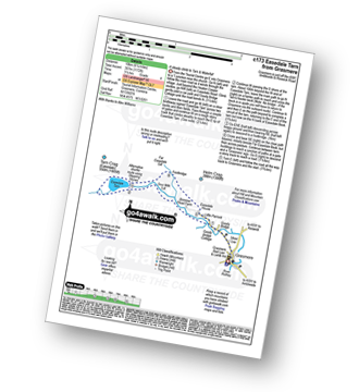
Route Summary:
Grasmere - Goody Bridge - Easedale Beck - Sourmilk Gill - Brinhowe Crag - Easedale - Sourmilk Falls - Easedale Tarn - Far Easedale Gill - Stythwaite Steps - Grasmere

|
Vital Statistics:
| Length: | 10.5 miles (17 km) |
| Ascent: | 4,693 ft (1,430 m) |
| Time: | 8½ hrs |
| Grade: | |

Route Summary:
Seatoller - Strands Bridge - Borrowdale - The Combe - Thornythwaite Fell - Comb Head - Glaramara - Looking Steads (Glaramara) - Red Beck - Red Beck Top - Allen Gill - High House Tarn - High House Tarn Top - Allen Crags - Esk Hause - Ruddy Gill - Sprinkling Tarn - Sty Head - Great Gable - Westmorland Cairn - Windy Gap - Green Gable - Gillercomb Head - Brandreth - Grey Knotts - Honister Hause - Honister Pass - Wainwright's Coast to Coast Walk - Seatoller

|
Vital Statistics:
| Length: | 10 miles (16 km) |
| Ascent: | 3,401 ft (1,037 m) |
| Time: | 7 hrs |
| Grade: | |

Route Summary:
Eskdale - Wha House Farm - Hare Crag - Goat Crag - Dawsonground Crags - Cat Crag - Quagrigg Moss - Slight Side - Sca Fell - Symonds Knott - Hard Rigg - Burnmoor Tarn - Eel Tarn - Christcliff - Wha House Farm - Eskdale

|
Vital Statistics:
| Length: | 8.25 miles (13 km) |
| Ascent: | 2,011 ft (613 m) |
| Time: | 5 hrs |
| Grade: | |

Route Summary:
Red Moss Nr Dockray - Barbary Rigg - Matterdale Common - Mariel Bridge - White Pike (Clough Head) - Clough Head - Calfhow Pike - Little Dodd (St John's Common) - Great Dodd - Randerside - Bruts Moss - Wolf Crags - Red Moss.

|
Vital Statistics:
| Length: | 6 miles (9.5 km) |
| Ascent: | 2,192 ft (668 m) |
| Time: | 5 hrs |
| Grade: | |
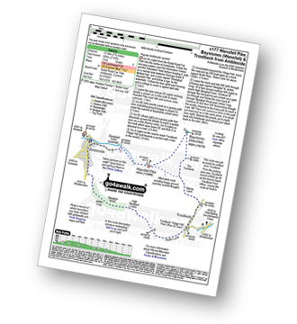
Route Summary:
Ambleside - Stockghyll Force - Wansfell Pike - Baystones (Wansfell) - The Hundreds - Nanny Lane - Troutbeck - Robin Lane - High Skelghyll Farm - Skelghyll Wood - Jenkin Crag - Ambleside

|
Vital Statistics:
| Length: | 6 miles (9.5 km) |
| Ascent: | 1,814 ft (553 m) |
| Time: | 4 hrs |
| Grade: | |

Route Summary:
Glenridding - Glenridding Dodd - Sheffield Pike - Nick Head - Lucy's Tongue - Glenridding Beck - Glenridding

|
Vital Statistics:
| Length: | 9.5 miles (15 km) |
| Ascent: | 3,523 ft (1,074 m) |
| Time: | 7 hrs |
| Grade: | |

Route Summary:
Walna Scar Road (nr Seathwaite (Duddon Valley) - Long Houses - Brown Pike - Dow Crag - Goat's Hawse - The Old Man of Coniston - Brim Fell - Levers Hawse - Swirl Band - Swirl How - Great Carrs - Grey Friar - Seathwaite Tarn - Walna Scar Road.

|
Vital Statistics:
| Length: | 10 miles (16 km) |
| Ascent: | 3,979 ft (1,213 m) |
| Time: | 7½ hrs |
| Grade: | |

Route Summary:
Patterdale - Grisedale Bridge - Ruthwaite Lodge - The Tongue - Dollywaggon Pike - Seat Sandal - Grisedale Tarn - Deepdale Hause - St Sunday Crag - Birks - Patterdale

|
Vital Statistics:
| Length: | 10 miles (16 km) |
| Ascent: | 1,364 ft (416 m) |
| Time: | 5 hrs |
| Grade: | |
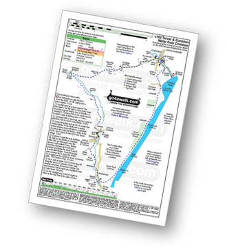
Route Summary:
Coniston - Walna Scar Road - Banishead - Torver Beck - Torver - Beckstones - The Cumbria Way - Coniston Water - Coniston Sailing Club - Coniston Hall - Coniston

|
Vital Statistics:
| Length: | 10 miles (16 km) |
| Ascent: | 3,039 ft (926 m) |
| Time: | 6.75 hrs |
| Grade: | |

Route Summary:
Whinlatter Forest Park - Thwaitehill Knotts - Beckstone Plantation - Beckstone Gill - Barf - Lord's Seat (Whinlatter) - Broom Fell - Graystones - Scawgill Bridge - Whinlatter (Brown How) - Whinlatter (Whinlatter Top) - Whinlatter Forest Park

|
Vital Statistics:
| Length: | 9.75 miles (15.5 km) |
| Ascent: | 3,551 ft (1,082 m) |
| Time: | 7.25 hrs |
| Grade: | |

Route Summary:
Ambleside - Snarker Pike - Red Screes - Scandale Pass - Little Hart Crag - Dove Crag - High Pike (Scandale) - Low Pike (Scandale) - High Sweden Bridge - Ambleside

|
Vital Statistics:
| Length: | 6 miles (9.5 km) |
| Ascent: | 531 ft (246 m) |
| Time: | 2½ hrs |
| Grade: | |

Route Summary:
Ings - High Fairbank - The Dales Way - Crag House Farm - Outrun Nook - Hag End Farm - School Knott - Schoolknott Plantation - Whasdike Farm - Ings

|
Vital Statistics:
| Length: | 10.25 miles (16.5 km) |
| Ascent: | 2,850 ft (869 m) |
| Time: | 6½ hrs |
| Grade: | |
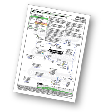
Route Summary:
Keswick - Gale Road (Underscar) Nr Keswick - Lonscale Fell - Jenkin Hill - Little Man (Skiddaw) - Skiddaw - Sale How (Skiddaw) - Skiddaw House - Gale Road (Underscar) Nr Keswick.

|
Vital Statistics:
| Length: | 6.25 miles (10 km) |
| Ascent: | 601 ft (183 m) |
| Time: | 3 hrs |
| Grade: | |

Route Summary:
Eskdale - Boot - Dalegarth Station - River Esk - Doctor Bridge - Jubilee Bridge - Hardknott Pass - Brotherilkeld - Taw House Farm - Boot - Eskdale

|
Vital Statistics:
| Length: | 7 miles (11 km) |
| Ascent: | 1,860 ft (567 m) |
| Time: | 4½ hrs |
| Grade: | |
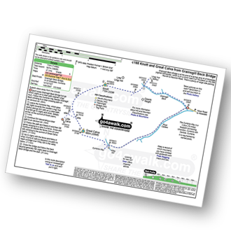
Route Summary:
Grainsgill Bridge - Swineside - Grainsgill Beck - Knott (Uldale Fells) - Little Calva - Great Calva - The Cumbria Way - Wiley Beck - River Caldew - Burdell - Gill - Wet Swine Gill - Grainsgill Beck - Swineside.

|
Vital Statistics:
| Length: | 9 miles (14.5 km) |
| Ascent: | 2,780 ft (847 m) |
| Time: | 6 hrs |
| Grade: | |
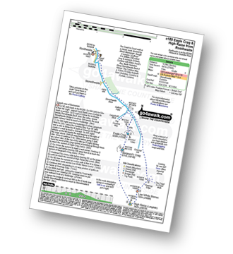
Route Summary:
Rosthwaite - Stonethwaite - Wainwright's Coast to Coast Walk - Stonethwaite Beck - Galleny Force - The Cumbria Way - Langstrath Beck - Eagle Crag - Sergeant's Crag - High Raise (Langdale) - Low White Stones - Greenup Edge - Lining Crag - Greenup Gill - Stonethwaite Beck - Stonethwaite - Rosthwaite

|
Vital Statistics:
| Length: | 7.25 miles (11.5 km) |
| Ascent: | 1,053 ft (321 m) |
| Time: | 3.75 hrs |
| Grade: | |

Route Summary:
Kendal - Kendal Fell - Kettlewell Crag - Cunswick Fell - Cunswick Scar - Scout Scar (Barrowfield) - Helsington Barrows - Bradleyfield - Brigsteer Road - Larch How - Kendal

|
Vital Statistics:
| Length: | 9.5 miles (15 km) |
| Ascent: | 3,070 ft (936 m) |
| Time: | 6½ hrs |
| Grade: | |

Route Summary:
Mungrisdale - Souther Fell - River Glendermackin - Brunt Knott - Scales Beck - Scales Tarn - Sharp Edge - Atkinson Pike - Blencathra or Saddleback (Hallsfell Top) - Foule Crag - Bannerdale Crags - Bowscale Fell - Tarn Crags Top - Raven Crags - Mungrisdale

|
Vital Statistics:
| Length: | 13 miles (21 km) |
| Ascent: | 4,359 ft (1,329 m) |
| Time: | 9.25 hrs |
| Grade: | |

Route Summary:
Glenridding - Glenridding Dodd - Sheffield Pike - Green Side - Stybarrow Dodd - Sticks Pass - Raise (Helvellyn) - White Side - Lower Man (Helvellyn) - Helvellyn - Nethermost Pike - High Crag (Helvellyn) - Dollywaggon Pike - Grisdale Tarn - Grisedale Beck - Brownend Plantation - Lanty's Tarn - Keldas - Glenridding

|
Vital Statistics:
| Length: | 7.25 miles (11.5 km) |
| Ascent: | 1,752 ft (534 m) |
| Time: | 4½ hrs |
| Grade: | |

Route Summary:
Aira Force National Trust Car Park (nr Glenridding) - Aira Force - Riddings Beck - Waterfalls - High Force - Dockray - Aira Beck - Matterdale Common - Dowthwaitehead - Brown Hills - Swineside Knott - Glencoyne Park - Aira Force Car Park.

|
Vital Statistics:
| Length: | 12.5 miles (20 km) |
| Ascent: | 4,684 ft (1,428 m) |
| Time: | 9.25 hrs |
| Grade: | |

Route Summary:
Great Langdale - The Old Dungeon Ghyll - The Cumbria Way - Mickleden Beck - Mickleden - Rossett Beck - Rossett Pike - Angle Tarn (Langdale) - Esk Hause - Great End - Ill Crag - Broad Crag - Scafell Pike - Esk Hause - Esk Pike - Ore Gap - Bow Fell (Bowfell) (North Top) - Bow Fell (Bowfell) - Bowfell Buttress - Cambridge Crag - Flat Crag - Climbers' Traverse (optional) - Three Tarns - The Band - Oxendale - Stool End Farm - The Old Dungeon Ghyll - Great Langdale

|
Vital Statistics:
| Length: | 8.5 miles (13.5 km) |
| Ascent: | 2,402 ft (732 m) |
| Time: | 5½ hrs |
| Grade: | |
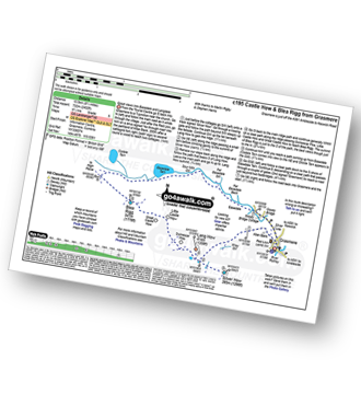
Route Summary:
Grasmere - Castle How - Blea Rigg - Easedale Tarn - Sour Milk Gill - Easedale - Goody Bridge - Grasmere

|
Vital Statistics:
| Length: | 9.75 miles (15.5 km) |
| Ascent: | 4,043 ft (1,232 m) |
| Time: | 7.75 hrs |
| Grade: | |

Route Summary:
Lanthwaite Green - Liza Beck - Whin Ben - Whiteside (Crummock) (West Top) - Whiteside (Crummock) - Gasgale Crags - Hopegill Head - Sand Hill - Coledale Hause - Grasmoor - Wandope - Whiteless Edge - Whiteless Pike - Whiteless Breast - Low Bank - Rannerdale Knotts - Crummock Water - Hause Point - Lanthwaite Green

|
Vital Statistics:
| Length: | 9 miles (14.5 km) |
| Ascent: | 3,696 ft (1,126 m) |
| Time: | 7 hrs |
| Grade: | |

Route Summary:
Wasdale Head - Wast Water - Lingmell - Lingmell Col - Scafell Pike - Broad Crag - Ill Crag - Great End - Esk Hause - Sty Head - Lingmell Beck - Gable Beck Bridge - Wasdale Head - Wast Water.

|
Vital Statistics:
| Length: | 7 miles (11 km) |
| Ascent: | 1,299 ft (396 m) |
| Time: | 3.75 hrs |
| Grade: | |
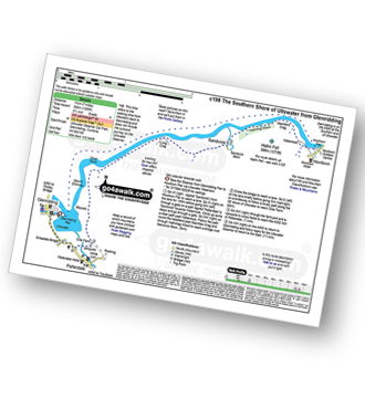
Route Summary:
Glenridding - Glenridding Pier - Ullswater Steamer - Howtown Pier - Geordie's Crag - Halinhag Wood - Sandwick - Long Crag (Ullswater) - Silver Point - Ullswater - Blowick - Rooking - Side Farm - Patterdale

|
Vital Statistics:
| Length: | 11.75 miles (19 km) |
| Ascent: | 2,970 ft (905 m) |
| Time: | 7½ hrs |
| Grade: | |
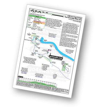
Route Summary:
Ennerdale Weir - Ennerdale Water - Silver Cove Beck - Woundell Beck - Caw Fell - Silver Cove - Iron Crag - Crag Fell - Grike - Ennerdale Weir

|
Vital Statistics:
| Length: | 14 miles (22.5 km) |
| Ascent: | 2,978 ft (908 m) |
| Time: | 8.25 hrs |
| Grade: | |

Route Summary:
Stone Ends Farm - Apronful of Stones - Rake Trod - Further Gill Sike - Scurth - The Trough - Carrock Fell - Round Knott (Caldbeck) - Miton Hill (Caldbeck) - Red Gate (Track) - High Pike (Caldbeck) - Hare Stones - Great Lingy Hill - Miller Moss - Lingy Hut - Grainsgill Beck - Knott (Uldale Fells) - Litle Calva - Great Calva - The Cumbria Way - Wiley Beck - River Caldew - Burdell - Gill - Wet Swine Gill - Grainsgill Beck - Swineside - Mosedale (Mungrisdale) - Stone Ends Farm

|
Vital Statistics:
| Length: | 6.25 miles (10 km) |
| Ascent: | 1,230 ft (375 m) |
| Time: | 3½ hrs |
| Grade: | |

Route Summary:
Keswick - Friar's Crag - Calfclose Bay - Barrow Bay - Derwent Water - Ashness Bridge - Walla Crag - Rakefoot - Castlerigg - Brockle Beck - Spring Farm - Keswick

|
Vital Statistics:
| Length: | 7 miles (11 km) |
| Ascent: | 1,726 ft (526 m) |
| Time: | 4.25 hrs |
| Grade: | |

Route Summary:
Maggie's Bridge (Loweswater) - Acorn Cottage - Crummockwater Cottages and Foulsyke - Pottergill - Raven Crag (Low Fell) - Low Fell - Low Fell (South Top) - Crabtree Beck - Darling Fell - Loweswater - Waterend Youth Hostel - Hudson Place Farm - Holme Wood - Watergate Farm - Maggie's Bridge (Loweswater)

|
Vital Statistics:
| Length: | 9.75 miles (15.5 km) |
| Ascent: | 886 ft (270 m) |
| Time: | 4.25 hrs |
| Grade: | |
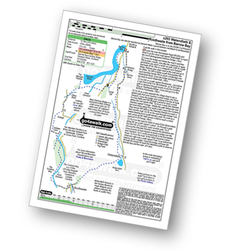
Route Summary:
Barrow Bay - Derwent Water - Ashness Bridge - Surprise View - Watendlath - Bracken Platt - Puddingstone Bank - The Cumbria Way - Rosthwaite - River Derwent - High Hows Wood - Low Hows Wood - Broadslack Gill - Hollows Farm - Borrowdale Gates - Ellers Beck Lodore Falls - Barrow Bay - Derwent Water

|
Vital Statistics:
| Length: | 10.5 miles (17 km) |
| Ascent: | 3,417 ft (1,041 m) |
| Time: | 7.25 hrs |
| Grade: | |

Route Summary:
Stockdale - Sadgill Bridge - Stockdale Beck - Great Howe - Grey Crag (Sleddale) - Tarn Crag (Sleddale) - Sleddale Fell - Selside Brow - Branstree (Artlecrag Pike) - Gatescarth Pass - Adam Seat - Harter Fell (Mardale) - Kentmere Pike - Goat Scar - Shipman Knotts - Wray Crag - Stockdale

|
Vital Statistics:
| Length: | 8.5 miles (13.5 km) |
| Ascent: | 1,953 ft (595 m) |
| Time: | 5 hrs |
| Grade: | |

Route Summary:
Stanley Force NT Car Park - Eskdale - Boot - River Esk - Low Birker - Crook Crag - Green Crag (Ulpha Fell) - Great Worm Crag - Brown Rigg - Sike Moss - Birkerthwaite - Low Ground Cottages - Stanley Force - River Esk - Stanley Force NT Car Park - Eskdale

|
Vital Statistics:
| Length: | 7 miles (11 km) |
| Ascent: | 1,920 ft (585 m) |
| Time: | 4½ hrs |
| Grade: | |

Route Summary:
Elterwater - Blea Tarn (Langdale) - Side Pike - Fat Man's Agony (or Fat Man's Struggle) - Lingmoor Fell - Dale End - Birk Howe - Slater Bridge - Little Langdale Tarn - Bridge End - Fell Foot Bridge - Castle Howe - Blea Tarn (Langdale) - Elterwater

|
Vital Statistics:
| Length: | 7.5 miles (12 km) |
| Ascent: | 3,338 ft (1,017 m) |
| Time: | 6.25 hrs |
| Grade: | |

Route Summary:
Buttermere - Sourmilk Gill - Bleaberry Tarn - Dodd (Buttermere) - The Saddle - Red Pike (Buttermere) - High Stile - High Crag (Buttermere) - Gamlin End - Seat (Buttermere) - Scarth Gap - Peggy's Bridge - Burtness Wood - Buttermere

|
Vital Statistics:
| Length: | 7.25 miles (11.5 km) |
| Ascent: | 3,046 ft (928 m) |
| Time: | 5.75 hrs |
| Grade: | |

Route Summary:
Great Langdale - The New Dungeon Ghyll - Stickle Ghyll - Whitegill Crag - Blea Rigg - Sergeant Man - High Raise (Langdale) - The Langdale Pikes - Thunacar Knott - Pavey Ark - Harrison Stickle - Pike of Stickle (Pike O' Stickle) - Loft Crag - Mark Gate - The New Dungeon Ghyll - Great Langdale

|
Vital Statistics:
| Length: | 7.25 miles (11.5 km) |
| Ascent: | 3,180 ft (969 m) |
| Time: | 5.75 hrs |
| Grade: | |

Route Summary:
Hopebeck - Hope Beck - Swinside (Whinlatter) - Hope Gill - Ladyside Pike - Hopegill Head - Hobcarton Crag - Grisedale Pike - Hopegill Head - Gasgale Crags - Whiteside (Crummock) - Whiteside (Crummock) (West Top) - Dodd (Whiteside) - Hopebeck

|
Vital Statistics:
| Length: | 5 miles (8 km) |
| Ascent: | 1,935 ft (590 m) |
| Time: | 4 hrs |
| Grade: | |

Route Summary:
Coniston - Walna Scar Road - Goat's Water - The Old Man of Coniston - Low Water - Walna Scar Road - Coniston

|
Vital Statistics:
| Length: | 3.75 miles (6 km) |
| Ascent: | 1,571 ft (479 m) |
| Time: | 3 hrs |
| Grade: | |

Route Summary:
Patterdale - Arnison Crag - Glenamara Park - Birks - Thornhow End - Grisedale Bridge - Patterdale

|
Vital Statistics:
| Length: | 9.5 miles (15 km) |
| Ascent: | 3,666 ft (1,117 m) |
| Time: | 7.25 hrs |
| Grade: | |
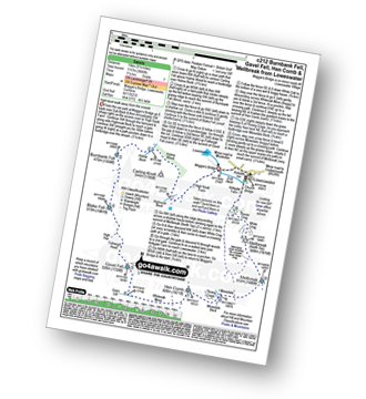
Route Summary:
Maggie's Bridge (Loweswater) - Loweswater - High Nook Farm - Highnook Beck - Holme Wood - Holme Beck - Burnbank Fell - Sharp Knott - Blake Fell - Fothergill Head - Gavel Fell - Grain Gill - Whiteoak Moss - Hen Comb - Thrang Crags - Mosedale (Loweswater) - Mosedale Beck (Loweswater) - Mellbreak - Mellbreak (North Top) - White Crag - Loweswater Village - Maggie's Bridge (Loweswater)

|
Vital Statistics:
| Length: | 8.5 miles (13.5 km) |
| Ascent: | 3,278 ft (999 m) |
| Time: | 6½ hrs |
| Grade: | |

Route Summary:
Glenridding - Birkhouse Moor - Hole-in-the-Wall - Red Tarn (Helvellyn) - Bleaberry Crag - Low Spying How - High Spying How - Striding Edge (High Spying How) - Helvellyn - Swirral Edge - Catstye Cam - Hole-in-the-Wall - Brownend Plantation - Grisedale Beck - Lanty's Tarn - Keldas - Glenridding

|
Vital Statistics:
| Length: | 7.25 miles (11.5 km) |
| Ascent: | 2,654 ft (809 m) |
| Time: | 5½ hrs |
| Grade: | |

Route Summary:
Little Town - Newlands Valley - Low Snab Farm - Scope End - High Crags - Hindscarth - Littledale Edge - Robinson - Blea Crags - High Snab Bank - High Snab Farm - Newlands Church - Little Town

|
Vital Statistics:
| Length: | 9.5 miles (15 km) |
| Ascent: | 3,477 ft (1,060 m) |
| Time: | 7 hrs |
| Grade: | |

Route Summary:
Seathwaite (Borrowdale) - Grains Gill - Styhead Gill - Styhead Tarn - Corridor Route - Scafell Pike - Broad Crag - Ill Crag - Great End - Esk Hause - Grains Gill - Seathwaite (Borrowdale)

|
Vital Statistics:
| Length: | 7 miles (11 km) |
| Ascent: | 2,661 ft (811 m) |
| Time: | 5.25 hrs |
| Grade: | |

Route Summary:
Grasmere - River Rothay - Grasmere (A591) - Stone Arthur - Great Rigg - Rydal Fell (Heron Pike North Top) - Heron Pike - Butter Crag - Alcock Tarn - Brackenfell - Dove Cottage - Grasmere (A591) - Grasmere

|
Vital Statistics:
| Length: | 5.5 miles (9 km) |
| Ascent: | 1,962 ft (598 m) |
| Time: | 4 hrs |
| Grade: | |

Route Summary:
Broughton Mills - River Lickle - Green Bank Farm - The Nursery - Hovel Knott - Dunnerdale Fell (Broughton Mills) - Great Stickle (Dunnerdale Fells) - Stickle Pike (Dunnerdale Fells) - Kiln Bank Cross - Park Head Road - Stainton Ground Quarry - Stephenson Haw - Raven's Crag (Stickle Pike) - The Knott (Dunnerdale Fells) - Broughton Mills

|
Vital Statistics:
| Length: | 10 miles (16 km) |
| Ascent: | 2,635 ft (803 m) |
| Time: | 6.25 hrs |
| Grade: | |

Route Summary:
Dob Gill Car Park (Thirlmere) - Harrop Tarn - Standing Crag - Ullscarf - Greenup Edge - Low White Stones - High Raise (Langdale) - Sergeant Man - Codale Head - Broadstone Head - Mere Beck - Brownrigg Moss - Calf Crag - Wyth Burn - Stockhow Bridge - Thirlmere

|
Vital Statistics:
| Length: | 4.75 miles (7.5 km) |
| Ascent: | 485 ft (148 m) |
| Time: | 2 hrs |
| Grade: |  |
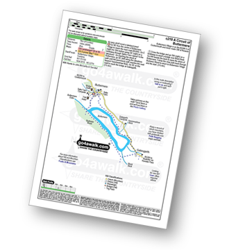
Route Summary:
Buttermere - Dalegarth - Hassnesshow Beck - Gatesgarth - Black Beck - Peggy's Bridge - Burtness Wood - Buttermere

|
Vital Statistics:
| Length: | 10 miles (16 km) |
| Ascent: | 3,382 ft (1,031 m) |
| Time: | 7 hrs |
| Grade: | |

Route Summary:
Glenridding - Birkhouse Moor - Hole-in-the-Wall - Red Tarn (Helvellyn) - Bleaberry Crag - Low Spying How - High Spying How - Striding Edge (High Spying How) - Helvellyn - Nethermost Pike - High Crag (Helvellyn) - Dollywaggon Pike - Grisdale Tarn - Ruthwaite Lodge - Grisedale Beck - Brownend Plantation - Lanty's Tarn - Keldas - Glenridding

|
Vital Statistics:
| Length: | 7.5 miles (12 km) |
| Ascent: | 262 ft (80 m) |
| Time: | 3 hrs |
| Grade: | |

Route Summary:
Buttermere - Great Wood - Wood House - Crummock Water - Hause Point - Rannerdale Bridge - Cinderdale Common - Lanthwaite Green - High Wood - Lanthwaite Wood - River Cocker - Park Beck - Iron Stone - Low Ling Crag - Scale Bridge - Buttermere

|
Vital Statistics:
| Length: | 10 miles (16 km) |
| Ascent: | 3,584 ft (1,092 m) |
| Time: | 7 hrs |
| Grade: | |

Route Summary:
Coniston - Church Beck - Levers Water Beck - Crowberry Haws - Low Water - Brim Fell - Levers Hawse - Swirl Band - Swirl How - Prison Band - Swirl Hawse - Keld Gill Head - Black Sails - Red Dell Head Moss - Wetherlam - Furness Fells - Coniston

|
Vital Statistics:
| Length: | 4.25 miles (6.5 km) |
| Ascent: | 98 ft (30 m) |
| Time: | 1½ hrs |
| Grade: |  |
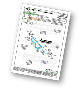
Route Summary:
Maggie's Bridge (Loweswater) - High Thrushbank - Loweswater - Waterend Youth Hostel - Hudson Place Farm - Holme Wood - Watergate Farm - Maggie's Bridge (Loweswater)

|
Vital Statistics:
| Length: | 10.75 miles (17 km) |
| Ascent: | 3,449 ft (1,051 m) |
| Time: | 7.25 hrs |
| Grade: | |

Route Summary:
Glenridding - Birkhouse Moor - Hole-in-the-Wall - Red Tarn (Helvellyn) - Catstye Cam - Swirral Edge - Helvellyn - Lower Man (Helvellyn) - White Side - Raise (Helvellyn) - Sticks Pass - Lucy's Tongue - Glenridding Beck - Glenridding

|
Vital Statistics:
| Length: | 4.5 miles (7.5 km) |
| Ascent: | 2,645 ft (806 m) |
| Time: | 4½ hrs |
| Grade: | |

Route Summary:
Great Langdale - The New Dungeon Ghyll - Great Langdale - Stickle Ghyll - Stickle Tarn - Jack's Rake - The Langdale Pikes - Pavey Ark - Thunacar Knott - Harrison Stickle - Pike of Stickle (Pike O' Stickle) - Loft Crag - Mark Gate - The New Dungeon Ghyll - Great Langdale

|
Vital Statistics:
| Length: | 8.5 miles (13.5 km) |
| Ascent: | 2,552 ft (778 m) |
| Time: | 6 hrs |
| Grade: | |
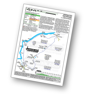
Route Summary:
Patterdale - Rooking - Boredale Hause - Place Fell - High Dodd (Sleet Fell) - Martindale - Sandwick - Long Crag (Ullswater) - Silver Point - Ullswater - Blowick - Rooking - Side Farm - Patterdale

|
Vital Statistics:
| Length: | 5 miles (8 km) |
| Ascent: | 912 ft (278 m) |
| Time: | 2.75 hrs |
| Grade: | |
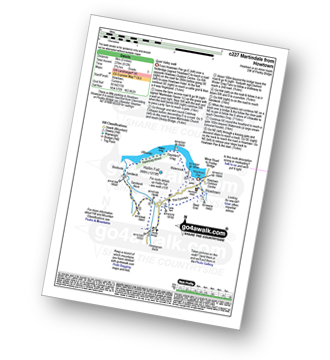
Route Summary:
Howtown - The Coombs - St Peter's Church - Lanty Tarn - Martindale - Christy Bridge - Howegrain Beck - Sandwick Beck - Sandwick - Hallinhag Wood - Geordie's Crag - Waternook - Howtown

|
Vital Statistics:
| Length: | 8.25 miles (13 km) |
| Ascent: | 2,334 ft (711 m) |
| Time: | 5½ hrs |
| Grade: | |

Route Summary:
Buttermere - Gatesgarth - Warnscale Bottom - Warnscale Beck - Green Crag (Buttermere) - Black Beck - Blackbeck Tarn - Innominate Tarn - Hay Stacks (Haystacks) - Scarth Gap - Burtness Wood - Buttermere

|
Vital Statistics:
| Length: | 5.75 miles (9 km) |
| Ascent: | 909 ft (277 m) |
| Time: | 3 hrs |
| Grade: | |
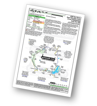
Route Summary:
Tom Gill - Tom Gill Waterfall - Tarn Hows - Rose Castle Plantation - Torver Intake - The Cumbria Way - Tom Heights - Arnside Intake - Stone Chair Hill - Griddle How - Oxen Fell High Cross - High Oxenfell Farm - Wythe Howe - Wythebank - Hodge Close Quarry - Bakestone Barrow Wood - Holme Ground - Low Tilberthwaite - Yew Bank - Shepherd's Bridge - Yew Tree Farm - Glen Mary Bridge - Tom Gill

|
Vital Statistics:
| Length: | 12.5 miles (20 km) |
| Ascent: | 3,411 ft (1,040 m) |
| Time: | 8 hrs |
| Grade: | |

Route Summary:
Ambleside - Rydal - Nab Scar - Heron Pike - Rydal Fell (Heron Pike North Top) - Great Rigg - Fairfield - Rydal Head - Hart Crag - Dove Crag - Little Hart Crag - Scandale Pass - Red Screes - Snarker Pike - Ambleside

|
Vital Statistics:
| Length: | 7.5 miles (12 km) |
| Ascent: | 3,131 ft (954 m) |
| Time: | 5.75 hrs |
| Grade: | |

Route Summary:
Cow Bridge - Brothers Water - Hartsop - Hartsop Dodd - Caudale Moor - Caudale Head - Stony Cove Pike (Caudale Moor) - Threshthwaite Mouth - Thornthwaite Crag - Gray Crag (Hayeswater) - Hayeswater Gill - Hartsop - Cow Bridge

|
Vital Statistics:
| Length: | 6 miles (9.5 km) |
| Ascent: | 1,401 ft (427 m) |
| Time: | 3½ hrs |
| Grade: | |

Route Summary:
Ambleside - Rothay Park - Ivy Fell - Loughrigg Fell - Loughrigg Terrace - Rydal Water - Loughrigg Caves - River Rothay - Pelter Bridge - Ambleside

|
Vital Statistics:
| Length: | 7.5 miles (12 km) |
| Ascent: | 4,195 ft (1,279 m) |
| Time: | 7 hrs |
| Grade: | |

Route Summary:
Wasdale Head - (National Trust Campsite) - Wast Water - Lingmell - Corridor Route - Scafell Pike - Mickledore - Foxes Tarn - Symonds Knott - Sca Fell - Lingmell Gill - Wasdale Head - Wast Water.

|
Vital Statistics:
| Length: | 8.5 miles (13.5 km) |
| Ascent: | 2,977 ft (907 m) |
| Time: | 6 hrs |
| Grade: | |
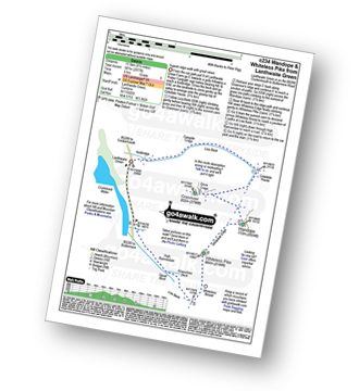
Route Summary:
Lanthwaite Green - Liza Beck - Gasgale Crags - Gasgale Gill - Coledale Hause - Grasmoor - Wandope - Whiteless Edge - Whiteless Pike - Whiteless Breast - Squat Beck - High Rannerdale - Crummock Water - Lanthwaite Green

|
Vital Statistics:
| Length: | 9.75 miles (15.5 km) |
| Ascent: | 3,516 ft (1,072 m) |
| Time: | 7 hrs |
| Grade: | |

Route Summary:
Patterdale - Arnison Crag - Birks - St Sunday Crag - Deepdale Hause - Cofa Pike - Fairfield - Rydal Head - Hart Crag - Blake Brow - Hartsop Above How - Hoggill Brow - Gale Crag - Bleaberry Knott - Cockley How - Bridgend - Patterdale

|
Vital Statistics:
| Length: | 8.25 miles (13 km) |
| Ascent: | 3,306 ft (1,008 m) |
| Time: | 6.25 hrs |
| Grade: | |
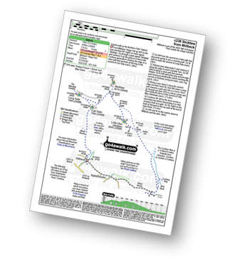
Route Summary:
Keswick - Millbeck - The Allerdale Ramble - Doups - White Stones - Carl Side - Longside Edge - Long Side - Skiddaw - Little Man (Skiddaw) - The Cumbria Way - Applethwaite - The Allerdale Ramble - Millbeck - Nr Keswick.

|
Vital Statistics:
| Length: | 7 miles (11 km) |
| Ascent: | 1,273 ft (388 m) |
| Time: | 3.75 hrs |
| Grade: | |

Route Summary:
Patterdale - Glenamara Park - Braesteads Farm - Elmhow Farm - Grisedale Bridge - Grisedale Beck - Ruthwaite Lodge (Bothy) - Grisedale Beck - Nethermostcove Beck - Grisedale Bridge - Patterdale

|
Vital Statistics:
| Length: | 7 miles (11 km) |
| Ascent: | 1,976 ft (602 m) |
| Time: | 4½ hrs |
| Grade: | |

Route Summary:
Elterwater - Elterwater Bridge - Dale End - Lingmoor Fell - Fat Man's Agony (or Fat Man's Struggle) - Side Pike - Great Langdale - Side House Farm - The Cumbria Way - Oak Howe - Chapel Stile - Elterwater Bridge - Elterwater

|
Vital Statistics:
| Length: | 11.25 miles (18 km) |
| Ascent: | 2,680 ft (817 m) |
| Time: | 6.75 hrs |
| Grade: | |

Route Summary:
Red Moss Nr Dockray - Barbary Rigg - Matterdale Common - Mariel Bridge - White Pike (Clough Head) - Clough Head - Calfhow Pike - Little Dodd (St John's Common) - Great Dodd - Watson's Dodd - Stybarrow Dodd - Green Side (White Stones) - Hart Side - Dowthwaitehead - Red Moss.

|
Vital Statistics:
| Length: | 7.75 miles (12.5 km) |
| Ascent: | 4,808 ft (1,465 m) |
| Time: | 7.75 hrs |
| Grade: | |

Route Summary:
Wasdale Head - Kirk Fell - Kirk Fell (East Top) - Black Sail Pass - Looking Stead (Pillar) - High Level Route - Robinson's Cairn - Pillar - Wind Gap - Black Crag (Pillar) - Scoat Fell (Little Scoat Fell) - Steeple - Red Pike (Wasdale) - Dore Head - Mosedale Beck - Wasdale Head - Wast Water.

|
Vital Statistics:
| Length: | 8.25 miles (13 km) |
| Ascent: | 3,016 ft (919 m) |
| Time: | 6 hrs |
| Grade: | |
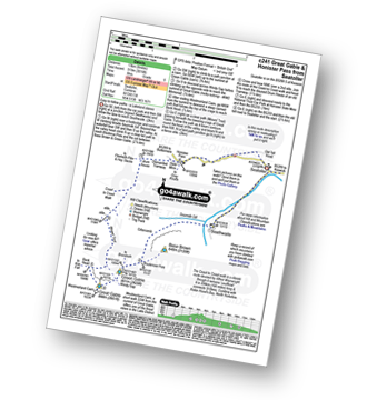
Route Summary:
Seatoller - Seathwaite (Borrowdale) - Sourmilk Gill (Borrowdale) - Gillercomb - Blackmoor Pols - Mitchell Cove - Green Gable - Windy Gap - Great Gable - Westmorland Cairn - Beck Head - Beckhead Tarn - Moses' Trod - Honister Pass - Honister Hause - Wainwright's Coast to Coast Walk - Seatoller

|
Vital Statistics:
| Length: | 6.25 miles (10 km) |
| Ascent: | 941 ft (287 m) |
| Time: | 3 hrs |
| Grade: | |


|
Vital Statistics:
| Length: | 11.25 miles (18 km) |
| Ascent: | 3,371 ft (1,027 m) |
| Time: | 7½ hrs |
| Grade: | |

Route Summary:
Rosthwaite - Stonethwaite - Wainwright's Coast to Coast Walk - Stonethwaite Beck - Galleny Force - The Cumbria Way - Langstrath Beck - Eagle Crag - Sergeant's Crag - High Raise (Langdale) - Low White Stones - Greenup Edge - Ullscarf - High Saddle (Coldbarrow Fell) - Low Saddle (Coldbarrow Fell) - Lord's How - Dock Tarn - Willygrass Gill - Great Crag - Rosthwaite

|
Vital Statistics:
| Length: | 6 miles (9.5 km) |
| Ascent: | 699 ft (213 m) |
| Time: | 2.75 hrs |
| Grade: | |
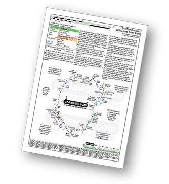
Route Summary:
Oxen Park - Furness - Abbot Park - Lord Ling - The Riggs - High Ickenthwaite - Low Ickenthwaite - Big Plantation - Glass Knott - The Syke - Rusland Cross - Rusland Hall - Rusland Moss Nature Reserve - Hulleter Moss - Low Hay Bridge Nature Reserve - Crooks Pastures - Black Knotts Plantation - Moss Wood - Oxen Park

|
Vital Statistics:
| Length: | 11 miles (17.5 km) |
| Ascent: | 3,264 ft (995 m) |
| Time: | 7.25 hrs |
| Grade: | |

Route Summary:
Mungrisdale - Souther Fell - River Glendermackin - Brunt Knott - Scales Beck - Scales Tarn - Sharp Edge - Atkinson Pike - Blencathra or Saddleback (Hallsfell Top) - Mungrisdale Common - Bannerdale Crags - Bowscale Fell - Tarn Crags Top - Raven Crags - Mungrisdale

|
Vital Statistics:
| Length: | 7.25 miles (11.5 km) |
| Ascent: | 3,164 ft (964 m) |
| Time: | 5.75 hrs |
| Grade: | |

Route Summary:
Lanthwaite Green - Liza Beck - Whin Ben - Whiteside (Crummock) (West Top) - Whiteside (Crummock) - Gasgale Crags - Hopegill Head - Hobcarton Crag - Sand Hill - Coledale Hause - Grasmoor - Liza Beck - Gasgale Gill - Lanthwaite

|
Vital Statistics:
| Length: | 11 miles (17.5 km) |
| Ascent: | 3,633 ft (1,107 m) |
| Time: | 7.75 hrs |
| Grade: | |

Route Summary:
Ambleside - Rydal - Nab Scar - Heron Pike - Rydal Fell (Heron Pike North Top) - Great Rigg - Fairfield - Rydal Head - Hart Crag - Dove Crag - High Pike (Scandale) - Low Pike (Scandale) - High Sweden Bridge - High Sweden Coppice - Ambleside

|
Vital Statistics:
| Length: | 8.25 miles (13 km) |
| Ascent: | 2,919 ft (890 m) |
| Time: | 6 hrs |
| Grade: | |

Route Summary:
High Side - The Allerdale Ramble - Ling How - The Edge - Ullock Pike - Longside Edge - Long Side - Carl Side - Skiddaw - Bakestall - Birkett Edge - Whitewater Dash - Back O' Skiddaw - Melbecks - High Side

|
Vital Statistics:
| Length: | 9 miles (14.5 km) |
| Ascent: | 2,619 ft (798 m) |
| Time: | 6 hrs |
| Grade: | |
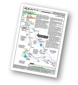
Route Summary:
Patterdale - Side Farm - Boredale Hause - Angletarn Pikes - Angle Tarn (Martindale) - Satura Crag - Brock Crags - Satura Crag - The Knott - Hayeswater Reservoir - Hayeswater Gill - Hartsop - Dubhow - Beckstones - Crookabeck - Rooking - Side Farm - Patterdale

|
Vital Statistics:
| Length: | 7.25 miles (11.5 km) |
| Ascent: | 683 ft (208 m) |
| Time: | 3.25 hrs |
| Grade: | |

Route Summary:
Bowness Knott Car Park - Bowness Plantations - River Liza - Ennerdale Water - Coast To Coast Path - Robin Hood's Chair - Anglers' Crag - Ennerdale Weir - River Ehen - Ennerdale Water - Bowness Knott Car Park

|
Vital Statistics:
| Length: | 12.5 miles (20 km) |
| Ascent: | 3,814 ft (1,162 m) |
| Time: | 8½ hrs |
| Grade: | |

Route Summary:
Mardale Head - Haweswater - Rowantreethwaite Beck - Old Corpse Road - Selside Pike - Branstree (North East Top) - Branstree (Artlecrag Pike) - Gatescarth Pass - Adam Seat - Harter Fell (Mardale) - Nan Bield Pass - Mardale Ill Bell - High Street - Riggindale - Rampsgill Head - Wainwright's Coast to Coast Walk - Kidsty Pike - Kidsty Howes - Bowderthaite Bridge - The Rigg - Mardale Head

|
Vital Statistics:
| Length: | 5 miles (8 km) |
| Ascent: | 1,533 ft (467 m) |
| Time: | 3½ hrs |
| Grade: | |
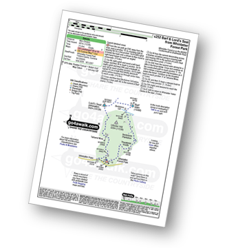
Route Summary:
Whinlatter Forest Park - Thwaitehill Knotts - Beckstone Plantation - Beckstone Gill - Barf - Lord's Seat (Whinlatter) - Whinlatter Forest Park

|
Vital Statistics:
| Length: | 5 miles (8 km) |
| Ascent: | 649 ft (198 m) |
| Time: | 2.75 hrs |
| Grade: | |

Route Summary:
Hawes End - Gutherscale - Derwent Water - Skelgill Farm - Yewthwaite Gill - Little Town - Parrocks Gill - Goldscope Lead Mine - Newlands Beck - Low Snab Farm - Newlands Church - Newlands Valley - Rigg Beck - Rowling End Farm - Newlands Beck - Ghyll Bank - Skelgill Farm - Gutherscale - Hawes End

|
Vital Statistics:
| Length: | 7.5 miles (12 km) |
| Ascent: | 2,762 ft (842 m) |
| Time: | 5.25 hrs |
| Grade: | |

Route Summary:
Coniston - Walna Scar Road - Boo Tarn - The Old Man of Coniston - Brim Fell - Levers Water - Boulder Valley - Crowberry Haws - Miners Bridge - Coniston

|
Vital Statistics:
| Length: | 7.5 miles (12 km) |
| Ascent: | 787 ft (240 m) |
| Time: | 3½ hrs |
| Grade: | |

Route Summary:
Windermere - Ellery Woods - Orrest Head - Near Orrest Farm - Mislet Farm - Heaning Farm - Blackmoss Farm - School Knott Plantation - School Knott - The Dales Way - High Cleabarrow Farm - Matson Ground - Heaththwaite Manor - Windermere

|
Vital Statistics:
| Length: | 7 miles (11 km) |
| Ascent: | 3,243 ft (988 m) |
| Time: | 5.75 hrs |
| Grade: | |

Route Summary:
Lanthwaite Green - Grasmoor - Wandope - Whiteless Edge - Whiteless Pike - Whiteless Breast - Low Bank - Rannerdale Knotts - Crummock Water - Lanthwaite Green

|
Vital Statistics:
| Length: | 11.5 miles (18.5 km) |
| Ascent: | 3,378 ft (1,030 m) |
| Time: | 7½ hrs |
| Grade: | |

Route Summary:
Kentmere - Garburn Pass - Yoke - Ill Bell - Froswick - Thornthwaite Crag - Mardale Ill Bell - Nan Bield Pass - Harter Fell (Mardale) - Kentmere Pike - Brookstones - Kentmere

|
Vital Statistics:
| Length: | 4.5 miles (7 km) |
| Ascent: | 1,902 ft (580 m) |
| Time: | 3½ hrs |
| Grade: | |

Route Summary:
Great Langdale - The Old Dungeon Ghyll - Wall End Farm - Redacre Gill - Wrynose Fell - Pike of Blisco (Pike O' Blisco) - Red Tarn (Langdale) - Browney Gill - Oxendale Beck - Oxendale - Stool End Farm - The Old Dungeon Ghyll - Great Langdale

|
Vital Statistics:
| Length: | 10 miles (16 km) |
| Ascent: | 492 ft (150 m) |
| Time: | 4 hrs |
| Grade: | |

Route Summary:
The Swirls Car Park - Thirlmere - Dalehead Hall - Thirlspot - Valve Houses - Beech Grove - Armboth - Hause Point - Dobgill Bridge - Wythburn - Stockhow Bridge - Wyth Burn - Helvellyn Screes - Highpark Wood - The Swirls Car Park - Thirlmere

|
Vital Statistics:
| Length: | 4.5 miles (7 km) |
| Ascent: | 361 ft (110 m) |
| Time: | 2 hrs |
| Grade: | |

Route Summary:
Keswick - Keswick Station - Former Keswick Railway Line - A591 - Chestnut Hill - Castlerigg Stone Circle - High Nest Farm - Castlerigg - Brockle Beck - Springs Farm - Keswick

|
Vital Statistics:
| Length: | 6.5 miles (10.5 km) |
| Ascent: | 1,453 ft (443 m) |
| Time: | 4 hrs |
| Grade: | |

Route Summary:
Seathwaite (Duddon Valley) - Hollin House Haw - Tarn Beck - Worm How - Trountal Tongue - Throng Close - Foss How - Brow Side - Pike How - Birks Bridge - Birks Farm Field Centre - Dunnerdale Forest - Grassguards Farm - Basin Barrow - Rowantree How - Wallowbarrow Crag - Wallowbarrow Farm - Seathwaite (Duddon Valley)

|
Vital Statistics:
| Length: | 8.75 miles (14 km) |
| Ascent: | 3,390 ft (1,033 m) |
| Time: | 6.25 hrs |
| Grade: | |

Route Summary:
Buttermere - Scale Force - Scale Beck - Blea Crag - Lingcomb Edge - Red Pike (Buttermere) - High Stile - High Crag (Buttermere) - Gamlin End - Seat (Buttermere) - Scarth Gap - Burtness Wood - Sourmilk Gill - Buttermere

|
Vital Statistics:
| Length: | 13.25 miles (21 km) |
| Ascent: | 5,189 ft (1,581 m) |
| Time: | 10 hrs |
| Grade: | |

Route Summary:
Patterdale - Grisedale Bridge - Grisedale Beck - Brownend Plantation - Hole-in-the-Wall - Birkhouse Moor - Hole-in-the-Wall - Red Tarn (Helvellyn) - Bleaberry Crag - Low Spying How - High Spying How - Striding Edge (High Spying How) - Helvellyn - Nethermost Pike - High Crag (Helvellyn) - Dollywaggon Pike - Seat Sandal - Grisedale Tarn - St Sunday Crag - Birks - Arnison Crag - Patterdale

|
Vital Statistics:
| Length: | 9 miles (14 km) |
| Ascent: | 131 ft (40 m) |
| Time: | 3.25 hrs |
| Grade: | |
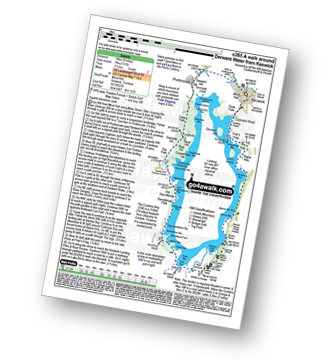
Route Summary:
Keswick - The Cumbria Way - The Allerdale Ramble - Portinscale - Nichol End - Derwent Water - Hawes End - Brandlehow Point - Park Neb - Strutta Wood - Calfclose Bay - Stable Hills - Friar's Crag - Keswick

|
Vital Statistics:
| Length: | 7.5 miles (12 km) |
| Ascent: | 3,116 ft (950 m) |
| Time: | 6 hrs |
| Grade: | |

Route Summary:
Grasmere - Wainwright's Coast to Coast Walk - Mill Bridge - Little Tongue - Seat Sandal - Grisedale Tarn - Fairfield - Rydal Head - Great Rigg - Stone Arthur - Grasmere

|
Vital Statistics:
| Length: | 15.25 miles (24.5 km) |
| Ascent: | 4,125 ft (1,257 m) |
| Time: | 9.75 hrs |
| Grade: | |

Route Summary:
Ennerdale Weir - Ennerdale Water - Silver Cove Beck - Woundell Beck - Little Gowder Crag - Haycock - Caw Fell - Silver Cove - Iron Crag - Whoap - Lank Rigg - Crag Fell - Grike - Ennerdale Weir

|
Vital Statistics:
| Length: | 5.5 miles (8.5 km) |
| Ascent: | 974 ft (297 m) |
| Time: | 3 hrs |
| Grade: | |

Route Summary:
Staveley - Barley Bridge - Craggy Plantation - Spy Crag - Littlewood Farm - Birk Field Farm - Potter Tarn - Ghyll Pool - Hundhowe - Hagg Foot - The River Kent - The Dales Way - Beckmickle Ing - Staveley

|
Vital Statistics:
| Length: | 11.5 miles (18.5 km) |
| Ascent: | 4,582 ft (1,396 m) |
| Time: | 8.75 hrs |
| Grade: | |

Route Summary:
Patterdale - Grisedale Bridge - Grisedale Beck - Brownends Plantation - Hole-in-the-Wall - Birkhouse Moor - Hole-in-the-Wall - Red Tarn (Helvellyn) - Bleaberry Crag - Low Spying How - High Spying How - Striding Edge (High Spying How) - Helvellyn - Nethermost Pike - High Crag (Helvellyn) - Dollywaggon Pike - Grisedale Tarn - Deepdale Hause - St Sunday Crag - Birks - Patterdale

|
Vital Statistics:
| Length: | 7.75 miles (12.5 km) |
| Ascent: | 2,419 ft (737 m) |
| Time: | 5.25 hrs |
| Grade: | |

Route Summary:
Stonethwaite - Stonethwaite Bridge - Stonethwaite Beck - The Cumbria Way - Wainwright's Coast to Coast Walk - Galleny Force - Greenup Gill - Lining Crag - Greenup Edge - Ullscarf - High Saddle (Coldbarrow Fell) - Low Saddle (Coldbarrow Fell) - Lord's How - Green Combe - Dock Tarn - Great Crag - Willygrass Gill - Stonethwaite

|
Vital Statistics:
| Length: | 9.75 miles (15.5 km) |
| Ascent: | 5,140 ft (1,567 m) |
| Time: | 8.75 hrs |
| Grade: | |

Route Summary:
Wasdale Head - (National Trust Campsite) - Wast Water - Lingmell - Middleboot Knotts - Round How (Scafell) - Great End - Ill Crag - Broad Crag - Scafell Pike - Mickledore - Foxes Tarn - Symonds Knott - Sca Fell - Wast Water.

|
Vital Statistics:
| Length: | 12.5 miles (20 km) |
| Ascent: | 3,889 ft (1,185 m) |
| Time: | 8½ hrs |
| Grade: | |
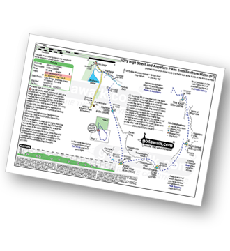
Route Summary:
Cow Bridge - Brothers Water - Hartsop - Hartsop Dodd - Stony Cove Pike - Caudale Head - Caudale Moor - Stony Cove Pike (Caudale Moor) - Threshthwaite Mouth - Thornthwaite Crag - High Street - Straits of Riggindale - The Knott - Angle Tarn (Martindale) - Angletarn Pikes - Boredale Hause - Patterdale

|
Vital Statistics:
| Length: | 11.5 miles (18.5 km) |
| Ascent: | 3,214 ft (980 m) |
| Time: | 7½ hrs |
| Grade: | |
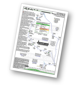
Route Summary:
Keswick - Gale Road - Lonscale Fell - Jenkin Hill - Little Man (Skiddaw) - Skiddaw - Bakestall - Birkett Edge - Whitewater Dash - Back O' Skiddaw - The Cumbria Way - Skiddaw House - Gale Road (Underscar) Nr Keswick.

|
Vital Statistics:
| Length: | 5.25 miles (8.5 km) |
| Ascent: | 1,099 ft (335 m) |
| Time: | 3 hrs |
| Grade: | |

Route Summary:
Elterwater - Walthwaite Common - Huntingstile Crag - Red Bank Wood - Loughrigg Terrace - Loughrigg Fell - Ivy Crag - Loughrigg Tarn - Tarn Foot - Skelwith Bridge - River Brathay - Skelwith Force - The Cumbria Way - Elter Water - Elterwater

|
Vital Statistics:
| Length: | 7.75 miles (12.5 km) |
| Ascent: | 1,923 ft (586 m) |
| Time: | 4.75 hrs |
| Grade: | |
Route Summary:
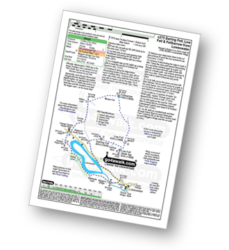
Maggie's Bridge (Loweswater) - Loweswater - Darling Fell - Crabtree Beck - Low Fell (South Top) - Low Fell - Fellbarrow - Mosser Fell - Wilkes How - Waterend Youth Hostel - Hudson Place Farm - Holme Wood - Watergate Farm - Maggie's Bridge (Loweswater)

|
Vital Statistics:
| Length: | 7.25 miles (11.5 km) |
| Ascent: | 2,745 ft (837 m) |
| Time: | 5½ hrs |
| Grade: | |

Route Summary:
Mardale Head - Haweswater Reservoir - The Rigg - Dudderwick - Swine Crag (Riggindale) - Heron Crag (Riggindale) - Rough Crag (Riggindale) - Caspel Gate - Riggindale Crag - Long Stile - High Street - Mardale Ill Bell - Nan Bield Pass - Harter Fell (Mardale) - Adam Seat - Gatescarth Pass - Mardale Head

|
Vital Statistics:
| Length: | 7.75 miles (12.5 km) |
| Ascent: | 2,247 ft (685 m) |
| Time: | 5 hrs |
| Grade: | |
Route Summary:
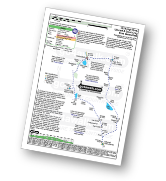
Watendlath - High Tove - Middle Crag - Shivery Man - Shivery Knott - Long Moss - Blea Tarn (Watendlath Fell) - Ullscarf - High Saddle (Coldbarrow Fell) - Low Saddle (Coldbarrow Fell) - Lord's How - Green Combe - Dock Tarn - Great Crag - Watendlath

|
Vital Statistics:
| Length: | 10 miles (16 km) |
| Ascent: | 4,007 ft (1,221 m) |
| Time: | 7½ hrs |
| Grade: | |

Route Summary:
Great Langdale - The Old Dungeon Ghyll - Wall End Farm - Redacre Gill - Wrynose Fell - Pike of Blisco (Pike O' Blisco) - Red Tarn (Langdale) - Cold Pike - Cold Pike (West Top) - Cold Pike (Far West Top) - Great Knott - Little Stand - Great Knott - Crinkle Crags (South Top) - Crinkle Crags (Long Top) - Crinkle Crags (Gunson Knott) - Shelter Crags - Shelter Crags - (North Top) - Three Tarns - Earing Crag - White Stones - The Band - Oxendale - Stool End Farm - The Old Dungeon Ghyll - Great Langdale

|
Vital Statistics:
| Length: | 6.25 miles (10 km) |
| Ascent: | 1,756 ft (535 m) |
| Time: | 4 hrs |
| Grade: | |
Route Summary:
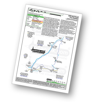
Eskdale - Jubilee Bridge - Hardknott Pass - Hardknott Castle. (Roman Fort) - Hardknott Pass - Hard Knott - Yew Bank - Lingcove Beck - Lingcove Bridge - Great Moss - River Esk - Jubilee Bridge - Eskdale

|
Vital Statistics:
| Length: | 8.25 miles (13 km) |
| Ascent: | 2,924 ft (891 m) |
| Time: | 6 hrs |
| Grade: | |

Route Summary:
Great Langdale - The New Dungeon Ghyll - Stickle Ghyll - Stickle Tarn - North Rake - The Langdale Pikes - Pavey Ark - Thunacar Knott - Harrison Stickle - Loft Crag - Pike of Stickle (Pike O' Stickle) - Martcrag Moor - Stake Pass - The Cumbria Way - Stake Gill - Mickleden - Mickleden Beck - The New Dungeon Ghyll - Great Langdale

|
Vital Statistics:
| Length: | 8.5 miles (13.5 km) |
| Ascent: | 1,994 ft (608 m) |
| Time: | 5 hrs |
| Grade: | |

Route Summary:
Howtown - Lock Bank - White Knott - Barton Fell - Whinny Crag - Arthur's Pike - Loadpot Hill - Bonscale Pike - Swarthbeck Gill - Howtown

|
Vital Statistics:
| Length: | 7.75 miles (12.5 km) |
| Ascent: | 2,198 ft (670 m) |
| Time: | 5 hrs |
| Grade: | |
Route Summary:
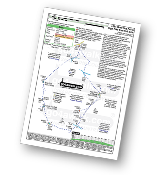
Fell Side - Dale Beck - Brae Fell - Little Sca Fell - Great Sca Fell - Knott (Uldale Fells) - Grainsgill Beck - The Cumbria Way - Lingy Hut - Miller Moss - Great Lingy Hill - Hare Stones - High Pike (Caldbeck) - Long Grain Beck - Fell Side

|
Vital Statistics:
| Length: | 6 miles (9.5 km) |
| Ascent: | 295 ft (90 m) |
| Time: | 2½ hrs |
| Grade: | |
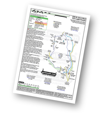
Route Summary:
Legburthwaite Car Park - Bridgend Farm - Shoulthwaite Farm - Shaw Bank - Carlisle Diocese Youth Centre - St John's in The Vale Church - Low Bridge End Farm - Legburthwaite Car Park

|
Vital Statistics:
| Length: | 11.5 miles (18.5 km) |
| Ascent: | 4,418 ft (1,346 m) |
| Time: | 8½ hrs |
| Grade: | |

Route Summary:
Glenridding - Glenridding Dodd - Sheffield Pike - Nick Head - Glencoyne Head - Hart Side - Green Side (White Stones) - Stybarrow Dodd - Sticks Pass - Raise (Helvellyn) - White Side - Lower Man (Helvellyn) - Helvellyn - Swirral Edge - Catstye Cam - Red Tarn Beck - Glenridding Beck - Glenridding Youth Hostel - Glenridding

|
Vital Statistics:
| Length: | 11.25 miles (18 km) |
| Ascent: | 4,132 ft (1,259 m) |
| Time: | 8.25 hrs |
| Grade: | |

Route Summary:
Buttermere - Scale Force - Scale Beck - Blea Crag - Lingcomb Edge - Red Pike (Buttermere) - High Stile - High Crag (Buttermere) - Gamlin End - Seat (Buttermere) - Scarth Gap - Hay Stacks (Haystacks) - Innominate Tarn - Blackbeck Tarn - Black Beck - Green Crag (Buttermere) - Warnscale Beck - Warnscale Bottom - Gatesgarth - Buttermere

|
Vital Statistics:
| Length: | 5 miles (8 km) |
| Ascent: | 2,002 ft (610 m) |
| Time: | 4 hrs |
| Grade: | |
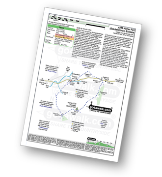
Route Summary:
Eskdale - Jubilee Bridge - Eskdale - Dobknott Gill - Spothow Gill - Harter Fell (Eskdale) - Dunnerdale Forest - Hardknott Pass - Hardknott Castle (Roman Fort) - Jubilee Bridge - Eskdale

|
Vital Statistics:
| Length: | 5.25 miles (8.5 km) |
| Ascent: | 899 ft (274 m) |
| Time: | 3 hrs |
| Grade: | |
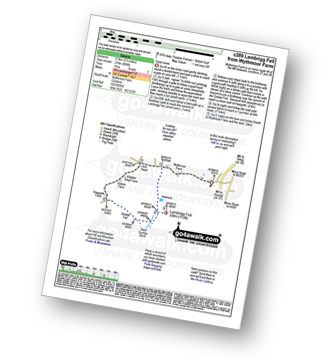

|
Vital Statistics:
| Length: | 7.75 miles (12.5 km) |
| Ascent: | 1,292 ft (394 m) |
| Time: | 4 hrs |
| Grade: | |
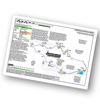
Route Summary:
Over Water Reservoir - Binsey Cottage - Binsey - Whittas Park - High House - High Ireby - Ruthwaite - Scawthwaite Mire - Over Water

|
Vital Statistics:
| Length: | 8.25 miles (13 km) |
| Ascent: | 2,512 ft (766 m) |
| Time: | 5½ hrs |
| Grade: | |

Route Summary:
Hawes End - Derwent Water - Newlands Valley - Skelgill Bank - Woodford's Path - Cat Bells (Catbells) - Maiden Moor - High Spy (North Top) - High Spy - Dalehead Tarn - Newlands Valley - Newlands Church - Little Town - Hawes End

|
Vital Statistics:
| Length: | 8.75 miles (14 km) |
| Ascent: | 558 ft (170 m) |
| Time: | 3½ hrs |
| Grade: | |
Route Summary:
Ambleside - Scandale Beck - Rydal Park - Rydal Hall - Rydal - Rydal Mount - Rydal Water - Coffin Route - Dove Cottage - Grasmere Village - Silverhowe - The Lea - Grasmere - Red Bank - Rydal Cave - Jobson Close - Rough Intake - Pelter Bridge - Foxghyll - River Rothay - Rothay Park - Ambleside

|
Vital Statistics:
| Length: | 8.5 miles (13.5 km) |
| Ascent: | 2,435 ft (742 m) |
| Time: | 5½ hrs |
| Grade: | |

Route Summary:
Grasmere - Goody Bridge - Ghyll Foot Farm - Green Burn - Greenburn Bottom - Contra Breast - Dead Pike - Steel Fell (Dead Pike) - Brownrigg Moss - Calf Crag - Gibson Knott - Helm Crag - The Lion and The Lamb - The Howitzer - High Raven Crag - Grasmere

|
Vital Statistics:
| Length: | 5.80 miles (8.5 km) |
| Ascent: | 2,455 ft (748 m) |
| Time: | 4½ hrs |
| Grade: | |

Route Summary:
Buttermere - Gatesgarth - Peggy's Bridge - Buttermere - Scarth Gap - Hay Stacks (Haystacks) - Innominate Tarn - Blackbeck Tarn - Black Beck - Green Crag (Buttermere) - Warnscale Beck - Dubs Hut - Dubs Quarry - Fleetwith Pike - Honister Crag (Black Star) - Fleetwith Pike - Fleetwith Edge - Gatesgarth - Buttermere

|
Vital Statistics:
| Length: | 9.5 miles (15 km) |
| Ascent: | 2,257 ft (688 m) |
| Time: | 5½ hrs |
| Grade: | |
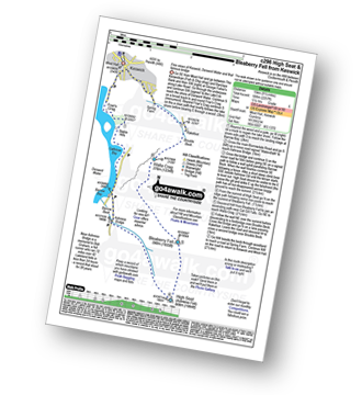
Route Summary:
Keswick - Derwent Water - Friar's Crag - Calfclose Bay - Barrow Bay - Derwent Water - Ashness Bridge - High Seat (Ashness Fell) - Bleaberry Fell - Walla Crag - Rakefoot - Castlerigg - Keswick

|
Vital Statistics:
| Length: | 14.5 miles (23 km) |
| Ascent: | 4,555 ft (1,388 m) |
| Time: | 9.75 hrs |
| Grade: | |

Route Summary:
St Peter's Church (Martindale) - Howtown - Steel Knotts (Pikeawassa) - Keasgill Head - High Raise (Mardale) - Kidsty Pike - Rampsgill Head - The Knott - Rest Dodd - The Nab - Satura Crag - Brock Crags - Angle Tarn (Martindale) - Angletarn Pikes - Bedafel Knott - Beda Head (Beda Fell) - Winter Crag - Christy Bridge - Howegrain Beck - Martindale - St Peter's Church (Martindale) - Howtown

|
Vital Statistics:
| Length: | 6.25 miles (10 km) |
| Ascent: | 1,968 ft (600 m) |
| Time: | 4.25 hrs |
| Grade: | |
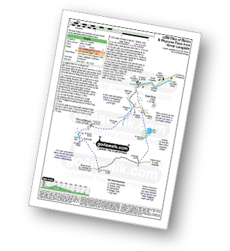
Route Summary:
Great Langdale - The Old Dungeon Ghyll - Wall End Farm - Redacre Gill - Wrynose Fell - Pike of Blisco (Pike O' Blisco) - Red Tarn (Langdale) - Wrynose Pass - Blea Tarn (Langdale) - The Old Dungeon Ghyll - Great Langdale

|
Vital Statistics:
| Length: | 7.25 miles (11.5 km) |
| Ascent: | 3,013 ft (918 m) |
| Time: | 5.75 hrs |
| Grade: | |
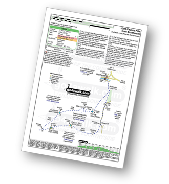
Route Summary:
Braithwaite - Barrow (Newlands) - Stile End - Low Moss - Outerside - High Moss - Scar Crags - Causey Pike - Sleet Hause - Rowling End - Stoneycroft - Braithwaite

|
Vital Statistics:
| Length: | 9.75 miles (15.5 km) |
| Ascent: | 3,046 ft (928 m) |
| Time: | 6½ hrs |
| Grade: | |

Route Summary:
Seatoller - Strands Bridge - Borrowdale - The Combe - Thornythwaite Fell - Comb Head - Glaramara - Looking Steads (Glaramara) - Red Beck - Red Beck Top - Allen Gill - High House Tarn - High House Tarn Top - Allen Crags - Esk Hause - Ruddy Gill - Sprinkling Tarn - Sty Head - Sty Head Tarn - Sty Head Gill - Stockley Bridge - Grains Gill - Seathwaite (Borrowdale) - The Allerdale Ramble - Seatoller

|
Vital Statistics:
| Length: | 10.25 miles (16.5 km) |
| Ascent: | 3,128 ft (953 m) |
| Time: | 6.75 hrs |
| Grade: | |

Route Summary:
Grasmere - Goody Bridge - High Raven Crag - Helm Crag - The Lion and The Lamb - The Howitzer - Gibson Knott - Calf Crag - Brownrigg Moss - Greenup Edge - High Raise (Langdale) - Sergeant Man - Belles Knott - Coledale Tarn - Easedale Tarn - Sour Milk Gill - Easedale - Grasmere

|
Vital Statistics:
| Length: | 8 miles (12 km) |
| Ascent: | 3,042 ft (927 m) |
| Time: | 5.75 hrs |
| Grade: | |

Route Summary:
Fell Foot Bridge - Little Langdale - Hollin Crag - Wet Side Edge - Little Carrs - Great Carrs - Swirl How - Swirl Hawse - Keld Gill Head - Black Sails - Red Dell Head Moss - Wetherlam - Wetherlam Edge - Birk Fell - Greenburn Beck - Fell Foot Bridge

|
Vital Statistics:
| Length: | 9.75 miles (15.5 km) |
| Ascent: | 3,470 ft (1,058 m) |
| Time: | 7 hrs |
| Grade: | |
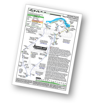
Route Summary:
St Peter's Church (Martindale) - Howtown - Howegrain Beck - Christy Bridge - Beda Head (Beda Fell) - Martindale Common - Angletarn Pikes - Angle Tarn (Martindale) - Boredale Hause - Steel Edge - Place Fell - High Dodd (Sleet Fell) - Sandwick - Hallinhag Wood - Geordies Crag - Hallin Fell (Martindale) - Howtown

|
Vital Statistics:
| Length: | 9.75 miles (15.5 km) |
| Ascent: | 3,699 ft (1,127 m) |
| Time: | 7.25 hrs |
| Grade: | |
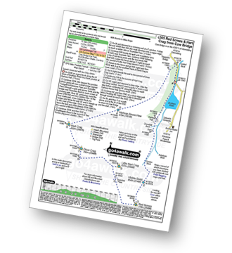
Route Summary:
Cow Bridge Car Park - Brothers Water - Hartsop Hall - Kirkstone Beck - Caiston Beck - Middle Dodd - Red Screes - Scandale Pass - Little Hart Crag - Dove Crag - Hart Crag - Blake Brow - Hartsop Above How - Hoggill Brow - Gale Crag - Bleaberry Knott - Cockley How - Cow Bridge

|
Vital Statistics:
| Length: | 9.75 miles (15.5 km) |
| Ascent: | 3,664 ft (1,117 m) |
| Time: | 7.25 hrs |
| Grade: | |

Route Summary:
Coniston - Church Beck - Levers Water Beck - Crowberry Haws - Low Water - The Old Man of Coniston - Brim Fell - Levers Hawse - Swirl Band - Swirl How - Prison Band - Swirl Hawse - Keld Gill Head - Black Sails - Red Dell Head Moss - Wetherlam - Furness Fells - Coniston

|
Vital Statistics:
| Length: | 12.25 miles (19.5 km) |
| Ascent: | 3,254 ft (992 m) |
| Time: | 7½ hrs |
| Grade: | |

Route Summary:
Brownrigg Farm - Great Mell Fell - Greenrow Great Barn - Lowthwaite - Little Mell Fell - The Hause - Underwood - Cove Park Campsite - Watermillock - Priest's Crag - Great Meldrum - Gowbarrow Fell (Airy Crag) - Norman Crag - Ulcat Row - Matterdale End - Brownrigg Farm

|
Vital Statistics:
| Length: | 12 miles (19 km) |
| Ascent: | 5,261 ft (1,603 m) |
| Time: | 9.75 hrs |
| Grade: | |

Route Summary:
Braithwaite - Sleet How - Grisedale Pike - Hobcarton Crag - Hopegill Head - Sand Hill - Coledale Hause - Grasmoor - Wandope - Crag Hill (Eel Crag) - Sail (Derwent Fells) - Scar Crags - Causey Pike - Outerside - Stile End - Barrow (Newlands) - Braithwaite

|
Vital Statistics:
| Length: | 11 miles (17.5 km) |
| Ascent: | 1,418 ft (432 m) |
| Time: | 5½ hrs |
| Grade: | |
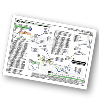
Route Summary:
Gosforth - Rowend Bridge - River Bleng - Bleng Bridge - Hall Bolton - Bolton Head - Low Thistleton Farm - High Thistleton Farm - Guards Head Farm - Hollow Moor - Brown Edge - Blengdale Forest - River Bleng - Scalderskew Beck - Ponsonby Fell - Scargreen Farm - Gidd Hall Farm - Ponsonby Old Hall - Middle Boonwood - Gosforth

|
Vital Statistics:
| Length: | 7 miles (11 km) |
| Ascent: | 2,373 ft (723 m) |
| Time: | 5 hrs |
| Grade: | |
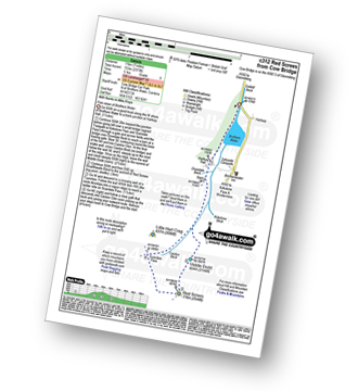
Route Summary:
Cow Bridge - Brothers Water - Hartsop Hall - Kirkstone Beck - Caiston Beck - Middle Dodd - Red Screes - Scandale Pass - Caiston Beck - Brothers Water.

|
Vital Statistics:
| Length: | 12 miles (19 km) |
| Ascent: | 4,152 ft (1,266 m) |
| Time: | 8½ hrs |
| Grade: | |

Route Summary:
Hawes End - Derwent Water - Skelgill Bank - Woodford's Path - Cat Bells (Catbells) - Maiden Moor - High Spy (North Top) - High Spy - Dale Head Tarn - Dale Head (Newlands) - Hindscarth Edge - Hindscarth - Littledale Edge - Robinson - High Snab Bank - Newlands Church - Little Town - Hawes End - Derwent Water.

|
Vital Statistics:
| Length: | 7.25 miles (11.5 km) |
| Ascent: | 3,116 ft (950 m) |
| Time: | 5.75 hrs |
| Grade: | |

Route Summary:
Old Sawmill Tearooms - Longside Wood - The Allerdale Ramble - Ling How - The Edge - Ullock Pike - Longside Edge - Long Side - Carl Side - White Stones - Skill Beck - Dodd (Skiddaw) - Dodd Wood - Old Sawmill Tearooms

|
Vital Statistics:
| Length: | 8.25 miles (13 km) |
| Ascent: | 1,421 ft (433 m) |
| Time: | 4½ hrs |
| Grade: | |

Route Summary:
Troutbeck Bridge - Troutbeck - Limefitt Holiday Park - Long Green Head - Ing Bridge - Troutbeck Park - Park Fell Head - Trout Beck - Troutbeck Tongue - Hagg Gill - Lowther Brow - Long Green Head - Limefitt Holiday Park - Troutbeck - Troutbeck Bridge

|
Vital Statistics:
| Length: | 8.5 miles (13.5 km) |
| Ascent: | 2,368 ft (722 m) |
| Time: | 5½ hrs |
| Grade: | |
Route Summary:
Thirlmere - Armboth - Armboth Fell - High Tove - High Seat (Ashness Fell) - Bleaberry Fell - Raven Crag (Thirlmere) - Thirlmere

|
Vital Statistics:
| Length: | 3 miles (5 km) |
| Ascent: | 922 ft (281 m) |
| Time: | 2 hrs |
| Grade: | |

|
Vital Statistics:
| Length: | 9.75 miles (15.5 km) |
| Ascent: | 3,529 ft (1,076 m) |
| Time: | 7 hrs |
| Grade: | |

Route Summary:
Keswick - Millbeck - The Allerdale Ramble - Doups - White Stones - Carl Side - Longside Edge - Long Side - Skiddaw - Little Man (Skiddaw) - Jenkin Hill - Lonscale Fell - Lonscale Crags - The Cumbria Way - Applethwaite - The Allerdale Ramble - Millbeck - Nr Keswick.

|
Vital Statistics:
| Length: | 9.5 miles (15 km) |
| Ascent: | 2,050 ft (625 m) |
| Time: | 5½ hrs |
| Grade: | |

Route Summary:
Demings Moss - Shap - Whatshaw Common - Little Yarlside - Great Yarlside - Harrop Pike - Grey Crag (Sleddale) - Lord's Seat (Crookdale) - Robin Hood (Crookdale) - High House Bank - Demings Moss - Shap.

|
Vital Statistics:
| Length: | 9.75 miles (15.5 km) |
| Ascent: | 3,157 ft (962 m) |
| Time: | 6½ hrs |
| Grade: | |

Route Summary:
Buttermere - Sourmilk Gill - Bleaberry Tarn - Dodd (Buttermere) - The Saddle - Red Pike (Buttermere) - Ling Comb - Little Dodd (Ennerdale) - Starling Dodd - Great Borne - Floutern Tarn - Black Beck (Mosedale) - Blea Crag - Scale Force - Scale Beck (Crummock Water) - Crummock Water - Buttermere Dubs - Buttermere

|
Vital Statistics:
| Length: | 7.5 miles (12 km) |
| Ascent: | 2,091 ft (637 m) |
| Time: | 5 hrs |
| Grade: | |
Route Summary:
Church of St Margaret - Wythop Mill - Sale Fell - Dodd Crag - Wythop Beck - Esking Farm - Corpse Road - Ling Fell (Wythop) - Burthwaite Cottage - Old Scale - Chapel Wood - Routenbeck - Wythop.

|
Vital Statistics:
| Length: | 4 miles (6.5 km) |
| Ascent: | 1,430 ft (436 m) |
| Time: | 2.75 hrs |
| Grade: | |
Route Summary:
Old Sawmill Tearooms - Longside Wood - Skill Beck - Dodd (Skiddaw) - Dodd Wood - Old Sawmill Tearooms

|
Vital Statistics:
| Length: | 6 miles (9.5 km) |
| Ascent: | 2,504 ft (763 m) |
| Time: | 4.75 hrs |
| Grade: | |

Route Summary:
Greendale Farm - Gill Farm - Gill Beck - Buckbarrow - Glade How - Cat Bields - Nether Wasdale Common - Seatallan - Pots of Ashness - Windscale Hows - Middle Fell (Wasdale) - Greendale Gill - Greendale Farm

|
Vital Statistics:
| Length: | 12 miles (19 km) |
| Ascent: | 3,502 ft (1,067 m) |
| Time: | 7.75 hrs |
| Grade: | |

Route Summary:
Stonethwaite - Wainwright's Coast to Coast Walk - Stonethwaite Beck - Galleny Force - The Cumbria Way - Langstrath Beck - Stake Pass - Pike of Stickle (Pike O' Stickle) - Harrison Stickle - Thunacar Knott - High Raise (Langdale) - Low White Stones - Greenup Edge - Ullscarf - Low Saddle (Coldbarrow Fell) - Willygrass Gill - Dock Tarn.

|
Vital Statistics:
| Length: | 11 miles (17.5 km) |
| Ascent: | 3,410 ft (1,039 m) |
| Time: | 7½ hrs |
| Grade: | |

Route Summary:
Troutbeck Bridge - Garburn Road - Backstone Barrow - Sour Howes - Sallows - Garburn Pass - Yoke - Ill Bell - Froswick - Wanfer Crag - Hagg Gill - Trout Beck - Troutbeck Tongue - Lowther Brow - Long Green Head - Limefitt Campsite - Troutbeck - Troutbeck Bridge

|
Vital Statistics:
| Length: | 7.75 miles (12.5 km) |
| Ascent: | 2,800 ft (853 m) |
| Time: | 5.75 hrs |
| Grade: | |

Route Summary:
Cow Bridge Car Park - Brothers Water - Hartsop Hall - Kirkstone Beck - High Hartsop Dodd - Little Hart Crag - Dove Crag - Hart Crag - Blake Brow - Hartsop Above How - Hoggill Brow - Gale Crag - Bleaberry Knott - Cockley How - Cow Bridge

|
Vital Statistics:
| Length: | 5.25 miles (8.5 km) |
| Ascent: | 1,414 ft (431 m) |
| Time: | 3½ hrs |
| Grade: | |
Route Summary:
Legburthwaite Car Park - A591 - Long Band - Cowrake Head - Moss Crag - High Rigg - Carlisle Diocese Youth Centre - St John's In The Vale Church - Low Bridge Farm - Legburthwaite Car Park

|
Vital Statistics:
| Length: | 2 miles (3 km) |
| Ascent: | 413 ft (126 m) |
| Time: | 1 hrs |
| Grade: | |

Route Summary:
Keswick - Gale Road (Underscar) - The Cumbria Way - Latrigg - Gale Road (Underscar) - Nr Keswick.

|
Vital Statistics:
| Length: | 7.5 miles (12 km) |
| Ascent: | 3,289 ft (1,002 m) |
| Time: | 6 hrs |
| Grade: | |
Route Summary:
Honister Pass - Honister Hause - Grey Knotts - Brandreth - Green Gable - Windy Gap - Great Gable - Westmorland Cairn - Beck Head - Beckhead Tarn - Kirk Fell (East Top) - Kirk Fell - Moses' Trod - Wainwright's Coast to Coast Walk - Honister Pass

|
Vital Statistics:
| Length: | 7.75 miles (12.5 km) |
| Ascent: | 2,028 ft (618 m) |
| Time: | 5½ hrs |
| Grade: | |
Route Summary:
Scaly Moss - Blackely Moss - Heckbarley Wood - Red Moss - Grike - Crag Fell - Black Pots - Whoap - Lank Rigg - Whoap Beck - Lankrigg Moss - Stinking Gill - Blackeley Raise - Whorl Gill - Scaly Moss

|
Vital Statistics:
| Length: | 6 miles (9.5 km) |
| Ascent: | 2,202 ft (671 m) |
| Time: | 4½ hrs |
| Grade: | |

Route Summary:
Mardale Head - Haweswater Reservoir - The Rigg - Swine Crag (Riggindale) - Heron Crag (Riggindale) - Eagle Crag (Riggindale) - Rough Crag (Riggindale) - Caspel Gate - Riggindale Crag - Long Stile - High Street - Rough Crag (Riggindale) - Eagle Crag (Riggindale) - Heron Crag (Riggindale) - Swine Crag (Riggindale) - Dudderwick - The Rigg - Mardale Head

|
Vital Statistics:
| Length: | 11 miles (17 km) |
| Ascent: | 4,001 ft (1,219 m) |
| Time: | 8 hrs |
| Grade: | |

Route Summary:
Wasdale Head - Mosedale Beck - Black Sail Pass - High Level Route - Robinson's Cairn - Pillar - Wind Gap - Black Crag (Pillar) - Scoat Fell (Little Scoat Fell) - Red Pike (Wasdale) - Dore Head - Over Beck - Wasdale Head - Wast Water.

|
Vital Statistics:
| Length: | 6 miles (9.5 km) |
| Ascent: | 1,894 ft (577 m) |
| Time: | 4 hrs |
| Grade: | |

Route Summary:
Little Town - Newlands Church - Keskerdale Farm - Knott Rigg - Ard Crags - Rigg Beck - Birkrigg - Gillbrow - Little Town

|
Vital Statistics:
| Length: | 2.5 miles (4 km) |
| Ascent: | 794 ft (242 m) |
| Time: | 2 hrs |
| Grade: | |
Route Summary:
Brumstone Bridge - Eskin Farm - Corpse Road - Ling Fell (Wythop) - Burthwaite Cottage - Brumstone Bridge

|
Vital Statistics:
| Length: | 5.5 miles (8.5 km) |
| Ascent: | 1,582 ft (482 m) |
| Time: | 3.75 hrs |
| Grade: | |
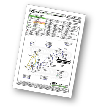
Route Summary:
Troutbeck Bridge - Garburn Road - Backstone Barrow - Sour Howes - Sallows - Garburn Pass - Troutbeck - Troutbeck Bridge

|
Vital Statistics:
| Length: | 3.75 miles (6 km) |
| Ascent: | 1,201 ft (366 m) |
| Time: | 3 hrs |
| Grade: | |

Route Summary:
Grasmere - Goody Bridge - Wainwright's Coast to Coast Walk - Easedale House - High Raven Crag - Helm Crag - The Lion and The Lamb - The Howitzer - Goody Bridge - Grasmere

|
Vital Statistics:
| Length: | 7 miles (11 km) |
| Ascent: | 2,737 ft (834 m) |
| Time: | 5.25 hrs |
| Grade: | |
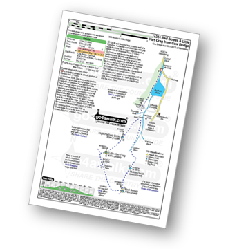
Route Summary:
Cow Bridge - Brothers Water - Hartsop Hall - Kirkstone Beck - Caiston Beck - Middle Dodd - Red Screes - Scandale Pass - Little Hart Crag - High Hartsop Dodd - Caiston Beck - Cow Bridge - Brothers Water.

|
Vital Statistics:
| Length: | 4.5 miles (7 km) |
| Ascent: | 1,204 ft (367 m) |
| Time: | 3 hrs |
| Grade: | |

Route Summary:
Aira Force National Trust Car Park (nr Glenridding) - Aira Force - Riddings Beck - Waterfalls - High Force - Gowbarrow Fell (Airy Crag) - Gowbarrow Park - Green Hill (Gowbarrow Fell) - Aira Force Car Park.

|
Vital Statistics:
| Length: | 8.25 miles (13 km) |
| Ascent: | 1,995 ft (608 m) |
| Time: | 5 hrs |
| Grade: | |

Route Summary:
Tom Gill Car Park - Glen Mary Bridge - Yew Tree Farm - Yew Tree Farm - Harry Guards Wood - Uskdale Gap - Holme Fell - Holme Hill Wood - Low Tilberthwaite - Hodge Close Quarry - High Tilberthwaite - Wythebank - High Oxenfell Farm - Low Arnside - Black Fell (Black Crag) - Iron Keld - Tarn Hows - Tom Gill Waterfalls - Tom Gill Car Park.

|
Vital Statistics:
| Length: | 6.5 miles (10.5 km) |
| Ascent: | 1,877 ft (572 m) |
| Time: | 4.25 hrs |
| Grade: | |
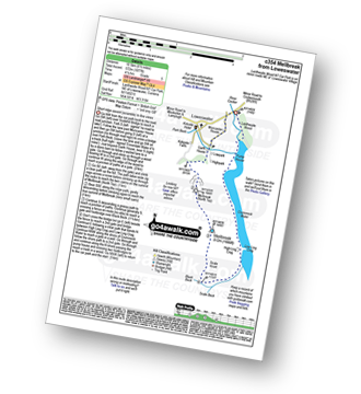
Route Summary:
Lanthwaite - Scale Hill - Scalehill Bridge - Muncaster House - Loweswater - Low Park - Mellbreak (North Top) - Mellbreak - Black Beck (Mosedale) - Scale Knott - Scale Beck - High Ling Crag - Low Ling Crag - Crummock Water - Lanthwaite

|
Vital Statistics:
| Length: | 3.75 miles (6 km) |
| Ascent: | 309 ft (94 m) |
| Time: | 1.75 hrs |
| Grade: | |
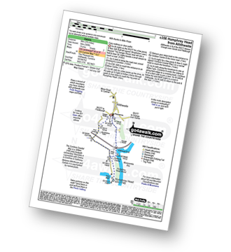
Route Summary:
Allithwaite - Wraysholme Tower - The Cumbria Coastal Way - Humphrey Head - Humphrey Head Wood - Wyke Farm - Kirkhead End - Allithwaite

|
Vital Statistics:
| Length: | 9.5 miles (15 km) |
| Ascent: | 3,682 ft (1,122 m) |
| Time: | 7.25 hrs |
| Grade: | |

Route Summary:
Grasmere - Mill Bridge - Little Tongue - Seat Sandal - Grisedale Tarn - Fairfield - Rydal Head - Great Rigg - Rydal Fell (Heron Pike North Top) - Heron Pike - Alcock Tarn - Grasmere

|
Vital Statistics:
| Length: | 14.5 miles (23 km) |
| Ascent: | 4,703 ft (1,433 m) |
| Time: | 10 hrs |
| Grade: | |

Route Summary:
Whinlatter Forest Park - Thwaitehill Knotts - Beckstone Plantation - Beckstone Gill - Barf - Lord's Seat (Whinlatter) - Broom Fell - Low Burthwaite Wood - Kelswick Farm - Sale Fell - Dodd Crag - Eskin Farm - Corpse Road - Ling Fell (Wythop) - Wythop Moss - Graystones - Scawgill Bridge - Whinlatter (Brown How) - - Whinlatter (Whinlatter Top) - Whinlatter Forest Park

|
Vital Statistics:
| Length: | 4 miles (6.5 km) |
| Ascent: | 433 ft (132 m) |
| Time: | 2 hrs |
| Grade: | |
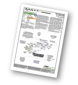
Route Summary:
Blindcrake - Clints Park - Clints Crags - Salkeld Close - Salkeldclose Crags - Thackray Wood - Willie White's Well - Ullerance Gill - Isle Park - Blindcrake

|
Vital Statistics:
| Length: | 11.25 miles (18 km) |
| Ascent: | 3,436 ft (1,047 m) |
| Time: | 7½ hrs |
| Grade: | |

Route Summary:
Mardale Head - Haweswater Reservoir - Rowantreethwaite Beck - Old Corpse Road - Selside Pike - Branstree (North East Top) - Branstree (Artlecrag Pike) - Gatescarth Pass - Adam Seat - Harter Fell (Mardale) - Nan Bield Pass - Mardale Ill Bell - High Street - Riggindale Crag - Caspel Gate - Rough Crag (Riggindale) - Eagle Crag (Riggindale) - Heron Crag (Riggindale) - Swine Crag (Riggindale) - Dudderwick - The Rigg - Mardale Head

|
Vital Statistics:
| Length: | 7 miles (11 km) |
| Ascent: | 2,422 ft (738 m) |
| Time: | 5 hrs |
| Grade: | |
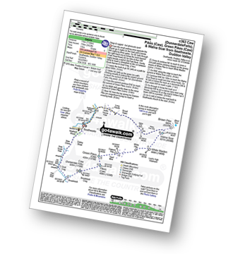
Route Summary:
Seathwaite (Duddon Valley) - Newfield Wood - Dobby Shaw - New Close - How Scale Haw - Old Park Beck - Broadslack - Caw (Dunnerdale Fells) - Pikes (Caw) - Green Pikes (Caw) - Dawson Pike - White Pike - White Maiden - Walna Scar - Walna Scar Road - Broad Haws - Hollin House Haw - Tarn Beck - Seathwaite (Duddon Valley)

|
Vital Statistics:
| Length: | 9.75 miles (15.5 km) |
| Ascent: | 3,236 ft (986 m) |
| Time: | 6.75 hrs |
| Grade: | |
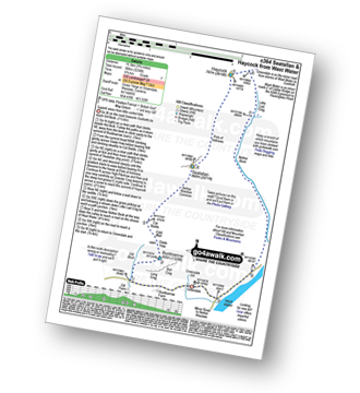
Route Summary:
Greendale Farm - Gill Farm - Buckbarrow - Seatallan - Pots of Ashness - Gowder Crag - Haycock - Little Lad Crag - Nether Beck - Wast Water - Wasdale - Greendale Farm

|
Vital Statistics:
| Length: | 9 miles (14.5 km) |
| Ascent: | 3,699 ft (1,127 m) |
| Time: | 7 hrs |
| Grade: | |

Route Summary:
Lanthwaite Green - Liza Beck - Whin Ben - Whiteside (Crummock) (West Top) - Whiteside (Crummock) - Gasgale Crags - Hopegill Head - Hobcarton Crag - Sand Hill - Coledale Hause - Grasmoor - Wandope - Whiteless Edge - Whiteless Pike - Whiteless Breast - Squat Beck - High Rannerdale - Crummock Water - Lanthwaite Green

|
Vital Statistics:
| Length: | 4.75 miles (7.5 km) |
| Ascent: | 2,363 ft (720 m) |
| Time: | 4.25 hrs |
| Grade: | |

Route Summary:
Buttermere - Dalegarth - Hassnesshow Beck - Goat Crag - Goat Gills - Robinson - Buttermere Moss - High Snockrigg - Buttermere

|
Vital Statistics:
| Length: | 12.25 miles (19.5 km) |
| Ascent: | 3,781 ft (1,152 m) |
| Time: | 8½ hrs |
| Grade: | |
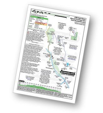
Route Summary:
Rosthwaite - The Cumbria Way - Stonethwaite - Wainwright's Coast to Coast Walk - Stonethwaite Beck - Galleny Force - The Cumbria Way - Langstrath Beck - Eagle Crag - Sergeant's Crag - High Raise (Langdale) - Low White Stones - Greenup Edge - Ullscarf - Low Saddle (Coldbarrow Fell) - Lord's How - Dock Tarn - Great Crag - Puddingstone Bank - Jopplety How - Joppletyhow Moss - Grange Fell (Brund Fell) - King's How - Rosthwaite

|
Vital Statistics:
| Length: | 8.5 miles (13.5 km) |
| Ascent: | 3,289 ft (1,020 m) |
| Time: | 6½ hrs |
| Grade: | |
Route Summary:
Seathwaite (Borrowdale) - Stockley Bridge - Grains Gill - Ruddy Gill - Sprinkling Tarn - Esk Hause - Scafell Pike - Esk Hause - Grains Gill - Stockley Bridge - Seathwaite (Borrowdale)

|
Vital Statistics:
| Length: | 9 miles (14.5 km) |
| Ascent: | 3,459 ft (1,054 m) |
| Time: | 6.75 hrs |
| Grade: | |

Route Summary:
Great Langdale - Old Dungeon Ghyll - The Cumbria Way - Mickleden Beck - Mickleden (Langdale) - Rossett Beck - Rossett Pike - Angle Tarn (Langdale) - Esk Hause - Esk Pike - Ore Gap - Bow Fell (Bowfell) (North Top) - Bow Fell (Bowfell) - Bowfell Buttress - Cambridge Crag - Flat Crag - Climbers' Traverse (optional) - Three Tarns - Earing Crag - White Stones - The Band - Oxendale - Stool End Farm - The Old Dungeon Ghyll - Great Langdale

|
Vital Statistics:
| Length: | 10.25 miles (16.5 km) |
| Ascent: | 2,198 ft (670 m) |
| Time: | 6 hrs |
| Grade: | |
Route Summary:
Broad Oak - Whitrow Beck - Waberthwaite Fell - Rowantree Falls - Stainton Pike - Whitfell (Whit Fell) - Burn Moor - Buck Barrow - Kinmont Buck Barrow - Whitrow Beck - Broad Oak

|
Vital Statistics:
| Length: | 3.5 miles (5.5 km) |
| Ascent: | 906 ft (276 m) |
| Time: | 2½ hrs |
| Grade: | |
Route Summary:
Grange (Borrowdale) - Borrowdale - The Cumbria Way - Holmcrag Wood - River Derwent - The Allerdale Ramble - Castle Crag - River Derwent - Grange (Borrowdale)

|
Vital Statistics:
| Length: | 4.5 miles (7 km) |
| Ascent: | 584 ft (178 m) |
| Time: | 2.25 hrs |
| Grade: | |
Route Summary:
Caldbeck - Caldbeck Duck Pond - Ratten Row - Grange View - Knocker House - Faulds Brow - Whelpo - Whelpo Bridge - Whelpo Beck - Howk Bobbin Mill - Caldbeck

|
Vital Statistics:
| Length: | 3.25 miles (5 km) |
| Ascent: | 968 ft (295 m) |
| Time: | 2.25 hrs |
| Grade: | |
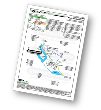

|
Vital Statistics:
| Length: | 1.5 miles (2.5 km) |
| Ascent: | 705 ft (215 m) |
| Time: | 1½ hrs |
| Grade: | |
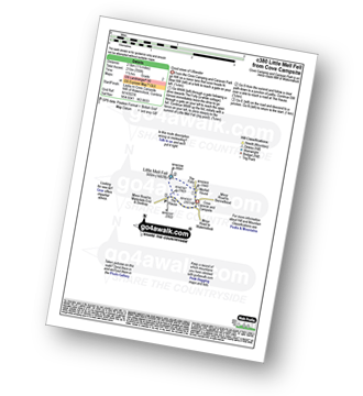
Route Summary:
Cove Park Campsite - Watermillock - Mellfell House - Little Mell Fell - The Hause - Cove Campsite - Watermillock.

|
Vital Statistics:
| Length: | 5.25 miles (8.5 km) |
| Ascent: | 2,255 ft (687 m) |
| Time: | 4½ hrs |
| Grade: | |

Route Summary:
Scales - Mousthwaite Comb - Scales Fell - Brunt Knott - Scales Beck - Scales Tarn - Sharp Edge - Atkinson Pike - Blencathra or Saddleback (Hallsfell Top) - Scales Fell - Mousthwaite Comb - Scales

|
Vital Statistics:
| Length: | 5.25 miles (8.5 km) |
| Ascent: | 2,123 ft (647 m) |
| Time: | 4 hrs |
| Grade: | |

Route Summary:
Wasdale Head - Mosedale Beck - Dore Head - Yewbarrow (North Top) - Yewbarrow - Bell Rib - Dropping Crag - Over Beck - Overbeck Bridge - Wasdale Head - Wast Water.

|
Vital Statistics:
| Length: | 5.25 miles (8.5 km) |
| Ascent: | 2,301 ft (701 m) |
| Time: | 4½ hrs |
| Grade: | |
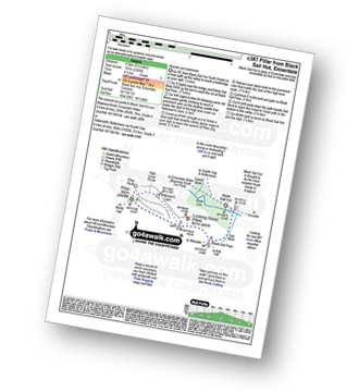
Route Summary:
Black Sail Hut (Youth Hostel) - Ennerdale - Black Sail Beck - Black Sail Pass - Looking Stead (Pillar) - Pillar - Black Sail Pass - Black Sail Beck - Black Sail Hut (Youth Hostel) - Ennerdale.

|
Vital Statistics:
| Length: | 12.25 miles (19.5 km) |
| Ascent: | 3,984 ft (1,214 m) |
| Time: | 8½ hrs |
| Grade: | |

Route Summary:
Ambleside - Rydal - Nab Scar - Heron Pike - Rydal Fell (Heron Pike North Top) - Greenhead Gill Head - Stone Arthur - Great Rigg - Fairfield - Rydal Head - Hart Crag - Dove Crag - High Pike (Scandale) - Low Pike (Scandale) - High Sweden Bridge - High Sweden Coppice - Ambleside

|
Vital Statistics:
| Length: | 6.5 miles (10.5 km) |
| Ascent: | 1,076 ft (328 m) |
| Time: | 3.75 hrs |
| Grade: | |
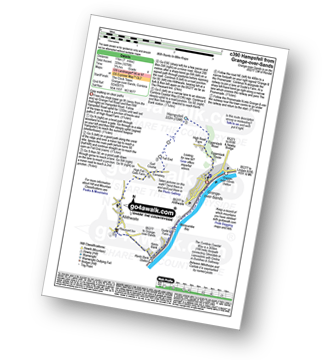
Route Summary:
Grange-over-Sands - Eggerslack Wood - Hampsfell - Fell End - High Fell Gate Farm - Allithwaite - The Cumbria Coastal Way - Kents Bank - Morecambe Bay - Grange-over-Sands

|
Vital Statistics:
| Length: | 11 miles (17.5 km) |
| Ascent: | 2,655 ft (809 m) |
| Time: | 6.75 hrs |
| Grade: | |

Route Summary:
Swindale - Swindale Foot Farm - Swindale Beck - Starling Gill - Stubby Hest - Bracken Howe - Thiefstead - Langhowe Pike - High Katelade - Rowantree Crag - Blea Moss - Stone Howe - Glede Howe - Willy Winder Hill - Haskew Beck - Fewling Stones - Swindale Common - Mosedale Beck (Swindale) - Nabs Moor - Nabs Crag - Howes (Mosedale) - Captain Whelter Bog - Branstree (North East Top) - Branstree (Artlecrag Pike) - Swirle Crag - Selside Pike - High Blake Dodd - Selside End - High Birkin Knott - Low Birkin Knott - Old Corpse Road - Thorny Knott - Swindale Head Farm - Truss Gap - Swindale Foot Farm - Swindale

|
Vital Statistics:
| Length: | 7.25 miles (11.5 km) |
| Ascent: | 896 ft (273 m) |
| Time: | 3½ hrs |
| Grade: | |

Route Summary:
Hawkshead - Colthouse - Long Height - Holland Band Plantation - Wise Een Tarn - Scale Tarn - Moss Eccles Tarn - Stones Lane - Near Sawrey - Hill Top (former Home of Beatrix Potter) - Ees Bridge - Esthwaite Tarn - Howe Farm - Roger Ground - Hawkshead

|
Vital Statistics:
| Length: | 10 miles (16 km) |
| Ascent: | 4,020 ft (1,225 m) |
| Time: | 8 hrs |
| Grade: | |

Route Summary:
Glenridding - Glenridding Dodd - Sheffield Pike - Nick Head - Sticks Pass - Raise (Helvellyn) - White Side - Lower Man (Helvellyn) - Helvellyn - Swirral Edge - Catstye Cam - Glenridding Beck - Glenridding Youth Hostel - Glenridding

|
Vital Statistics:
| Length: | 10.5 miles (17 km) |
| Ascent: | 3,384 ft (1,031 m) |
| Time: | 7.25 hrs |
| Grade: | |

Route Summary:
Stonethwaite - Big Stanger Gill - Hanging Haystack Crag - Alisongrass Crag - Rosthwaite Fell (Bessyboot) - Tarn At Leaves - Rosthwaite Cam (Rosthwaite Fell) - Dovenest Top - Combe Door Top - Combe Head - Glaramara - Looking Steads (Glaramara) - Red Beck Top - High House Tarn Top - Allen Crags - Esk Hause - Allencrags Gill - Langstrath - Stonethwaite

|
Vital Statistics:
| Length: | 16 miles (25.5 km) |
| Ascent: | 6,285 ft (1,915 m) |
| Time: | 12.25 hrs |
| Grade: | |
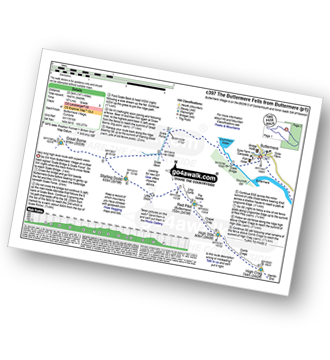
Route Summary:
Buttermere - Scale Force - Scale Beck - Blea Crag - Great Borne - Starling Dodd - Little Dodd (Ennerdale) - Ling Comb - Lingcomb Edge - Red Pike (Buttermere) - Dodd (Buttermere) - Red Pike (Buttermere) - High Stile - High Crag (Buttermere) - Gamlin End - Seat (Buttermere) - Scarth Gap - Hay Stacks (Haystacks) - Innominate Tarn - Blackbeck Tarn - Black Beck - Green Crag (Buttermere) - Warnscale Beck - Dubs Hut - Dubs Quarry - Fleetwith Pike - Honister Crag (Black Star) - Fleetwith Pike - Fleetwith Edge - Gatesgarth - Buttermere

|
Vital Statistics:
| Length: | 2.5 miles (4 km) |
| Ascent: | 748 ft (228 m) |
| Time: | 1.75 hrs |
| Grade: | |


|
Vital Statistics:
| Length: | 3.75 miles (6 km) |
| Ascent: | 1,628 ft (496 m) |
| Time: | 3 hrs |
| Grade: | |

Route Summary:
Keswick - Derwent Water Launch - Nichol End Pier - Hawes End Pier - Newlands Valley - Woodford's Path - Cat Bells (Catbells) - Hawes End Pier - Derwent Water Launch - Keswick

|
Vital Statistics:
| Length: | 6.25 miles (10 km) |
| Ascent: | 1,382 ft (421 m) |
| Time: | 4 hrs |
| Grade: | |
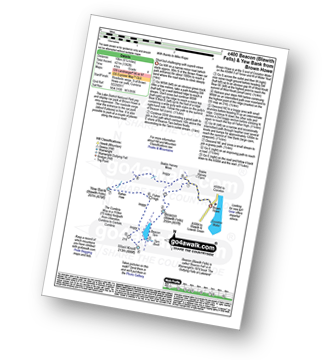
Route Summary:
Brown Howe Car Park - Coniston Water - Beacon (Blawith Fells) - Beacon Tarn - Tarn Beck - The Cumbria Way - Wool Knott - Fisher High - Rattan Haw - Yew Bank (Blawith Fells) - Stable Harvey Moss - Brown Howe - Coniston Water.

|
Vital Statistics:
| Length: | 6 miles (9.5 km) |
| Ascent: | 900 ft (274 m) |
| Time: | 3.24 hrs |
| Grade: | |
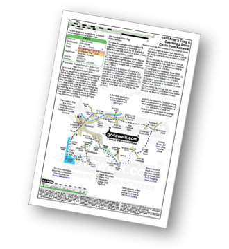
Route Summary:
Keswick - Friar's Crag - Borrowdale Road - Spring Farm - Brockle Beck - Castlerigg - High Nest Farm - Castlerigg Stone Circle - Brigham - River Greta - Keswick

|
Vital Statistics:
| Length: | 12.25 miles (19.5 km) |
| Ascent: | 3,568 ft (1,087 m) |
| Time: | 8 hrs |
| Grade: | |

Route Summary:
Eskdale - The Woolpack Inn - Doctor Bridge - Low Birker - Birker Force - Low Birker Tarn - Green Crag (Ulpha Fell) - Crook Crag - Harter Fell (Eskdale) - Dunnerdale Forest - Hardknott Pass - Hardknott Gill - Hard Knott - Yew Bank - Lingcove Beck - Lingcove Bridge - Great Moss - Brotherilkeld - Taw House Farm - Wha House Farm - The River Esk - The Woolpack Inn - Eskdale

|
Vital Statistics:
| Length: | 8.75 miles (14 km) |
| Ascent: | 1,854 ft (565 m) |
| Time: | 5 hrs |
| Grade: | |

Route Summary:
Friar Well - Friar Gill - River Calder - Tongue How - Town Bank - Lank Rigg - Whoap - Whoap Beck - Stinking Gill - Lankrigg Moss - Latterbrow Moss - Latterbrow Beck - Friar Well

|
Vital Statistics:
| Length: | 10 miles (16 km) |
| Ascent: | 3,349 ft (1,082 m) |
| Time: | 7.25 hrs |
| Grade: | |

Route Summary:
Hawes End - Derwent Water - Skelgill Bank - Woodford's Path - Cat Bells (Catbells) - Maiden Moor - Narrow Moor - High Spy (North Top) - High Spy - Dale Head Tarn - Rigghead Quarries - The Allerdale Ramble - Castle Crag - River Derwent - Yewdale Knott - Manesty - Manesty Band - Hawes End - Derwent Water.

|
Vital Statistics:
| Length: | 3.25 miles (6 km) |
| Ascent: | 1,920 ft (585 m) |
| Time: | 3½ hrs |
| Grade: | |

Route Summary:
Buttermere - Gatesgarth - Peggy's Bridge - Buttermere - Scarth Gap - Hay Stacks - Innominate Tarn - Hay Stacks (Haystacks) - Scarth Gap - Peggy's Bridge - Gatesgarth - Buttermere

|
Vital Statistics:
| Length: | 10 miles (16 km) |
| Ascent: | 4,641 ft (1,414 m) |
| Time: | 8½ hrs |
| Grade: | |
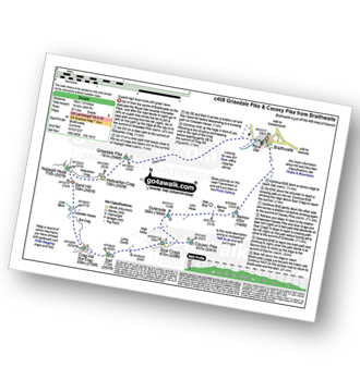
Route Summary:
Braithwaite - Sleet How - Grisedale Pike - Hobcarton Crag - Hopegill Head - Sand Hill - Coledale Hause - Crag Hill (Eel Crag) - Sail (Derwent Fells) - Scar Crags - Causey Pike - Outerside - Stile End - Barrow (Newlands) - Braithwaite

|
Vital Statistics:
| Length: | 9.75 miles (15.5 km) |
| Ascent: | 2,734 ft (833 m) |
| Time: | 6.25 hrs |
| Grade: | |

Route Summary:
Buttermere - Buttermere Dubbs - Scale Bridge - Scale Force - Scale Beck - Blea Crag - Lingcomb Edge - Ling Comb - Little Dodd (Ennerdale) - Starling Dodd - Great Borne - Floutern Tarn - Black Beck (Mosedale) - Scale Force - Scale Beck (Crummock Water) - Crummock Water - Buttermere

|
Vital Statistics:
| Length: | 5 miles (8 km) |
| Ascent: | 1,769 ft (539 m) |
| Time: | 3.75 hrs |
| Grade: | |

Route Summary:
Ambleside - Stockghyll Force - Wansfell Pike - Baystones (Wansfell) - Wansfell Pike - Stockghyll Force - Ambleside

|
Vital Statistics:
| Length: | 8.5 miles (13.5 km) |
| Ascent: | 2,540 ft (774 m) |
| Time: | 6 hrs |
| Grade: | |

Route Summary:
Maggie's Bridge (Loweswater) - Loweswater - High Nook Farm - Highnook Beck - Holme Wood - Holme Beck - Burnbank Fell - Sharp Knott - Blake Fell - Fothergill Head - Gavel Fell - Grain Gill - Whiteoak Moss - Hen Comb - Little Dodd (Loweswater Fell) - Mosedale (Loweswater) - Mosedale Beck (Loweswater) - Loweswater Village - Maggie's Bridge (Loweswater)

|
Vital Statistics:
| Length: | 9 miles (14.5 km) |
| Ascent: | 3,387 ft (1,032 m) |
| Time: | 6.75 hrs |
| Grade: | |

Route Summary:
Great Langdale - The Old Dungeon Ghyll - Oxendale - Oxendale Beck - Red Tarn (Langdale) - Great Knott - Crinkle - Crags (South Top) - Bad Step - Crinkle Crags (Long Top) - Crinkle Crags (Gunson Knott) - Shelter Crags - Shelter Crags (North Top) - Three Tarns - Climbers' Traverse (optional) - Flat Crag - Cambridge Crag - Bowfell Buttress - Bow Fell (Bowfell) - Three Tarns - Earing Crag - White Stones - The Band - Stool End Farm - Mickleden Beck - Mickleden - The Old Dungeon Ghyll - Great Langdale

|
Vital Statistics:
| Length: | 11.25 miles (18 km) |
| Ascent: | 3,883 ft (1,183 m) |
| Time: | 8 hrs |
| Grade: | |

Route Summary:
Great Langdale - The Old Dungeon Ghyll - The Cumbria Way - Mickleden Beck - Rossett Gill - Rossett Pike - Angle Tarn (Langdale) - Esk Hause - Scafell Pike - Ill Crag - Broad Crag - Great End - Esk Hause - Angle Tarn - Rossett Gill - Mickleden - Mickleden Beck - The Cumbria Way - The Old Dungeon Ghyll - Great Langdale

|
Vital Statistics:
| Length: | 9 miles (14.5 km) |
| Ascent: | 3,965 ft (1,208 m) |
| Time: | 7½ hrs |
| Grade: | |

Route Summary:
Honister Pass - Honister Hause - Grey Knotts - Brandreth - Blackmoor Pols - Base Brown - Mitchell Cove - Green Gable - Windy Gap - Great Gable - Westmorland Cairn - Beck Head - Beckhead Tarn - Kirk Fell (East Top) - Kirk Fell - Moses' Trod - Wainwright's Coast to Coast Walk - Honister Pass

|
Vital Statistics:
| Length: | 10 miles (16 km) |
| Ascent: | 3,580 ft (1,091 m) |
| Time: | 7.25 hrs |
| Grade: | |

Route Summary:
Great Langdale - The New Dungeon Ghyll - Stickle Ghyll - Stickle Tarn - North Rake - The Langdale Pikes - Pavey Ark - Thunacar Knott - Harrison Stickle - Loft Crag - Pike of Stickle (Pike o' Stickle) - Martcrag Moor - Stake Pass - Black Crags (Langdale) - Little Gill Head - Rossett Pike - Rossett Gill - The Cumbria Way - Mickleden - Mickleden Beck - The New Dungeon Ghyll - Great Langdale

|
Vital Statistics:
| Length: | 12.75 miles (20.5 km) |
| Ascent: | 4,191 ft (1,277 m) |
| Time: | 8.75 hrs |
| Grade: | |

Route Summary:
Coniston - Walna Scar Road - Boo Tarn - Torver Beck - Cove Bridge - Goat's Water - Goat's Hawse - Dow Crag - Goat's Hawse - The Old Man of Coniston - Brim Fell - Levers Hawse - Grey Friar - Great Carrs - Swirl How - Prison Band - Keld Gill Head - Black Sails - Wetherlam - Swirl Hawse - Levers Water - Crowberry Haws - Walna Scar Road - Coniston

|
Vital Statistics:
| Length: | 6.25 miles (10 km) |
| Ascent: | 6 ft (770 m) |
| Time: | 5 hrs |
| Grade: | |

Route Summary:
Maggie's Bridge (Loweswater) - Loweswater - Kirkgate Farm - Raven Crag - White Crag - Mellbreak (North Top) - Mellbreak - Mosedale Beck (Loweswater) - Thrang Crags - Hen Comb - Little Dodd (Loweswater Fell) - Mosedale Beck (Loweswater) - Kirkgate Farm - Loweswater - Maggie's Bridge (Loweswater)

|
Vital Statistics:
| Length: | 15.25 miles (24.5 km) |
| Ascent: | 4,841 ft (1,475 m) |
| Time: | 10½ hrs |
| Grade: | |

Route Summary:
Wasdale Head - (National Trust Campsite) - Wast Water - Lingmell Gill - Illgill Head - Whin Rigg - Greathall Gill - Low Wood - Lund Bridge - Woodhow Farm - Woodhow Tarn - Scale Farm - Tosh Tarn - Gill Farm - Gill Beck - Buckbarrow - Cold Well - Nether Wasdale Common - Seatallan - Windscale Hows - Middle Fell (Wasdale) - Greendale Farm - Nether Beck - Overbeck Bridge - Wasdale Head - Wast Water.

|
Vital Statistics:
| Length: | 11.75 miles (19 km) |
| Ascent: | 4,680 ft (1,426 m) |
| Time: | 9 hrs |
| Grade: | |

Route Summary:
Great Langdale - The Old Dungeon Ghyll - Wall End Farm - Redacre Gill - Wrynose Fell - Pike of Blisco (Pike O' Blisco) - Red Tarn (Langdale) - Great Knott - Crinkle Crags (South Top) - Crinkle Crags (Long Top) - Crinkle Crags (Gunson Knott) - Shelter Crags - Shelter Crags (North Top) - Three Tarns - Climbers' Traverse (optional) - Flat Crag - Cambridge Crag - Bowfell Buttress - Bow Fell (Bowfell) - Bow Fell (Bowfell) (North Top) - Ore Gap - Angle Tarn (Langdale) - Rossett Pike - Rossett Beck - Mickleden - Mickleden Beck - The Cumbria Way - The Old Dungeon Ghyll - Great Langdale

|
Vital Statistics:
| Length: | 8 miles (12.5 km) |
| Ascent: | 2,990 ft (911 m) |
| Time: | 6 hrs |
| Grade: | |

Route Summary:
Patterdale - Patterdale Church - Grisedale Bridge - Grisedale Beck - Brownend Plantation - Lanty's Tarn - Hole-in-the-Wall - Red Tarn (Helvellyn) - Bleaberry Crag - Low Spying How - High Spying How - Striding Edge (High Spying How) - Helvellyn - Swirral Edge (optional) - Hole-in-the-Wall - Grisedale Beck - Patterdale

|
Vital Statistics:
| Length: | 13.75 miles (22 km) |
| Ascent: | 3,991 ft (1,216 m) |
| Time: | 9 hrs |
| Grade: | |

Route Summary:
Grasmere - Allan Bank - Wray Gill - Silver How - Lang How - Sinescar Pike - Little Castle How - Great Castle How - Blea Rigg - Sergeant Man - Thunacar Knott - Pavey Ark - Harrison Stickle - Loft Crag - Pike of Stickle (Pike O' Stickle) - High Raise (Langdale) - Codale Head - Tarn Crag (Easedale) - Far Easedale Gill - Sourmilk Falls - Far Easedale Beck - Goody Bridge - Grasmere

|
Vital Statistics:
| Length: | 1.5 miles (2.5 km) |
| Ascent: | 351 ft (107 m) |
| Time: | 1 hrs |
| Grade: | |
Route Summary:
Pooley Bridge - Dunmallet Woods - Dunmallard Hill (Dunmallet) - River Eamont - Pooley Bridge

|
Vital Statistics:
| Length: | 11.25 miles (18 km) |
| Ascent: | 1,614 ft (492 m) |
| Time: | 5.75 hrs |
| Grade: | |

Route Summary:
Wet Sladdale Reservoir - Poor Hag Wood - Poorhag Gill - Wetsleddale Moor Lunch House - Howe Gill - The Shap Fells - Gray Bull - Sherry Gill - Sleddale Pike - Wasdale Pike - Great Yarlside - Great Saddle Crag - Ulthwaite Rigg - Scam Matthew - High Wether Howe - Haskew Tarn - Seat Robert - Gambling Crag - Willy Winder Hill - Great Ladstones - Bleak Hill - Willy Fold - White Crag - Michael Moss - Sleddale Hall - Sleddale Beck - Wet Sladdale Reservoir.

|
Vital Statistics:
| Length: | 5 miles (8 km) |
| Ascent: | 2,649 ft (807 m) |
| Time: | 4½ hrs |
| Grade: | |
Route Summary:
The Swirls - Helvellyn Gill - Browncove Crags - Lower Man (Helvellyn) - Helvellyn - Lower Man (Helvellyn) - Browncove Crags - Helvellyn Gill - The Swirls

|
Vital Statistics:
| Length: | 11.25 miles (18 km) |
| Ascent: | 3,965 ft (1,208 m) |
| Time: | 8.25 hrs |
| Grade: | |

Route Summary:
Legburthwaite Car Park - A591 - Long Band - Cowrake Head - Moss Crag - High Rigg - Carlisle Diocese Youth Centre - St John's In The Vale Church - B5322 - Wanthwaite Bank - Threlkeld Knotts - Buck Castles - Clough Head - Calfhow Pike - Great Dodd - Watson's Dodd - Stybarrow Dodd - Sticks Pass - Legburthwaite Car Park

|
Vital Statistics:
| Length: | 10.25 miles (16.5 km) |
| Ascent: | 1,375 ft (419 m) |
| Time: | 5.25 hrs |
| Grade: | |
Route Summary:
Grange-over-Sands - Eggerslack Wood - Hampsfell - Fell End - High Fell Gate Farm - Allithwaite - Wraysholme Tower - The Cumbria Coastal Way - Humphrey Head - Humphrey Head Wood - Wyke Farm - Kirkhead End - Allithwaite - Kents Bank - Morecambe Bay - Grange-over-Sands

|
Vital Statistics:
| Length: | 8.5 miles (13.5 km) |
| Ascent: | 2,645 ft (806 m) |
| Time: | 5.75 hrs |
| Grade: | |

Route Summary:
Silecroft - Whicham Church - Kirkbank Farm - Townend Knotts - Black Combe - Blackcombe Screes - Whitcombe Screes - Stoupdale Head - White Combe - White Hall Knott - Whitecombe Beck - Parsonage Breast - Kirkbank Farm - Whicham Church.

|
Vital Statistics:
| Length: | 8.75 miles (14 km) |
| Ascent: | 2,347 ft (715 m) |
| Time: | 5½ hrs |
| Grade: | |

Route Summary:
Miterdale Bridge - Porterthwaite - Miterdale Forest - Irton Fell - Greathall Gill - Whin Rigg - Illgill Head - Burnmoor Tarn - Burnmoor Lodge - Eskdale Moor - Ellerhow Moss - Boat How - Low Longrigg - River Mite - Low Place Farm - Miterdale Bridge

|
Vital Statistics:
| Length: | 5.75 miles (9 km) |
| Ascent: | 2,340 ft (731 m) |
| Time: | 4½ hrs |
| Grade: | |

Route Summary:
Honister Pass - Honister Hause - Grey Knotts - Brandreth - Green Gable - Windy Gap - Great Gable - Westmorland Cairn - Beck Head - Beckhead Tarn - Moses' Trod - Wainwright's Coast to Coast Walk - Honister Pass

|
Vital Statistics:
| Length: | 6.75 miles (11 km) |
| Ascent: | 1,243 ft (379 m) |
| Time: | 3.75 hrs |
| Grade: | |
Route Summary:
Mill Side - Buckhouse Wood - Farrar's Allotment - Pether Pots. Whitbarrow National Nature Reserve - Lord's Seat (Whitbarrow Scar) - Flodder Allotment - Bell Rake - High Park Wood - Black Yew Scars - Witherslack Hall School - Chapel Head Scar - High Crag Wood - Low Crag Wood - Beck Head - Mill Side

|
Vital Statistics:
| Length: | 15.25 miles (24.5 km) |
| Ascent: | 5,458 ft (1,663 m) |
| Time: | 11 hrs |
| Grade: | |

Route Summary:
Keswick - Millbeck - The Allerdale Ramble - Doups - Dodd (Skiddaw) - White Stones (Skiddaw) - Carl Side - Longside Edge - Long Side - Ullock Pike - Carlside Tarn - Skiddaw - Blake Hill - Bakestall - Little Man (Skiddaw) - Jenkin Hill - Lonscale Fell - Lonscale Crags - The Cumbria Way - Latrigg - Applethwaite - The Allerdale Ramble - Millbeck - Nr Keswick.

|
Vital Statistics:
| Length: | 7.5 miles (12 km) |
| Ascent: | 1,216 ft (462 m) |
| Time: | 4.25 hrs |
| Grade: | |

Route Summary:
Ullthwaite Bridge - Croft Head - Meadowplatts Plantation - Capple Howe - Sour Howes - Sallows - Garburn Pass - Crabtree Brow - Kentmere - kentmere Hall - Hall Wood - Kentmere Plantation - Sawmill Cottage - Kentmere - Ullthwaite Bridge

|
Vital Statistics:
| Length: | 11 miles (17.5 km) |
| Ascent: | 5,409 ft (1,648 m) |
| Time: | 9½ hrs |
| Grade: | |

Route Summary:
Wasdale Head - (National Trust Campsite) - Wast Water - Lingmell - Corridor Route - Great End - Ill Crag - Broad Crag - Scafell Pike - Mickledore - Foxes Tarn - Symonds Knott - Sca Fell - Slight Side - Broad Tongue - Hardrigg Gill - Wasdale Head - Wast Water.

|
Vital Statistics:
| Length: | 9 miles (14.5 km) |
| Ascent: | 3,236 ft (986 m) |
| Time: | 6.75 hrs |
| Grade: | |

Route Summary:
Seathwaite (Borrowdale) - Grains Gill - Stockley Bridge - Styhead Gill - Styhead Tarn - Sty Head - The Corridor Route - Skew Gill - Greta Gill - Piers Gill - Scafell Pike - The Corridor Route - Sty Head - Stockley Bridge - Seathwaite (Borrowdale)

|
Vital Statistics:
| Length: | 3.25 miles (5 km) |
| Ascent: | 1,428 ft (435 m) |
| Time: | 2½ hrs |
| Grade: | |


|
Vital Statistics:
| Length: | 6.25 miles (10 km) |
| Ascent: | 2,756 ft (840 m) |
| Time: | 5.25 hrs |
| Grade: | |

Route Summary:
Honister Pass - Honister Hause - Bell Crags - Hopper Quarry - Honister Quarries - Honister Crag (Black Star) - Burnt Scarth - Fleetwith Pike - Dubs Hut - Dubs Quarry - Warnscale Beck - Green Crag (Buttermere) - Blackbeck Tarn - Innominate Tarn - Hay Stacks (Haystacks) - Innominate Tarn - Loft Beck - Coast to Coast Walk - Brandreth - Grey Knotts - Honister Hause.

|
Vital Statistics:
| Length: | 4.5 miles (7 km) |
| Ascent: | 630 ft (192 m) |
| Time: | 2.25 hrs |
| Grade: | |
Route Summary:
Cockermouth - Watch Hill (Cockermouth) - Hay - Setmurthy Plantation - Setmurthy Common (Watch Hill) - Peel Wood - Long Bottom - Greenlands - Cockermouth

|
Vital Statistics:
| Length: | 14.5 miles (23 km) |
| Ascent: | 5,409 ft (1,648 m) |
| Time: | 11 hrs |
| Grade: | |

Route Summary:
Hawes End - Derwent Water - Skelgill Bank - Woodford's Path - Cat Bells (Catbells) - Maiden Moor - High Spy (North Top) - High Spy - Dalehead Tarn - Dale Head (Newlands) - Hindscarth - Littledale Edge - Robinson - High Snockrigg - Moss Force - Newlands Hause - Knott Rigg - Ard Crags - Birkrigg - Keskerdale Beck - Newlands Church - Newlands Beck - Little Town - Skelgill Farm - Hawes End Derwent Water.

|
Vital Statistics:
| Length: | 12.25 miles (19.5 km) |
| Ascent: | 3,062 ft (933 m) |
| Time: | 7½ hrs |
| Grade: | |
Route Summary:
Over Water Reservoir - Waterside Wood - Whitefield Cottage - Binsey Cottage - Binsey - Dogkennel Wood - Overwater Hall - Black Wood - Orthwaite - Orthwaite Bank - Uldale Fells - Great Cockup - Meal Fell - Great Sca Fell - Little Sca Fell - Brae Fell - Broad Moss - Charleton Gill - Langlands Fell - The Cumbria Way - Lowthwaite - Chapelhouse Reservoir - Over Water

|
Vital Statistics:
| Length: | 6.25 miles (10 km) |
| Ascent: | 1,611 ft (491 m) |
| Time: | 4 hrs |
| Grade: | |

Route Summary:
Birker Fell - Tewit Moss - Rough Crag (Birker Fell) - Water Crag (Birker Fell) - Linbeck Gill - Birkby Fell - The Knott (Stainton Fell) - White Pike (Birkby Fell) - Yoadcastle - Woodend Height (Yoadcastle) - Cockly Moss - Rowantree How - Devoke Water - Washfold Point - Seat How (Birker Fell) - Tewit Moss - Birker Fell

|
Vital Statistics:
| Length: | 4.5 miles (7 km) |
| Ascent: | 1,559 ft (475 m) |
| Time: | 3.25 hrs |
| Grade: | |
Route Summary:
Beckside Farm - Whitecombe Beck - Whitcombe Screes - Stoupdale Head - White Combe - White Hall Knott - Whitecombe Beck - Beckside Farm

|
Vital Statistics:
| Length: | 8.5 miles (13.5 km) |
| Ascent: | 1,952 ft (595 m) |
| Time: | 5 hrs |
| Grade: | |

Route Summary:
Swindale - Swindale Foot Farm - Swindale Beck - Starling Gill - Stubby Hest - Bracken Howe - Thiefstead - Langhowe Pike - High Katelade - Rowantree Crag - Blea Moss - Stone Howe - Glede Howe - Willy Winder Hill - Haskew Beck - Fewling Stones - Swindale Common - Mosedale Beck (Swindale) - Nabs Moor - Nabs Crag - Howes (Mosedale) - Nabs Crag - Nabs Moor - Dodd Bottom - Hobgrumble Gill - Swindale Head Farm - Truss Gap - Swindale Foot Farm - Swindale

|
Vital Statistics:
| Length: | 7.75 miles (12.5 km) |
| Ascent: | 1,168 ft (356 m) |
| Time: | 4 hrs |
| Grade: | |
Route Summary:
Wet Sleddale Reservoir - Selside Beck - Michael Moss - Selside Hall - Scam Matthew - High Wether Howe - Haskew Tarn - Seat Robert - Great Ladstones - Bleak Hill - Willy Fold - White Crag - Peat Hill - Stackhouse Brow - Green Farm - Throney Bank Farm - River Lowther - Cooper Green Farm - eddale Reservoir.

|
Vital Statistics:
| Length: | 8.75 miles (14 km) |
| Ascent: | 2,271 ft (692 m) |
| Time: | 5½ hrs |
| Grade: | |

Route Summary:
Great Langdale - Old Dungeon Ghyll - The Cumbria Way - Mickleden Beck - Mickleden (Langdale) - Rossett Beck - Rossett Pike - Little Gill Head - Black Crags (Langdale) - Stake Pass - The Cumbria Way - Stake Gill - Mickleden - Mickleden Beck - The New Dungeon Ghyll - Great Langdale

|
Vital Statistics:
| Length: | 7.75 miles (12.5 km) |
| Ascent: | 1,483 ft (452 m) |
| Time: | 4½ hrs |
| Grade: | |

Route Summary:
Hazel Shaw Parking Area - Rosgill Moor - Scalebarrow Knott - Harper Hills - Low Goat Gill - Long Rigg - Powley's Hill - Hare Shaw - Woodhowe Moss - Kit Crag (Naddle Forest) - Wallow Crag (Naddle Forest) - Hugh's Laithes Pike - Hugh's Laithes Pike (North East Top) - Highfield Crag - Naddle Farm - Naddle Beck - Mirkside Wood - Scalebarrow Knott - Hazel Shaw Parking Area

|
Vital Statistics:
| Length: | 6.5 miles (10.5 km) |
| Ascent: | 2,025 ft (617 m) |
| Time: | 4½ hrs |
| Grade: | |

Route Summary:
Maggie's Bridge (Loweswater) - Loweswater - High Nook Farm - Highnook Beck - Holme Wood - Burnbank Fell - Sharp Knott - Blake Fell - Fothergill Head - Gavel Fell - Black Crag (Gavel Fell) - Highnook Beck - Maggie's Bridge (Loweswater)

|
Vital Statistics:
| Length: | 5.75 miles (9 km) |
| Ascent: | 1,260 ft (384 m) |
| Time: | 3½ hrs |
| Grade: | |
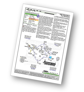
Route Summary:
Kentmere - Cornclose Lane (track) - Rasp Howe - Skeggles Water - Cocklaw Fell - Green Quarter Fell - Hollow Moor (Green Quarter) - Hollow Moor (North East Top) - Kentmere

|
Vital Statistics:
| Length: | 10.5 miles (17 km) |
| Ascent: | 1,411 ft (430 m) |
| Time: | 2.25 hrs |
| Grade: | |
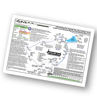
Route Summary:
Wet Sleddale Reservoir - Poor Hag Wood - Poorhag Gill - Wetsleddale Moor Lunch House - Howe Gill - The Shap Fells - Gray Bull - Sherry Gill - Sleddale Pike - Wasdale Pike - Great Yarlside - Great Saddle Crag - Ulthwaite Rigg - Sleddale Hall - Michael Moss - Sleddale Beck - Wet Sleddale Reservoir

|
Vital Statistics:
| Length: | 5 miles (8 km) |
| Ascent: | 663 ft (202 m) |
| Time: | 2 hrs |
| Grade: | |
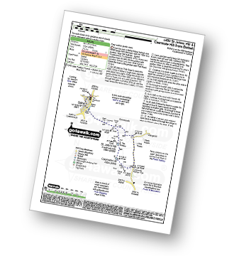
Route Summary:
Bothel - Beck Farm - Borrowscale - The Battery - St. John's Hill (Caermote Hill) - Caermote Hill - Camp Hill - Caermote Roman Fort - Borrowscale - Bothel

|
Vital Statistics:
| Length: | 10 miles (16 km) |
| Ascent: | 1,496 ft (456 m) |
| Time: | 5.25 hrs |
| Grade: | |

Route Summary:
Underbarrow - Hagg Cottage - Gambleshire Lane - Gambleshire Lane - Cunswick Fell - Cunswick Scar - Scout Scar (Barrowfield) - Hodgeson's Leap - Bradleyfield - Helsington Barrows - Windy Howe - Helsington Church - Honeybee Wood - Barrowfield Farm - Barrowfield Lot - Copeland Wood - Hollinwood - Cooper Tenement - Rockyfield - Underbarrow

|
Vital Statistics:
| Length: | 6.25 miles (10 km) |
| Ascent: | 1,352 ft (412 m) |
| Time: | 3.75 hrs |
| Grade: | |
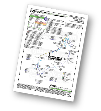
Route Summary:
Swindale - Swindale Foot Farm - Swindale Beck - Starling Gill - Stubby Hest - Bracken Howe - Thiefstead - Langhowe Pike - High Katelade - Rowantree Crag - Blea Moss - Stone Howe - Glede Howe - Willy Winder Hill - Haskew Beck - Fewling Stones - Swindale Common - Mosedale Beck (Swindale) - Dodd Bottom - Hobgrumble Gill - Swindale Head Farm - Truss Gap - Swindale Foot Farm - Swindale
See this list of walks, routes & maps in:
Grade Order | Length Order | Time Order | Walk Number or Start Location Order
NB. To reverse (toggle) this order, click Grade Order again