Nine easy-to-follow, circular walk route maps from the small town of Coniston in the Lake District
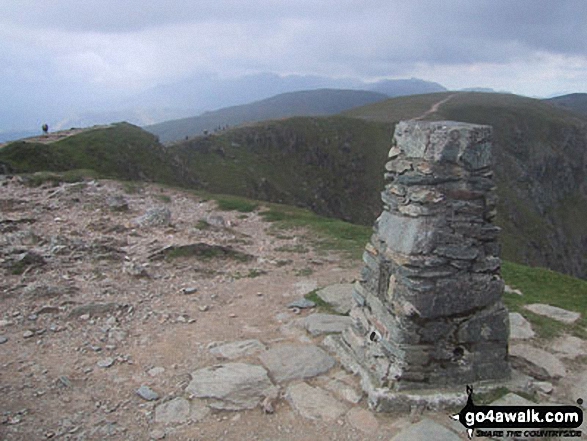 The summit trig point on The Old Man of Coniston
Photo: Chris Leonard
Coniston is an excellent base from which to explore the Southern Fells of the Lake District with lots of local walks from a stroll along the shore of Coniston Water to all-day hikes in the high mountains.
Walking the Wainwrights from Coniston
Walkers seeking to Walk the Wainwrights will find no shortage of opportunities to add to your hill bagging tick lists with Wainwrights accessible by foot direct from the village of Coniston itself. These are:-
- The Old Man of Coniston (Wainwright No. 30);
- Swirl How (No. 32);
- Brim Fell (No. 37);
- Great Carrs (No. 43);
- Dow Crag (No. 48);
- Grey Friar (No. 53) and
- Wetherlam (No. 56);
And if Wainwright Bagging is your thing, then don't miss our popular Walk All 214 Wainwrights in just 59 Walks feature.
9 easy to follow walks from Coniston

   |
Vital Statistics:
| Length: | 7.75 miles (12.5 km) |
| Ascent: | 1,758 ft (536 m) |
| Time: | 4.75 hrs |
| Grade: |  |
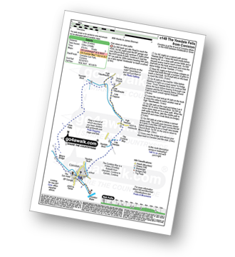
Detailed walk route map PDF
complete with GPS Waypoints
Route Summary:
Coniston - The Cumbria Way - Low Yewdale - Yewdale Beck - High Yewdale - Yew Band - Low Tilberthwaite - High Tilberthwaite - Low Coppice - Tilberthwaite Gill - Crook Beck - Hole Rake - Miners Bridge - Church Beck - Coniston


|
Vital Statistics:
| Length: | 10 miles (16 km) |
| Ascent: | 1,364 ft (416 m) |
| Time: | 5 hrs |
| Grade: | |
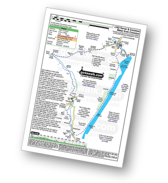
Detailed walk route map PDF
complete with GPS Waypoints
Route Summary:
Coniston - Walna Scar Road - Banishead - Torver Beck - Torver - Beckstones - The Cumbria Way - Coniston Water - Coniston Sailing Club - Coniston Hall - Coniston

|
Vital Statistics:
| Length: | 5 miles (8 km) |
| Ascent: | 1,935 ft (590 m) |
| Time: | 4 hrs |
| Grade: | |

Detailed walk route map PDF
complete with GPS Waypoints
Route Summary:
Coniston - Walna Scar Road - Goat's Water - The Old Man of Coniston - Low Water - Walna Scar Road - Coniston

|
Vital Statistics:
| Length: | 8.25 miles (13 km) |
| Ascent: | 2,778 ft (847 m) |
| Time: | 5.75 hrs |
| Grade: |  |

Detailed walk route map PDF
complete with GPS Waypoints
Route Summary:
Coniston - Walna Scar Road - Goat's Water - The Old Man of Coniston - Brim Fell - Levers Hawse - Swirl Band - Swirl How - Prison Band - Levers Water - Walna Scar Road - Coniston

|
Vital Statistics:
| Length: | 7.5 miles (12 km) |
| Ascent: | 2,762 ft (842 m) |
| Time: | 5.25 hrs |
| Grade: | |

Detailed walk route map PDF
complete with GPS Waypoints
Route Summary:
Coniston - Walna Scar Road - Boo Tarn - The Old Man of Coniston - Brim Fell - Levers Water - Boulder Valley - Crowberry Haws - Miners Bridge - Coniston

|
Vital Statistics:
| Length: | 9.5 miles (15 km) |
| Ascent: | 3,523 ft (1,074 m) |
| Time: | 7 hrs |
| Grade: |  |

Detailed walk route map PDF
complete with GPS Waypoints
Route Summary:
Walna Scar Road (nr Seathwaite (Duddon Valley) - Long Houses - Brown Pike - Dow Crag - Goat's Hawse - The Old Man of Coniston - Brim Fell - Levers Hawse - Swirl Band - Swirl How - Great Carrs - Grey Friar - Seathwaite Tarn - Walna Scar Road.

|
Vital Statistics:
| Length: | 10 miles (16 km) |
| Ascent: | 3,584 ft (1,092 m) |
| Time: | 7 hrs |
| Grade: | |

Detailed walk route map PDF
complete with GPS Waypoints
Route Summary:
Coniston - Church Beck - Levers Water Beck - Crowberry Haws - Low Water - Brim Fell - Levers Hawse - Swirl Band - Swirl How - Prison Band - Swirl Hawse - Keld Gill Head - Black Sails - Red Dell Head Moss - Wetherlam - Furness Fells - Coniston

|
Vital Statistics:
| Length: | 9.75 miles (15.5 km) |
| Ascent: | 3,664 ft (1,117 m) |
| Time: | 7.25 hrs |
| Grade: | |

Detailed walk route map PDF
complete with GPS Waypoints
Route Summary:
Coniston - Church Beck - Levers Water Beck - Crowberry Haws - Low Water - The Old Man of Coniston - Brim Fell - Levers Hawse - Swirl Band - Swirl How - Prison Band - Swirl Hawse - Keld Gill Head - Black Sails - Red Dell Head Moss - Wetherlam - Furness Fells - Coniston

|
Vital Statistics:
| Length: | 12.75 miles (20.5 km) |
| Ascent: | 4,191 ft (1,277 m) |
| Time: | 8.75 hrs |
| Grade: |  |

Detailed walk route map PDF
complete with GPS Waypoints
Route Summary:
Coniston - Walna Scar Road - Boo Tarn - Torver Beck - Cove Bridge - Goat's Water - Goat's Hawse - Dow Crag - Goat's Hawse - The Old Man of Coniston - Brim Fell - Levers Hawse - Grey Friar - Great Carrs - Swirl How - Prison Band - Keld Gill Head - Black Sails - Wetherlam - Swirl Hawse - Levers Water - Crowberry Haws - Walna Scar Road - Coniston


