

Robinson
737m (2419ft)
The North Western Fells, The Lake District, Cumbria, England


Not familiar with this top?
You can walk/hike to the top of Robinson by using any of these 5 easy‑to‑follow route maps:

Walk c367 Robinson and High Snockrigg from Buttermere
Long, steep ascent to superb views
   |
|---|
Vital Statistics:
| Length: | 4.75ml (7.5km) |
|---|---|
| Ascent: | 2,363ft (720m) |
| Time: | 4.25hrs |
| Grade: |  (Moderate) (Moderate) |

Route Summary:
Buttermere - Dalegarth - Hassnesshow Beck - Goat Crag - Goat Gills - Robinson - Buttermere Moss - High Snockrigg - Buttermere


Walk c214 Robinson and Hindscarth from Little Town
One Lakeland's loveliest valleys
|
|---|
Vital Statistics:
| Length: | 7.25ml (11.5km) |
|---|---|
| Ascent: | 2,654ft (809m) |
| Time: | 5½ hrs |
| Grade: |  (Moderate) (Moderate) |

Route Summary:
Little Town - Newlands Valley - Low Snab Farm - Scope End - High Crags - Hindscarth - Littledale Edge - Robinson - Blea Crags - High Snab Bank - High Snab Farm - Newlands Church - Little Town

Walk c142 Robinson and Dale Head from Little Town
Classic Lakeland
|
|---|
Vital Statistics:
| Length: | 8.75ml (14km) |
|---|---|
| Ascent: | 3,073ft (937m) |
| Time: | 6.25hrs |
| Grade: |  (Hard) (Hard) |

Route Summary:
Little Town - High Snab Bank - Blea Crags - Robinson - Littledale Edge - Hindscarth - Hindscarth Edge - Dale Head (Newlands) - Dalehead Tarn - Newlands Valley - Newlands Church - Little Town

Walk c313 The Newlands Fells from Hawes End
Classic Lakeland
|
|---|
Vital Statistics:
| Length: | 12mls (19km) |
|---|---|
| Ascent: | 4,152ft (1,266m) |
| Time: | 8½ hrs |
| Grade: |  (Hard) (Hard) |

Route Summary:
Hawes End - Derwent Water - Skelgill Bank - Woodford's Path - Cat Bells (Catbells) - Maiden Moor - High Spy (North Top) - High Spy - Dale Head Tarn - Dale Head (Newlands) - Hindscarth Edge - Hindscarth - Littledale Edge - Robinson - High Snab Bank - Newlands Church - Little Town - Hawes End - Derwent Water.

Walk c459 The Greater Newlands Horseshoe from Hawes End
Popular Horseshoe route with fine views
|
|---|
Vital Statistics:
| Length: | 14.5ml (23km) |
|---|---|
| Ascent: | 5,409ft (1,648m) |
| Time: | 11 hrs |
| Grade: |  (Very Hard) (Very Hard) |

Route Summary:
Hawes End - Derwent Water - Skelgill Bank - Woodford's Path - Cat Bells (Catbells) - Maiden Moor - High Spy (North Top) - High Spy - Dalehead Tarn - Dale Head (Newlands) - Hindscarth - Littledale Edge - Robinson - High Snockrigg - Moss Force - Newlands Hause - Knott Rigg - Ard Crags - Birkrigg - Keskerdale Beck - Newlands Church - Newlands Beck - Little Town - Skelgill Farm - Hawes End Derwent Water.
See Robinson and the surrounding tops on our free-to-access 'Google Style' Peak Bagging Maps:

The North Western Fells of The Lake District National Park
Less data - quicker to download
The Whole of The Lake District National Park
More data - might take a little longer to download
See Robinson and the surrounding tops on our unique, downloadable, PDF Peak Bagging Maps:

NB: Whether you print off a copy or download it to your phone, these PDF Peak Baggers' Maps might prove incredibly useful when your are up there on the tops and you cannot get a phone signal.
*This version is marked with the walk routes you need to follow to Walk all 214 Wainwrights in just 59 walks.
You can find Robinson & all the walks that climb it on these unique free-to-access Interactive Walk Planning Maps:
1:25,000 scale OS Explorer Map (orange/yellow covers):
1:50,000 scale OS Landranger Maps (pink/magenta covers):
 Fellow go4awalkers who have already walked, climbed, scaled, summited, hiked & bagged Robinson
Iain Jones walked up Robinson on December 28th, 2025 [from/via/route] Little Town
Martin Hartshorne climbed it on April 25th, 2025 [from/via/route] Chapel bridge [with] finley [weather] Started warm & sunny with a cool breeze then clouded over later
Richard Beardsley bagged it on April 17th, 2025 [from/via/route] Honister Slate Mine. [with] Myself, Paula, Andy, Dylan, Lara and Daniel. [weather] Nice fine day but cold on the summit - Robinson was part of the route that included Dalehead & Hindscarth with the starting point from the slate mine.
Pete George hiked Robinson on November 16th, 2024 [from/via/route] from Honister [with] Roco [weather] Late autumn. Misty & rain in the air
Ian Ashton summited on October 5th, 2024 [with] With JPH
To add (or remove) your name and experiences on this page - Log On and edit your Personal Mountain Bagging Record
. . . [see more walk reports]
More Photographs & Pictures of views from, on, or of, Robinson


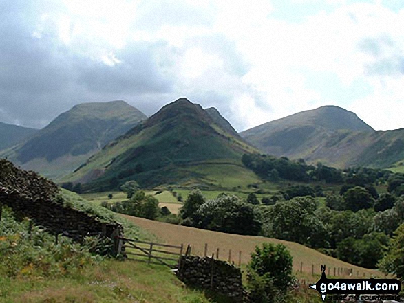
Hindscarth (left), Scope End (centre) and Robinson (right) from above Little Town

Robinson, Crag Hill (Eel Crag), Sail, Causey Pike, Rowling End, The Skiddaw Masiff, Keswick, Cat Bells (Catbells) and High Crags from Blea Crags


The summit of Ard Crags with the shoulder of Robinson and High Snockrigg beyond

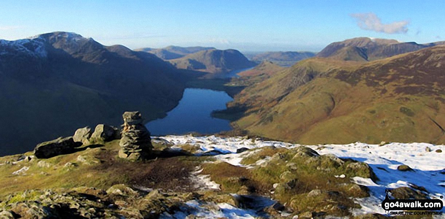
High Stile (left) Buttermere, Mellbreak, Rannerdale Knotts, High Snockrigg, Grasmoor and the shoulder of Robinson (right) from the summit of Fleetwith Pike
. . . see all 54 walk photographs & pictures of views from, on, or of, Robinson
Send us your photographs and pictures on, of, or from Robinson
If you would like to add your walk photographs and pictures to this page, please send them as email attachments (configured for any computer) along with your name to:
and we shall do our best to publish them.
(Guide Resolution = 300dpi. At least = 660pixels (wide) x 440 pixels (high).)

You can also submit photos via our Facebook Page.
NB. Please indicate where each photo was taken and whether you wish us to credit your photos with a Username or your First Name/Last Name.





