
![]()
Lingmell
807m (2648ft)
The Southern Fells, The Lake District, Cumbria, England

Not familiar with this top?
You can walk/hike to the top of Lingmell by using any of these 4 easy‑to‑follow route maps:
Walk c233 Sca Fell and Scafell Pike from Wasdale Head, Wast Water
England's 2 highest mountains
   |
|---|
Vital Statistics:
| Length: | 7.5ml (12km) |
|---|---|
| Ascent: | 4,195ft (1,279m) |
| Time: | 7 hrs |
| Grade: |  (Hard) (Hard) |

Route Summary:
Wasdale Head - (National Trust Campsite) - Wast Water - Lingmell - Corridor Route - Scafell Pike - Mickledore - Foxes Tarn - Symonds Knott - Sca Fell - Lingmell Gill - Wasdale Head - Wast Water.
Walk c197 Lingmell and Scafell Pike from Wasdale Head, Wast Water
England's highest mountain
|
|---|
Vital Statistics:
| Length: | 9ml (14.5km) |
|---|---|
| Ascent: | 3,696ft (1,126m) |
| Time: | 7 hrs |
| Grade: | (Hard) |

Route Summary:
Wasdale Head - Wast Water - Lingmell - Lingmell Col - Scafell Pike - Broad Crag - Ill Crag - Great End - Esk Hause - Sty Head - Lingmell Beck - Gable Beck Bridge - Wasdale Head - Wast Water.
Walk c271 The Scafell Massif from Wasdale Head, Wast Water
England's highest & 2nd highest mountains
|
|---|
Vital Statistics:
| Length: | 9.75ml (15.5km) |
|---|---|
| Ascent: | 5,140ft (1,567m) |
| Time: | 8.75hrs |
| Grade: |  (Hard) (Hard) |

Route Summary:
Wasdale Head - (National Trust Campsite) - Wast Water - Lingmell - Middleboot Knotts - Round How (Scafell) - Great End - Ill Crag - Broad Crag - Scafell Pike - Mickledore - Foxes Tarn - Symonds Knott - Sca Fell - Wast Water.
Walk c453 The Scafell Mountains from Wasdale Head, Wast Water
Testing route up England's highest mountains
|
|---|
Vital Statistics:
| Length: | 11ml (17.5km) |
|---|---|
| Ascent: | 5,409ft (1,648m) |
| Time: | 9½ hrs |
| Grade: | (Hard) |

Route Summary:
Wasdale Head - (National Trust Campsite) - Wast Water - Lingmell - Corridor Route - Great End - Ill Crag - Broad Crag - Scafell Pike - Mickledore - Foxes Tarn - Symonds Knott - Sca Fell - Slight Side - Broad Tongue - Hardrigg Gill - Wasdale Head - Wast Water.
See Lingmell and the surrounding tops on our free-to-access 'Google Style' Peak Bagging Maps:
The Southern Fells of The Lake District National Park
Less data - quicker to download
The Whole of The Lake District National Park
More data - might take a little longer to download
See Lingmell and the surrounding tops on our unique, downloadable, PDF Peak Bagging Maps:

NB: Whether you print off a copy or download it to your phone, these PDF Peak Baggers' Maps might prove incredibly useful when your are up there on the tops and you cannot get a phone signal.
*This version is marked with the walk routes you need to follow to Walk all 214 Wainwrights in just 59 walks.
You can find Lingmell & all the walks that climb it on these unique free-to-access Interactive Walk Planning Maps:
1:25,000 scale OS Explorer Map (orange/yellow covers):
1:50,000 scale OS Landranger Maps (pink/magenta covers):
 Fellow go4awalkers who have already walked, climbed, scaled, summited, hiked & bagged Lingmell
Michael Nolan walked up Lingmell on December 9th, 2023 [with] Morag
Pete George climbed it on October 13th, 2025 [from/via/route] Wasdale Head [with] Roco [weather] Beautiful cloud inversion on Lingmell, cloud rising on Scafell Pike, rest of day in fog
Geoff Hand bagged it on July 2nd, 2025 [from/via/route] Originally planned to do the Mosedale round, however the weather was against us so we opted for Lingmell from Wasdale head straight up & down. [with] richard Macilwaine (friend) [weather] Poor at first then improved as afternoon went on. - Great views around once on top. Nice to see the hoards on scar felland yet it be fairly quiet on Lingmell.
Ian Ashton hiked Lingmell on July 28th, 2024 [with] Solo - Ì
David Higginbottom summited on November 15th, 2018 [from/via/route] Scafell loop [with] Carolyn [weather] Good bit of cloud up Scafell
To add (or remove) your name and experiences on this page - Log On and edit your Personal Mountain Bagging Record
. . . [see more walk reports]
More Photographs & Pictures of views from, on, or of, Lingmell
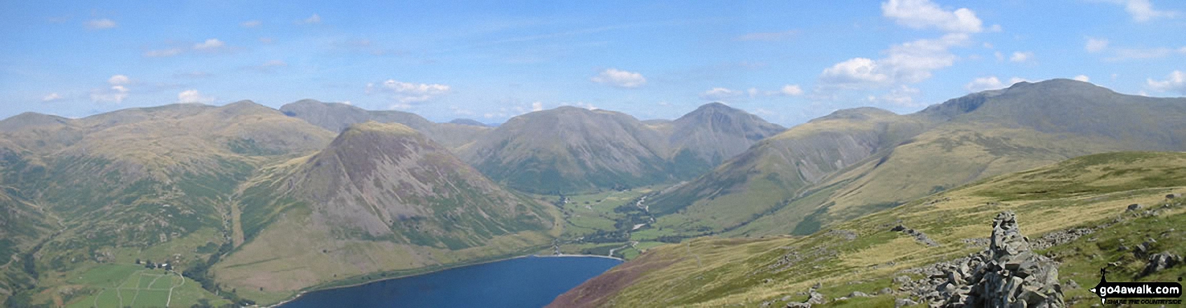
*From Left to right: Caw Fell, Seatallan, Red Pike, Pillar, Yewbarrow, Kirk Fell, Great Gable, Lingmell and Sca Fell and Wast Water (foreground) from Illgill Head (NB. Scafell Pike is largely hidden behind Sca Fell)

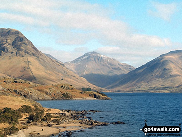
*Kirk Fell (left), Great Gable (centre) Lingmell, Scafell Pike (partially hidden) and Illgill Head across Wast Water
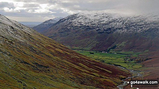
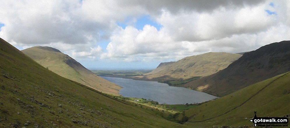
A dusting of snow on the shoulder of Lingmell (left), Middle Fell (centre left in the distance) and Yewbarrow above Wasdale from Sty Head
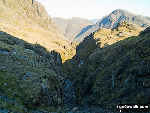
Piers Gill with Lingmell (near left) and Kirk Fell (centre) and Great Gable (right) on the horizon

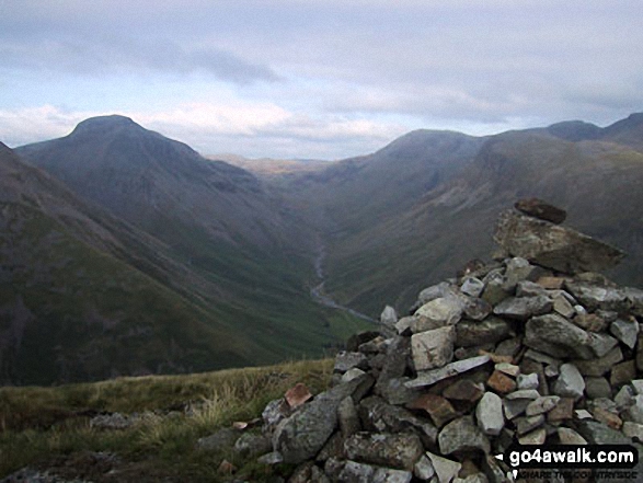
Great Gable (back), Lingmell, the shoulder of Scafell Pike and Mickeldore from Symonds Knott
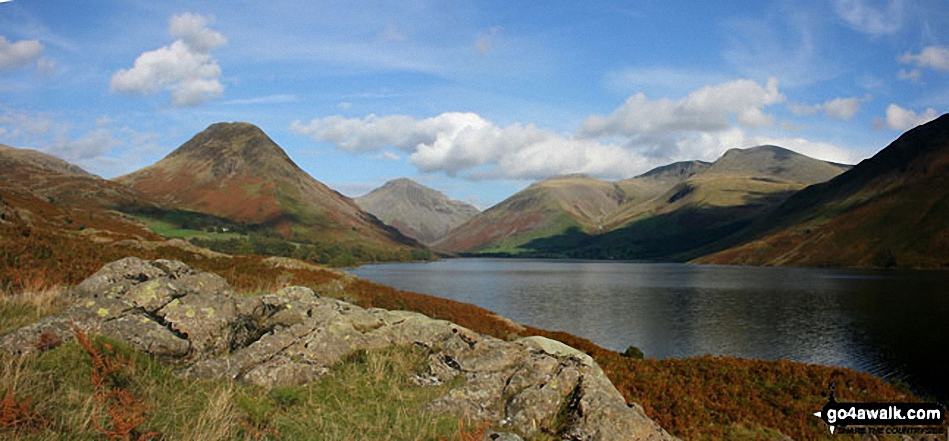
Britain's Favourite View - Yewbarrow, Great Gable, Lingmell, Great End, Sca Fell and the shoulder of Illgill Head (far right) from Wast Water

. . . see all 62 walk photographs & pictures of views from, on, or of, Lingmell
Send us your photographs and pictures on, of, or from Lingmell
If you would like to add your walk photographs and pictures to this page, please send them as email attachments (configured for any computer) along with your name to:
and we shall do our best to publish them.
(Guide Resolution = 300dpi. At least = 660pixels (wide) x 440 pixels (high).)

You can also submit photos via our Facebook Page.
NB. Please indicate where each photo was taken and whether you wish us to credit your photos with a Username or your First Name/Last Name.


