
![]()
Helvellyn
950m (3118ft)
The Eastern Fells, The Lake District, Cumbria, England
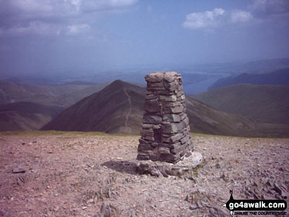
The summit of Helvellyn is marked by an Ordnance Survey Trig Point.
Not familiar with this top?
You can walk/hike to the top of Helvellyn by using any of these 12 easy‑to‑follow route maps:
Walk c432 Helvellyn from Thirlmere
The 'easiest' way up Lakeland's most climbed mountain
   |
|---|
Vital Statistics:
| Length: | 5ml (8km) |
|---|---|
| Ascent: | 2,649ft (807m) |
| Time: | 4½ hrs |
| Grade: |  (Moderate) (Moderate) |
Route Summary:
The Swirls - Helvellyn Gill - Browncove Crags - Lower Man (Helvellyn) - Helvellyn - Lower Man (Helvellyn) - Browncove Crags - Helvellyn Gill - The Swirls
Walk c427 Helvellyn via Striding Edge (High Spying How) from Patterdale
Lakeland's 3rd highest via the infamous Striding Edge
|
|---|
Vital Statistics:
| Length: | 8ml (12.5km) |
|---|---|
| Ascent: | 2,990ft (911m) |
| Time: | 6 hrs |
| Grade: | (Moderate) |

Route Summary:
Patterdale - Patterdale Church - Grisedale Bridge - Grisedale Beck - Brownend Plantation - Lanty's Tarn - Hole-in-the-Wall - Red Tarn (Helvellyn) - Bleaberry Crag - Low Spying How - High Spying How - Striding Edge (High Spying How) - Helvellyn - Swirral Edge (optional) - Hole-in-the-Wall - Grisedale Beck - Patterdale
Walk c213 Helvellyn from Glenridding
Lakeland's 3rd highest via the infamous Striding & Swirral Edges - not for the faint hearted
|
|---|
Vital Statistics:
| Length: | 8.5ml (13.5km) |
|---|---|
| Ascent: | 3,278ft (999m) |
| Time: | 6½ hrs |
| Grade: |  (Hard) (Hard) |

Route Summary:
Glenridding - Birkhouse Moor - Hole-in-the-Wall - Red Tarn (Helvellyn) - Bleaberry Crag - Low Spying How - High Spying How - Striding Edge (High Spying How) - Helvellyn - Swirral Edge - Catstye Cam - Hole-in-the-Wall - Brownend Plantation - Grisedale Beck - Lanty's Tarn - Keldas - Glenridding
Walk c113 Helvellyn from Thirlmere
Lakeland's most popular mountain
|
|---|
Vital Statistics:
| Length: | 8.75ml (14km) |
|---|---|
| Ascent: | 3,296ft (1,005m) |
| Time: | 6½ hrs |
| Grade: | (Hard) |

Route Summary:
The Swirls Car Park Thirlmere - Browncove Crags - Lower Man (Helvellyn) - Helvellyn - White Side - Raise (Helvellyn) - Sticks Pass - Sticks Gill - Stanah Gill - Legburthwaite - Thirlmere - Thirlspot - The Swirls Car Park Thirlmere.
Walk c220 Helvellyn via Striding Edge (High Spying How) from Glenridding
Lakeland's most climbed mountain via the infamous Striding Edge - not for the faint hearted
|
|---|
Vital Statistics:
| Length: | 10ml (16km) |
|---|---|
| Ascent: | 3,382ft (1,031m) |
| Time: | 7 hrs |
| Grade: | (Hard) |

Route Summary:
Glenridding - Birkhouse Moor - Hole-in-the-Wall - Red Tarn (Helvellyn) - Bleaberry Crag - Low Spying How - High Spying How - Striding Edge (High Spying How) - Helvellyn - Nethermost Pike - High Crag (Helvellyn) - Dollywaggon Pike - Grisdale Tarn - Ruthwaite Lodge - Grisedale Beck - Brownend Plantation - Lanty's Tarn - Keldas - Glenridding
Walk c124 Helvellyn Ridge from Thirlmere
Lakeland's most popular mountain with a fine ridge walk
|
|---|
Vital Statistics:
| Length: | 10.5ml (17km) |
|---|---|
| Ascent: | 3,575ft (1,090m) |
| Time: | 7½ hrs |
| Grade: | (Hard) |

Route Summary:
The Swirls Car Park Thirlmere - Browncove Crags - Lower Man (Helvellyn) - Helvellyn - White Side - Raise (Helvellyn) - Sticks Pass - Stybarrow Dodd - Watson's Dodd - Great Dodd - Legburthwaite - Thirlmere - Thirlspot - The Swirls Car Park Thirlmere.
Walk c224 Helvellyn via Swirral Edge and Raise from Glenridding
Lakeland's most popular via the easier Swirral Edge
|
|---|
Vital Statistics:
| Length: | 10.75ml (17km) |
|---|---|
| Ascent: | 3,449ft (1,051m) |
| Time: | 7.25hrs |
| Grade: | (Hard) |

Route Summary:
Glenridding - Birkhouse Moor - Hole-in-the-Wall - Red Tarn (Helvellyn) - Catstye Cam - Swirral Edge - Helvellyn - Lower Man (Helvellyn) - White Side - Raise (Helvellyn) - Sticks Pass - Lucy's Tongue - Glenridding Beck - Glenridding
Walk c394 Helvellyn, Catstye Cam and Sheffield Pike from Glenridding
Superb high level walk
|
|---|
Vital Statistics:
| Length: | 10ml (16km) |
|---|---|
| Ascent: | 4,020ft (1,225m) |
| Time: | 8 hrs |
| Grade: |  (Hard) (Hard) |

Route Summary:
Glenridding - Glenridding Dodd - Sheffield Pike - Nick Head - Sticks Pass - Raise (Helvellyn) - White Side - Lower Man (Helvellyn) - Helvellyn - Swirral Edge - Catstye Cam - Glenridding Beck - Glenridding Youth Hostel - Glenridding
Walk c269 The Grisedale Horseshoe from Patterdale
Lakeland's most climbed mountain - not for the faint hearted
|
|---|
Vital Statistics:
| Length: | 11.5ml (18.5km) |
|---|---|
| Ascent: | 4,582ft (1,396m) |
| Time: | 8.75hrs |
| Grade: | (Hard) |

Route Summary:
Patterdale - Grisedale Bridge - Grisedale Beck - Brownends Plantation - Hole-in-the-Wall - Birkhouse Moor - Hole-in-the-Wall - Red Tarn (Helvellyn) - Bleaberry Crag - Low Spying How - High Spying How - Striding Edge (High Spying How) - Helvellyn - Nethermost Pike - High Crag (Helvellyn) - Dollywaggon Pike - Grisedale Tarn - Deepdale Hause - St Sunday Crag - Birks - Patterdale
Walk c286 The Glenridding Skyline from Glenridding
Superb high level walk
|
|---|
Vital Statistics:
| Length: | 11.5ml (18.5km) |
|---|---|
| Ascent: | 4,418ft (1,346m) |
| Time: | 8½ hrs |
| Grade: | (Hard) |

Route Summary:
Glenridding - Glenridding Dodd - Sheffield Pike - Nick Head - Glencoyne Head - Hart Side - Green Side (White Stones) - Stybarrow Dodd - Sticks Pass - Raise (Helvellyn) - White Side - Lower Man (Helvellyn) - Helvellyn - Swirral Edge - Catstye Cam - Red Tarn Beck - Glenridding Beck - Glenridding Youth Hostel - Glenridding
Walk c192 Helvellyn Ridge from Glenridding
An exhilarating high ridge walk
|
|---|
Vital Statistics:
| Length: | 13ml (21km) |
|---|---|
| Ascent: | 4,359ft (1,329m) |
| Time: | 9.25hrs |
| Grade: | (Hard) |

Route Summary:
Glenridding - Glenridding Dodd - Sheffield Pike - Green Side - Stybarrow Dodd - Sticks Pass - Raise (Helvellyn) - White Side - Lower Man (Helvellyn) - Helvellyn - Nethermost Pike - High Crag (Helvellyn) - Dollywaggon Pike - Grisdale Tarn - Grisedale Beck - Brownend Plantation - Lanty's Tarn - Keldas - Glenridding
Walk c264 The Grisedale Round from Patterdale
Superb high level ridge walk
|
|---|
Vital Statistics:
| Length: | 13.25ml (21km) |
|---|---|
| Ascent: | 5,189ft (1,581m) |
| Time: | 10 hrs |
| Grade: |  (Very Hard) (Very Hard) |

Route Summary:
Patterdale - Grisedale Bridge - Grisedale Beck - Brownend Plantation - Hole-in-the-Wall - Birkhouse Moor - Hole-in-the-Wall - Red Tarn (Helvellyn) - Bleaberry Crag - Low Spying How - High Spying How - Striding Edge (High Spying How) - Helvellyn - Nethermost Pike - High Crag (Helvellyn) - Dollywaggon Pike - Seat Sandal - Grisedale Tarn - St Sunday Crag - Birks - Arnison Crag - Patterdale
See Helvellyn and the surrounding tops on our free-to-access 'Google Style' Peak Bagging Maps:
The Eastern Fells of The Lake District National Park
Less data - quicker to download
The Whole of The Lake District National Park
More data - might take a little longer to download
See Helvellyn and the surrounding tops on our unique, downloadable, PDF Peak Bagging Maps:

NB: Whether you print off a copy or download it to your phone, these PDF Peak Baggers' Maps might prove incredibly useful when your are up there on the tops and you cannot get a phone signal.
*This version is marked with the walk routes you need to follow to Walk all 214 Wainwrights in just 59 walks.
You can find Helvellyn & all the walks that climb it on these unique free-to-access Interactive Walk Planning Maps:
1:25,000 scale OS Explorer Map (orange/yellow covers):
1:50,000 scale OS Landranger Map (pink/magenta covers):
 Fellow go4awalkers who have already walked, climbed, scaled, summited, hiked & bagged Helvellyn
Sarah Moore walked up Helvellyn on December 31st, 2025 [from/via/route] My own Hellvellyn route - from Glenridding up the zig zag to WhiteSide. I didn't want to do the edges & given the wind & conditions it was a very good decision. Across the ridge from Whiteside along to Dollywaggon Pike & then down to Grisedale Tarn & back along the valley. [with] My, myself and I. More people about - certainly on the tops it's something I was grateful for. [weather] Great winter conditions. Started off thinking I was going to get the morning colours, then when the cloud came I thought I might get a cloud inversion. Instead I got strong winds & cloud that reduced visibility at the top to not much. - This one pushed me - it was just so cold. Again, felt slow going up to Whiteside & I have to stop regularly but then the time overall isn't bad & the wind was truly ferocious & I was walking into it almost from constantly from Glenridding YHA to the top. Very glad I did this route & missed the edges - great to be able to do it myself & a lovely box ticked.
Tim Winn climbed it on April 4th, 2025 [from/via/route] Glenridding [with] Barry, Paul, Roger, Dave and Andy Last [weather] Dry. Sunny.
Nick Tippins bagged it on December 31st, 2019 [from/via/route] Helvellyn Circular from Glenridding via Birkhouse Moor, Striding Edge, & Catstye Cam [with] Fran
Hazel Gilbert hiked Helvellyn on May 12th, 2017 [with] Lawrence
Vincent Clarke summited on May 31st, 2024 [from/via/route] Glenridding on route to Helvlynn [with] Chopper [weather] Early morning
To add (or remove) your name and experiences on this page - Log On and edit your Personal Mountain Bagging Record
. . . [see more walk reports]
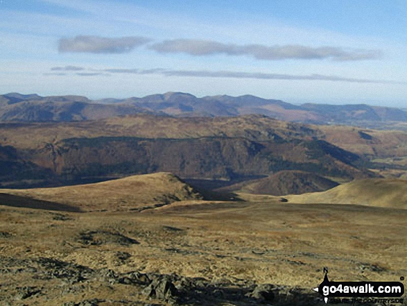
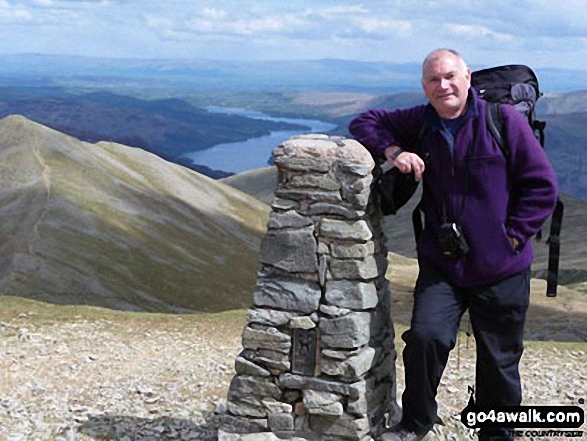
More Photographs & Pictures of views from, on, or of, Helvellyn

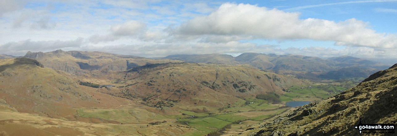
*Little Langdale with the Langdale Pikes, Helvellyn and Fairfield beyond from Wetherlam

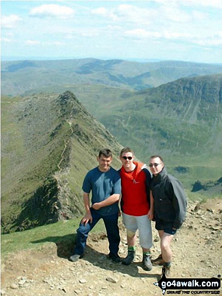
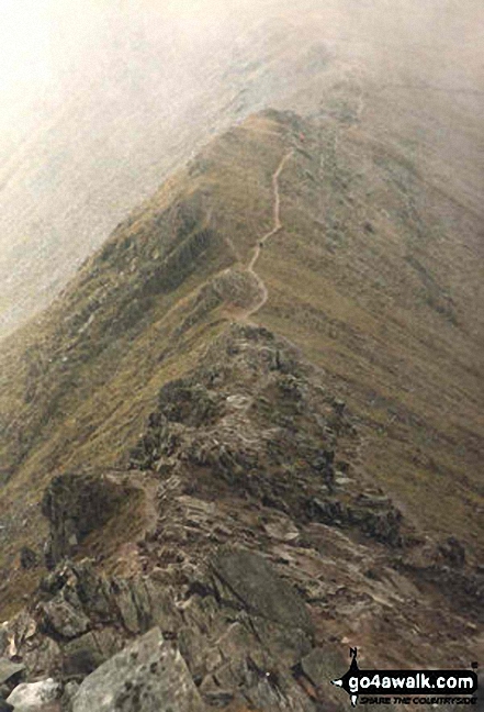
Striding Edge (High Spying How), Helvellyn, Swirral Edge and Catstye Cam from Birkhouse Moor
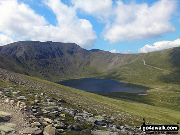
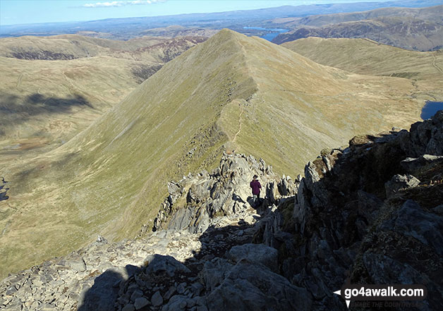
Helvellyn, Swirral Edge and Red Tarn taken from Hole-in-the-Wall at the beginning of Striding Edge (High Spying How)

. . . see all 224 walk photographs & pictures of views from, on, or of, Helvellyn
Send us your photographs and pictures on, of, or from Helvellyn
If you would like to add your walk photographs and pictures to this page, please send them as email attachments (configured for any computer) along with your name to:
and we shall do our best to publish them.
(Guide Resolution = 300dpi. At least = 660pixels (wide) x 440 pixels (high).)

You can also submit photos via our Facebook Page.
NB. Please indicate where each photo was taken and whether you wish us to credit your photos with a Username or your First Name/Last Name.


