Carl Side
746m (2448ft)
The Northern Fells, The Lake District, Cumbria, England


Not familiar with this top?
You can walk/hike to the top of Carl Side by using any of these 5 easy‑to‑follow route maps:

Walk c315 Carl Side and Dodd (Skiddaw) from Dodd Wood
Terrific Views
   |
|---|
Vital Statistics:
| Length: | 7.25ml (11.5km) |
|---|---|
| Ascent: | 3,116ft (950m) |
| Time: | 5.75hrs |
| Grade: |  (Moderate) (Moderate) |

Route Summary:
Old Sawmill Tearooms - Longside Wood - The Allerdale Ramble - Ling How - The Edge - Ullock Pike - Longside Edge - Long Side - Carl Side - White Stones - Skill Beck - Dodd (Skiddaw) - Dodd Wood - Old Sawmill Tearooms


Walk c248 Skiddaw from High Side
Stunning high level route
|
|---|
Vital Statistics:
| Length: | 8.25ml (13km) |
|---|---|
| Ascent: | 2,919ft (890m) |
| Time: | 6 hrs |
| Grade: | (Moderate) |

Route Summary:
High Side - The Allerdale Ramble - Ling How - The Edge - Ullock Pike - Longside Edge - Long Side - Carl Side - Skiddaw - Bakestall - Birkett Edge - Whitewater Dash - Back O' Skiddaw - Melbecks - High Side

Walk c236 Skiddaw from Millbeck, nr Keswick
Superb walk up the Northern Fells' Highest
|
|---|
Vital Statistics:
| Length: | 8.25ml (13km) |
|---|---|
| Ascent: | 3,306ft (1,008m) |
| Time: | 6.25hrs |
| Grade: |  (Hard) (Hard) |
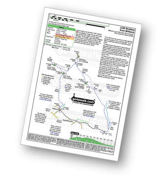
Route Summary:
Keswick - Millbeck - The Allerdale Ramble - Doups - White Stones - Carl Side - Longside Edge - Long Side - Skiddaw - Little Man (Skiddaw) - The Cumbria Way - Applethwaite - The Allerdale Ramble - Millbeck - Nr Keswick.

Walk c321 Skiddaw and Lonscale Fell from Millbeck, nr Keswick
Peak Baggers route
|
|---|
Vital Statistics:
| Length: | 9.75ml (15.5km) |
|---|---|
| Ascent: | 3,529ft (1,076m) |
| Time: | 7 hrs |
| Grade: | (Hard) |

Route Summary:
Keswick - Millbeck - The Allerdale Ramble - Doups - White Stones - Carl Side - Longside Edge - Long Side - Skiddaw - Little Man (Skiddaw) - Jenkin Hill - Lonscale Fell - Lonscale Crags - The Cumbria Way - Applethwaite - The Allerdale Ramble - Millbeck - Nr Keswick.

Walk c447 The Skiddaw Massif from Millbeck, nr Keswick
Long high level route
|
|---|
Vital Statistics:
| Length: | 15.25ml (24.5km) |
|---|---|
| Ascent: | 5,458ft (1,663m) |
| Time: | 11 hrs |
| Grade: |  (Very Hard) (Very Hard) |

Route Summary:
Keswick - Millbeck - The Allerdale Ramble - Doups - Dodd (Skiddaw) - White Stones (Skiddaw) - Carl Side - Longside Edge - Long Side - Ullock Pike - Carlside Tarn - Skiddaw - Blake Hill - Bakestall - Little Man (Skiddaw) - Jenkin Hill - Lonscale Fell - Lonscale Crags - The Cumbria Way - Latrigg - Applethwaite - The Allerdale Ramble - Millbeck - Nr Keswick.
See Carl Side and the surrounding tops on our free-to-access 'Google Style' Peak Bagging Maps:

The Northern Fells of The Lake District National Park
Less data - quicker to download
The Whole of The Lake District National Park
More data - might take a little longer to download
See Carl Side and the surrounding tops on our unique, downloadable, PDF Peak Bagging Maps:

NB: Whether you print off a copy or download it to your phone, these PDF Peak Baggers' Maps might prove incredibly useful when your are up there on the tops and you cannot get a phone signal.
*This version is marked with the walk routes you need to follow to Walk all 214 Wainwrights in just 59 walks.
You can find Carl Side & all the walks that climb it on these unique free-to-access Interactive Walk Planning Maps:
1:25,000 scale OS Explorer Map (orange/yellow covers):
1:50,000 scale OS Landranger Maps (pink/magenta covers):
 Fellow go4awalkers who have already walked, climbed, scaled, summited, hiked & bagged Carl Side
Nick Tippins walked up Carl Side on December 31st, 2025 [from/via/route] c315: Carl Side & Dodd (Skiddaw) from Dodd Wood [with] Fran
James Hughes climbed it on May 16th, 2025 [from/via/route] c315 Carl Side & Dodd from Ravenstone Hotel [weather] Warm sunny but very windy on tops. - Second walk of the day. Path up bridleway from Ravenstone Hotel was steep & challenging - maybe difficult after rain. Steep climb all the way to Ullock Pike. Awesome views & then easy progress across ridge to Carl Side. Path down to White Stones steep & tricky. Descent to Dodd from Cairn also technical. Climb through forest up to Dodd Memorial delightful. Against AW advice descended on a path which was on OS Map through wood to rejoin summit path. Meander through Rabbit Warren back to Hotel. Pint of Corby Blonde.
Sarah Gunn bagged it on February 28th, 2024 [with] Martin Gunn, Dan Gunn and Shannon Worton
Claire Kirk hiked Carl Side on May 9th, 2024 [from/via/route] Sawmill Tearooms [with] Self [weather] Warm & sunny, light breeze
David Higginbottom summited on April 26th, 2024 [from/via/route] C315 from tea room [with] Carolyn [weather] Good
To add (or remove) your name and experiences on this page - Log On and edit your Personal Mountain Bagging Record
. . . [see more walk reports]
More Photographs & Pictures of views from, on, or of, Carl Side


The North Western Fells (far left distance), Carl Side, Skiddaw and Lonscale Fell (centre left), Great Calva (centre) and Belncathra or Saddleback, Bannerdale Crags and Souther Fell (centre right) and the shoulder of Clough Head (far right) from the summit of High Rigg

Longside Edge, Long Side and Ullock Pike summit with Bassenthwaite Lake beyond from Carl Side

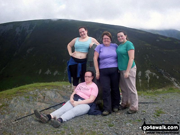
Family on top of Dodd (Skiddaw) with Ullock Pike, Longside Edge and Carl Side behind

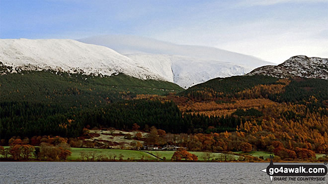
Snow on Carl Side (left), Skiddaw (centre) and Dodd (Skiddaw) across Bassenthwaite Lake from Woodend Brow


Descending Carl Side towards the White Stones with a fine view of Derwent water
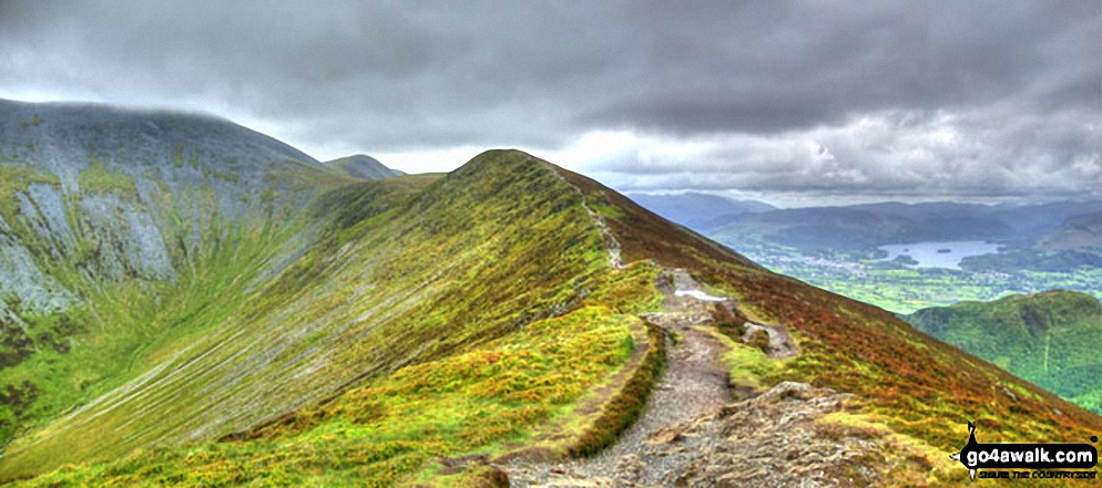
Skiddaw, Skiddaw (Little Man), Carl Side (left), Long Side, Longside Edge, Derwent Water and Dodd (Skiddaw) and the upper reaches of Southerndale from Ullock Pike
. . . see all 18 walk photographs & pictures of views from, on, or of, Carl Side
Send us your photographs and pictures on, of, or from Carl Side
If you would like to add your walk photographs and pictures to this page, please send them as email attachments (configured for any computer) along with your name to:
and we shall do our best to publish them.
(Guide Resolution = 300dpi. At least = 660pixels (wide) x 440 pixels (high).)

You can also submit photos via our Facebook Page.
NB. Please indicate where each photo was taken and whether you wish us to credit your photos with a Username or your First Name/Last Name.