Rossett Pike
651m (2136ft)
The Southern Fells, The Lake District, Cumbria, England


Looking across Mickleden Beck towards the Bowfell Buttress (left) and Rossett Pike (right)
Not familiar with this top?
You can walk/hike to the top of Rossett Pike by using any of these 7 easy‑to‑follow route maps:

Walk c466 Rossett Pike and Black Crags (Langdale) from Great Langdale
Superb views up the Langdale Valley
   |
|---|
Vital Statistics:
| Length: | 8.75mls (14km) |
|---|---|
| Ascent: | 2,271ft (692m) |
| Time: | 5½ hrs |
| Grade: |  (Moderate) (Moderate) |

Route Summary:
Great Langdale - Old Dungeon Ghyll - The Cumbria Way - Mickleden Beck - Mickleden (Langdale) - Rossett Beck - Rossett Pike - Little Gill Head - Black Crags (Langdale) - Stake Pass - The Cumbria Way - Stake Gill - Mickleden - Mickleden Beck - The New Dungeon Ghyll - Great Langdale


Walk c371 Esk Pike and Bow Fell (Bowfell) from The Old Dungeon Ghyll, Great Langdale
Superb ridge walking with good views of Scafell Pike
|
|---|
Vital Statistics:
| Length: | 9ml (14.5km) |
|---|---|
| Ascent: | 3,459ft (1,054m) |
| Time: | 6.75hrs |
| Grade: |  (Hard) (Hard) |

Route Summary:
Great Langdale - Old Dungeon Ghyll - The Cumbria Way - Mickleden Beck - Mickleden (Langdale) - Rossett Beck - Rossett Pike - Angle Tarn (Langdale) - Esk Hause - Esk Pike - Ore Gap - Bow Fell (Bowfell) (North Top) - Bow Fell (Bowfell) - Bowfell Buttress - Cambridge Crag - Flat Crag - Climbers' Traverse (optional) - Three Tarns - Earing Crag - White Stones - The Band - Oxendale - Stool End Farm - The Old Dungeon Ghyll - Great Langdale

Walk c418 The Langdale Pikes via North Rake and Rossett Pike from Great Langdale
A busy path leads to wild seclusion
|
|---|
Vital Statistics:
| Length: | 10mls (16km) |
|---|---|
| Ascent: | 3,580ft (1,091m) |
| Time: | 7.25hrs |
| Grade: | (Hard) |

Route Summary:
Great Langdale - The New Dungeon Ghyll - Stickle Ghyll - Stickle Tarn - North Rake - The Langdale Pikes - Pavey Ark - Thunacar Knott - Harrison Stickle - Loft Crag - Pike of Stickle (Pike o' Stickle) - Martcrag Moor - Stake Pass - Black Crags (Langdale) - Little Gill Head - Rossett Pike - Rossett Gill - The Cumbria Way - Mickleden - Mickleden Beck - The New Dungeon Ghyll - Great Langdale

Walk c129 Crinkle Crags and Bow Fell from The Old Dungeon Ghyll, Great Langdale
Superb fell walking on a superb ridge
|
|---|
Vital Statistics:
| Length: | 11.25ml (18km) |
|---|---|
| Ascent: | 3,604ft (1,098m) |
| Time: | 7.75hrs |
| Grade: | (Hard) |

Route Summary:
Great Langdale - The Old Dungeon Ghyll - Stool End Farm - Oxendale - Oxendale Beck - Browney Gill - Red Tarn (Langdale) - Great Knott - Crinkle Crags (South Top) - Crinkle Crags (Long Top) - Crinkle Crags (Gunson Knott) - Shelter Crags - Shelter Crags (North Top) - Three Tarns - Climbers' Traverse (optional) - Flat Crag - Cambridge Crag - Bowfell Buttress - Bow Fell (Bowfell) - Bow Fell (Bowfell) (North Top) - Ore Gap - Angle Tarn (Langdale) - Rossett Pike - Rossett Beck - Mickleden - Mickleden Beck - The Cumbria Way - The Old Dungeon Ghyll - Great Langdale

Walk c416 Scafell Pike from The Old Dungeon Ghyll, Great Langdale
The 'easiest' way up England's highest from Great Langdale
|
|---|
Vital Statistics:
| Length: | 11.25ml (18km) |
|---|---|
| Ascent: | 3,883ft (1,183m) |
| Time: | 8 hrs |
| Grade: |  (Hard) (Hard) |

Route Summary:
Great Langdale - The Old Dungeon Ghyll - The Cumbria Way - Mickleden Beck - Rossett Gill - Rossett Pike - Angle Tarn (Langdale) - Esk Hause - Scafell Pike - Ill Crag - Broad Crag - Great End - Esk Hause - Angle Tarn - Rossett Gill - Mickleden - Mickleden Beck - The Cumbria Way - The Old Dungeon Ghyll - Great Langdale

Walk c425 The Oxendale Fells from The Old Dungeon Ghyll, Great Langdale
High level route with superb views
|
|---|
Vital Statistics:
| Length: | 11.75ml (19km) |
|---|---|
| Ascent: | 4,680ft (1,426m) |
| Time: | 9 hrs |
| Grade: | (Hard) |

Route Summary:
Great Langdale - The Old Dungeon Ghyll - Wall End Farm - Redacre Gill - Wrynose Fell - Pike of Blisco (Pike O' Blisco) - Red Tarn (Langdale) - Great Knott - Crinkle Crags (South Top) - Crinkle Crags (Long Top) - Crinkle Crags (Gunson Knott) - Shelter Crags - Shelter Crags (North Top) - Three Tarns - Climbers' Traverse (optional) - Flat Crag - Cambridge Crag - Bowfell Buttress - Bow Fell (Bowfell) - Bow Fell (Bowfell) (North Top) - Ore Gap - Angle Tarn (Langdale) - Rossett Pike - Rossett Beck - Mickleden - Mickleden Beck - The Cumbria Way - The Old Dungeon Ghyll - Great Langdale

Walk c194 Scafell Pike from The Old Dungeon Ghyll, Great Langdale
England's Highest Mountain
|
|---|
Vital Statistics:
| Length: | 12.5ml (20km) |
|---|---|
| Ascent: | 4,684ft (1,428m) |
| Time: | 9.25hrs |
| Grade: | (Hard) |

Route Summary:
Great Langdale - The Old Dungeon Ghyll - The Cumbria Way - Mickleden Beck - Mickleden - Rossett Beck - Rossett Pike - Angle Tarn (Langdale) - Esk Hause - Great End - Ill Crag - Broad Crag - Scafell Pike - Esk Hause - Esk Pike - Ore Gap - Bow Fell (Bowfell) (North Top) - Bow Fell (Bowfell) - Bowfell Buttress - Cambridge Crag - Flat Crag - Climbers' Traverse (optional) - Three Tarns - The Band - Oxendale - Stool End Farm - The Old Dungeon Ghyll - Great Langdale
See Rossett Pike and the surrounding tops on our free-to-access 'Google Style' Peak Bagging Maps:

The Southern Fells of The Lake District National Park
Less data - quicker to download
The Whole of The Lake District National Park
More data - might take a little longer to download
See Rossett Pike and the surrounding tops on our unique, downloadable, PDF Peak Bagging Maps:

NB: Whether you print off a copy or download it to your phone, these PDF Peak Baggers' Maps might prove incredibly useful when your are up there on the tops and you cannot get a phone signal.
*This version is marked with the walk routes you need to follow to Walk all 214 Wainwrights in just 59 walks.
You can find Rossett Pike & all the walks that climb it on these unique free-to-access Interactive Walk Planning Maps:
1:25,000 scale OS Explorer Map (orange/yellow covers):
1:50,000 scale OS Landranger Maps (pink/magenta covers):
 Fellow go4awalkers who have already walked, climbed, scaled, summited, hiked & bagged Rossett Pike
Pete George walked up Rossett Pike on October 13th, 2025 [from/via/route] Wasdale Head [with] Roco [weather] Beautiful cloud inversion on Lingmell, cloud rising on Scafell Pike, rest of day in fog
Tim Winn climbed it on May 18th, 2025 [from/via/route] Stickle Ghyll Car Park [with] Walks with Matt [weather] Dry. Sunny.
James Hughes bagged it on April 2nd, 2025 [from/via/route] c371 Esk Pike & Bow Fell from Great Langdale c279 Oxendale Horseshoe [weather] Beautiful clear skies, blustery on tops, warm in valleys & in sheltered spots. - Epic double walk day from Old Dungeon Ghyll including Rosset Pike, Esk Pike, Bow Fell, Cringle Crags, Cold Pike, Pike of Blisco. Helped down 'Bad Step', unorthodox descent of Cold Pike & ascent of Pike of Blisco. Great views of Sca Fell. Awesome Day.
Christine Shepherd hiked Rossett Pike on April 25th, 2009 [from/via/route] Great Langdale using walk c371 [with] On my own [weather] Fine at first storms on the descent. - Climbed again on 20.6.19 while bagging Black Crags Langdale. Climbed for a third time on 6. 10 21 doing walk c371 in reverse. Did this walk again on 25/04/23. I added Great End on to this walk from Esk Hause as it was such a stunning day.
John Tippins summited on October 25th, 2022 [from/via/route] From the Old Dungeon Ghyll [with] Alone [weather] Dry most of the day, even a bit of sunshine. Some light rain around lunchtime, warm by mid-afteroon. Winds much lighter than recently, but also colder, maybe the fact that I was higher.
To add (or remove) your name and experiences on this page - Log On and edit your Personal Mountain Bagging Record
. . . [see more walk reports]
More Photographs & Pictures of views from, on, or of, Rossett Pike
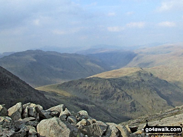
Rossett Pike and Black Crags from the top of Great Slab below Bow Fell (Bowfell)

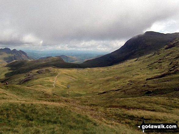
The Langdale Pikes (left), Rossett Pike (foreground left) and Esk Pike (right) from Esk Hause

Rossett Pike summit ridge with The Langdale Pikes in the distance and Great Langdale far below
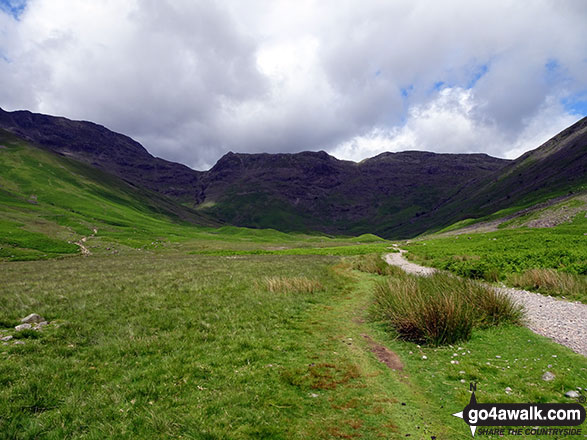
Looking up Mickleden towards Rossett Pike, Buck Pike (Langdale) and Black Crags (Langdale) from Great Langdale
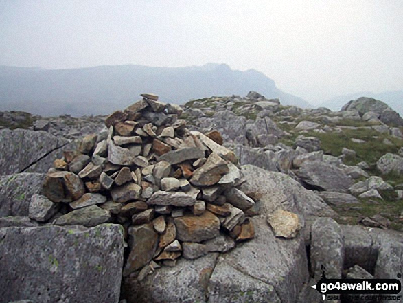

Crinkle Crags (South Top), Crinkle Crags (Long Top), Crinkle Crags (Gunson Knott), Shelter Crags, Shelter Crags, (North Top), The Band , Bow Fell (Bowfell) and Bow Fell (Bowfell) (North Top), Esk Pike, Rossett Pike and The Langdale Pikes including Pike of Stickle (Pike o' Stickle) (left) Loft Crag and Harrison Stickle from Stool End, Great Langdale
Send us your photographs and pictures on, of, or from Rossett Pike
If you would like to add your walk photographs and pictures to this page, please send them as email attachments (configured for any computer) along with your name to:
and we shall do our best to publish them.
(Guide Resolution = 300dpi. At least = 660pixels (wide) x 440 pixels (high).)

You can also submit photos via our Facebook Page.
NB. Please indicate where each photo was taken and whether you wish us to credit your photos with a Username or your First Name/Last Name.