Mountain (Hewitt) & Nuttall Icon

Black Sails
745m (2445ft)

The Southern Fells, The Lake District, Cumbria, England


Record Black Sails as Bagged, Climbed & Conquered


English Mountain Icon

English Mountain
71st highest in England,
125th in England & Wales

English Nuttall Icon

English Nuttall
88th highest in England,
153rd in England & Wales

Walk Black Sails walking UK Mountains in The Southern Fells The Lake District National Park Cumbria, England

Black Sails Summit

Photo: David Elliott

You can find Black Sails & all the walks that climb it on these unique free-to-access Interactive Walk Planning Maps: (click/TAP to select)

The Lake District National Park


1:25,000 scale OS Explorer Map (the ones with orange/yellow covers):

OL6 The English Lakes - South Western area


1:50,000 scale OS Landranger Maps (the ones with pink/magenta covers):

89 West Cumbria, Cockermouth & Wast Water


90 Penrith & Keswick, Ambleside


See Black Sails and the surrounding tops on our free-to-access 'Google Style' Peak Bagging Maps:

See Black Sails and the surrounding tops on our downloadable PDF Peak Bagging Maps:

NB: Whether you print off a copy on to paper or download it to your phone, these PDF Peak Baggers Maps will prove incredibly useful when your are up there on the tops and you cannot get a phone signal!


You can walk to the top of Black Sails by using any of these 5 easy‑to‑follow route maps:
Walking Boot Print Icon

Walk c303 Swirl How and Wetherlam from Little Langdale

A quieter alternative to the Coniston crowds.

Walk GPS Icon
Walk GPX Icon
Walk PDF Icon

Vital Statistics:

Length: 8ml (12km)
Ascent:3,042ft (927m)
Time:5.75hrs
Grade:Walk Grade 6 Icon (Moderate)
Walking Boot Print Icon

Walk c167 Wetherlam and Swirl How from Low Tilberthwaite

A quiet alternative to the usual honey pots

Walk GPS Icon
Walk GPX Icon
Walk PDF Icon

Vital Statistics:

Length: 8.75ml (14km)
Ascent:3,584ft (1,092m)
Time:6.75hrs
Grade:Walk Grade 7 Icon (Hard)
Walking Boot Print Icon

Walk c306 The Old Man of Coniston and Wetherlam from Coniston

Superb views of Coniston Water

Walk GPS Icon
Walk GPX Icon
Walk PDF Icon

Vital Statistics:

Length: 9.75ml (15.5km)
Ascent:3,664ft (1,117m)
Time:7.25hrs
Grade:Walk Grade 7 Icon (Hard)
Walking Boot Print Icon

Walk c222 Swirl How and Wetherlam from Coniston

The Consiton fells without the crowds

Walk GPS Icon
Walk GPX Icon
Walk PDF Icon

Vital Statistics:

Length: 10ml (16km)
Ascent:3,584ft (1,092m)
Time:7 hrs
Grade:Walk Grade 7 Icon (Hard)
Walking Boot Print Icon

Walk c420 The Coniston Fells from Walna Scar Road, Coniston

Superb high level route

Walk GPS Icon
Walk GPX Icon
Walk PDF Icon

Vital Statistics:

Length: 12.75ml (20.5km)
Ascent:4,191ft (1,277m)
Time:8.75hrs
Grade:Walk Grade 8 Icon (Hard)

Other walkers who hiked, climbed, bagged and summited Black Sails Fellow go4awalkers who have already walked, climbed, summited & bagged Black Sails

Chris Faulkner walked up Black Sails on August 24th, 2024 [from/via/route] From Coniston via Levers Water & Wetherlam [weather] Bright & blustery.

Paul Macey climbed Black Sails on August 13th, 2012 [with] Luke Macey

Martin Woods bagged Black Sails on March 4th, 2023 [from/via/route] Old man of Coniston to Swirl How, Black Sails & Wetherlam c306 [with] N/A [weather] Overcast, 7 degerees in the valley cold on the tops - Be careful of navigation towards Swirl How easy to forget where you are up to

Kevin Foster hiked Black Sails on September 6th, 2021 [from/via/route] Low Tilberthwaite. [with] By myself. [weather] Cloudy. Summits mostly covered. Good visibility on lower slopes. - An interesting route onto Wetherlam via Steel Edge. The one Wainwright doesn't mention in his books for some reason? Don't know why because it's a cracking way up. Sadly on Prison Band the cloud level was reached & the rest of the walk was view less. Of interest on route was the war memorial & Halifax bomber crash site between Swirl How & Great Carrs. The views opened up again on the descent of wet side edge & the clouds & sunshine poking through made for some great photos.

Alan Smith summited Black Sails on September 15th, 2020 [from/via/route] From Coniston. With kev. Hot sunny day [with] kevin [weather] Sunny

Caroline Winter conquered Black Sails on April 11th, 2018 [from/via/route] Wrynose pass, Great Carrs, Grey Friar, Swirl How, Black sails, Wetherlam [with] Becky [weather] Cloud lifted & great views late morning/afternoon, breezy on ascent to Hell Gill Pike - Busy up here. Some off to Coniston from Swirl Hawse, we some how missed plane debris on Great Carrs! Lost time on descent of Prison Band & detour off path to Black Sails. Also, after rocky scramble decent.....ended up on the minor track to the mines, & boy was it steep & never ending. We were in dismay at another climb to get back over to Wet Side. Late for booked meal, but fantastic circuit

Anthony Scott scaled Black Sails on September 22nd, 2015 [with] me

Graham Coules walked up Black Sails on April 23rd, 2017 [from/via/route] Nel Foot bridge [weather] Perfect

Louis Smith climbed Black Sails on July 12th, 2015 [from/via/route] temperature inversion

Mark Davidson has bagged Black Sails [with] Theresa [weather] Can't remember - Can't remember the date but would have been the late 1990's

To add (or remove) your name and experiences on this page - Log On and edit your Personal Mountain Bagging Record

. . . [see more walk reports]


More Photographs & Pictures of views from, on or of Black Sails

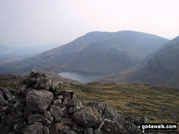
Levers Water and The Old Man of Coniston from Black Sails summit cairn

Levers Water and The Old Man of Coniston from Black Sails summit cairn

Photo: Jon Nuttalls (14)

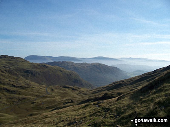
Black Sails and The Furness Fells from the summit of Swirl How

Black Sails and The Furness Fells from the summit of Swirl How

Photo: Ian Gaylard (18)

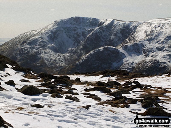
Coniston Old Man from Black Sails in the snow

Coniston Old Man from Black Sails in the snow

Photo: David Elliott (2)


Send us your photographs and pictures on, of, or from Black Sails

If you would like to add your walk photographs and pictures featuring views from, on or of Black Sails to this page, please send them as email attachments (configured for any computer) along with your name to:


and we shall do our best to publish them.

(Guide Resolution = 300dpi. At least = 660pixels (wide) x 440 pixels (high).)

Send us your photographs and pictures on, of, or from Black Sails via Facebook

You can also submit photos via our Facebook Page.

NB. Please indicate where each photo was taken.


Do not miss our pick of the Best Walks in the UK


Follow go4awalk.com on Twitter Follow go4awalk.com on Facebook


Home


Find new Friends to go walking with

Walk all 214 Wainwrights in just 59 Walks. Download GPS Waypoints - Great Walks you must not miss!

Walk The Yorkshire Three Peaks Challenge Walk - All the Latest Route Information, GPS Waypoints and Split Times to keep you on Schedule

Walk The British Three Peaks Challenge Walk - All the Latest Route Information and GPS Waypoints

See our pick of The Best Walks in The Lake District - Great Walks you must not miss!

Walk our pick of the Best Lake District Ridge Walks - Great Walks you must not miss!

Walk our pick of the Best Lake District Walks to do in the rain - Great Walks you must not miss!

Walk our pick of The Best Walks in Snowdonia - Great Walks you must not miss!

Walk our pick of The Best Ridge Walks in Wales - Walks you must not miss!

Walk our pick of The Best Walks in The Brecon Beacons - Great Walks you must not miss!

Walk our pick of The Best Walks in The Yorkshire Dales - Walks you must not miss!

Walk our pick of The Best Walks in The Peak District - Walks you must not miss!

Walk our pick of The Best Walks in The Forest of Bowland - Walks you must not miss!

Walk our pick of The Best Walks in Shropshire - Walks you must not miss!

Walk our pick of The Best Walks in Cheshire - Walks you must not miss!

Walk our pick of The Best Walks in Lancashire - Walks you must not miss!

Not sure where to walk next? Try Peak Bagging - Great Walks you must not miss!

Not sure where to walk next? Walk part of a National Trail - Great Walks you must not miss!

Walks with Downloadable and Uploadable GPS Waypoint Data

Walking Kit and Gear Tested by Walkers

Full Site Search