Scar Crags
672m (2205ft)
The North Western Fells, The Lake District, Cumbria, England


Scar Crags with Sail (Derwent Fells) and Crag Hill (Eel Crag) beyond from Causey Pike
Not familiar with this top?
You can walk/hike to the top of Scar Crags by using any of these 3 easy‑to‑follow route maps:

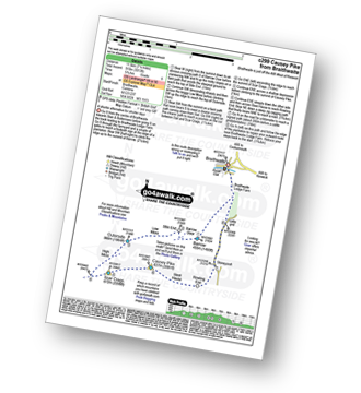
Walk c299 Causey Pike from Braithwaite
Shorter alternative for shorter days
   |
|---|
Vital Statistics:
| Length: | 7.25ml (11.5km) |
|---|---|
| Ascent: | 3,013ft (918m) |
| Time: | 5.75hrs |
| Grade: |  (Moderate) (Moderate) |
Route Summary:
Braithwaite - Barrow (Newlands) - Stile End - Low Moss - Outerside - High Moss - Scar Crags - Causey Pike - Sleet Hause - Rowling End - Stoneycroft - Braithwaite


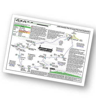
Walk c408 Grisedale Pike and Causey Pike from Braithwaite
Superb high level route with great views
|
|---|
Vital Statistics:
| Length: | 10ml (16km) |
|---|---|
| Ascent: | 4,641ft (1,414m) |
| Time: | 8½ hrs |
| Grade: |  (Hard) (Hard) |
Route Summary:
Braithwaite - Sleet How - Grisedale Pike - Hobcarton Crag - Hopegill Head - Sand Hill - Coledale Hause - Crag Hill (Eel Crag) - Sail (Derwent Fells) - Scar Crags - Causey Pike - Outerside - Stile End - Barrow (Newlands) - Braithwaite

Walk c310 The Coledale Horseshoe from Braithwaite
Superb round with fabulous views & variation
|
|---|
Vital Statistics:
| Length: | 12ml (19km) |
|---|---|
| Ascent: | 5,261ft (1,603m) |
| Time: | 9.75hrs |
| Grade: |  (Very Hard) (Very Hard) |

Route Summary:
Braithwaite - Sleet How - Grisedale Pike - Hobcarton Crag - Hopegill Head - Sand Hill - Coledale Hause - Grasmoor - Wandope - Crag Hill (Eel Crag) - Sail (Derwent Fells) - Scar Crags - Causey Pike - Outerside - Stile End - Barrow (Newlands) - Braithwaite
See Scar Crags and the surrounding tops on our free-to-access 'Google Style' Peak Bagging Maps:

The North Western Fells of The Lake District National Park
Less data - quicker to download
The Whole of The Lake District National Park
More data - might take a little longer to download
See Scar Crags and the surrounding tops on our unique, downloadable, PDF Peak Bagging Maps:

NB: Whether you print off a copy or download it to your phone, these PDF Peak Baggers' Maps might prove incredibly useful when your are up there on the tops and you cannot get a phone signal.
*This version is marked with the walk routes you need to follow to Walk all 214 Wainwrights in just 59 walks.
You can find Scar Crags & all the walks that climb it on these unique free-to-access Interactive Walk Planning Maps:
1:25,000 scale OS Explorer Map (orange/yellow covers):
1:50,000 scale OS Landranger Maps (pink/magenta covers):
 Fellow go4awalkers who have already walked, climbed, scaled, summited, hiked & bagged Scar Crags
James Hughes walked up Scar Crags on June 19th, 2025 [from/via/route] c408 Grisedale Pike & Causey Pike from Braithwaite [weather] Very hot, energy sapping sunny day with odd rumble of thunder without a storm in sight. - Epic round, perhaps a tad too long in the conditions. Hard slog up Grisedale Pike after initial route finding error which involved a double back to get onto the ridge. Greeted by swarm of flies at summit before swift descent to Hobcarton Crag. Jaunt up to Hopegill Head before a bumble down to Coledale Hause. Watched a someone ascend Eel crag up scree & opted for longer route up to col with Grasmoor. Hugged the trig point before the now becoming arduous up & downs over Sail & Scar Crags to Causey Pike. Exhausted, dragged myself up Outerside before a flop down to Barrow Door & last slog up Barrow. All very commendable summits. Slower than snail's pace managed to rejuvenate with an Erdinger at the Royal Oak... Real Ale looked mainstream - think it's a Marston's pub.
Ian Ashton climbed it on June 30th, 2024 [with] Solo - Ì
Geoff Hand bagged it on June 18th, 2024 [from/via/route] Walk C408 Grisedale Pike, Crag Hill, Sail, Scar Craggs & Outerside [with] Tess the Jack Russell [weather] Misty & claggy at first then clearing into a pleasant sunny day. - Left a couple of peaks out as I had already completed them. Went upto Stile end on the way back. It was a tough, fun climb up Eel crag from Coledale Hause
Claire Kirk hiked Scar Crags on August 6th, 2023 [from/via/route] Braithwaite - Coledale Horseshoe [with] Leigh
Dan Milman summited on April 11th, 2024 [with] Milly [weather] Warm & clear
To add (or remove) your name and experiences on this page - Log On and edit your Personal Mountain Bagging Record
. . . [see more walk reports]
More Photographs & Pictures of views from, on, or of, Scar Crags

Looking back to the zig zags from Scar Crags at the route down from Sail (Derwent Fells)

Scar Crags (left), Sail and Crag Hill (Eel Crag) from the summit cairn on Outerside
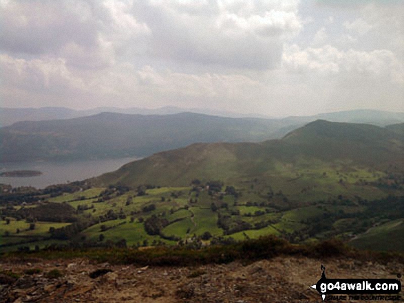
Cat Bells (Catbells), Derwent Water with Bleaberry Fell & High Seat (Ashness Fell) from Scar Crags
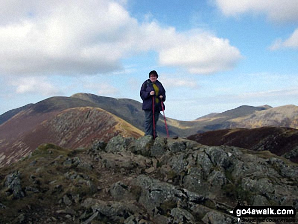
On top of Causey Pike with Scar Crags, Sail (Derwent Fells) and Crag Hill (Eel Crag) behind


*Looking back along Scar Crags to Sail (Derwent Fells) and Crag Hill (Eel Crag) from Causey Pike
Send us your photographs and pictures on, of, or from Scar Crags
If you would like to add your walk photographs and pictures to this page, please send them as email attachments (configured for any computer) along with your name to:
and we shall do our best to publish them.
(Guide Resolution = 300dpi. At least = 660pixels (wide) x 440 pixels (high).)

You can also submit photos via our Facebook Page.
NB. Please indicate where each photo was taken and whether you wish us to credit your photos with a Username or your First Name/Last Name.