
![]()
Sheffield Pike
676m (2218ft)
The Eastern Fells, The Lake District, Cumbria, England
Not familiar with this top?
You can walk/hike to the top of Sheffield Pike by using any of these 4 easy‑to‑follow route maps:
Walk c178 Sheffield Pike from Glenridding
Glenridding's much ignored fell
   |
|---|
Vital Statistics:
| Length: | 6ml (9.5km) |
|---|---|
| Ascent: | 1,814ft (553m) |
| Time: | 4 hrs |
| Grade: |  (Moderate) (Moderate) |

Route Summary:
Glenridding - Glenridding Dodd - Sheffield Pike - Nick Head - Lucy's Tongue - Glenridding Beck - Glenridding
Walk c394 Helvellyn, Catstye Cam and Sheffield Pike from Glenridding
Superb high level walk
|
|---|
Vital Statistics:
| Length: | 10ml (16km) |
|---|---|
| Ascent: | 4,020ft (1,225m) |
| Time: | 8 hrs |
| Grade: |  (Hard) (Hard) |

Route Summary:
Glenridding - Glenridding Dodd - Sheffield Pike - Nick Head - Sticks Pass - Raise (Helvellyn) - White Side - Lower Man (Helvellyn) - Helvellyn - Swirral Edge - Catstye Cam - Glenridding Beck - Glenridding Youth Hostel - Glenridding
Walk c286 The Glenridding Skyline from Glenridding
Superb high level walk
|
|---|
Vital Statistics:
| Length: | 11.5ml (18.5km) |
|---|---|
| Ascent: | 4,418ft (1,346m) |
| Time: | 8½ hrs |
| Grade: | (Hard) |

Route Summary:
Glenridding - Glenridding Dodd - Sheffield Pike - Nick Head - Glencoyne Head - Hart Side - Green Side (White Stones) - Stybarrow Dodd - Sticks Pass - Raise (Helvellyn) - White Side - Lower Man (Helvellyn) - Helvellyn - Swirral Edge - Catstye Cam - Red Tarn Beck - Glenridding Beck - Glenridding Youth Hostel - Glenridding
Walk c192 Helvellyn Ridge from Glenridding
An exhilarating high ridge walk
|
|---|
Vital Statistics:
| Length: | 13ml (21km) |
|---|---|
| Ascent: | 4,359ft (1,329m) |
| Time: | 9.25hrs |
| Grade: | (Hard) |

Route Summary:
Glenridding - Glenridding Dodd - Sheffield Pike - Green Side - Stybarrow Dodd - Sticks Pass - Raise (Helvellyn) - White Side - Lower Man (Helvellyn) - Helvellyn - Nethermost Pike - High Crag (Helvellyn) - Dollywaggon Pike - Grisdale Tarn - Grisedale Beck - Brownend Plantation - Lanty's Tarn - Keldas - Glenridding
See Sheffield Pike and the surrounding tops on our free-to-access 'Google Style' Peak Bagging Maps:
The Eastern Fells of The Lake District National Park
Less data - quicker to download
The Whole of The Lake District National Park
More data - might take a little longer to download
See Sheffield Pike and the surrounding tops on our unique, downloadable, PDF Peak Bagging Maps:

NB: Whether you print off a copy or download it to your phone, these PDF Peak Baggers' Maps might prove incredibly useful when your are up there on the tops and you cannot get a phone signal.
*This version is marked with the walk routes you need to follow to Walk all 214 Wainwrights in just 59 walks.
You can find Sheffield Pike & all the walks that climb it on these unique free-to-access Interactive Walk Planning Maps:
1:25,000 scale OS Explorer Map (orange/yellow covers):
1:50,000 scale OS Landranger Map (pink/magenta covers):
 Fellow go4awalkers who have already walked, climbed, scaled, summited, hiked & bagged Sheffield Pike
Martin Hartshorne walked up Sheffield Pike on September 10th, 2024 [from/via/route] Glenridding eagle farm, seldom seen, down through the old mines [with] finley [weather] Showers sunshine windy & rainbows
Andrew Gayne climbed it on August 29th, 2024 [from/via/route] Walked up from Glenridding [with] Becky [weather] Sunny, cloudy clearing later in the day. Boggy underfoot given all the rain - Took the ferry from Pooley Bridge to Glenridding & then waked up to Glenridding Dodd, onto to Hectors Pike which was quite steep & finally onto Sheffield Pike before coming back down on the Roman Road to Glenridding to catch the ferry back
Mr M A Blanchard bagged it on August 29th, 2024 [from/via/route] > [with] Ted, Florence, Millie and Woodie [weather] Sunny
Kate Peacock hiked Sheffield Pike on July 19th, 2024 [from/via/route] Glennridding car park [with] Me, Sheila & Skye [weather] Cloudy & sunny. Quite breezy but it was a warm breeze
Ian Ashton summited on April 13th, 2024 [with] Solo - Ì
To add (or remove) your name and experiences on this page - Log On and edit your Personal Mountain Bagging Record
. . . [see more walk reports]
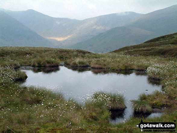
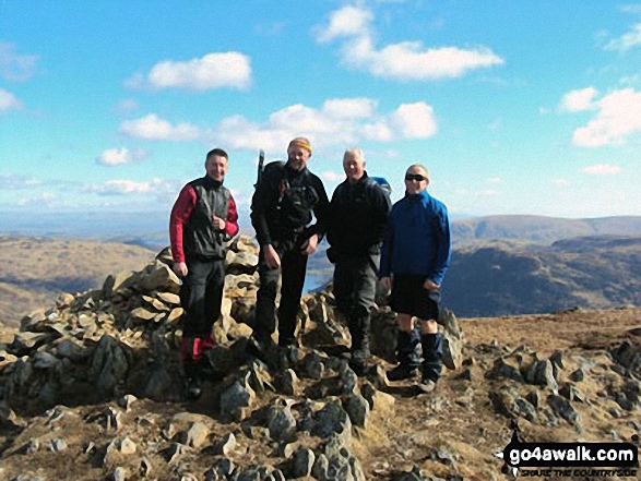
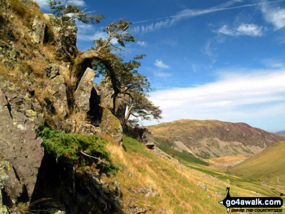
More Photographs & Pictures of views from, on, or of, Sheffield Pike

The shoulder of St Sunday Crag and Birks (left), Catstye Cam, Birkhouse Moor (centre) and Sheffield Pike from Arnison Crag, Patterdale
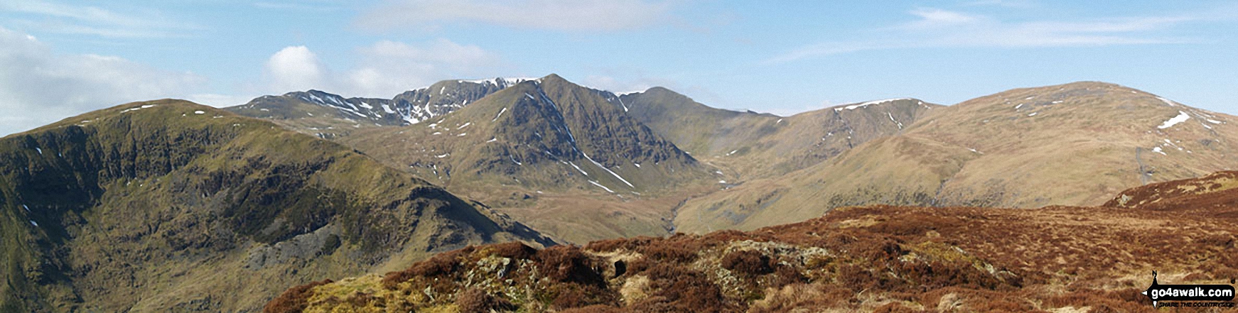
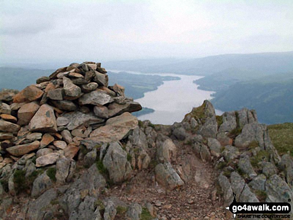
Birkhouse Moor (foreground left), Catstye Cam (foreground centre), White Side (centre right) and Raise (Helvellyn) (right) with Striding Edge (High Spying How), Helvellyn and Lower Man (Helvellyn) in the background from Sheffield Pike

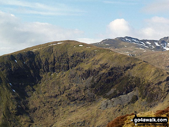
Birkhouse Moor (foreground) and Striding Edge (High Spying How) (right background) from Sheffield Pike

Striding Edge (High Spying How) and Helvellyn (in mist) with Birkhouse Moor in front, Catstycam and Sheffield Pike from Gowbarrow Fell (Airy Crag)
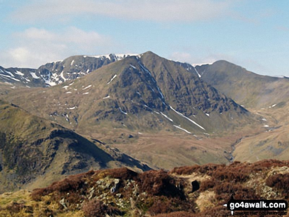
Catstye Cam (centre) with Striding Edge (High Spying How) (left), Helvellyn and Lower Man (Helvellyn) (right) in the background from Sheffield Pike
. . . see all 12 walk photographs & pictures of views from, on, or of, Sheffield Pike
Send us your photographs and pictures on, of, or from Sheffield Pike
If you would like to add your walk photographs and pictures to this page, please send them as email attachments (configured for any computer) along with your name to:
and we shall do our best to publish them.
(Guide Resolution = 300dpi. At least = 660pixels (wide) x 440 pixels (high).)

You can also submit photos via our Facebook Page.
NB. Please indicate where each photo was taken and whether you wish us to credit your photos with a Username or your First Name/Last Name.


