
![]()
Place Fell
657m (2156ft)
The Far Eastern Fells, The Lake District, Cumbria, England
The summit of Place Fell is marked by an Ordnance Survey Trig Point.

Not familiar with this top?
You can walk/hike to the top of Place Fell by using any of these 3 easy‑to‑follow route maps:
Walk c226 Place Fell from Patterdale
Popular walk with good views of Ullswater
   |
|---|
Vital Statistics:
| Length: | 8.5ml (13.5km) |
|---|---|
| Ascent: | 2,552ft (778m) |
| Time: | 6 hrs |
| Grade: |  (Moderate) (Moderate) |
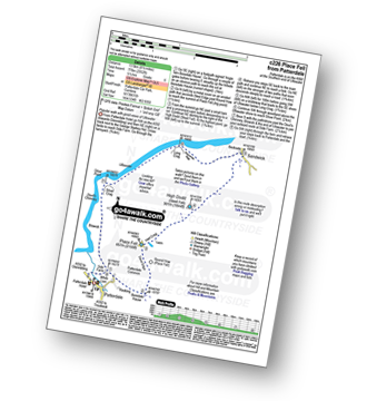
Route Summary:
Patterdale - Rooking - Boredale Hause - Place Fell - High Dodd (Sleet Fell) - Martindale - Sandwick - Long Crag (Ullswater) - Silver Point - Ullswater - Blowick - Rooking - Side Farm - Patterdale
Walk c304 Beda Head and Place Fell from Howtown
Superb views of Ullswater
|
|---|
Vital Statistics:
| Length: | 9.75ml (15.5km) |
|---|---|
| Ascent: | 3,470ft (1,058m) |
| Time: | 7 hrs |
| Grade: |  (Hard) (Hard) |
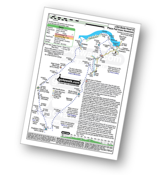
Route Summary:
St Peter's Church (Martindale) - Howtown - Howegrain Beck - Christy Bridge - Beda Head (Beda Fell) - Martindale Common - Angletarn Pikes - Angle Tarn (Martindale) - Boredale Hause - Steel Edge - Place Fell - High Dodd (Sleet Fell) - Sandwick - Hallinhag Wood - Geordies Crag - Hallin Fell (Martindale) - Howtown
Walk c155 The Knott and Place Fell from Patterdale
Long high level route with fine views of Ullswater
|
|---|
Vital Statistics:
| Length: | 15.5ml (25km) |
|---|---|
| Ascent: | 4,293ft (1,308m) |
| Time: | 10 hrs |
| Grade: |  (Very Hard) (Very Hard) |

Route Summary:
Patterdale - Rooking - Crookabeck - Beckstones - Dubhow - Hartsop - Hayswater Gill - Hayswater - The Knott - Brock Crags - Angle Tarn (Martindale) - Angletarn Pikes - Boredale Hause - Place Fell - High Dodd (Sleet Fell) - Sandwick - Long Crag - Silver Point - Ullswater - Blowick - Rooking - Side Farm - Patterdale
See Place Fell and the surrounding tops on our free-to-access 'Google Style' Peak Bagging Maps:
The Far Eastern Fells of The Lake District National Park
Less data - quicker to download
The Whole of The Lake District National Park
More data - might take a little longer to download
See Place Fell and the surrounding tops on our unique, downloadable, PDF Peak Bagging Maps:

NB: Whether you print off a copy or download it to your phone, these PDF Peak Baggers' Maps might prove incredibly useful when your are up there on the tops and you cannot get a phone signal.
*This version is marked with the walk routes you need to follow to Walk all 214 Wainwrights in just 59 walks.
You can find Place Fell & all the walks that climb it on these unique free-to-access Interactive Walk Planning Maps:
1:25,000 scale OS Explorer Map (orange/yellow covers):
1:50,000 scale OS Landranger Map (pink/magenta covers):
 Fellow go4awalkers who have already walked, climbed, scaled, summited, hiked & bagged Place Fell
Mr M A Blanchard walked up Place Fell on November 21st, 2025 [with] The mutts
Geoff Hand climbed it on July 25th, 2025 [from/via/route] Walk 304. Walked from St Peters Church to Christy Bridge then along the ridge to Beda Head, carried on South from there to Angletarn Pikes,(2 pikes) then heading North Again & upto Place Fell. Down & up took us to High Dodd then down to Sandwick & into Hallinhag Wood. We finally climbed through the ferns to reachHallin Fell. [with] Richard MaCillwaine. [weather] Cloud increasing as the morning progressed ending up foggy & drissly on Place fell, then clearing as we reduced height. - Last of the fells completed in the Far East section.
James Hughes bagged it on March 16th, 2025 [from/via/route] c304 Return to complete Beda Head round - High Dodd, Place Fell & Hallin Fell [weather] Clear, cold & blustery. - Walked in morning to avoid deterioration in weather in afternoon. Steady climb over High Dodd to Place Fell. Descent into Boredale valley & finish up Hallin Fell. Pint of Wainwright in the Sun - Pooley Bridge. Saw a Red Squirrel.
Angeline Grieveson hiked Place Fell on July 29th, 2024 [with] Anu & Dotty
Ian Ashton summited on August 2nd, 2024 [with] Solo - Ì
To add (or remove) your name and experiences on this page - Log On and edit your Personal Mountain Bagging Record
. . . [see more walk reports]
More Photographs & Pictures of views from, on, or of, Place Fell
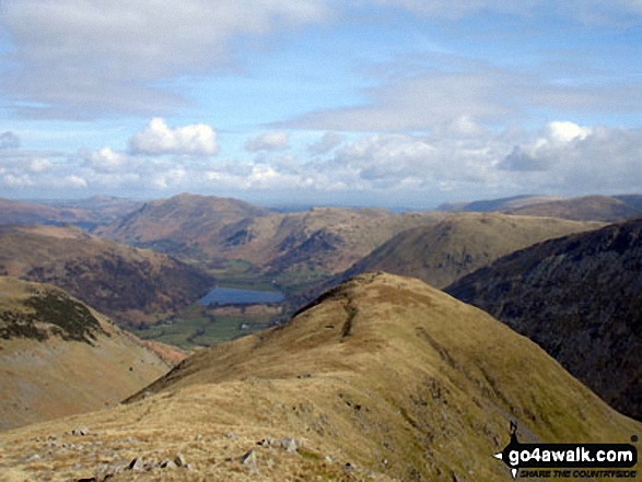
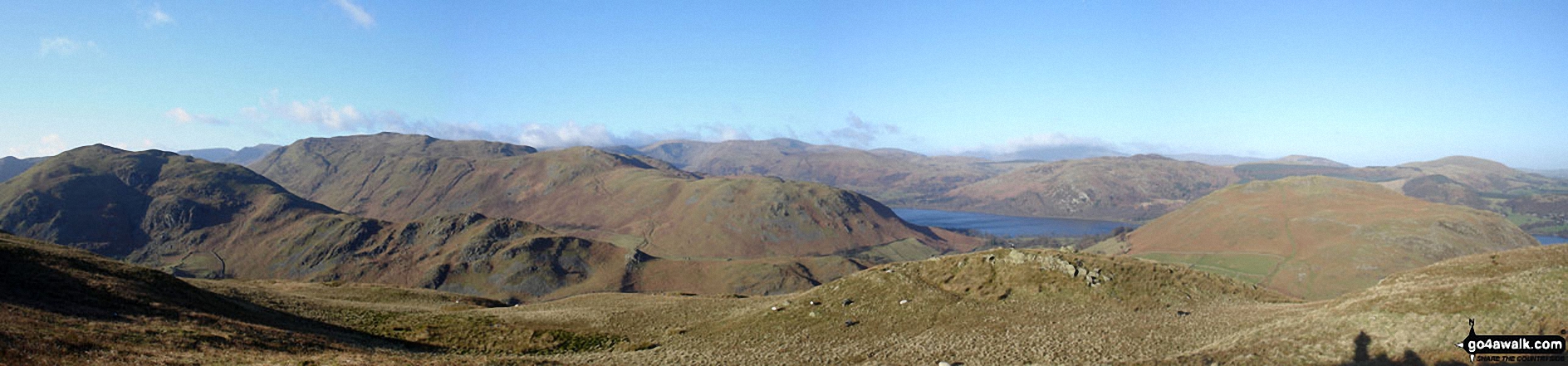
Middle Dodd with Place Fell, Angletarn Peaks and Hartsop Dodd beyond Brothers Water in the valley below from Red Screes
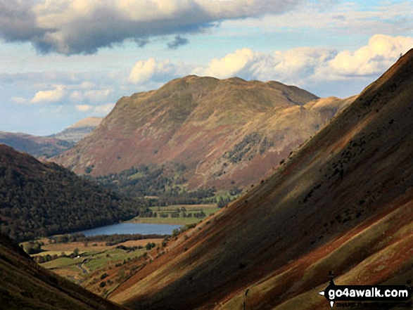
*Beda Head (Beda Fell) with Place Fell beyond (left), Ullswater and Hallin Fell (right) from Steel Knotts (Pikeawassa)
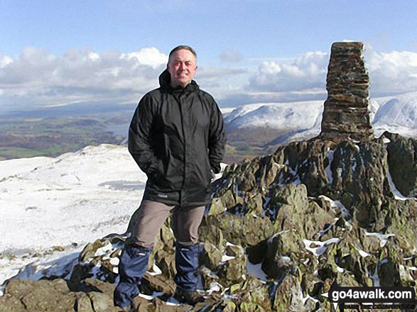

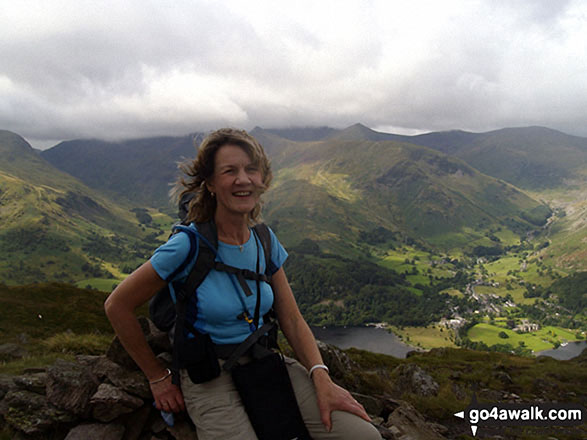
Me, Wainwright bagging, at the top of Middle Dodd with Brothers Water and Place Fell in the distance


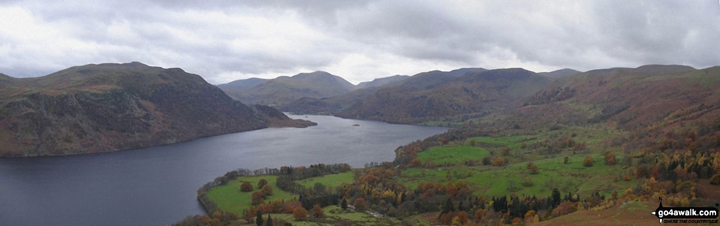
Ullswater, Place Fell (right - distance) and
Hartsop Dodd (right - mid-distance) from Caudale Head
. . . see all 39 walk photographs & pictures of views from, on, or of, Place Fell
Send us your photographs and pictures on, of, or from Place Fell
If you would like to add your walk photographs and pictures to this page, please send them as email attachments (configured for any computer) along with your name to:
and we shall do our best to publish them.
(Guide Resolution = 300dpi. At least = 660pixels (wide) x 440 pixels (high).)

You can also submit photos via our Facebook Page.
NB. Please indicate where each photo was taken and whether you wish us to credit your photos with a Username or your First Name/Last Name.


