
![]()
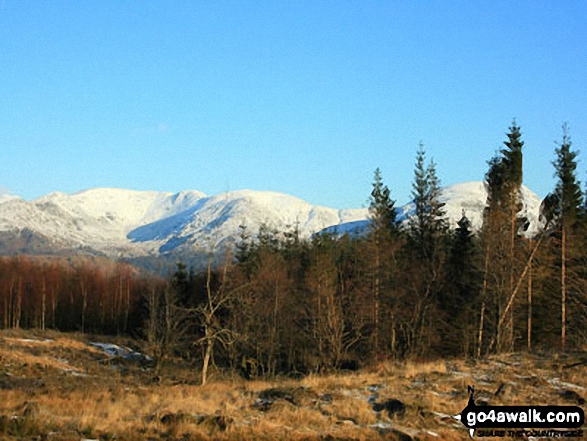
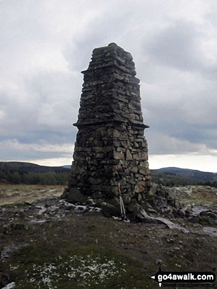
Latterbarrow
244m (801ft)
The Southern Marches, The Lake District, Cumbria, England
Not familiar with this top?
   |
|---|
Vital Statistics:
| Length: | 8.5ml (13.5km) |
|---|---|
| Ascent: | 1,644ft (501m) |
| Time: | 4.75hrs |
| Grade: |  (Moderate) (Moderate) |

Route Summary:
Far Sawrey - Mitchell Knotts - Low Pate Crag - Claife Heights (High Blind How) - The Heald - High Moss - Belle Grange Beck - Long Height - Latterbarrow - High Wray - Red Nap Car Park - Lake Windermere - Belle Grange Bay - Bark Barn Ferry - Slape Scar - Strawberry Gardens - Far Sawrey
See Latterbarrow and the surrounding tops on our free-to-access 'Google Style' Peak Bagging Maps:
The Southern Marches area of The Lake District National Park
Less data - quicker to download
The Whole of The Lake District National Park
More data - might take a little longer to download
A go4awalk.com downloadable Peak Bagging Map in PDF format featuring Latterbarrow should be available soon.
You can find Latterbarrow & all the walks that climb it on these unique free-to-access Interactive Walk Planning Maps:
1:25,000 scale OS Explorer Map (orange/yellow covers):
1:50,000 scale OS Landranger Maps (pink/magenta covers):
 Fellow go4awalkers who have already walked, climbed, summited & bagged Latterbarrow
Nick Tippins walked up Latterbarrow on July 5th, 2025 [from/via/route] Wray to Blelham Tarn circular walk [with] Fran
Trevor Williams climbed it on December 3rd, 2021 [from/via/route] Far Sawrey [with] paul [weather] overcast. - Return from Latterbarrow to Sawrey was very difficult due to numerous fallen trees.
David Lord bagged it on October 25th, 2019 [from/via/route] From a car park in Hawkshead. [with] Debbie Lord [weather] Cloudy / sunny day. - A very nice walk & views along with the big hilltop cairn for which the hill is famous.
Neil Bennett hiked Latterbarrow on July 23rd, 2021 [from/via/route] Climbed Latterbarrow from Hawkshead. Our starting point was the main car park in the centre of the village. We followed a clockwise route which entailed a steep ascent followed by a longer more gentle descent winding through the forest. Pam & I had done this walk without the boys on 14th July. Both walks were rewarded with an ice cream at the Little Ice Cream Shop in the village. [with] Pam Bennett, Oliver Bennett, Thomas Bennett. [weather] Hot & Sunny.
Charlie Housley summited on July 15th, 2020 [from/via/route] From Far Sawry via Claif Heights as per the route outlined in AW's Outlying Fells guide book. [with] With Candy. [weather] Warm & a bit overcast, but quite humid.
To add (or remove) your name and experiences on this page - Log On and edit your Personal Mountain Bagging Record
. . . [see more walk reports]
More Photographs & Pictures of views from, on or of Latterbarrow

Send us your photographs and pictures on, of, or from Latterbarrow
If you would like to add your walk photographs and pictures to this page, please send them as email attachments (configured for any computer) along with your name to:
and we shall do our best to publish them.
(Guide Resolution = 300dpi. At least = 660pixels (wide) x 440 pixels (high).)

You can also submit photos via our Facebook Page.
NB. Please indicate where each photo was taken and whether you wish us to credit your photos with a Username or your First Name/Last Name.


