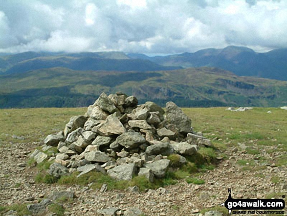
Watson's Dodd
789m (2589ft)
The Eastern Fells, The Lake District, Cumbria, England
Not familiar with this top?
You can walk/hike to the top of Watson's Dodd by using any of these 4 easy‑to‑follow route maps:

Walk c146 The Dodds from Dockray
Superb views of Ullswater and Thirlmere
   |
|---|
Vital Statistics:
| Length: | 8.75ml (14km) |
|---|---|
| Ascent: | 2,129ft (649m) |
| Time: | 5½ hrs |
| Grade: |  (Moderate) (Moderate) |

Route Summary:
Red Moss Nr Dockray - Matterdale Common - Wolf Crags - Bruts Moss - Randerside - Great Dodd - Watson's Dodd - Stybarrow Dodd - Green Side (White Stones) - Hart Side - Dowthwaitehead - Red Moss.


Walk c124 Helvellyn Ridge from Thirlmere
Lakeland's most popular mountain with a fine ridge walk
|
|---|
Vital Statistics:
| Length: | 10.5ml (17km) |
|---|---|
| Ascent: | 3,575ft (1,090m) |
| Time: | 7½ hrs |
| Grade: |  (Hard) (Hard) |

Route Summary:
The Swirls Car Park Thirlmere - Browncove Crags - Lower Man (Helvellyn) - Helvellyn - White Side - Raise (Helvellyn) - Sticks Pass - Stybarrow Dodd - Watson's Dodd - Great Dodd - Legburthwaite - Thirlmere - Thirlspot - The Swirls Car Park Thirlmere.

Walk c239 The Deepdale Round from nr Dockray
Superb views of Ullswater and Thirlmere
|
|---|
Vital Statistics:
| Length: | 11.25ml (18km) |
|---|---|
| Ascent: | 2,680ft (817m) |
| Time: | 6.75hrs |
| Grade: | (Hard) |

Route Summary:
Red Moss Nr Dockray - Barbary Rigg - Matterdale Common - Mariel Bridge - White Pike (Clough Head) - Clough Head - Calfhow Pike - Little Dodd (St John's Common) - Great Dodd - Watson's Dodd - Stybarrow Dodd - Green Side (White Stones) - Hart Side - Dowthwaitehead - Red Moss.

Walk c433 The St John's in the Vale Skyline from Legburthwaite
A fine walk with fine views
|
|---|
Vital Statistics:
| Length: | 11.25ml (18km) |
|---|---|
| Ascent: | 3,965ft (1,208m) |
| Time: | 8.25hrs |
| Grade: |  (Hard) (Hard) |

Route Summary:
Legburthwaite Car Park - A591 - Long Band - Cowrake Head - Moss Crag - High Rigg - Carlisle Diocese Youth Centre - St John's In The Vale Church - B5322 - Wanthwaite Bank - Threlkeld Knotts - Buck Castles - Clough Head - Calfhow Pike - Great Dodd - Watson's Dodd - Stybarrow Dodd - Sticks Pass - Legburthwaite Car Park
See Watson's Dodd and the surrounding tops on our free-to-access 'Google Style' Peak Bagging Maps:

The Eastern Fells of The Lake District National Park
Less data - quicker to download
The Whole of The Lake District National Park
More data - might take a little longer to download
See Watson's Dodd and the surrounding tops on our unique, downloadable, PDF Peak Bagging Maps:

NB: Whether you print off a copy or download it to your phone, these PDF Peak Baggers' Maps might prove incredibly useful when your are up there on the tops and you cannot get a phone signal.
*This version is marked with the walk routes you need to follow to Walk all 214 Wainwrights in just 59 walks.
You can find Watson's Dodd & all the walks that climb it on these unique free-to-access Interactive Walk Planning Maps:
1:25,000 scale OS Explorer Map (orange/yellow covers):
1:50,000 scale OS Landranger Map (pink/magenta covers):
 Fellow go4awalkers who have already walked, climbed, scaled, summited, hiked & bagged Watson's Dodd
Geoff Hand walked up Watson's Dodd on June 21st, 2025 [from/via/route] Set off from Legburthwaite Uuited Utilities carpark. Walked to up Stybarrow Dodd, Watson's Dodd, then backtracked to Hartside & returned by Sticks pass. [weather] Very sunny & warm Amazing! - Went for a pint at the Kings Head & the way home. watched a guy take a rock on Watson's Dodd & draw two hearts & Wrote Mack in between them, then took a photo of it. graffiti even in the lake district!
Angeline Grieveson climbed it on October 19th, 2024 [with] Rick & Dotty
James Hughes bagged it on May 12th, 2024 [from/via/route] Deepdale Round c239 - From Red Moss after staying in Troutbeck [weather] Warm sunny morning
Caroline Winter hiked Watson's Dodd on August 14th, 2024 [from/via/route] Moss bay, Seldom Seen, Glencoyne head, Stybarrow Dodd, Watson Dodd [with] Solo [weather] Warm, no breeze, excellent views - Had become disoriented as hadn't realised the trail had taken me to Stybarrow Dodd, as not marked on the OS map. Previously done the other Dodds from Threlkeld side.
Dan Collins summited on June 29th, 2024 [from/via/route] As part of c239 walk [with] Family (just the lads) [weather] Misty / cloudy throughout - Misty & low visibility but great walk
To add (or remove) your name and experiences on this page - Log On and edit your Personal Mountain Bagging Record
. . . [see more walk reports]
More Photographs & Pictures of views from, on, or of, Watson's Dodd


Clough Head, Calfhow Pike, Great Dodd and Watson's Dodd from Castlerigg in the snow

Clough Head, Fisher's Wife's Rake, Calfhow Pike, Great Dodd, Watson's Dodd, Stybarrow Dodd, Raise (Helvellyn) and Helvellyn from the summit of High Rigg
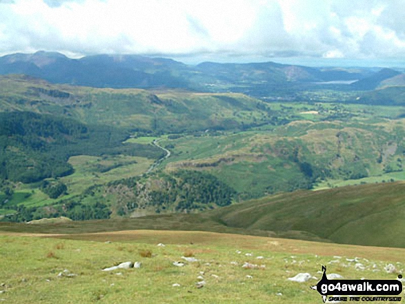

Watson's Dodd, Great Dodd and Clough Head and Dockray from Gowbarrow Fell (Airy Crag)

Blencathra or Saddleback (left), Clough Head, Fisher's Wife's Rake, Calfhow Pike, Great Dodd, Watson's Dodd, Stybarrow Dodd, Raise (Helvellyn) and Helvellyn in the centre with a glimpse of Thirlmere (right) from the summit of High Rigg
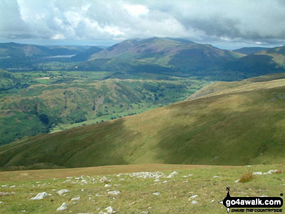

*The Helvellyn summit ridge, Whiteside, Thirlmere and Watson's Dodd from Raise (Helvellyn) summit
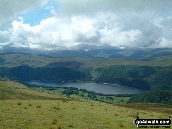
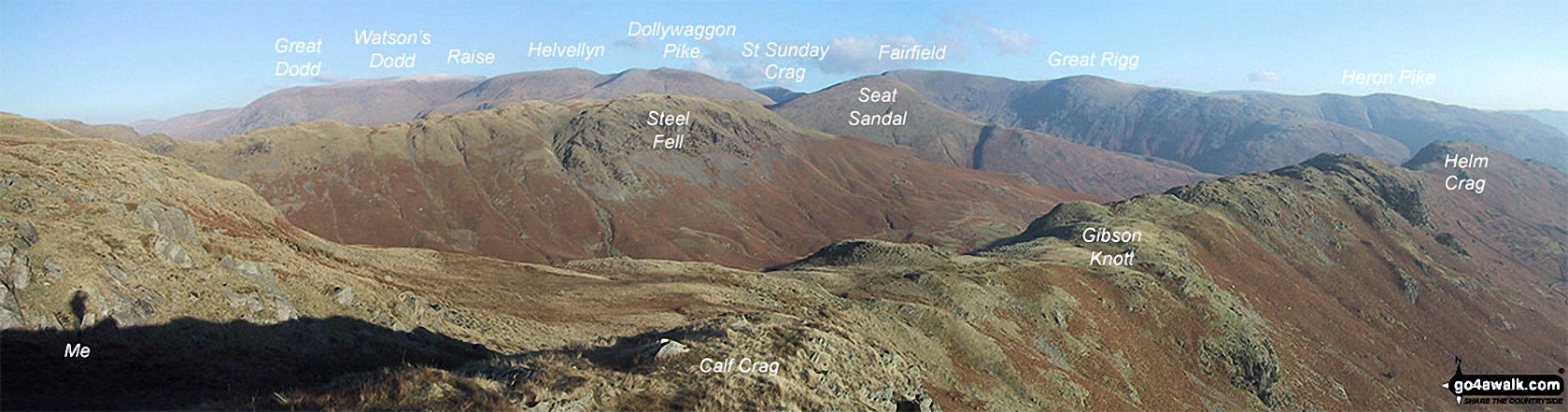
The Helvellyn Ridge featuring: Great Dodd, Watson's Dodd, Stybarrow Dodd, Raise (Helvellyn), White Side, Helvellyn, Nethermost Pike, Dollywaggon Pike, St Sunday Crag, Fairfield, Great Rigg and Heron Pike with Steel Fell (mid distance) and Calf Crag, Gibson Knott and Helm Crag (foreground) from Brownrigg Moss
. . . see all 10 walk photographs & pictures of views from, on, or of, Watson's Dodd
Send us your photographs and pictures on, of, or from Watson's Dodd
If you would like to add your walk photographs and pictures to this page, please send them as email attachments (configured for any computer) along with your name to:
and we shall do our best to publish them.
(Guide Resolution = 300dpi. At least = 660pixels (wide) x 440 pixels (high).)

You can also submit photos via our Facebook Page.
NB. Please indicate where each photo was taken and whether you wish us to credit your photos with a Username or your First Name/Last Name.