Seventeen easy to follow circular walk route maps from the majestic Great Langdale in the The Lake District National Park, Cumbria, England
   |
Vital Statistics:
| Length: | 4.5 miles (7 km) |
| Ascent: | 1,902ft (580m) |
| Time: | 3½ hrs |
| Grade: |  |

Route Summary:
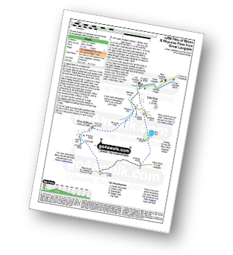
Great Langdale - The Old Dungeon Ghyll - Wall End Farm - Redacre Gill - Wrynose Fell - Pike of Blisco (Pike O' Blisco) - Red Tarn (Langdale) - Browney Gill - Oxendale Beck - Oxendale - Stool End Farm - The Old Dungeon Ghyll - Great Langdale
|
Vital Statistics:
| Length: | 8.5 miles (13.5 km) |
| Ascent: | 1,447ft (441m) |
| Time: | 4½ hrs |
| Grade: |  |

Route Summary:
Elterwater - Elterwater Bridge - Little Langdale - Little Langdale Tarn - Bridge End - Fell Foot Bridge - Castle Howe - Blea Tarn (Langdale) - Great Langdale - Oak Howe - Chapel Stile - Elterwater
|
Vital Statistics:
| Length: | 4.5 miles (7.5 km) |
| Ascent: | 2,645ft (806m) |
| Time: | 4½ hrs |
| Grade: | |

Route Summary:
Great Langdale - The New Dungeon Ghyll - Great Langdale - Stickle Ghyll - Stickle Tarn - Jack's Rake - The Langdale Pikes - Pavey Ark - Thunacar Knott - Harrison Stickle - Pike of Stickle (Pike O' Stickle) - Loft Crag - Mark Gate - The New Dungeon Ghyll - Great Langdale
|
Vital Statistics:
| Length: | 7 miles (11 km) |
| Ascent: | 1,976ft (602m) |
| Time: | 4½ hrs |
| Grade: | |

Route Summary:
Elterwater - Elterwater Bridge - Dale End - Lingmoor Fell - Fat Man's Agony (or Fat Man's Struggle) - Side Pike - Great Langdale - Side House Farm - The Cumbria Way - Oak Howe - Chapel Stile - Elterwater Bridge - Elterwater
|
Vital Statistics:
| Length: | 6.25 miles (10 km) |
| Ascent: | 1,968ft (600m) |
| Time: | 4.25hrs |
| Grade: | |
Route Summary:
Great Langdale - The Old Dungeon Ghyll - Wall End Farm - Redacre Gill - Wrynose Fell - Pike of Blisco (Pike O' Blisco) - Red Tarn (Langdale) - Wrynose Pass - Blea Tarn (Langdale) - The Old Dungeon Ghyll - Great Langdale
|
Vital Statistics:
| Length: | 7.75 miles (12.5 km) |
| Ascent: | 2,770ft (844m) |
| Time: | 5.75hrs |
| Grade: |  |

Route Summary:
Great Langdale - Old Dungeon Ghyll - Stool End - Oxendale Beck - Browney Gill - Red Tarn (Langdale) - Great Knott - Crinkle Crags (South Top) - Crinkle Crags (Long Top) - Crinkle Crags (Gunson Knott) - Shelter Crags - Shelter Crags (North Top) - Three Tarns - Earing Crag - White Stones - The Band - Oxendale - Stool End Farm - The Old Dungeon Ghyll - Great Langdale
|
Vital Statistics:
| Length: | 7.25 miles (11.5 km) |
| Ascent: | 3,046ft (928m) |
| Time: | 5.75hrs |
| Grade: | |

Route Summary:
Great Langdale - The New Dungeon Ghyll - Stickle Ghyll - Whitegill Crag - Blea Rigg - Sergeant Man - High Raise (Langdale) - The Langdale Pikes - Thunacar Knott - Pavey Ark - Harrison Stickle - Pike of Stickle (Pike O' Stickle) - Loft Crag - Mark Gate - The New Dungeon Ghyll - Great Langdale
|
Vital Statistics:
| Length: | 8.25 miles (13 km) |
| Ascent: | 2,924ft (891m) |
| Time: | 6 hrs |
| Grade: | |

Route Summary:
Great Langdale - The New Dungeon Ghyll - Stickle Ghyll - Stickle Tarn - North Rake - The Langdale Pikes - Pavey Ark - Thunacar Knott - Harrison Stickle - Loft Crag - Pike of Stickle (Pike O' Stickle) - Martcrag Moor - Stake Pass - The Cumbria Way - Stake Gill - Mickleden - Mickleden Beck - The New Dungeon Ghyll - Great Langdale
|
Vital Statistics:
| Length: | 8.75 miles (14 km) |
| Ascent: | 2,271ft (692m) |
| Time: | 5½ hrs |
| Grade: | |

Route Summary:
Great Langdale - Old Dungeon Ghyll - The Cumbria Way - Mickleden Beck - Mickleden (Langdale) - Rossett Beck - Rossett Pike - Little Gill Head - Black Crags (Langdale) - Stake Pass - The Cumbria Way - Stake Gill - Mickleden - Mickleden Beck - The New Dungeon Ghyll - Great Langdale
|
Vital Statistics:
| Length: | 11.25 miles (18 km) |
| Ascent: | 3,604ft (1,098m) |
| Time: | 7.75hrs |
| Grade: |  |

Route Summary:
Great Langdale - The Old Dungeon Ghyll - Stool End Farm - Oxendale - Oxendale Beck - Browney Gill - Red Tarn (Langdale) - Great Knott - Crinkle Crags (South Top) - Crinkle Crags (Long Top) - Crinkle Crags (Gunson Knott) - Shelter Crags - Shelter Crags (North Top) - Three Tarns - Climbers' Traverse (optional) - Flat Crag - Cambridge Crag - Bowfell Buttress - Bow Fell (Bowfell) - Bow Fell (Bowfell) (North Top) - Ore Gap - Angle Tarn (Langdale) - Rossett Pike - Rossett Beck - Mickleden - Mickleden Beck - The Cumbria Way - The Old Dungeon Ghyll - Great Langdale
|
Vital Statistics:
| Length: | 10 miles (16 km) |
| Ascent: | 4,007ft (1,221m) |
| Time: | 7½ hrs |
| Grade: | |

Route Summary:
Great Langdale - The Old Dungeon Ghyll - Wall End Farm - Redacre Gill - Wrynose Fell - Pike of Blisco (Pike O' Blisco) - Red Tarn (Langdale) - Cold Pike - Cold Pike (West Top) - Cold Pike (Far West Top) - Great Knott - Little Stand - Great Knott - Crinkle Crags (South Top) - Crinkle Crags (Long Top) - Crinkle Crags (Gunson Knott) - Shelter Crags - Shelter Crags - (North Top) - Three Tarns - Earing Crag - White Stones - The Band - Oxendale - Stool End Farm - The Old Dungeon Ghyll - Great Langdale
|
Vital Statistics:
| Length: | 9 miles (14.5 km) |
| Ascent: | 3,459ft (1,054m) |
| Time: | 6.75hrs |
| Grade: | |

Route Summary:
Great Langdale - Old Dungeon Ghyll - The Cumbria Way - Mickleden Beck - Mickleden (Langdale) - Rossett Beck - Rossett Pike - Angle Tarn (Langdale) - Esk Hause - Esk Pike - Ore Gap - Bow Fell (Bowfell) (North Top) - Bow Fell (Bowfell) - Bowfell Buttress - Cambridge Crag - Flat Crag - Climbers' Traverse (optional) - Three Tarns - Earing Crag - White Stones - The Band - Oxendale - Stool End Farm - The Old Dungeon Ghyll - Great Langdale
|
Vital Statistics:
| Length: | 9 miles (14.5 km) |
| Ascent: | 3,387ft (1,032m) |
| Time: | 6.75hrs |
| Grade: | |

Route Summary:
Great Langdale - The Old Dungeon Ghyll - Oxendale - Oxendale Beck - Red Tarn (Langdale) - Great Knott - Crinkle - Crags (South Top) - Bad Step - Crinkle Crags (Long Top) - Crinkle Crags (Gunson Knott) - Shelter Crags - Shelter Crags (North Top) - Three Tarns - Climbers' Traverse (optional) - Flat Crag - Cambridge Crag - Bowfell Buttress - Bow Fell (Bowfell) - Three Tarns - Earing Crag - White Stones - The Band - Stool End Farm - Mickleden Beck - Mickleden - The Old Dungeon Ghyll - Great Langdale
|
Vital Statistics:
| Length: | 10 miles (16 km) |
| Ascent: | 3,580ft (1,091m) |
| Time: | 7.25hrs |
| Grade: | |

Route Summary:
Great Langdale - The New Dungeon Ghyll - Stickle Ghyll - Stickle Tarn - North Rake - The Langdale Pikes - Pavey Ark - Thunacar Knott - Harrison Stickle - Loft Crag - Pike of Stickle (Pike o' Stickle) - Martcrag Moor - Stake Pass - Black Crags (Langdale) - Little Gill Head - Rossett Pike - Rossett Gill - The Cumbria Way - Mickleden - Mickleden Beck - The New Dungeon Ghyll - Great Langdale
|
Vital Statistics:
| Length: | 12.5 miles (20 km) |
| Ascent: | 4,684ft (1,428m) |
| Time: | 9.25hrs |
| Grade: |  |

Route Summary:
Great Langdale - The Old Dungeon Ghyll - The Cumbria Way - Mickleden Beck - Mickleden - Rossett Beck - Rossett Pike - Angle Tarn (Langdale) - Esk Hause - Great End - Ill Crag - Broad Crag - Scafell Pike - Esk Hause - Esk Pike - Ore Gap - Bow Fell (Bowfell) (North Top) - Bow Fell (Bowfell) - Bowfell Buttress - Cambridge Crag - Flat Crag - Climbers' Traverse (optional) - Three Tarns - The Band - Oxendale - Stool End Farm - The Old Dungeon Ghyll - Great Langdale
|
Vital Statistics:
| Length: | 11.25 miles (18 km) |
| Ascent: | 3,883ft (1,183m) |
| Time: | 8 hrs |
| Grade: | |

Route Summary:
Great Langdale - The Old Dungeon Ghyll - The Cumbria Way - Mickleden Beck - Rossett Gill - Rossett Pike - Angle Tarn (Langdale) - Esk Hause - Scafell Pike - Ill Crag - Broad Crag - Great End - Esk Hause - Angle Tarn - Rossett Gill - Mickleden - Mickleden Beck - The Cumbria Way - The Old Dungeon Ghyll - Great Langdale
|
Vital Statistics:
| Length: | 11.75 miles (19 km) |
| Ascent: | 4,680ft (1,426m) |
| Time: | 9 hrs |
| Grade: | |

Route Summary:
Great Langdale - The Old Dungeon Ghyll - Wall End Farm - Redacre Gill - Wrynose Fell - Pike of Blisco (Pike O' Blisco) - Red Tarn (Langdale) - Great Knott - Crinkle Crags (South Top) - Crinkle Crags (Long Top) - Crinkle Crags (Gunson Knott) - Shelter Crags - Shelter Crags (North Top) - Three Tarns - Climbers' Traverse (optional) - Flat Crag - Cambridge Crag - Bowfell Buttress - Bow Fell (Bowfell) - Bow Fell (Bowfell) (North Top) - Ore Gap - Angle Tarn (Langdale) - Rossett Pike - Rossett Beck - Mickleden - Mickleden Beck - The Cumbria Way - The Old Dungeon Ghyll - Great Langdale


