
![]()
Rough Crag (Riggindale)
628m (2060ft)
The Far Eastern Fells, The Lake District, Cumbria, England

Not familiar with this top?
You can walk/hike to the top of Rough Crag (Riggindale) by using any of these 3 easy‑to‑follow route maps:
Walk c341 High Street via Rough Crag (Riggindale) from Mardale Head
An easy scramble to unsurpassed views
   |
|---|
Vital Statistics:
| Length: | 6ml (9.5km) |
|---|---|
| Ascent: | 2,202ft (671m) |
| Time: | 4½ hrs |
| Grade: |  (Moderate) (Moderate) |

Route Summary:
Mardale Head - Haweswater Reservoir - The Rigg - Swine Crag (Riggindale) - Heron Crag (Riggindale) - Eagle Crag (Riggindale) - Rough Crag (Riggindale) - Caspel Gate - Riggindale Crag - Long Stile - High Street - Rough Crag (Riggindale) - Eagle Crag (Riggindale) - Heron Crag (Riggindale) - Swine Crag (Riggindale) - Dudderwick - The Rigg - Mardale Head
Walk c276 High Street and Harter Fell from Mardale Head
An easy scramble to unsurpassed views
|
|---|
Vital Statistics:
| Length: | 7.25ml (11.5km) |
|---|---|
| Ascent: | 2,745ft (837m) |
| Time: | 5½ hrs |
| Grade: |  (Hard) (Hard) |

Route Summary:
Mardale Head - Haweswater Reservoir - The Rigg - Dudderwick - Swine Crag (Riggindale) - Heron Crag (Riggindale) - Rough Crag (Riggindale) - Caspel Gate - Riggindale Crag - Long Stile - High Street - Mardale Ill Bell - Nan Bield Pass - Harter Fell (Mardale) - Adam Seat - Gatescarth Pass - Mardale Head
Walk c362 Branstree and High Street from Mardale Head
Stunning Haweswater
|
|---|
Vital Statistics:
| Length: | 11.25ml (18km) |
|---|---|
| Ascent: | 3,436ft (1,047m) |
| Time: | 7½ hrs |
| Grade: | (Hard) |

Route Summary:
Mardale Head - Haweswater Reservoir - Rowantreethwaite Beck - Old Corpse Road - Selside Pike - Branstree (North East Top) - Branstree (Artlecrag Pike) - Gatescarth Pass - Adam Seat - Harter Fell (Mardale) - Nan Bield Pass - Mardale Ill Bell - High Street - Riggindale Crag - Caspel Gate - Rough Crag (Riggindale) - Eagle Crag (Riggindale) - Heron Crag (Riggindale) - Swine Crag (Riggindale) - Dudderwick - The Rigg - Mardale Head
See Rough Crag (Riggindale) and the surrounding tops on our free-to-access 'Google Style' Peak Bagging Maps:
The Far Eastern Fells of The Lake District National Park
Less data - quicker to download
The Whole of The Lake District National Park
More data - might take a little longer to download
See Rough Crag (Riggindale) and the surrounding tops on our unique, downloadable, PDF Peak Bagging Maps:

NB: Whether you print off a copy or download it to your phone, these PDF Peak Baggers' Maps might prove incredibly useful when your are up there on the tops and you cannot get a phone signal.
*This version is marked with the walk routes you need to follow to Walk all 214 Wainwrights in just 59 walks.
You can find Rough Crag (Riggindale) & all the walks that climb it on these unique free-to-access Interactive Walk Planning Maps:
1:25,000 scale OS Explorer Map (orange/yellow covers):
1:50,000 scale OS Landranger Map (pink/magenta covers):
 Fellow go4awalkers who have already walked, climbed, scaled, summited, hiked & bagged Rough Crag (Riggindale)
Paul Macey walked up Rough Crag (Riggindale) on July 24th, 2018 [from/via/route] From Brothers Water using walks c251 & c204
Caroline Winter climbed it on June 3rd, 2021 [from/via/route] Mardale head CP, Riggindale edge, Rough Crag, The Knott, Rest Dodd, Rampsgill Head, High Raise, Riggindale edge [with] Becky [weather] Cloudy & warm, with dense fog in afternoon - Short cut taken to Rampsgill head from The Knott, but fog rapidly descended & needed to find Rampsgill Head by gps. Eventually, found High Raise with assistance from man familiar with area, but visibility so poor that unable to find route to Kirsty Pike, so needed to back track down Riggindale.
Christine Shepherd bagged it on February 9th, 2008 [from/via/route] Walked from Mardale Head using walk c276 Climbed again with Jenny on 7.9.19 [with] Garry and Jonathan [weather] Cold but bright
Kevin Foster hiked Rough Crag (Riggindale) on April 28th, 2019 [from/via/route] Ridge connecting High Street & Rough crag. [with] Henry. [weather] Clouds but with sunny breaks & clear visibility. Very warm when the sun was out. - There is exactly 200metres height difference & a mile distance between High Street & Rough Crag. The majority of this difference is down hill some of it very rocky & steep. Rough crags elevated perch has great views down into Riggindale & of Blea water.
Anthony Scott summited on November 28th, 2017 [from/via/route] Mardale Head car park & up onto High Street [with] me [weather] sunny but only just above freezing
To add (or remove) your name and experiences on this page - Log On and edit your Personal Mountain Bagging Record
. . . [see more walk reports]
More Photographs & Pictures of views from, on, or of, Rough Crag (Riggindale)
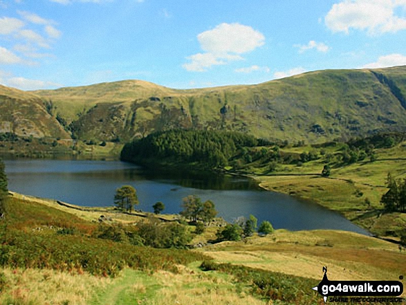
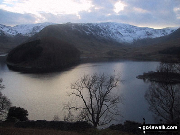
Overlooking the ruins of Riggindale Farm with Haweswater Reservoir beyond from the lower slopes of Rough Crag (Riggindale)

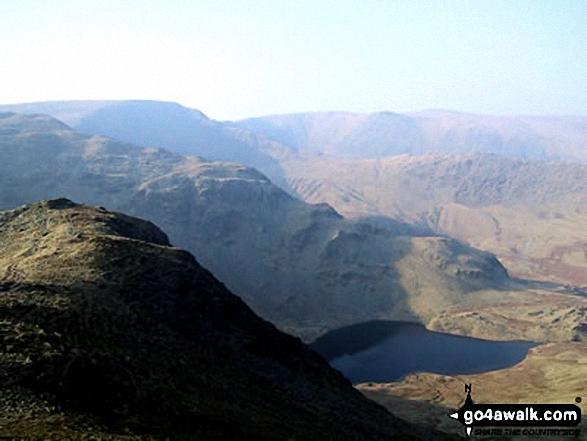
Mardale Ill Bell, High Street and Rough Crag (Riggindale) above Blea Tarn from Nan Bield Pass

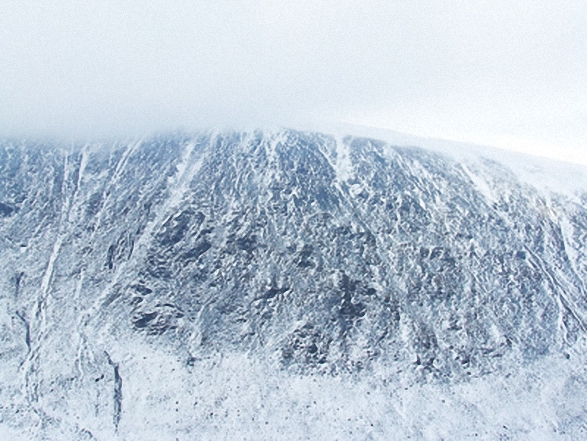
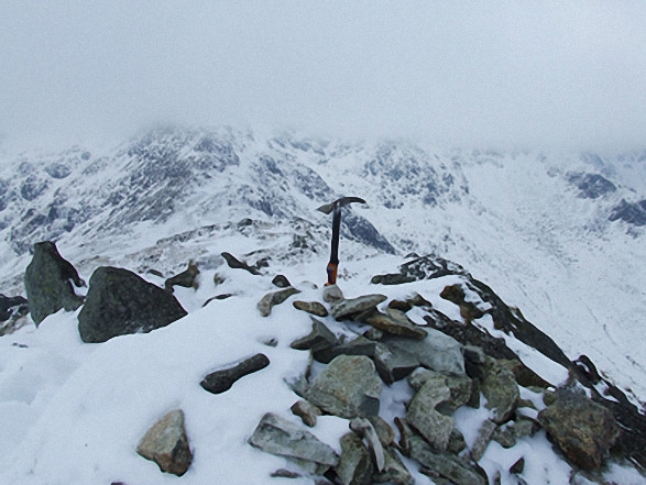
Blea Water with mist still shrouding High Street beyond from Rough Crag (Riggindale) summit in the snow

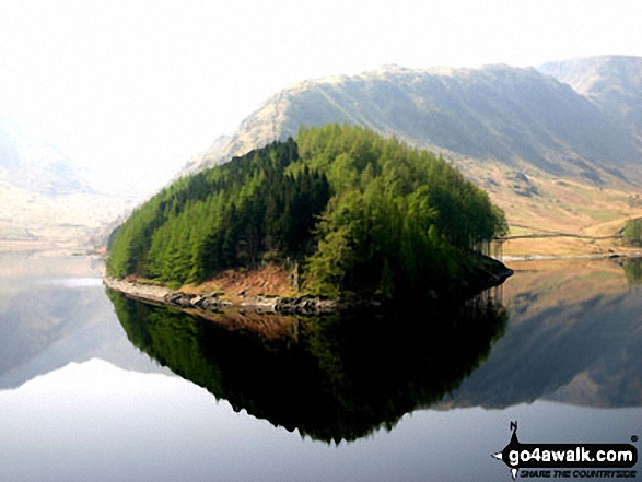
The Rigg with Rough Crag (Riggindale) and High Street beyond from near Rowantreethwaite Beck, Haweswater Reservoir
High Street, The Rigg and Rough Crag (Riggindale) across Haweswater Reservoir

*High Street, Blea Water, Rough Crag (Riggindale), Riggindale, Kidsty Pike and Haweswater Reservoir from The Rigg
. . . see all 17 walk photographs & pictures of views from, on, or of, Rough Crag (Riggindale)
Send us your photographs and pictures on, of, or from Rough Crag (Riggindale)
If you would like to add your walk photographs and pictures to this page, please send them as email attachments (configured for any computer) along with your name to:
and we shall do our best to publish them.
(Guide Resolution = 300dpi. At least = 660pixels (wide) x 440 pixels (high).)

You can also submit photos via our Facebook Page.
NB. Please indicate where each photo was taken and whether you wish us to credit your photos with a Username or your First Name/Last Name.


