Brock Crags
561m (1841ft)
The Far Eastern Fells, The Lake District, Cumbria, England

Not familiar with this top?
You can walk/hike to the top of Brock Crags by using any of these 4 easy‑to‑follow route maps:

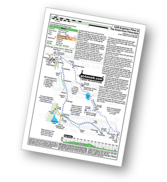
Walk c249 The Knott and Angletarn Pikes from Patterdale
Excellent high level route with good views
   |
|---|
Vital Statistics:
| Length: | 9ml (14.5km) |
|---|---|
| Ascent: | 2,619ft (798m) |
| Time: | 6 hrs |
| Grade: |  (Moderate) (Moderate) |
Route Summary:
Patterdale - Side Farm - Boredale Hause - Angletarn Pikes - Angle Tarn (Martindale) - Satura Crag - Brock Crags - Satura Crag - The Knott - Hayeswater Reservoir - Hayeswater Gill - Hartsop - Dubhow - Beckstones - Crookabeck - Rooking - Side Farm - Patterdale


Walk c159 The Nab and Rest Dodd from Christy Bridge
Long mountain walk over multiple tops
|
|---|
Vital Statistics:
| Length: | 12.5ml (20km) |
|---|---|
| Ascent: | 3,769ft (1,149m) |
| Time: | 8½ hrs |
| Grade: |  (Hard) (Hard) |

Route Summary:
Christy Bridge - Martindale - Dale Head Farm - Heck Crag - Angle Tarn - Buck Crag - Brock Crags - Satura Crag - The Nab (Martindale) - Rest Dodd - The Knott - Rampsgill Head - Kidsty Pike - High Raise (Mardale) - Red Crag - Keasgill Head - Christy Bridge

Walk c297 The Martindale Horseshoe from Howtown
Fantastic high level walk with glorious views
|
|---|
Vital Statistics:
| Length: | 14.5ml (23km) |
|---|---|
| Ascent: | 4,555ft (1,388m) |
| Time: | 9.75hrs |
| Grade: |  (Very Hard) (Very Hard) |

Route Summary:
St Peter's Church (Martindale) - Howtown - Steel Knotts (Pikeawassa) - Keasgill Head - High Raise (Mardale) - Kidsty Pike - Rampsgill Head - The Knott - Rest Dodd - The Nab - Satura Crag - Brock Crags - Angle Tarn (Martindale) - Angletarn Pikes - Bedafel Knott - Beda Head (Beda Fell) - Winter Crag - Christy Bridge - Howegrain Beck - Martindale - St Peter's Church (Martindale) - Howtown

Walk c155 The Knott and Place Fell from Patterdale
Long high level route with fine views of Ullswater
|
|---|
Vital Statistics:
| Length: | 15.5ml (25km) |
|---|---|
| Ascent: | 4,293ft (1,308m) |
| Time: | 10 hrs |
| Grade: | (Very Hard) |

Route Summary:
Patterdale - Rooking - Crookabeck - Beckstones - Dubhow - Hartsop - Hayswater Gill - Hayswater - The Knott - Brock Crags - Angle Tarn (Martindale) - Angletarn Pikes - Boredale Hause - Place Fell - High Dodd (Sleet Fell) - Sandwick - Long Crag - Silver Point - Ullswater - Blowick - Rooking - Side Farm - Patterdale
See Brock Crags and the surrounding tops on our free-to-access 'Google Style' Peak Bagging Maps:

The Far Eastern Fells of The Lake District National Park
Less data - quicker to download
The Whole of The Lake District National Park
More data - might take a little longer to download
See Brock Crags and the surrounding tops on our unique, downloadable, PDF Peak Bagging Maps:

NB: Whether you print off a copy or download it to your phone, these PDF Peak Baggers' Maps might prove incredibly useful when your are up there on the tops and you cannot get a phone signal.
*This version is marked with the walk routes you need to follow to Walk all 214 Wainwrights in just 59 walks.
You can find Brock Crags & all the walks that climb it on these unique free-to-access Interactive Walk Planning Maps:
1:25,000 scale OS Explorer Map (orange/yellow covers):
1:50,000 scale OS Landranger Map (pink/magenta covers):
 Fellow go4awalkers who have already walked, climbed, scaled, summited, hiked & bagged Brock Crags
Simon Myerscough walked up Brock Crags on August 23rd, 2025 [from/via/route] C231 - From Hartsop found a farmers field to park for £5 just as you go into the village. Steep start up onto the ridge on Hartsop Dodd. Had dinner at Thornthwaite Crag, decide to stay high onto High Street to bag Brock Crags [with] Joanne [weather] No wind & quite warm
Pete George climbed it on August 23rd, 2025 [from/via/route] Martindale [with] Roco [weather] Lovely warm & clear.
Geoff Hand bagged it on July 16th, 2025 [from/via/route] C159 Walked from Martindale church down to Dalehead, upto Angletarn & Brock Crags, onto the Nab, Rest Dodd (no rest!) onto the Knott, then Kidsy Pike (realised I had already climbed this several years ago). From there it was straight up High Raise. From here, because I had parked in the wrong place I headed back over Pikeawassa & down to the church. Great day [with] none [weather] Started off a bit dull & overcast but cleared to a pleasent sunny afternoon. - Lots of wildlife: Hawks, deer, badger & strangely a wasps nest in the cairn on High raise.
James Hughes hiked Brock Crags on September 17th, 2024 [from/via/route] c159 The Nab & Rest Dodd from Christy Bridge [weather] Beautiful clear warm day. - Long day added Beda Fell & Angletarn Pikes to start of walk. Slight variations up to Brock Crags & the Nab. Nab very boggy in places. Stags & Bucks mating calls in valley. Parked at Church at the Coombs below Hallin Hill. Stayed at Waterside Campsite.
Angeline Grieveson summited on July 21st, 2024 [with] Dotty & Rick
To add (or remove) your name and experiences on this page - Log On and edit your Personal Mountain Bagging Record
. . . [see more walk reports]
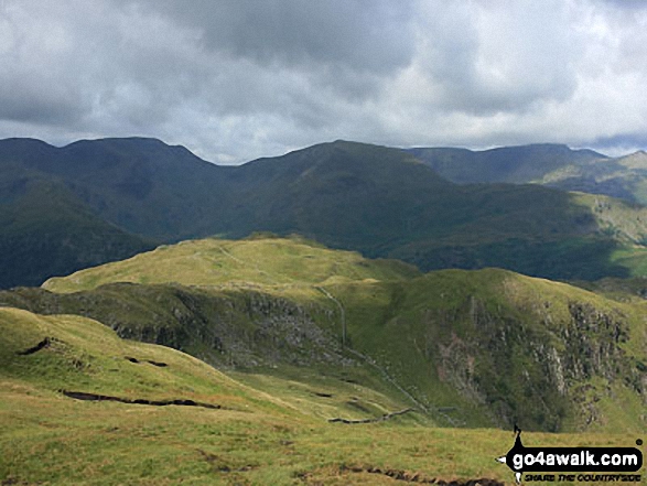
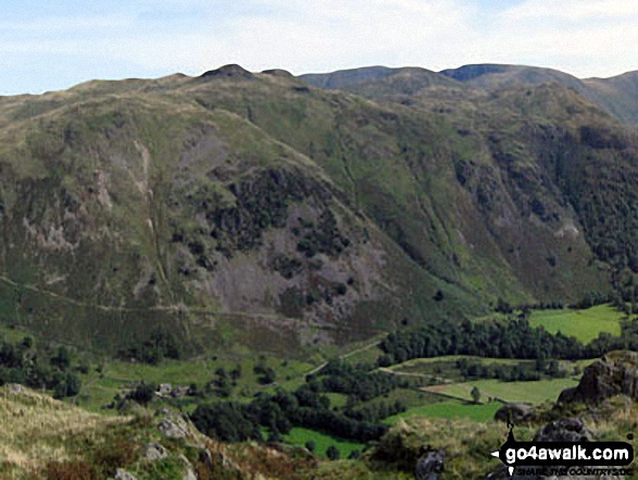
More Photographs & Pictures of views from, on, or of, Brock Crags



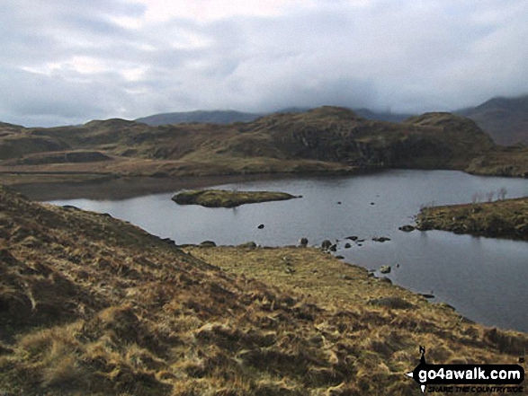
Send us your photographs and pictures on, of, or from Brock Crags
If you would like to add your walk photographs and pictures to this page, please send them as email attachments (configured for any computer) along with your name to:
and we shall do our best to publish them.
(Guide Resolution = 300dpi. At least = 660pixels (wide) x 440 pixels (high).)

You can also submit photos via our Facebook Page.
NB. Please indicate where each photo was taken and whether you wish us to credit your photos with a Username or your First Name/Last Name.