Ten easy to follow circular walk route maps from Ambleside in the The Lake District National Park, Cumbria, England
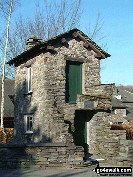 The famous bridge house in Ambleside
Photo: David Hayter
Ambleside is a busy little market town which has grown from its beginnings as a Roman Fort (Galava) to be one of the most popular walking destinations in the Lake District.
Located in the southeastern part of The Lake District National Park, Ambleside sits at the northern end of Windermere, the largest natural Lake in England.
Ambleside is a fabulous base from which to explore the Southern Fells and The Eastern Fells of the Lake District with lots of local walks for all grades and abilities.
Ambleside's Local Mountains
There are several English Mountains accessible by foot from Ambleside itself - including:-
- Fairfield (the 15th Highest Mountain in England);
- Dove Crag (46th);
- Red Screes (56th);
- Great Rigg (62nd) and
- Little Hart Crag (154th).
It is possible to climb three of these mountains (Fairfield, Dove Crag & Great Rigg) in one classic Lakeland walk: Walk c247 The Fairfield Horseshoe from Ambleside which clocks in at 11 miles with some 3,633 feet of ascent.
Red Screes and Little Hart Crag can then be bagged the next day using: Walk c184 Red Screes and High Pike (Scandale) from Ambleside, 9¾ mile route climbing 3,551 feet of ascent - if you have the energy.
Walking the Wainwrights from Ambleside
Walkers seeking to Walk the Wainwrights will find no shortage of opportunities to add to their hill bagging tick lists with 12 Wainwrights accessible by foot direct from Ambleside town centre. These are:-
- Fairfield (Wainwright No. 13);
- Dove Crag (No. 38);
- Red Screes (No. 49);
- Great Rigg (No. 54);
- High Pike (Scandale) (No. 109);
- Little Hart Crag (No. 27);
- Heron Pike (No. 128);
- Low Pike (Scandale) (No. 172);
- Stone Arthur (No. 175);
- Nab Scar (No. 190);
- Baystones (Wansfell) (No. 177) and
- Loughrigg Fell (No. 211).
And if Wainwright Bagging is your thing, then don't miss our popular Walk All 214 Wainwrights in just 59 Walks feature.
When the weather turns
If you want a day off from walking, there are plenty of other things to do in Ambleside. Check out Ambleside Museum for a fascinating flavour of local life over the centuries. Also worth a visit if Beatrix Potter is your thing as it houses a variety of artefacts from her life and work - the author of Peter Rabbit, Mrs Tiggy-Winkle and Jemima Puddleduck lived nearby at Hill Top - see Walking in the Footsteps of Beatrix Potter for more details.
Do not miss Bridge House, one of the smallest houses in Britain (and the former home of the Ambleside Tourist Information Centre). It is said to be built on a bridge to avoid paying local land taxes. For a wide choice of retail-therapy opportunities, Ambleside boasts a plethora of top quality outdoor shops, cafes, pubs and restaurants to suit every taste.
Hotels, B & Bs (Bed & Breakfast), Pubs and Inns and Places to Stay.
Ambleside has a fine collection of Hotels, B & Bs (Bed & Breakfast), Pubs and Inns and Places to Stay to suit every requirement and pocket.
10 easy to follow walks from Ambleside

   |
Vital Statistics:
| Length: | 8.75 miles (14 km) |
| Ascent: | 558ft (170m) |
| Time: | 3½ hrs |
| Grade: |  |
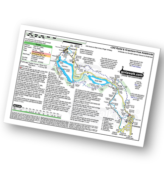
Route Summary:
Ambleside - Scandale Beck - Rydal Park - Rydal Hall - Rydal - Rydal Mount - Rydal Water - Coffin Route - Dove Cottage - Grasmere Village - Silverhowe - The Lea - Grasmere - Red Bank - Rydal Cave - Jobson Close - Rough Intake - Pelter Bridge - Foxghyll - River Rothay - Rothay Park - Ambleside


|
Vital Statistics:
| Length: | 3.25 miles (5 km) |
| Ascent: | 1,428ft (435m) |
| Time: | 2½ hrs |
| Grade: | |


|
Vital Statistics:
| Length: | 6 miles (9.5 km) |
| Ascent: | 1,401ft (427m) |
| Time: | 3½ hrs |
| Grade: |  |

Route Summary:
Ambleside - Rothay Park - Ivy Fell - Loughrigg Fell - Loughrigg Terrace - Rydal Water - Loughrigg Caves - River Rothay - Pelter Bridge - Ambleside

|
Vital Statistics:
| Length: | 5 miles (8 km) |
| Ascent: | 1,769ft (539m) |
| Time: | 3.75hrs |
| Grade: | |

Route Summary:
Ambleside - Stockghyll Force - Wansfell Pike - Baystones (Wansfell) - Wansfell Pike - Stockghyll Force - Ambleside

|
Vital Statistics:
| Length: | 6 miles (9.5 km) |
| Ascent: | 2,192ft (668m) |
| Time: | 5 hrs |
| Grade: |  |
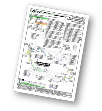
Route Summary:
Ambleside - Stockghyll Force - Wansfell Pike - Baystones (Wansfell) - The Hundreds - Nanny Lane - Troutbeck - Robin Lane - High Skelghyll Farm - Skelghyll Wood - Jenkin Crag - Ambleside

|
Vital Statistics:
| Length: | 7.5 miles (12 km) |
| Ascent: | 2,519ft (768m) |
| Time: | 5.25hrs |
| Grade: |  |
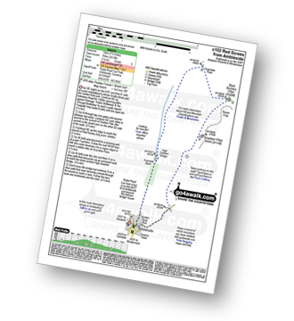
Route Summary:
Ambleside - Snarker Pike - Red Screes - Scandale Pass - High Sweden Bridge - Ambleside

|
Vital Statistics:
| Length: | 9.75 miles (15.5 km) |
| Ascent: | 3,551ft (1,082m) |
| Time: | 7.25hrs |
| Grade: |  |

Route Summary:
Ambleside - Snarker Pike - Red Screes - Scandale Pass - Little Hart Crag - Dove Crag - High Pike (Scandale) - Low Pike (Scandale) - High Sweden Bridge - Ambleside

|
Vital Statistics:
| Length: | 11 miles (17.5 km) |
| Ascent: | 3,633ft (1,107m) |
| Time: | 7.75hrs |
| Grade: | |

Route Summary:
Ambleside - Rydal - Nab Scar - Heron Pike - Rydal Fell (Heron Pike North Top) - Great Rigg - Fairfield - Rydal Head - Hart Crag - Dove Crag - High Pike (Scandale) - Low Pike (Scandale) - High Sweden Bridge - High Sweden Coppice - Ambleside

|
Vital Statistics:
| Length: | 12.5 miles (20 km) |
| Ascent: | 3,411ft (1,040m) |
| Time: | 8 hrs |
| Grade: |  |

Route Summary:
Ambleside - Rydal - Nab Scar - Heron Pike - Rydal Fell (Heron Pike North Top) - Great Rigg - Fairfield - Rydal Head - Hart Crag - Dove Crag - Little Hart Crag - Scandale Pass - Red Screes - Snarker Pike - Ambleside

|
Vital Statistics:
| Length: | 12.25 miles (19.5 km) |
| Ascent: | 3,984ft (1,214m) |
| Time: | 8½ hrs |
| Grade: | |

Route Summary:
Ambleside - Rydal - Nab Scar - Heron Pike - Rydal Fell (Heron Pike North Top) - Greenhead Gill Head - Stone Arthur - Great Rigg - Fairfield - Rydal Head - Hart Crag - Dove Crag - High Pike (Scandale) - Low Pike (Scandale) - High Sweden Bridge - High Sweden Coppice - Ambleside