
![]()
Yewbarrow
628m (2062ft)
The Western Fells, The Lake District, Cumbria, England

Not familiar with this top?
You can walk/hike to the top of Yewbarrow by using any of these 3 easy‑to‑follow route maps:
Walk c386 Yewbarrow from Wasdale Head, Wast Water
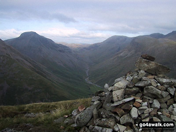
Very steep ascent up to Dore Head - pick a nice day
   |
|---|
Vital Statistics:
| Length: | 5.25ml (8.5km) |
|---|---|
| Ascent: | 2,123ft (647m) |
| Time: | 4 hrs |
| Grade: |  (Moderate) (Moderate) |

Route Summary:
Wasdale Head - Mosedale Beck - Dore Head - Yewbarrow (North Top) - Yewbarrow - Bell Rib - Dropping Crag - Over Beck - Overbeck Bridge - Wasdale Head - Wast Water.
Walk c101 Pillar and Little Scoat Fell from Wasdale Head, Wast Water
One of Lakeland's finest walks - unmissable
|
|---|
Vital Statistics:
| Length: | 11ml (17.5km) |
|---|---|
| Ascent: | 4,782ft (1,457m) |
| Time: | 8.75hrs |
| Grade: |  (Hard) (Hard) |

Route Summary:
Wasdale Head - Mosedale Beck - Black Sail Pass - Looking Stead (Pillar) - High Level Route - Robinson's Cairn - Pillar - Wind Gap - Black Crag (Pillar) - Scoat Fell (Little Scoat Fell) - Steeple - Red Pike (Wasdale) - Dore Head - Yewbarrow (North Top) - Yewbarrow - Dropping Crag - Bell Rib - Over Beck - Wasdale Head - Wast Water.
Walk c133 The Netherbeck Round from Greendale
Superb mountain walk on less crowded fells
|
|---|
Vital Statistics:
| Length: | 11.25ml (18km) |
|---|---|
| Ascent: | 5,100ft (1,554m) |
| Time: | 9.25hrs |
| Grade: | (Hard) |

Route Summary:
Greendale Farm - Middle Fell (Wasdale) - Seatallan - Pots of Ashness - Gowder Crag - Haycock - Great Scoat Fell - Steeple - Scoat Fell (Little Scoat Fell) - Red Pike (Wasdale) - Dore Head - Yewbarrow (North Top) - Yewbarrow - Bell Rib - Dropping Crag - Overbeck Bridge - Wast Water - Greendale Farm
See Yewbarrow and the surrounding tops on our free-to-access 'Google Style' Peak Bagging Maps:
The Western Fells of The Lake District National Park
Less data - quicker to download
The Whole of The Lake District National Park
More data - might take a little longer to download
See Yewbarrow and the surrounding tops on our unique, downloadable, PDF Peak Bagging Maps:

NB: Whether you print off a copy or download it to your phone, these PDF Peak Baggers' Maps might prove incredibly useful when your are up there on the tops and you cannot get a phone signal.
*This version is marked with the walk routes you need to follow to Walk all 214 Wainwrights in just 59 walks.
You can find Yewbarrow & all the walks that climb it on these unique free-to-access Interactive Walk Planning Maps:
1:25,000 scale OS Explorer Map (orange/yellow covers):
1:50,000 scale OS Landranger Map (pink/magenta covers):
 Fellow go4awalkers who have already walked, climbed, scaled, summited, hiked & bagged Yewbarrow
Geoff Hand walked up Yewbarrow on July 3rd, 2025 [from/via/route] Walked the Mosedale round from Burnthwaite Cottage. Pillar, Black Crag, Scoat fell, Steeple, Red Pike & Yewbarrow. One of my toghest days in the lakes, but very enjoyable & rewarding. [with] none [weather] Started off Sunny then cloud, mist, high wind & rain caught me up at Pillar. Some great views before that. - Got a bit confused coming off Scoat fell & picking up the path to Red Pike. Had to use my map compass & watch to find the path.
Ian Ashton climbed it on November 9th, 2024 [with] Solo
Richard Fulcher bagged it on July 16th, 2024 [from/via/route] Parked at the NT car park at Overbeck Bridge (the only car at 8:40am on Tuesday). We set off up the path towards Bell Rib following the left side of the wall. At the end of the wall we traversed over to the scree area just before Dropping Crag. Here we followed the rhs zig zag path up until we reached a gorge that required both hands & feet. After a short while we found a path on the left that provided another zig zag path up to Great Door. From here we followed the well used path over Bull Crag up to the summit of Yewbarrow. We descended via the diagonal path to the left that crosses many patches of scree to arrive at Dore Head. We returned to the car park by following the rock strewn paths down the valley. [with] Jen [weather] A mixture of low cloud & misty conditions with a smattering of rain. Warm & humid. - Great views when the clag cleared a bit!
Christina Lander hiked Yewbarrow on June 4th, 2021 [from/via/route] Wasdale Head - Kirk Fell - Pillar - Yewbarrow North Top - Yewbarrow - Wasdale Head [with] Dick [weather] A beautiful, sunny day - During our holiday staying at Station House, Troutbeck, Penrith
Christine Shepherd summited on October 29th, 2009 [from/via/route] Walked from Wasdale Head using walk c386 Climbed again on 23.8.21 adding Yewbarrow to the end of walk c240 Climbed for a third time using walk c101 with the addition on Haycock with Louise. [with] On my own [weather] Mixed - Added Yewbarrow to the end of walk c240. This made a very long but brilliant day's walking. Tired legs made the descent off Yewbarrow a bit slow but very welcome.
To add (or remove) your name and experiences on this page - Log On and edit your Personal Mountain Bagging Record
. . . [see more walk reports]
More Photographs & Pictures of views from, on, or of, Yewbarrow

Looking NE up Wast Water to featuring Yewbarrow (left), Kirk Fell and Great Gable (right) from near Lund Bridge
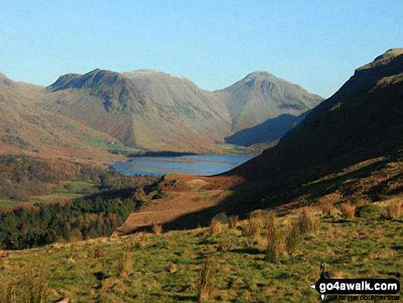
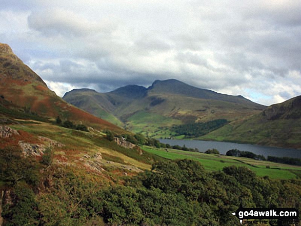
Yewbarrow (left), the shoulder of Kirk Fell, Great Gable (centre) and Lingmoor Fell (right) from Wast Water
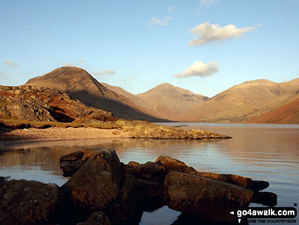
Yewbarrow (left), Great Gable (centre in cloud), Lingmell and the shoulder or Scafell Pike (right) from across Wast Water

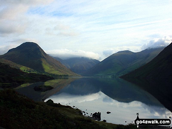
Yewbarrow (left), Great Gable (in cloud centre), Lingmell (centre right) and the Wast Water screes (right) reflected in Wast Water
Wasdale Head featuring Yewbarrow, Kirk Fell and Great Gable from Irton Pike
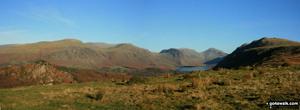
Seatallan, Great Scoat Fell, Little Scoat Fell, Red Pike (Wasdale), Yewbarrow, Kirk Fell, Great Gable and Whin Rigg from Irton Pike
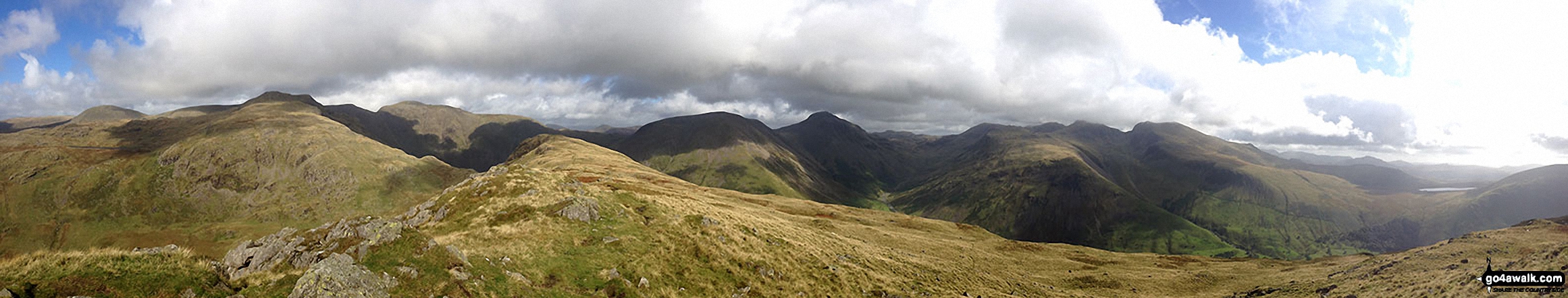
Haycock, Little Scoat Fell, Red Pike (Wasdale), Pillar, Top of Stirrup Crag, Kirk Fell, Great Gable, Great End, Lingmell, Scafell Pike, Sca Fell, Slightside, Harter Fell (Eskdale) and Burnmoor Tarn from the summit of Yewbarrow

. . . see all 65 walk photographs & pictures of views from, on, or of, Yewbarrow
Send us your photographs and pictures on, of, or from Yewbarrow
If you would like to add your walk photographs and pictures to this page, please send them as email attachments (configured for any computer) along with your name to:
and we shall do our best to publish them.
(Guide Resolution = 300dpi. At least = 660pixels (wide) x 440 pixels (high).)

You can also submit photos via our Facebook Page.
NB. Please indicate where each photo was taken and whether you wish us to credit your photos with a Username or your First Name/Last Name.


