

13 easy-to-follow circular walks from Grasmere in the Lake District
The charming little village of Grasmere located in the heart of the Lakes is an ideal base for walkers.
With a wide variety of hills and surrounding countryside there is going to be something suitable for everyone.
Surrounded by high hills and peaceful waters, Grasmere is best known for its stunning natural beauty and its ties to the famous poet William Wordsworth who lived there.
Indeed, in the summer of 1802, before leaving Dove Cottage for several months, Wordsworth composed 'A Farewell', a poem addressed to the Garden-Orchard.
He described it as 'The loveliest spot that man hath ever found.'

Grasmere
Photo: David Hayter
Whether you're into hiking, poetry, or just soaking up the vibes, Grasmere has something for everyone.
It is the perfect little escape where nature and history come together in the most delightful way.
Popular circular walks from Grasmere range from easy lakeside strolls to moderate fell climbs.
The most accessible option is the Grasmere Lake Circular, a roughly 3 to 3.7-mile route that follows the shoreline, passes Dove Cottage, and offers gentle terrain suitable for all abilities.

Dove Cottage
Photo: David Wright
For scenic views with slightly more elevation, the Silver How walk is a favorite, covering approximately 2¾ to 5¼ miles with a steady ascent to a cairned summit overlooking Rydal Water and the Langdale Valley.
This route often includes a stop at Allan Bank, the former home of poet William Wordsworth.
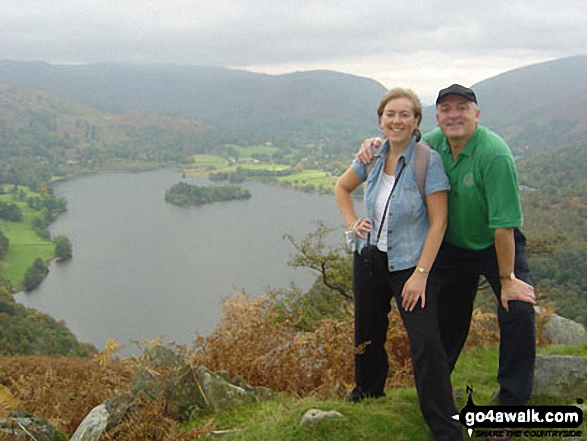
On Silver How above Grasmere
Photo: Gillian Lauder
Other notable options include the Helm Crag (a.k.a. 'Lion and the Lamb') at 3½ miles, known for its distinctive rock formations and panoramic views, and the Alcock Tarn loop, a 3-mile family-friendly path through Brackenfell woodlands.

On Helm Crag (a.k.a. 'Lion and the Lamb')
Photo: Wayne Hill
For those seeking a longer adventure, the Grasmere and Rydal Water circular walk extends to 5¼ to 7½ miles, combining lakeside paths with the historic 'Coffin Route.'
Thirteen easy-to-follow, circular walk route maps from the lovely village of Grasmere in the central Lake District

Walk c292 Rydal and Grasmere from Ambleside
Superb valley walk
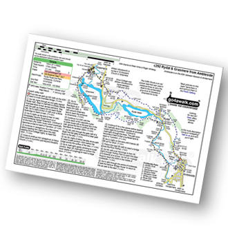
Detailed walk route map PDF
complete with GPS Waypoints
Vital Statistics for walk c292:
8.75
miles
(14 km)
558
feet
(170m)
3½
Hours
3
Easy
Route outline for walk c292:
Ambleside - Scandale Beck - Rydal Park - Rydal Hall - Rydal - Rydal Mount - Rydal Water - Coffin Route - Dove Cottage - Grasmere Village - Silverhowe - The Lea - Grasmere - Red Bank - Rydal Cave - Jobson Close - Rough Intake - Pelter Bridge - Foxghyll - River Rothay - Rothay Park - Ambleside


Walk c350 Helm Crag from Grasmere
One steep ascent to fine views of Grasemere

Detailed walk route map PDF
complete with GPS Waypoints
Vital Statistics for walk c350:
3.75
miles
(6 km)
1201
feet
(366m)
3
Hours
3
Easy
Route outline for walk c350:
Grasmere - Goody Bridge - Wainwright's Coast to Coast Walk - Easedale House - High Raven Crag - Helm Crag - The Lion and The Lamb - The Howitzer - Goody Bridge - Grasmere

Walk c105 Lang How and Silver How from Grasmere
Fine Views of Grasmere
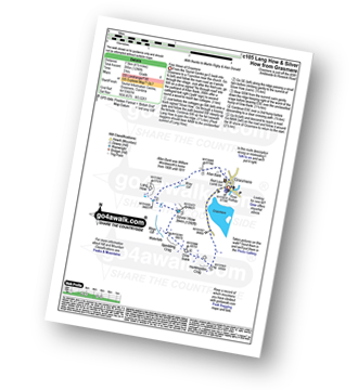
Detailed walk route map PDF
complete with GPS Waypoints
Vital Statistics for walk c105:
4.5
miles
(7.5 km)
1296
feet
(395m)
3
Hours
4
Moderate
Route outline for walk c105:
Grasmere - Lang How - Silver How - Dow Bank - Huntingstile Crag - Grasmere

Walk c173 Easedale Tarn from Grasmere
An easy ascent to Tarn and Waterfall
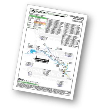
Detailed walk route map PDF
complete with GPS Waypoints
Vital Statistics for walk c173:
6.25
miles
(10 km)
1172
feet
(357m)
3½
Hours
4
Moderate
Route outline for walk c173:
Grasmere - Goody Bridge - Easedale Beck - Sourmilk Gill - Brinhowe Crag - Easedale - Sourmilk Falls - Easedale Tarn - Far Easedale Gill - Stythwaite Steps - Grasmere

Walk c152 Calf Crag and Helm Crag from Grasmere
One steep ascent to fine views of Grasmere

Detailed walk route map PDF
complete with GPS Waypoints
Vital Statistics for walk c152:
8.75
miles
(14 km)
2212
feet
(674m)
5½
Hours
6
Moderate
Route outline for walk c152:
Grasmere - Goody Bridge - High Raven Crag - Helm Crag - The Lion and The Lamb - The Howitzer - Gibson Knott - Calf Crag - Wainwright's Coast to Coast Walk - Brownrigg Moss - Moor Moss - Far Easdale Gill - Goody Bridge - Grasmere

Walk c195 Castle How and Blea Rigg from Grasmere
Good views into Easedale and Langdale
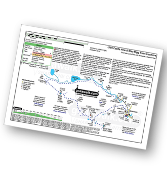
Detailed walk route map PDF
complete with GPS Waypoints
Vital Statistics for walk c195:
8.5
miles
(13.5 km)
2402
feet
(732m)
5½
Hours
6
Moderate
Route outline for walk c195:
Grasmere - Castle How - Blea Rigg - Easedale Tarn - Sour Milk Gill - Easedale - Goody Bridge - Grasmere

Walk c216 Stone Arthur, Great Rigg and Heron Pike from Grasmere
Fabulous views of Grasmere - the descent off Heron Pike is down steep grass

Detailed walk route map PDF
complete with GPS Waypoints
Vital Statistics for walk c216:
7
miles
(11 km)
2661
feet
(811m)
5.25
Hours
6
Moderate
Route outline for walk c216:
Grasmere - River Rothay - Grasmere (A591) - Stone Arthur - Great Rigg - Rydal Fell (Heron Pike North Top) - Heron Pike - Butter Crag - Alcock Tarn - Brackenfell - Dove Cottage - Grasmere (A591) - Grasmere

Walk c266 Seat Sandal and Fairfield from Grasmere
Fabulous views - classic Lakeland

Detailed walk route map PDF
complete with GPS Waypoints
Vital Statistics for walk c266:
7.5
miles
(12 km)
3116
feet
(950m)
6
Hours
6
Moderate
Route outline for walk c266:
Grasmere - Wainwright's Coast to Coast Walk - Mill Bridge - Little Tongue - Seat Sandal - Grisedale Tarn - Fairfield - Rydal Head - Great Rigg - Stone Arthur - Grasmere

Walk c294 Steel Fell from Grasmere
Fine views and (often) less busy

Detailed walk route map PDF
complete with GPS Waypoints
Vital Statistics for walk c294:
8.5
miles
(13.5 km)
2435
feet
(742m)
5½
Hours
6
Moderate
Route outline for walk c294:
Grasmere - Goody Bridge - Ghyll Foot Farm - Green Burn - Greenburn Bottom - Contra Breast - Dead Pike - Steel Fell (Dead Pike) - Brownrigg Moss - Calf Crag - Gibson Knott - Helm Crag - The Lion and The Lamb - The Howitzer - High Raven Crag - Grasmere

Walk c144 Sergeant Man from Grasmere
Good ridge walk above Grasmere
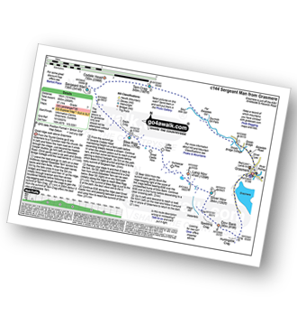
Detailed walk route map PDF
complete with GPS Waypoints
Vital Statistics for walk c144:
10
miles
(16 km)
2936
feet
(895m)
6½
Hours
7
Hard
Route outline for walk c144:
Grasmere - Sour Milk Gill - Sourmilk Gill Falls - Tarn Crag (Easedale) - Sergeant Man - Blea Rigg - Great Castle How - Little Castle How - Raw Pike - Swinescar Pike - Lang How - Silver How - Spedding Crag - Dow Bank - Huntingstile Crag - Grasmere

Walk c302 High Raise via Calf Crag from Grasmere
The Central Fells' Highest point

Detailed walk route map PDF
complete with GPS Waypoints
Vital Statistics for walk c302:
10.25
miles
(16.5 km)
3128
feet
(953m)
6.75
Hours
7
Hard
Route outline for walk c302:
Grasmere - Goody Bridge - High Raven Crag - Helm Crag - The Lion and The Lamb - The Howitzer - Gibson Knott - Calf Crag - Brownrigg Moss - Greenup Edge - High Raise (Langdale) - Sergeant Man - Belles Knott - Coledale Tarn - Easedale Tarn - Sour Milk Gill - Easedale - Grasmere

Walk c358 Seat Sandal, Fairfield and Heron Pike from Grasmere
Fabulous views - classic Lakeland

Detailed walk route map PDF
complete with GPS Waypoints
Vital Statistics for walk c358:
9.5
miles
(15 km)
3682
feet
(1122m)
7.25
Hours
7
Hard
Route outline for walk c358:
Grasmere - Mill Bridge - Little Tongue - Seat Sandal - Grisedale Tarn - Fairfield - Rydal Head - Great Rigg - Rydal Fell (Heron Pike North Top) - Heron Pike - Alcock Tarn - Grasmere

Walk c428 The Langdale Pikes, High Raise and The Easedale Fells from Grasmere
Long high level round

Detailed walk route map PDF
complete with GPS Waypoints
Vital Statistics for walk c428:
13.75
miles
(22 km)
3991
feet
(1216m)
9
Hours
8
Hard
Route outline for walk c428:
Grasmere - Allan Bank - Wray Gill - Silver How - Lang How - Sinescar Pike - Little Castle How - Great Castle How - Blea Rigg - Sergeant Man - Thunacar Knott - Pavey Ark - Harrison Stickle - Loft Crag - Pike of Stickle (Pike O' Stickle) - High Raise (Langdale) - Codale Head - Tarn Crag (Easedale) - Far Easedale Gill - Sourmilk Falls - Far Easedale Beck - Goody Bridge - Grasmere

