Hartsop Above How
570m (1871ft)
The Eastern Fells, The Lake District, Cumbria, England

Not familiar with this top?
You can walk/hike to the top of Hartsop Above How by using any of these 4 easy‑to‑follow route maps:

Walk c333 The Dovedale Round
Fine views of Dovedale and Brothers Water
   |
|---|
Vital Statistics:
| Length: | 7.75ml (12.5km) |
|---|---|
| Ascent: | 2,800ft (853m) |
| Time: | 5.75hrs |
| Grade: |  (Moderate) (Moderate) |

Route Summary:
Cow Bridge Car Park - Brothers Water - Hartsop Hall - Kirkstone Beck - High Hartsop Dodd - Little Hart Crag - Dove Crag - Hart Crag - Blake Brow - Hartsop Above How - Hoggill Brow - Gale Crag - Bleaberry Knott - Cockley How - Cow Bridge


Walk c235 The Deepdale Horseshoe from Patterdale
Quieter alternative to crowded Helvellyn
|
|---|
Vital Statistics:
| Length: | 9.75ml (15.5km) |
|---|---|
| Ascent: | 3,516ft (1,072m) |
| Time: | 7 hrs |
| Grade: |  (Hard) (Hard) |

Route Summary:
Patterdale - Arnison Crag - Birks - St Sunday Crag - Deepdale Hause - Cofa Pike - Fairfield - Rydal Head - Hart Crag - Blake Brow - Hartsop Above How - Hoggill Brow - Gale Crag - Bleaberry Knott - Cockley How - Bridgend - Patterdale

Walk c305 Red Screes and Hart Crag from Brothers Water
Superb views of Brothers Water and Patterdale
|
|---|
Vital Statistics:
| Length: | 9.75ml (15.5km) |
|---|---|
| Ascent: | 3,699ft (1,127m) |
| Time: | 7.25hrs |
| Grade: | (Hard) |
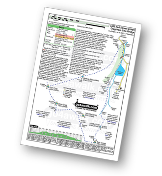
Route Summary:
Cow Bridge Car Park - Brothers Water - Hartsop Hall - Kirkstone Beck - Caiston Beck - Middle Dodd - Red Screes - Scandale Pass - Little Hart Crag - Dove Crag - Hart Crag - Blake Brow - Hartsop Above How - Hoggill Brow - Gale Crag - Bleaberry Knott - Cockley How - Cow Bridge

Walk c162 Stony Cove Pike (Caudale Moor), Red Screes and Hart Crag from Brothers Water
Long high level route with one very steep climb
|
|---|
Vital Statistics:
| Length: | 13.75ml (22km) |
|---|---|
| Ascent: | 5,501ft (1,676m) |
| Time: | 10½ hrs |
| Grade: |  (Very Hard) (Very Hard) |
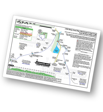
Route Summary:
Cow Bridge Car Park - Brothers Water - Hartsop - Hartsop Dodd - Caudale Moor - Stony Cove Pike (Caudale Moor) - Caudale Head - Pike How - St Raven's Edge - The Kirkstone Pass - Red Screes - Smallthwaite Band - Middle Dodd - Scandale Pass - Little Hart Crag - High Hartsop Dodd - Little Hart Crag - Scandale Head - Dove Crag - Hart Crag - Blake Brow - Hartsop Above How - Hoggill Brow - Gale Crag - Bleaberry Knott - Cockley How - Cow Bridge
See Hartsop Above How and the surrounding tops on our free-to-access 'Google Style' Peak Bagging Maps:

The Eastern Fells of The Lake District National Park
Less data - quicker to download
The Whole of The Lake District National Park
More data - might take a little longer to download
See Hartsop Above How and the surrounding tops on our unique, downloadable, PDF Peak Bagging Maps:

NB: Whether you print off a copy or download it to your phone, these PDF Peak Baggers' Maps might prove incredibly useful when your are up there on the tops and you cannot get a phone signal.
*This version is marked with the walk routes you need to follow to Walk all 214 Wainwrights in just 59 walks.
You can find Hartsop Above How & all the walks that climb it on these unique free-to-access Interactive Walk Planning Maps:
1:25,000 scale OS Explorer Map (orange/yellow covers):
1:50,000 scale OS Landranger Map (pink/magenta covers):
 Fellow go4awalkers who have already walked, climbed, scaled, summited, hiked & bagged Hartsop Above How
Jerry Snow walked up Hartsop Above How on February 8th, 2025 [from/via/route] From CP of White Lion in Patterdale (had ok'd with landlord, promising to go for meal) [with] James Thompson [weather] Mainly overcast; moderate to strong winds; extensive ice & snow on ground at higher levels; higher tops in cloud - approx 100m visibility; some precipitation (snow) on highest tops - Left CP 0810 Picked up by Chris & Bob 16.20 Found iPhone in snow between Fairfield & Hart Crag
Kate Peacock climbed it on September 21st, 2024 [from/via/route] Patterdale Hotel [with] Me, Mike, Skye and Amber [weather] Some sun, dry, breezy on the tops. Mist came & went several times - Road walking on our return to the car park. Going up to Fairfield was good fun from St Sunday Crag
James Hughes bagged it on June 11th, 2024 [from/via/route] Deepdale Horseshoe c235 - From Patterdale [weather] Clear - Post walk pint in Queens Head Troutbeck
John Ramsbottom hiked Hartsop Above How on July 27th, 2024 [from/via/route] Patterdale [with] Lola [weather] Hot Sunny - wild camped on St Sunday Crag, finish with a pint at Queens Head Tirrel.
Mr M A Blanchard summited on May 21st, 2024 [from/via/route] With all the mutts apart from Ted [with] Florence, Millie and Woodie [weather] Cold, bright
To add (or remove) your name and experiences on this page - Log On and edit your Personal Mountain Bagging Record
. . . [see more walk reports]
More Photographs & Pictures of views from, on, or of, Hartsop Above How


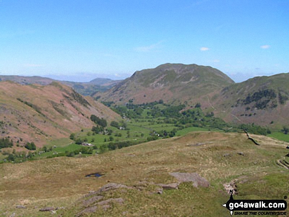
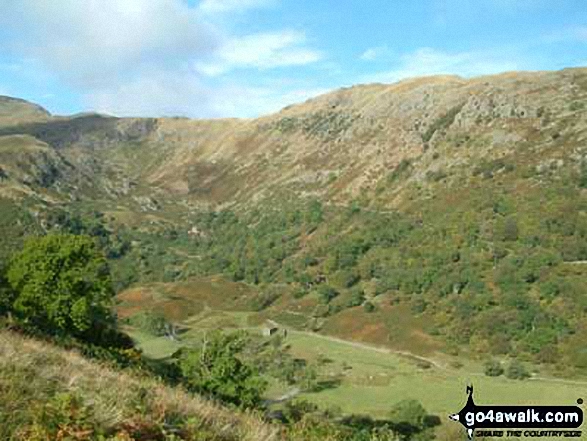
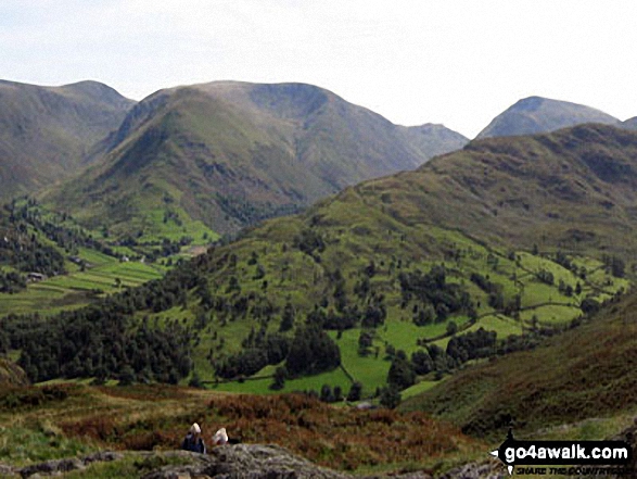
Thornthwaite Crag (left), Hartsop Dodd and Stony Cove Pike (Caudale Moor) (centre), Red Screes (right) and the shoulder of Hartsop above How (foreground) from Arnison Crag, Patterdale
Send us your photographs and pictures on, of, or from Hartsop Above How
If you would like to add your walk photographs and pictures to this page, please send them as email attachments (configured for any computer) along with your name to:
and we shall do our best to publish them.
(Guide Resolution = 300dpi. At least = 660pixels (wide) x 440 pixels (high).)

You can also submit photos via our Facebook Page.
NB. Please indicate where each photo was taken and whether you wish us to credit your photos with a Username or your First Name/Last Name.