121 easy-to-follow walk, route maps of all grades on OS Explorer Map OL4 The English Lakes - North Western area
One hundred twenty-one easy-to-follow walk, route maps of all grades on OS Explorer Map OL4 The English Lakes - North Western area in Walk Grade OrderTap/mouse over a coloured circle (1-3 easy walks, 4-6 moderate walks, 7-9 hard walks) and click to select.
You can use these checkboxes to show only the grades of walk you are interested in:-
One hundred twenty-one easy-to-follow walk, route maps of all grades on OS Explorer Map OL4 The English Lakes - North Western area in Walk Grade Order
Scroll down the list of walks below & click on each walk title (in blue) to locate it on the map above.
See this list of walks, routes & maps in:
Grade Order | Length Order | Time Order | Walk Number or Start Location Order
NB. To reverse (toggle) this order, click Grade Order again
   |
Vital Statistics:
| Length: | 10.25 miles (16.5 km) |
| Ascent: | 3,585ft (1,093m) |
| Time: | 7½ hrs |
| Grade: |  |

Route Summary:
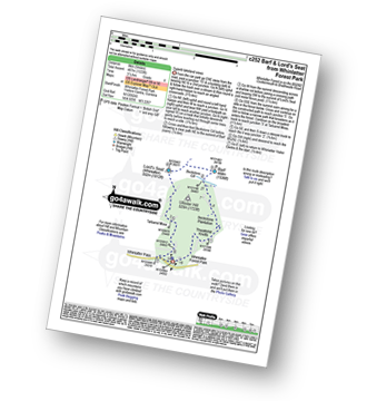
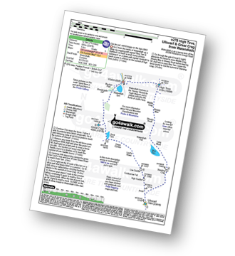
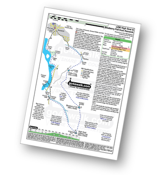
Hawes End - Derwent Water - Skelgill Bank - Woodford's Path - Cat Bells (Catbells) - Maiden Moor - High Spy (North Top) - High Spy - Dalehead Tarn - Dale Head (Newlands) - Hindscarth - High Crags - Scope End - Low Snab Farm - Newlands Church - Little Town - Newlands Valley - Hawes End - Derwent Water.
|
Vital Statistics:
| Length: | 11 miles (17.5 km) |
| Ascent: | 4,782ft (1,457m) |
| Time: | 8.75hrs |
| Grade: |  |

Route Summary:
Wasdale Head - Mosedale Beck - Black Sail Pass - Looking Stead (Pillar) - High Level Route - Robinson's Cairn - Pillar - Wind Gap - Black Crag (Pillar) - Scoat Fell (Little Scoat Fell) - Steeple - Red Pike (Wasdale) - Dore Head - Yewbarrow (North Top) - Yewbarrow - Dropping Crag - Bell Rib - Over Beck - Wasdale Head - Wast Water.
|
Vital Statistics:
| Length: | 8.25 miles (13 km) |
| Ascent: | 1,031ft (314m) |
| Time: | 4 hrs |
| Grade: |  |
Route Summary:
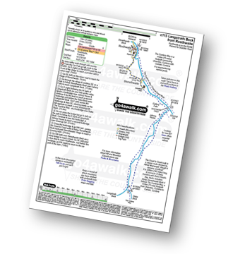
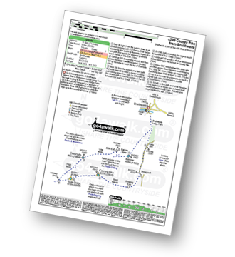
Rosthwaite - Wainwright's Coast to Coast Walk - Stonethwaite - Stonethwaite Beck - Galleny Force - Langstrath Beck - The Cumbria Way - Greenup Gill - Stonethwaite - Rosthwaite
|
Vital Statistics:
| Length: | 6 miles (9.5 km) |
| Ascent: | 2,845ft (867m) |
| Time: | 5 hrs |
| Grade: |  |

Route Summary:
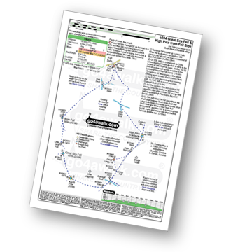
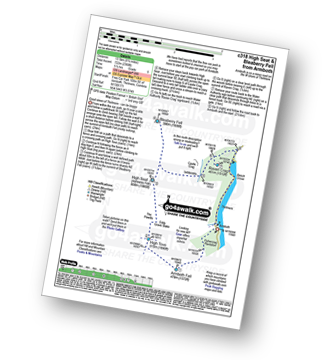
Seathwaite (Borrowdale) - Stockley Bridge - Styhead Tarn - Sty Head - Great Gable - Westmorland Cairn - Windy Gap - Green Gable - Mitchell Cove - Blackmoor Pols - Base Brown - Gillercomb - Sour Milk Gill (Borrowdale) - Seathwaite (Borrowdale)
|
Vital Statistics:
| Length: | 18.75 miles (30 km) |
| Ascent: | 7,309ft (2,408m) |
| Time: | 14.75hrs |
| Grade: |  |

Route Summary:
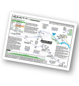
Bowness Knott Car Park Ennerdale - Low Gillerthwaite Field Centre - High Gillerthwaite Yourth Hostel - Red Pike (Buttermere) - High Stile - High Crag (Buttermere) - Seat (Buttermere) - Scarth Gap - Hay Stacks (Haystacks) - Innominate Tarn - Blackbeck Tarn - Black Beck - Green Crag (Buttermere) - Great Round How - Brandreth - Gillercomb Head - Green Gable - Windy Gap - Great Gable - Westmorland Cairn - Beck Head - Beckhead Tarn - Kirk Fell (East Top) - Kirk Fell - Black Sail Pass - Looking Stead (Pillar) - High Level Route - Robinson's Cairn - Pillar - Wind Gap - Black Crag (Pillar) - High Beck - Low Beck - Ennerdale.
|
Vital Statistics:
| Length: | 9.5 miles (15 km) |
| Ascent: | 1,250ft (381m) |
| Time: | 4.75hrs |
| Grade: |  |

Route Summary:
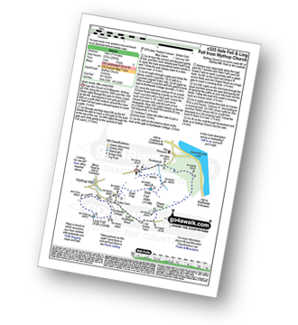
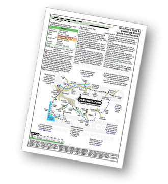
Keswick - Friar's Crag - Borrowdale Road - Spring Farm - Brockle Beck - Castlerigg - High Nest Farm - Castlerigg Stone Circle - Naddle Bridge - Threlkeld - River Greta - Keswick
|
Vital Statistics:
| Length: | 10.5 miles (17 km) |
| Ascent: | 2,903ft (885m) |
| Time: | 6.75hrs |
| Grade: | |

Route Summary:
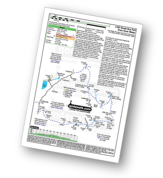
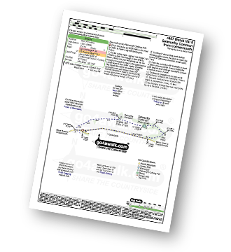
Over Water Reservoir - Orthwaite - Orthwaite Bank - Uldale Fells - Great Cockup - Frozenfell Gill - Trusmadoor - Meal Fell - Little Sca Fell - Great Sca Fell - Knott (Uldale Fells) - Little Calva - Great Calva - Hause Gill - Burn Tod - Burntod Gill - Brockle Crags - Orthwaite - Over Water
|
Vital Statistics:
| Length: | 11.25 miles (18 km) |
| Ascent: | 3,275ft (998m) |
| Time: | 7½ hrs |
| Grade: | |

Route Summary:
Bowness Knott Car Park Ennerdale Water - Char Dub - Silver Cove Beck - Woundell Beck - Caw Fell - Little Gowder Crag - Haycock - Great Scoat Fell - Scoat Fell (Little Scoat Fell) - Steeple - Long Crag - Moss Dub - Lingmell Plantation - Bowness Knott Car Park Ennerdale Water.
|
Vital Statistics:
| Length: | 8.75 miles (14 km) |
| Ascent: | 1,884ft (574m) |
| Time: | 5 hrs |
| Grade: | |
Route Summary:
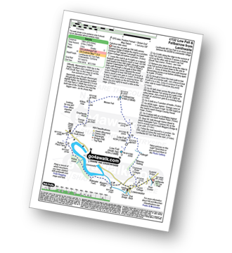
Lanthwaite - Acorn Cottage - Crummockwater Cottages and Foulsyke - Pottergill - Raven Crag (Low Fell) - Low Fell - Low Fell (South Top) - Fellbarrow - Mosser Fell - Wilkes How - Waterend Youth Hostel - Hudson Place Farm - Holme Wood - Watergate Farm - Maggie's Bridge (Loweswater) - Loweswater - Lanthwaite
|
Vital Statistics:
| Length: | 11.25 miles (18 km) |
| Ascent: | 5,100ft (1,554m) |
| Time: | 9.25hrs |
| Grade: | |

Route Summary:
Greendale Farm - Middle Fell (Wasdale) - Seatallan - Pots of Ashness - Gowder Crag - Haycock - Great Scoat Fell - Steeple - Scoat Fell (Little Scoat Fell) - Red Pike (Wasdale) - Dore Head - Yewbarrow (North Top) - Yewbarrow - Bell Rib - Dropping Crag - Overbeck Bridge - Wast Water - Greendale Farm
|
Vital Statistics:
| Length: | 5.5 miles (9 km) |
| Ascent: | 1,384ft (422m) |
| Time: | 3½ hrs |
| Grade: | |
Route Summary:
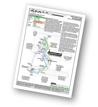
Seatoller - The Allerdale Ramble - Longthwaite - Rosthwaite - New Bridge - The River Derwent - The Cumbria Way - Castle Crag - Seatoller
|
Vital Statistics:
| Length: | 8.5 miles (13.5 km) |
| Ascent: | 3,840ft (1,170m) |
| Time: | 7 hrs |
| Grade: | |

Route Summary:
Braithwaite - Sleet How - Grisedale Pike - Hobcarton Crag - Hopegill Head - Sand Hill - Coldale Hause - Eel Crag - Crag Hill (Eel Crag) - Sail (Derwent Fells) - Long Comb - High Moss - Low Moss - Barrow Door - Braithwaite
|
Vital Statistics:
| Length: | 10.5 miles (17 km) |
| Ascent: | 3,407ft (1,038m) |
| Time: | 7.25hrs |
| Grade: | |

Route Summary:
Seatoller - Big Stanger Gill - Hanging Haystack Crag - Alisongrass Crag - Rosthwaite Fell (Bessyboot) - Tarn At Leaves - Rosthwaite Cam (Rosthwaite Fell) - Dovenest Top - Combe Door Top - Combe Head - Glaramara - Looking Steads (Glaramara) - Red Beck Top - High House Tarn Top - Allen Crags - Sprinking Tarn - Seathwaite Fell (South Top) - Seathwaite Fell - Grains Gill - The Allerdale Ramble - Stockley Bridge - Seathwaite (Borrowdale) - Thornythwaite Farm - Strands Bridge - The River Derwent - Seatoller
|
Vital Statistics:
| Length: | 11.25 miles (18 km) |
| Ascent: | 5,819ft (1,773m) |
| Time: | 10 hrs |
| Grade: | |

Route Summary:
Wasdale Head - Moses' Trod - Lingmell Beck - Gable Beck Bridge - Sty Head - Great Gable - Westmorland Cairn - Beck Head - Beckhead Tarn - Kirk Fell (East Top) - Kirk Fell - Black Sail Pass - Looking Stead (Pillar) - High Level Route - Robinson's Cairn - Pillar - Wind Gap - Black Crag (Pillar) - Scoat Fell (Little Scoat Fell) - Steeple - Red Pike (Wasdale) - Dore Head - Mosedale Beck - Wasdale Head - Wast Water.
|
Vital Statistics:
| Length: | 8.75 miles (14 km) |
| Ascent: | 3,073ft (937m) |
| Time: | 6.25hrs |
| Grade: | |

Route Summary:
Little Town - High Snab Bank - Blea Crags - Robinson - Littledale Edge - Hindscarth - Hindscarth Edge - Dale Head (Newlands) - Dalehead Tarn - Newlands Valley - Newlands Church - Little Town
|
Vital Statistics:
| Length: | 6 miles (9.5 km) |
| Ascent: | 1,861ft (567m) |
| Time: | 4½ hrs |
| Grade: | |

Route Summary:
Rosthwaite - The Cumbria Way - Lingy End - Willygrass Gill - Dock Tarn - Great Crag - Puddingstone Bank - Jopplety How - Joppletyhow Moss - Grange Fell (Brund Fell) - King's How - Rosthwaite
|
Vital Statistics:
| Length: | 8.5 miles (13.5 km) |
| Ascent: | 4,260ft (1,298m) |
| Time: | 7.25hrs |
| Grade: | |

Route Summary:
Honister Pass - Honister Hause - Green Crag (Buttermere) - Black Beck - Blackbeck Tarn - Innominate Tarn - Hay Stacks (Haystacks) - Scarth Gap - Ennerdale - River Liza - Black Sail Hut (Youth Hostel) - Black Sail Path - Kirk Fell - Kirk Fell (East Top) - Beckhead Tarn - Beck Head - Great Gable - Westmorland Cairn - Windy Gap - Green Gable - Gillercomb Head - Brandreth - Grey Knotts - Honister Hause.
|
Vital Statistics:
| Length: | 8.5 miles (13.5 km) |
| Ascent: | 2,181ft (665m) |
| Time: | 5.25hrs |
| Grade: | |

Route Summary:
Watendlath - High Tove - Cockrigg Crags - Thirlmere - Harrop Tarn - Blea Tarn (Watendlath Fell) - Brimming Knott - Robinbank Crag - Rough Knott - Watendlath
|
Vital Statistics:
| Length: | 10.25 miles (16.5 km) |
| Ascent: | 4,611ft (1,405m) |
| Time: | 8½ hrs |
| Grade: | |

Route Summary:
Buttermere - Gatesgarth - Peggy's Bridge - Scarth Gap Pass - Scarth Gap - Black Sail Hut (Youth Hostel) - Black Sail Pass - Looking Stead (Pillar) - High Level Route - Robinson's Cairn - Pillar - Wind Gap - Black Crag (Pillar) - High Beck - Ennerdale - Scarth Gap Pass - Peggy's Bridge - Gatescarth - Buttermere
|
Vital Statistics:
| Length: | 9 miles (14.5 km) |
| Ascent: | 2,624ft (800m) |
| Time: | 6 hrs |
| Grade: | |
Route Summary:
Over Water - Orthwaite - Orthwaite Bank - Uldale Fells - Great Cockup - Trusmadoor - Meal Fell - Great Sca Fell - Little Sca Fell - Brae Fell - Broad Moss - Lowthwaite Fell - Longlands Fell - The Cumbria Way - Longlands - Lowthwaite - Over Water
|
Vital Statistics:
| Length: | 6.5 miles (10.5 km) |
| Ascent: | 2,573ft (784m) |
| Time: | 5 hrs |
| Grade: | |
Route Summary:
Revelin Moss - Whinlatter Forest Park - Hobcarton End - Grisedale Pike - Hobcarton Crag - Hopegill Head - Ladyside Pike - Swinside Plantation - Whinlatter Pass - Hobcarton Plantation - Revelin Moss
|
Vital Statistics:
| Length: | 10.5 miles (17 km) |
| Ascent: | 4,693ft (1,430m) |
| Time: | 8½ hrs |
| Grade: | |

Route Summary:
Seatoller - Strands Bridge - Borrowdale - The Combe - Thornythwaite Fell - Comb Head - Glaramara - Looking Steads (Glaramara) - Red Beck - Red Beck Top - Allen Gill - High House Tarn - High House Tarn Top - Allen Crags - Esk Hause - Ruddy Gill - Sprinkling Tarn - Sty Head - Great Gable - Westmorland Cairn - Windy Gap - Green Gable - Gillercomb Head - Brandreth - Grey Knotts - Honister Hause - Honister Pass - Wainwright's Coast to Coast Walk - Seatoller
|
Vital Statistics:
| Length: | 10 miles (16 km) |
| Ascent: | 3,039ft (926m) |
| Time: | 6.75hrs |
| Grade: | |

Route Summary:
Whinlatter Forest Park - Thwaitehill Knotts - Beckstone Plantation - Beckstone Gill - Barf - Lord's Seat (Whinlatter) - Broom Fell - Graystones - Scawgill Bridge - Whinlatter (Brown How) - Whinlatter (Whinlatter Top) - Whinlatter Forest Park
|
Vital Statistics:
| Length: | 10.25 miles (16.5 km) |
| Ascent: | 2,850ft (869m) |
| Time: | 6½ hrs |
| Grade: | |
Route Summary:
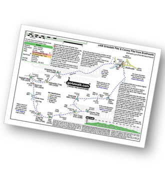
Keswick - Gale Road (Underscar) Nr Keswick - Lonscale Fell - Jenkin Hill - Little Man (Skiddaw) - Skiddaw - Sale How (Skiddaw) - Skiddaw House - Gale Road (Underscar) Nr Keswick.
|
Vital Statistics:
| Length: | 7 miles (11 km) |
| Ascent: | 1,860ft (567m) |
| Time: | 4½ hrs |
| Grade: | |
Route Summary:
Grainsgill Bridge - Swineside - Grainsgill Beck - Knott (Uldale Fells) - Little Calva - Great Calva - The Cumbria Way - Wiley Beck - River Caldew - Burdell - Gill - Wet Swine Gill - Grainsgill Beck - Swineside.
|
Vital Statistics:
| Length: | 9 miles (14.5 km) |
| Ascent: | 2,780ft (847m) |
| Time: | 6 hrs |
| Grade: | |
Route Summary:
Rosthwaite - Stonethwaite - Wainwright's Coast to Coast Walk - Stonethwaite Beck - Galleny Force - The Cumbria Way - Langstrath Beck - Eagle Crag - Sergeant's Crag - High Raise (Langdale) - Low White Stones - Greenup Edge - Lining Crag - Greenup Gill - Stonethwaite Beck - Stonethwaite - Rosthwaite
|
Vital Statistics:
| Length: | 9.75 miles (15.5 km) |
| Ascent: | 4,043ft (1,232m) |
| Time: | 7.75hrs |
| Grade: | |

Route Summary:
Lanthwaite Green - Liza Beck - Whin Ben - Whiteside (Crummock) (West Top) - Whiteside (Crummock) - Gasgale Crags - Hopegill Head - Sand Hill - Coledale Hause - Grasmoor - Wandope - Whiteless Edge - Whiteless Pike - Whiteless Breast - Low Bank - Rannerdale Knotts - Crummock Water - Hause Point - Lanthwaite Green
|
Vital Statistics:
| Length: | 11.75 miles (19 km) |
| Ascent: | 2,970ft (905m) |
| Time: | 7½ hrs |
| Grade: | |
Route Summary:
Ennerdale Weir - Ennerdale Water - Silver Cove Beck - Woundell Beck - Caw Fell - Silver Cove - Iron Crag - Crag Fell - Grike - Ennerdale Weir
|
Vital Statistics:
| Length: | 14 miles (22.5 km) |
| Ascent: | 2,978ft (908m) |
| Time: | 8.25hrs |
| Grade: | |

Route Summary:
Stone Ends Farm - Apronful of Stones - Rake Trod - Further Gill Sike - Scurth - The Trough - Carrock Fell - Round Knott (Caldbeck) - Miton Hill (Caldbeck) - Red Gate (Track) - High Pike (Caldbeck) - Hare Stones - Great Lingy Hill - Miller Moss - Lingy Hut - Grainsgill Beck - Knott (Uldale Fells) - Litle Calva - Great Calva - The Cumbria Way - Wiley Beck - River Caldew - Burdell - Gill - Wet Swine Gill - Grainsgill Beck - Swineside - Mosedale (Mungrisdale) - Stone Ends Farm
|
Vital Statistics:
| Length: | 6.25 miles (10 km) |
| Ascent: | 1,230ft (375m) |
| Time: | 3½ hrs |
| Grade: | |

Route Summary:
Keswick - Friar's Crag - Calfclose Bay - Barrow Bay - Derwent Water - Ashness Bridge - Walla Crag - Rakefoot - Castlerigg - Brockle Beck - Spring Farm - Keswick
|
Vital Statistics:
| Length: | 7 miles (11 km) |
| Ascent: | 1,726ft (526m) |
| Time: | 4.25hrs |
| Grade: | |

Route Summary:
Maggie's Bridge (Loweswater) - Acorn Cottage - Crummockwater Cottages and Foulsyke - Pottergill - Raven Crag (Low Fell) - Low Fell - Low Fell (South Top) - Crabtree Beck - Darling Fell - Loweswater - Waterend Youth Hostel - Hudson Place Farm - Holme Wood - Watergate Farm - Maggie's Bridge (Loweswater)
|
Vital Statistics:
| Length: | 9.75 miles (15.5 km) |
| Ascent: | 886ft (270m) |
| Time: | 4.25hrs |
| Grade: | |
Route Summary:
Barrow Bay - Derwent Water - Ashness Bridge - Surprise View - Watendlath - Bracken Platt - Puddingstone Bank - The Cumbria Way - Rosthwaite - River Derwent - High Hows Wood - Low Hows Wood - Broadslack Gill - Hollows Farm - Borrowdale Gates - Ellers Beck Lodore Falls - Barrow Bay - Derwent Water
|
Vital Statistics:
| Length: | 7.5 miles (12 km) |
| Ascent: | 3,338ft (1,017m) |
| Time: | 6.25hrs |
| Grade: | |

Route Summary:
Buttermere - Sourmilk Gill - Bleaberry Tarn - Dodd (Buttermere) - The Saddle - Red Pike (Buttermere) - High Stile - High Crag (Buttermere) - Gamlin End - Seat (Buttermere) - Scarth Gap - Peggy's Bridge - Burtness Wood - Buttermere
|
Vital Statistics:
| Length: | 7.25 miles (11.5 km) |
| Ascent: | 3,180ft (969m) |
| Time: | 5.75hrs |
| Grade: | |

Route Summary:
Hopebeck - Hope Beck - Swinside (Whinlatter) - Hope Gill - Ladyside Pike - Hopegill Head - Hobcarton Crag - Grisedale Pike - Hopegill Head - Gasgale Crags - Whiteside (Crummock) - Whiteside (Crummock) (West Top) - Dodd (Whiteside) - Hopebeck
|
Vital Statistics:
| Length: | 9.5 miles (15 km) |
| Ascent: | 3,666ft (1,117m) |
| Time: | 7.25hrs |
| Grade: | |
Route Summary:
Maggie's Bridge (Loweswater) - Loweswater - High Nook Farm - Highnook Beck - Holme Wood - Holme Beck - Burnbank Fell - Sharp Knott - Blake Fell - Fothergill Head - Gavel Fell - Grain Gill - Whiteoak Moss - Hen Comb - Thrang Crags - Mosedale (Loweswater) - Mosedale Beck (Loweswater) - Mellbreak - Mellbreak (North Top) - White Crag - Loweswater Village - Maggie's Bridge (Loweswater)
|
Vital Statistics:
| Length: | 7.25 miles (11.5 km) |
| Ascent: | 2,654ft (809m) |
| Time: | 5½ hrs |
| Grade: | |

Route Summary:
Little Town - Newlands Valley - Low Snab Farm - Scope End - High Crags - Hindscarth - Littledale Edge - Robinson - Blea Crags - High Snab Bank - High Snab Farm - Newlands Church - Little Town
|
Vital Statistics:
| Length: | 9.5 miles (15 km) |
| Ascent: | 3,477ft (1,060m) |
| Time: | 7 hrs |
| Grade: | |

Route Summary:
Seathwaite (Borrowdale) - Grains Gill - Styhead Gill - Styhead Tarn - Corridor Route - Scafell Pike - Broad Crag - Ill Crag - Great End - Esk Hause - Grains Gill - Seathwaite (Borrowdale)
|
Vital Statistics:
| Length: | 10 miles (16 km) |
| Ascent: | 2,635ft (803m) |
| Time: | 6.25hrs |
| Grade: | |

Route Summary:
Dob Gill Car Park (Thirlmere) - Harrop Tarn - Standing Crag - Ullscarf - Greenup Edge - Low White Stones - High Raise (Langdale) - Sergeant Man - Codale Head - Broadstone Head - Mere Beck - Brownrigg Moss - Calf Crag - Wyth Burn - Stockhow Bridge - Thirlmere
|
Vital Statistics:
| Length: | 4.75 miles (7.5 km) |
| Ascent: | 485ft (148m) |
| Time: | 2 hrs |
| Grade: |  |
Route Summary:
Buttermere - Dalegarth - Hassnesshow Beck - Gatesgarth - Black Beck - Peggy's Bridge - Burtness Wood - Buttermere
|
Vital Statistics:
| Length: | 7.5 miles (12 km) |
| Ascent: | 262ft (80m) |
| Time: | 3 hrs |
| Grade: | |

Route Summary:
Buttermere - Great Wood - Wood House - Crummock Water - Hause Point - Rannerdale Bridge - Cinderdale Common - Lanthwaite Green - High Wood - Lanthwaite Wood - River Cocker - Park Beck - Iron Stone - Low Ling Crag - Scale Bridge - Buttermere
|
Vital Statistics:
| Length: | 4.25 miles (6.5 km) |
| Ascent: | 98ft (30m) |
| Time: | 1½ hrs |
| Grade: |  |
Route Summary:
Maggie's Bridge (Loweswater) - High Thrushbank - Loweswater - Waterend Youth Hostel - Hudson Place Farm - Holme Wood - Watergate Farm - Maggie's Bridge (Loweswater)
|
Vital Statistics:
| Length: | 8.25 miles (13 km) |
| Ascent: | 2,334ft (711m) |
| Time: | 5½ hrs |
| Grade: | |

Route Summary:
Buttermere - Gatesgarth - Warnscale Bottom - Warnscale Beck - Green Crag (Buttermere) - Black Beck - Blackbeck Tarn - Innominate Tarn - Hay Stacks (Haystacks) - Scarth Gap - Burtness Wood - Buttermere
|
Vital Statistics:
| Length: | 8.5 miles (13.5 km) |
| Ascent: | 2,977ft (907m) |
| Time: | 6 hrs |
| Grade: | |
Route Summary:
Lanthwaite Green - Liza Beck - Gasgale Crags - Gasgale Gill - Coledale Hause - Grasmoor - Wandope - Whiteless Edge - Whiteless Pike - Whiteless Breast - Squat Beck - High Rannerdale - Crummock Water - Lanthwaite Green
|
Vital Statistics:
| Length: | 8.25 miles (13 km) |
| Ascent: | 3,306ft (1,008m) |
| Time: | 6.25hrs |
| Grade: | |
Route Summary:
Keswick - Millbeck - The Allerdale Ramble - Doups - White Stones - Carl Side - Longside Edge - Long Side - Skiddaw - Little Man (Skiddaw) - The Cumbria Way - Applethwaite - The Allerdale Ramble - Millbeck - Nr Keswick.
|
Vital Statistics:
| Length: | 7.75 miles (12.5 km) |
| Ascent: | 4,808ft (1,465m) |
| Time: | 7.75hrs |
| Grade: | |

Route Summary:
Wasdale Head - Kirk Fell - Kirk Fell (East Top) - Black Sail Pass - Looking Stead (Pillar) - High Level Route - Robinson's Cairn - Pillar - Wind Gap - Black Crag (Pillar) - Scoat Fell (Little Scoat Fell) - Steeple - Red Pike (Wasdale) - Dore Head - Mosedale Beck - Wasdale Head - Wast Water.
|
Vital Statistics:
| Length: | 8.25 miles (13 km) |
| Ascent: | 3,016ft (919m) |
| Time: | 6 hrs |
| Grade: | |
Route Summary:
Seatoller - Seathwaite (Borrowdale) - Sourmilk Gill (Borrowdale) - Gillercomb - Blackmoor Pols - Mitchell Cove - Green Gable - Windy Gap - Great Gable - Westmorland Cairn - Beck Head - Beckhead Tarn - Moses' Trod - Honister Pass - Honister Hause - Wainwright's Coast to Coast Walk - Seatoller
|
Vital Statistics:
| Length: | 6.25 miles (10 km) |
| Ascent: | 941ft (287m) |
| Time: | 3 hrs |
| Grade: | |

|
Vital Statistics:
| Length: | 11.25 miles (18 km) |
| Ascent: | 3,371ft (1,027m) |
| Time: | 7½ hrs |
| Grade: | |

Route Summary:
Rosthwaite - Stonethwaite - Wainwright's Coast to Coast Walk - Stonethwaite Beck - Galleny Force - The Cumbria Way - Langstrath Beck - Eagle Crag - Sergeant's Crag - High Raise (Langdale) - Low White Stones - Greenup Edge - Ullscarf - High Saddle (Coldbarrow Fell) - Low Saddle (Coldbarrow Fell) - Lord's How - Dock Tarn - Willygrass Gill - Great Crag - Rosthwaite
|
Vital Statistics:
| Length: | 7.25 miles (11.5 km) |
| Ascent: | 3,164ft (964m) |
| Time: | 5.75hrs |
| Grade: | |

Route Summary:
Lanthwaite Green - Liza Beck - Whin Ben - Whiteside (Crummock) (West Top) - Whiteside (Crummock) - Gasgale Crags - Hopegill Head - Hobcarton Crag - Sand Hill - Coledale Hause - Grasmoor - Liza Beck - Gasgale Gill - Lanthwaite
|
Vital Statistics:
| Length: | 8.25 miles (13 km) |
| Ascent: | 2,919ft (890m) |
| Time: | 6 hrs |
| Grade: | |

Route Summary:
High Side - The Allerdale Ramble - Ling How - The Edge - Ullock Pike - Longside Edge - Long Side - Carl Side - Skiddaw - Bakestall - Birkett Edge - Whitewater Dash - Back O' Skiddaw - Melbecks - High Side
|
Vital Statistics:
| Length: | 7.25 miles (11.5 km) |
| Ascent: | 683ft (208m) |
| Time: | 3.25hrs |
| Grade: |  |

Route Summary:
Bowness Knott Car Park - Bowness Plantations - River Liza - Ennerdale Water - Coast To Coast Path - Robin Hood's Chair - Anglers' Crag - Ennerdale Weir - River Ehen - Ennerdale Water - Bowness Knott Car Park
|
Vital Statistics:
| Length: | 5 miles (8 km) |
| Ascent: | 1,533ft (467m) |
| Time: | 3½ hrs |
| Grade: | |
Route Summary:
Whinlatter Forest Park - Thwaitehill Knotts - Beckstone Plantation - Beckstone Gill - Barf - Lord's Seat (Whinlatter) - Whinlatter Forest Park
|
Vital Statistics:
| Length: | 5 miles (8 km) |
| Ascent: | 649ft (198m) |
| Time: | 2.75hrs |
| Grade: | |

Route Summary:
Hawes End - Gutherscale - Derwent Water - Skelgill Farm - Yewthwaite Gill - Little Town - Parrocks Gill - Goldscope Lead Mine - Newlands Beck - Low Snab Farm - Newlands Church - Newlands Valley - Rigg Beck - Rowling End Farm - Newlands Beck - Ghyll Bank - Skelgill Farm - Gutherscale - Hawes End
|
Vital Statistics:
| Length: | 7 miles (11 km) |
| Ascent: | 3,243ft (988m) |
| Time: | 5.75hrs |
| Grade: | |

Route Summary:
Lanthwaite Green - Grasmoor - Wandope - Whiteless Edge - Whiteless Pike - Whiteless Breast - Low Bank - Rannerdale Knotts - Crummock Water - Lanthwaite Green
|
Vital Statistics:
| Length: | 10 miles (16 km) |
| Ascent: | 492ft (150m) |
| Time: | 4 hrs |
| Grade: | |

Route Summary:
The Swirls Car Park - Thirlmere - Dalehead Hall - Thirlspot - Valve Houses - Beech Grove - Armboth - Hause Point - Dobgill Bridge - Wythburn - Stockhow Bridge - Wyth Burn - Helvellyn Screes - Highpark Wood - The Swirls Car Park - Thirlmere
|
Vital Statistics:
| Length: | 4.5 miles (7 km) |
| Ascent: | 361ft (110m) |
| Time: | 2 hrs |
| Grade: | |

Route Summary:
Keswick - Keswick Station - Former Keswick Railway Line - A591 - Chestnut Hill - Castlerigg Stone Circle - High Nest Farm - Castlerigg - Brockle Beck - Springs Farm - Keswick
|
Vital Statistics:
| Length: | 8.75 miles (14 km) |
| Ascent: | 3,390ft (1,033m) |
| Time: | 6.25hrs |
| Grade: | |

Route Summary:
Buttermere - Scale Force - Scale Beck - Blea Crag - Lingcomb Edge - Red Pike (Buttermere) - High Stile - High Crag (Buttermere) - Gamlin End - Seat (Buttermere) - Scarth Gap - Burtness Wood - Sourmilk Gill - Buttermere
|
Vital Statistics:
| Length: | 9 miles (14 km) |
| Ascent: | 131ft (40m) |
| Time: | 3.25hrs |
| Grade: | |
Route Summary:
Keswick - The Cumbria Way - The Allerdale Ramble - Portinscale - Nichol End - Derwent Water - Hawes End - Brandlehow Point - Park Neb - Strutta Wood - Calfclose Bay - Stable Hills - Friar's Crag - Keswick
|
Vital Statistics:
| Length: | 15.25 miles (24.5 km) |
| Ascent: | 4,125ft (1,257m) |
| Time: | 9.75hrs |
| Grade: | |

Route Summary:
Ennerdale Weir - Ennerdale Water - Silver Cove Beck - Woundell Beck - Little Gowder Crag - Haycock - Caw Fell - Silver Cove - Iron Crag - Whoap - Lank Rigg - Crag Fell - Grike - Ennerdale Weir
|
Vital Statistics:
| Length: | 7.75 miles (12.5 km) |
| Ascent: | 2,419ft (737m) |
| Time: | 5.25hrs |
| Grade: | |

Route Summary:
Stonethwaite - Stonethwaite Bridge - Stonethwaite Beck - The Cumbria Way - Wainwright's Coast to Coast Walk - Galleny Force - Greenup Gill - Lining Crag - Greenup Edge - Ullscarf - High Saddle (Coldbarrow Fell) - Low Saddle (Coldbarrow Fell) - Lord's How - Green Combe - Dock Tarn - Great Crag - Willygrass Gill - Stonethwaite
|
Vital Statistics:
| Length: | 11.5 miles (18.5 km) |
| Ascent: | 3,214ft (980m) |
| Time: | 7½ hrs |
| Grade: | |
Route Summary:
Keswick - Gale Road - Lonscale Fell - Jenkin Hill - Little Man (Skiddaw) - Skiddaw - Bakestall - Birkett Edge - Whitewater Dash - Back O' Skiddaw - The Cumbria Way - Skiddaw House - Gale Road (Underscar) Nr Keswick.
|
Vital Statistics:
| Length: | 7.75 miles (12.5 km) |
| Ascent: | 1,923ft (586m) |
| Time: | 4.75hrs |
| Grade: | |
Route Summary:
Maggie's Bridge (Loweswater) - Loweswater - Darling Fell - Crabtree Beck - Low Fell (South Top) - Low Fell - Fellbarrow - Mosser Fell - Wilkes How - Waterend Youth Hostel - Hudson Place Farm - Holme Wood - Watergate Farm - Maggie's Bridge (Loweswater)
|
Vital Statistics:
| Length: | 7.75 miles (12.5 km) |
| Ascent: | 2,247ft (685m) |
| Time: | 5 hrs |
| Grade: | |
Route Summary:
Watendlath - High Tove - Middle Crag - Shivery Man - Shivery Knott - Long Moss - Blea Tarn (Watendlath Fell) - Ullscarf - High Saddle (Coldbarrow Fell) - Low Saddle (Coldbarrow Fell) - Lord's How - Green Combe - Dock Tarn - Great Crag - Watendlath
|
Vital Statistics:
| Length: | 7.75 miles (12.5 km) |
| Ascent: | 2,198ft (670m) |
| Time: | 5 hrs |
| Grade: | |
Route Summary:
Fell Side - Dale Beck - Brae Fell - Little Sca Fell - Great Sca Fell - Knott (Uldale Fells) - Grainsgill Beck - The Cumbria Way - Lingy Hut - Miller Moss - Great Lingy Hill - Hare Stones - High Pike (Caldbeck) - Long Grain Beck - Fell Side
|
Vital Statistics:
| Length: | 6 miles (9.5 km) |
| Ascent: | 295ft (90m) |
| Time: | 2½ hrs |
| Grade: | |
Route Summary:
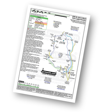
Legburthwaite Car Park - Bridgend Farm - Shoulthwaite Farm - Shaw Bank - Carlisle Diocese Youth Centre - St John's in The Vale Church - Low Bridge End Farm - Legburthwaite Car Park
|
Vital Statistics:
| Length: | 11.25 miles (18 km) |
| Ascent: | 4,132ft (1,259m) |
| Time: | 8.25hrs |
| Grade: | |

Route Summary:
Buttermere - Scale Force - Scale Beck - Blea Crag - Lingcomb Edge - Red Pike (Buttermere) - High Stile - High Crag (Buttermere) - Gamlin End - Seat (Buttermere) - Scarth Gap - Hay Stacks (Haystacks) - Innominate Tarn - Blackbeck Tarn - Black Beck - Green Crag (Buttermere) - Warnscale Beck - Warnscale Bottom - Gatesgarth - Buttermere
|
Vital Statistics:
| Length: | 7.75 miles (12.5 km) |
| Ascent: | 1,292ft (394m) |
| Time: | 4 hrs |
| Grade: | |
Route Summary:
Over Water Reservoir - Binsey Cottage - Binsey - Whittas Park - High House - High Ireby - Ruthwaite - Scawthwaite Mire - Over Water
|
Vital Statistics:
| Length: | 8.25 miles (13 km) |
| Ascent: | 2,512ft (766m) |
| Time: | 5½ hrs |
| Grade: | |

Route Summary:
Hawes End - Derwent Water - Newlands Valley - Skelgill Bank - Woodford's Path - Cat Bells (Catbells) - Maiden Moor - High Spy (North Top) - High Spy - Dalehead Tarn - Newlands Valley - Newlands Church - Little Town - Hawes End
|
Vital Statistics:
| Length: | 5.80 miles (8.5 km) |
| Ascent: | 2,455ft (748m) |
| Time: | 4½ hrs |
| Grade: | |

Route Summary:
Buttermere - Gatesgarth - Peggy's Bridge - Buttermere - Scarth Gap - Hay Stacks (Haystacks) - Innominate Tarn - Blackbeck Tarn - Black Beck - Green Crag (Buttermere) - Warnscale Beck - Dubs Hut - Dubs Quarry - Fleetwith Pike - Honister Crag (Black Star) - Fleetwith Pike - Fleetwith Edge - Gatesgarth - Buttermere
|
Vital Statistics:
| Length: | 9.5 miles (15 km) |
| Ascent: | 2,257ft (688m) |
| Time: | 5½ hrs |
| Grade: | |
Route Summary:
Keswick - Derwent Water - Friar's Crag - Calfclose Bay - Barrow Bay - Derwent Water - Ashness Bridge - High Seat (Ashness Fell) - Bleaberry Fell - Walla Crag - Rakefoot - Castlerigg - Keswick
|
Vital Statistics:
| Length: | 7.25 miles (11.5 km) |
| Ascent: | 3,013ft (918m) |
| Time: | 5.75hrs |
| Grade: | |
Route Summary:
Braithwaite - Barrow (Newlands) - Stile End - Low Moss - Outerside - High Moss - Scar Crags - Causey Pike - Sleet Hause - Rowling End - Stoneycroft - Braithwaite
|
Vital Statistics:
| Length: | 9.75 miles (15.5 km) |
| Ascent: | 3,046ft (928m) |
| Time: | 6½ hrs |
| Grade: | |

Route Summary:
Seatoller - Strands Bridge - Borrowdale - The Combe - Thornythwaite Fell - Comb Head - Glaramara - Looking Steads (Glaramara) - Red Beck - Red Beck Top - Allen Gill - High House Tarn - High House Tarn Top - Allen Crags - Esk Hause - Ruddy Gill - Sprinkling Tarn - Sty Head - Sty Head Tarn - Sty Head Gill - Stockley Bridge - Grains Gill - Seathwaite (Borrowdale) - The Allerdale Ramble - Seatoller
|
Vital Statistics:
| Length: | 12 miles (19 km) |
| Ascent: | 5,261ft (1,603m) |
| Time: | 9.75hrs |
| Grade: | |

Route Summary:
Braithwaite - Sleet How - Grisedale Pike - Hobcarton Crag - Hopegill Head - Sand Hill - Coledale Hause - Grasmoor - Wandope - Crag Hill (Eel Crag) - Sail (Derwent Fells) - Scar Crags - Causey Pike - Outerside - Stile End - Barrow (Newlands) - Braithwaite
|
Vital Statistics:
| Length: | 12 miles (19 km) |
| Ascent: | 4,152ft (1,266m) |
| Time: | 8½ hrs |
| Grade: | |

Route Summary:
Hawes End - Derwent Water - Skelgill Bank - Woodford's Path - Cat Bells (Catbells) - Maiden Moor - High Spy (North Top) - High Spy - Dale Head Tarn - Dale Head (Newlands) - Hindscarth Edge - Hindscarth - Littledale Edge - Robinson - High Snab Bank - Newlands Church - Little Town - Hawes End - Derwent Water.
|
Vital Statistics:
| Length: | 7.25 miles (11.5 km) |
| Ascent: | 3,116ft (950m) |
| Time: | 5.75hrs |
| Grade: | |

Route Summary:
Old Sawmill Tearooms - Longside Wood - The Allerdale Ramble - Ling How - The Edge - Ullock Pike - Longside Edge - Long Side - Carl Side - White Stones - Skill Beck - Dodd (Skiddaw) - Dodd Wood - Old Sawmill Tearooms
|
Vital Statistics:
| Length: | 8.5 miles (13.5 km) |
| Ascent: | 2,368ft (722m) |
| Time: | 5½ hrs |
| Grade: | |
Route Summary:
Thirlmere - Armboth - Armboth Fell - High Tove - High Seat (Ashness Fell) - Bleaberry Fell - Raven Crag (Thirlmere) - Thirlmere
|
Vital Statistics:
| Length: | 9.75 miles (15.5 km) |
| Ascent: | 3,529ft (1,076m) |
| Time: | 7 hrs |
| Grade: | |

Route Summary:
Keswick - Millbeck - The Allerdale Ramble - Doups - White Stones - Carl Side - Longside Edge - Long Side - Skiddaw - Little Man (Skiddaw) - Jenkin Hill - Lonscale Fell - Lonscale Crags - The Cumbria Way - Applethwaite - The Allerdale Ramble - Millbeck - Nr Keswick.
|
Vital Statistics:
| Length: | 9.75 miles (15.5 km) |
| Ascent: | 3,157ft (962m) |
| Time: | 6½ hrs |
| Grade: | |

Route Summary:
Buttermere - Sourmilk Gill - Bleaberry Tarn - Dodd (Buttermere) - The Saddle - Red Pike (Buttermere) - Ling Comb - Little Dodd (Ennerdale) - Starling Dodd - Great Borne - Floutern Tarn - Black Beck (Mosedale) - Blea Crag - Scale Force - Scale Beck (Crummock Water) - Crummock Water - Buttermere Dubs - Buttermere
|
Vital Statistics:
| Length: | 7.5 miles (12 km) |
| Ascent: | 2,091ft (637m) |
| Time: | 5 hrs |
| Grade: | |
Route Summary:
Church of St Margaret - Wythop Mill - Sale Fell - Dodd Crag - Wythop Beck - Esking Farm - Corpse Road - Ling Fell (Wythop) - Burthwaite Cottage - Old Scale - Chapel Wood - Routenbeck - Wythop.
|
Vital Statistics:
| Length: | 4 miles (6.5 km) |
| Ascent: | 1,430ft (436m) |
| Time: | 2.75hrs |
| Grade: | |
Route Summary:
Old Sawmill Tearooms - Longside Wood - Skill Beck - Dodd (Skiddaw) - Dodd Wood - Old Sawmill Tearooms
|
Vital Statistics:
| Length: | 12 miles (19 km) |
| Ascent: | 3,502ft (1,067m) |
| Time: | 7.75hrs |
| Grade: | |

Route Summary:
Stonethwaite - Wainwright's Coast to Coast Walk - Stonethwaite Beck - Galleny Force - The Cumbria Way - Langstrath Beck - Stake Pass - Pike of Stickle (Pike O' Stickle) - Harrison Stickle - Thunacar Knott - High Raise (Langdale) - Low White Stones - Greenup Edge - Ullscarf - Low Saddle (Coldbarrow Fell) - Willygrass Gill - Dock Tarn.
|
Vital Statistics:
| Length: | 2 miles (3 km) |
| Ascent: | 413ft (126m) |
| Time: | 1 hrs |
| Grade: | |

Route Summary:
Keswick - Gale Road (Underscar) - The Cumbria Way - Latrigg - Gale Road (Underscar) - Nr Keswick.
|
Vital Statistics:
| Length: | 7.5 miles (12 km) |
| Ascent: | 3,289ft (1,002m) |
| Time: | 6 hrs |
| Grade: | |
Route Summary:
Honister Pass - Honister Hause - Grey Knotts - Brandreth - Green Gable - Windy Gap - Great Gable - Westmorland Cairn - Beck Head - Beckhead Tarn - Kirk Fell (East Top) - Kirk Fell - Moses' Trod - Wainwright's Coast to Coast Walk - Honister Pass
|
Vital Statistics:
| Length: | 7.75 miles (12.5 km) |
| Ascent: | 2,028ft (618m) |
| Time: | 5½ hrs |
| Grade: | |
Route Summary:
Scaly Moss - Blackely Moss - Heckbarley Wood - Red Moss - Grike - Crag Fell - Black Pots - Whoap - Lank Rigg - Whoap Beck - Lankrigg Moss - Stinking Gill - Blackeley Raise - Whorl Gill - Scaly Moss
|
Vital Statistics:
| Length: | 11 miles (17 km) |
| Ascent: | 4,001ft (1,219m) |
| Time: | 8 hrs |
| Grade: | |

Route Summary:
Wasdale Head - Mosedale Beck - Black Sail Pass - High Level Route - Robinson's Cairn - Pillar - Wind Gap - Black Crag (Pillar) - Scoat Fell (Little Scoat Fell) - Red Pike (Wasdale) - Dore Head - Over Beck - Wasdale Head - Wast Water.
|
Vital Statistics:
| Length: | 6 miles (9.5 km) |
| Ascent: | 1,894ft (577m) |
| Time: | 4 hrs |
| Grade: | |

Route Summary:
Little Town - Newlands Church - Keskerdale Farm - Knott Rigg - Ard Crags - Rigg Beck - Birkrigg - Gillbrow - Little Town
|
Vital Statistics:
| Length: | 2.5 miles (4 km) |
| Ascent: | 794ft (242m) |
| Time: | 2 hrs |
| Grade: | |
Route Summary:
Brumstone Bridge - Eskin Farm - Corpse Road - Ling Fell (Wythop) - Burthwaite Cottage - Brumstone Bridge
|
Vital Statistics:
| Length: | 6.5 miles (10.5 km) |
| Ascent: | 1,877ft (572m) |
| Time: | 4.25hrs |
| Grade: | |
Route Summary:
Lanthwaite - Scale Hill - Scalehill Bridge - Muncaster House - Loweswater - Low Park - Mellbreak (North Top) - Mellbreak - Black Beck (Mosedale) - Scale Knott - Scale Beck - High Ling Crag - Low Ling Crag - Crummock Water - Lanthwaite
|
Vital Statistics:
| Length: | 14.5 miles (23 km) |
| Ascent: | 4,703ft (1,433m) |
| Time: | 10 hrs |
| Grade: | |

Route Summary:
Whinlatter Forest Park - Thwaitehill Knotts - Beckstone Plantation - Beckstone Gill - Barf - Lord's Seat (Whinlatter) - Broom Fell - Low Burthwaite Wood - Kelswick Farm - Sale Fell - Dodd Crag - Eskin Farm - Corpse Road - Ling Fell (Wythop) - Wythop Moss - Graystones - Scawgill Bridge - Whinlatter (Brown How) - - Whinlatter (Whinlatter Top) - Whinlatter Forest Park
|
Vital Statistics:
| Length: | 4 miles (6.5 km) |
| Ascent: | 433ft (132m) |
| Time: | 2 hrs |
| Grade: | |
Route Summary:
Blindcrake - Clints Park - Clints Crags - Salkeld Close - Salkeldclose Crags - Thackray Wood - Willie White's Well - Ullerance Gill - Isle Park - Blindcrake
|
Vital Statistics:
| Length: | 9 miles (14.5 km) |
| Ascent: | 3,699ft (1,127m) |
| Time: | 7 hrs |
| Grade: | |

Route Summary:
Lanthwaite Green - Liza Beck - Whin Ben - Whiteside (Crummock) (West Top) - Whiteside (Crummock) - Gasgale Crags - Hopegill Head - Hobcarton Crag - Sand Hill - Coledale Hause - Grasmoor - Wandope - Whiteless Edge - Whiteless Pike - Whiteless Breast - Squat Beck - High Rannerdale - Crummock Water - Lanthwaite Green
|
Vital Statistics:
| Length: | 4.75 miles (7.5 km) |
| Ascent: | 2,363ft (720m) |
| Time: | 4.25hrs |
| Grade: | |

Route Summary:
Buttermere - Dalegarth - Hassnesshow Beck - Goat Crag - Goat Gills - Robinson - Buttermere Moss - High Snockrigg - Buttermere
|
Vital Statistics:
| Length: | 12.25 miles (19.5 km) |
| Ascent: | 3,781ft (1,152m) |
| Time: | 8½ hrs |
| Grade: | |
Route Summary:
Rosthwaite - The Cumbria Way - Stonethwaite - Wainwright's Coast to Coast Walk - Stonethwaite Beck - Galleny Force - The Cumbria Way - Langstrath Beck - Eagle Crag - Sergeant's Crag - High Raise (Langdale) - Low White Stones - Greenup Edge - Ullscarf - Low Saddle (Coldbarrow Fell) - Lord's How - Dock Tarn - Great Crag - Puddingstone Bank - Jopplety How - Joppletyhow Moss - Grange Fell (Brund Fell) - King's How - Rosthwaite
|
Vital Statistics:
| Length: | 8.5 miles (13.5 km) |
| Ascent: | 3,289ft (1,020m) |
| Time: | 6½ hrs |
| Grade: | |
Route Summary:
Seathwaite (Borrowdale) - Stockley Bridge - Grains Gill - Ruddy Gill - Sprinkling Tarn - Esk Hause - Scafell Pike - Esk Hause - Grains Gill - Stockley Bridge - Seathwaite (Borrowdale)
|
Vital Statistics:
| Length: | 3.5 miles (5.5 km) |
| Ascent: | 906ft (276m) |
| Time: | 2½ hrs |
| Grade: | |
Route Summary:
Grange (Borrowdale) - Borrowdale - The Cumbria Way - Holmcrag Wood - River Derwent - The Allerdale Ramble - Castle Crag - River Derwent - Grange (Borrowdale)
|
Vital Statistics:
| Length: | 4.5 miles (7 km) |
| Ascent: | 584ft (178m) |
| Time: | 2.25hrs |
| Grade: | |
Route Summary:
Caldbeck - Caldbeck Duck Pond - Ratten Row - Grange View - Knocker House - Faulds Brow - Whelpo - Whelpo Bridge - Whelpo Beck - Howk Bobbin Mill - Caldbeck
|
Vital Statistics:
| Length: | 3.25 miles (5 km) |
| Ascent: | 968ft (295m) |
| Time: | 2.25hrs |
| Grade: | |
|
Vital Statistics:
| Length: | 5.25 miles (8.5 km) |
| Ascent: | 2,123ft (647m) |
| Time: | 4 hrs |
| Grade: | |

Route Summary:
Wasdale Head - Mosedale Beck - Dore Head - Yewbarrow (North Top) - Yewbarrow - Bell Rib - Dropping Crag - Over Beck - Overbeck Bridge - Wasdale Head - Wast Water.
|
Vital Statistics:
| Length: | 5.25 miles (8.5 km) |
| Ascent: | 2,301ft (701m) |
| Time: | 4½ hrs |
| Grade: | |
Route Summary:
Black Sail Hut (Youth Hostel) - Ennerdale - Black Sail Beck - Black Sail Pass - Looking Stead (Pillar) - Pillar - Black Sail Pass - Black Sail Beck - Black Sail Hut (Youth Hostel) - Ennerdale.
|
Vital Statistics:
| Length: | 10.5 miles (17 km) |
| Ascent: | 3,384ft (1,031m) |
| Time: | 7.25hrs |
| Grade: | |

Route Summary:
Stonethwaite - Big Stanger Gill - Hanging Haystack Crag - Alisongrass Crag - Rosthwaite Fell (Bessyboot) - Tarn At Leaves - Rosthwaite Cam (Rosthwaite Fell) - Dovenest Top - Combe Door Top - Combe Head - Glaramara - Looking Steads (Glaramara) - Red Beck Top - High House Tarn Top - Allen Crags - Esk Hause - Allencrags Gill - Langstrath - Stonethwaite
|
Vital Statistics:
| Length: | 16 miles (25.5 km) |
| Ascent: | 6,285ft (1,915m) |
| Time: | 12.25hrs |
| Grade: | |
Route Summary:
Buttermere - Scale Force - Scale Beck - Blea Crag - Great Borne - Starling Dodd - Little Dodd (Ennerdale) - Ling Comb - Lingcomb Edge - Red Pike (Buttermere) - Dodd (Buttermere) - Red Pike (Buttermere) - High Stile - High Crag (Buttermere) - Gamlin End - Seat (Buttermere) - Scarth Gap - Hay Stacks (Haystacks) - Innominate Tarn - Blackbeck Tarn - Black Beck - Green Crag (Buttermere) - Warnscale Beck - Dubs Hut - Dubs Quarry - Fleetwith Pike - Honister Crag (Black Star) - Fleetwith Pike - Fleetwith Edge - Gatesgarth - Buttermere
|
Vital Statistics:
| Length: | 2.5 miles (4 km) |
| Ascent: | 748ft (228m) |
| Time: | 1.75hrs |
| Grade: | |

|
Vital Statistics:
| Length: | 3.75 miles (6 km) |
| Ascent: | 1,628ft (496m) |
| Time: | 3 hrs |
| Grade: | |

Route Summary:
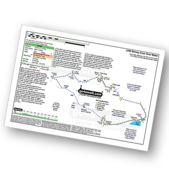
Keswick - Derwent Water Launch - Nichol End Pier - Hawes End Pier - Newlands Valley - Woodford's Path - Cat Bells (Catbells) - Hawes End Pier - Derwent Water Launch - Keswick
|
Vital Statistics:
| Length: | 6 miles (9.5 km) |
| Ascent: | 900ft (274m) |
| Time: | 3.24hrs |
| Grade: | |
Route Summary:
Keswick - Friar's Crag - Borrowdale Road - Spring Farm - Brockle Beck - Castlerigg - High Nest Farm - Castlerigg Stone Circle - Brigham - River Greta - Keswick
|
Vital Statistics:
| Length: | 8.75 miles (14 km) |
| Ascent: | 1,854ft (565m) |
| Time: | 5 hrs |
| Grade: | |

Route Summary:
Friar Well - Friar Gill - River Calder - Tongue How - Town Bank - Lank Rigg - Whoap - Whoap Beck - Stinking Gill - Lankrigg Moss - Latterbrow Moss - Latterbrow Beck - Friar Well
|
Vital Statistics:
| Length: | 10 miles (16 km) |
| Ascent: | 3,349ft (1,082m) |
| Time: | 7.25hrs |
| Grade: | |

Route Summary:
Hawes End - Derwent Water - Skelgill Bank - Woodford's Path - Cat Bells (Catbells) - Maiden Moor - Narrow Moor - High Spy (North Top) - High Spy - Dale Head Tarn - Rigghead Quarries - The Allerdale Ramble - Castle Crag - River Derwent - Yewdale Knott - Manesty - Manesty Band - Hawes End - Derwent Water.
|
Vital Statistics:
| Length: | 3.25 miles (6 km) |
| Ascent: | 1,920ft (585m) |
| Time: | 3½ hrs |
| Grade: | |

Route Summary:
Buttermere - Gatesgarth - Peggy's Bridge - Buttermere - Scarth Gap - Hay Stacks - Innominate Tarn - Hay Stacks (Haystacks) - Scarth Gap - Peggy's Bridge - Gatesgarth - Buttermere
|
Vital Statistics:
| Length: | 10 miles (16 km) |
| Ascent: | 4,641ft (1,414m) |
| Time: | 8½ hrs |
| Grade: | |
Route Summary:
Braithwaite - Sleet How - Grisedale Pike - Hobcarton Crag - Hopegill Head - Sand Hill - Coledale Hause - Crag Hill (Eel Crag) - Sail (Derwent Fells) - Scar Crags - Causey Pike - Outerside - Stile End - Barrow (Newlands) - Braithwaite
|
Vital Statistics:
| Length: | 9.75 miles (15.5 km) |
| Ascent: | 2,734ft (833m) |
| Time: | 6.25hrs |
| Grade: | |

Route Summary:
Buttermere - Buttermere Dubbs - Scale Bridge - Scale Force - Scale Beck - Blea Crag - Lingcomb Edge - Ling Comb - Little Dodd (Ennerdale) - Starling Dodd - Great Borne - Floutern Tarn - Black Beck (Mosedale) - Scale Force - Scale Beck (Crummock Water) - Crummock Water - Buttermere
|
Vital Statistics:
| Length: | 8.5 miles (13.5 km) |
| Ascent: | 2,540ft (774m) |
| Time: | 6 hrs |
| Grade: | |

Route Summary:
Maggie's Bridge (Loweswater) - Loweswater - High Nook Farm - Highnook Beck - Holme Wood - Holme Beck - Burnbank Fell - Sharp Knott - Blake Fell - Fothergill Head - Gavel Fell - Grain Gill - Whiteoak Moss - Hen Comb - Little Dodd (Loweswater Fell) - Mosedale (Loweswater) - Mosedale Beck (Loweswater) - Loweswater Village - Maggie's Bridge (Loweswater)
|
Vital Statistics:
| Length: | 9 miles (14.5 km) |
| Ascent: | 3,965ft (1,208m) |
| Time: | 7½ hrs |
| Grade: | |

Route Summary:
Honister Pass - Honister Hause - Grey Knotts - Brandreth - Blackmoor Pols - Base Brown - Mitchell Cove - Green Gable - Windy Gap - Great Gable - Westmorland Cairn - Beck Head - Beckhead Tarn - Kirk Fell (East Top) - Kirk Fell - Moses' Trod - Wainwright's Coast to Coast Walk - Honister Pass
|
Vital Statistics:
| Length: | 6.25 miles (10 km) |
| Ascent: | 6ft (770m) |
| Time: | 5 hrs |
| Grade: | |

Route Summary:
Maggie's Bridge (Loweswater) - Loweswater - Kirkgate Farm - Raven Crag - White Crag - Mellbreak (North Top) - Mellbreak - Mosedale Beck (Loweswater) - Thrang Crags - Hen Comb - Little Dodd (Loweswater Fell) - Mosedale Beck (Loweswater) - Kirkgate Farm - Loweswater - Maggie's Bridge (Loweswater)
|
Vital Statistics:
| Length: | 5.75 miles (9 km) |
| Ascent: | 2,340ft (731m) |
| Time: | 4½ hrs |
| Grade: | |

Route Summary:
Honister Pass - Honister Hause - Grey Knotts - Brandreth - Green Gable - Windy Gap - Great Gable - Westmorland Cairn - Beck Head - Beckhead Tarn - Moses' Trod - Wainwright's Coast to Coast Walk - Honister Pass
|
Vital Statistics:
| Length: | 15.25 miles (24.5 km) |
| Ascent: | 5,458ft (1,663m) |
| Time: | 11 hrs |
| Grade: | |

Route Summary:
Keswick - Millbeck - The Allerdale Ramble - Doups - Dodd (Skiddaw) - White Stones (Skiddaw) - Carl Side - Longside Edge - Long Side - Ullock Pike - Carlside Tarn - Skiddaw - Blake Hill - Bakestall - Little Man (Skiddaw) - Jenkin Hill - Lonscale Fell - Lonscale Crags - The Cumbria Way - Latrigg - Applethwaite - The Allerdale Ramble - Millbeck - Nr Keswick.
|
Vital Statistics:
| Length: | 9 miles (14.5 km) |
| Ascent: | 3,236ft (986m) |
| Time: | 6.75hrs |
| Grade: | |

Route Summary:
Seathwaite (Borrowdale) - Grains Gill - Stockley Bridge - Styhead Gill - Styhead Tarn - Sty Head - The Corridor Route - Skew Gill - Greta Gill - Piers Gill - Scafell Pike - The Corridor Route - Sty Head - Stockley Bridge - Seathwaite (Borrowdale)
|
Vital Statistics:
| Length: | 6.25 miles (10 km) |
| Ascent: | 2,756ft (840m) |
| Time: | 5.25hrs |
| Grade: | |

Route Summary:
Honister Pass - Honister Hause - Bell Crags - Hopper Quarry - Honister Quarries - Honister Crag (Black Star) - Burnt Scarth - Fleetwith Pike - Dubs Hut - Dubs Quarry - Warnscale Beck - Green Crag (Buttermere) - Blackbeck Tarn - Innominate Tarn - Hay Stacks (Haystacks) - Innominate Tarn - Loft Beck - Coast to Coast Walk - Brandreth - Grey Knotts - Honister Hause.
|
Vital Statistics:
| Length: | 4.5 miles (7 km) |
| Ascent: | 630ft (192m) |
| Time: | 2.25hrs |
| Grade: | |
Route Summary:
Cockermouth - Watch Hill (Cockermouth) - Hay - Setmurthy Plantation - Setmurthy Common (Watch Hill) - Peel Wood - Long Bottom - Greenlands - Cockermouth
|
Vital Statistics:
| Length: | 14.5 miles (23 km) |
| Ascent: | 5,409ft (1,648m) |
| Time: | 11 hrs |
| Grade: | |

Route Summary:
Hawes End - Derwent Water - Skelgill Bank - Woodford's Path - Cat Bells (Catbells) - Maiden Moor - High Spy (North Top) - High Spy - Dalehead Tarn - Dale Head (Newlands) - Hindscarth - Littledale Edge - Robinson - High Snockrigg - Moss Force - Newlands Hause - Knott Rigg - Ard Crags - Birkrigg - Keskerdale Beck - Newlands Church - Newlands Beck - Little Town - Skelgill Farm - Hawes End Derwent Water.
|
Vital Statistics:
| Length: | 12.25 miles (19.5 km) |
| Ascent: | 3,062ft (933m) |
| Time: | 7½ hrs |
| Grade: | |
Route Summary:
Over Water Reservoir - Waterside Wood - Whitefield Cottage - Binsey Cottage - Binsey - Dogkennel Wood - Overwater Hall - Black Wood - Orthwaite - Orthwaite Bank - Uldale Fells - Great Cockup - Meal Fell - Great Sca Fell - Little Sca Fell - Brae Fell - Broad Moss - Charleton Gill - Langlands Fell - The Cumbria Way - Lowthwaite - Chapelhouse Reservoir - Over Water
|
Vital Statistics:
| Length: | 6.5 miles (10.5 km) |
| Ascent: | 2,025ft (617m) |
| Time: | 4½ hrs |
| Grade: | |

Route Summary:
Maggie's Bridge (Loweswater) - Loweswater - High Nook Farm - Highnook Beck - Holme Wood - Burnbank Fell - Sharp Knott - Blake Fell - Fothergill Head - Gavel Fell - Black Crag (Gavel Fell) - Highnook Beck - Maggie's Bridge (Loweswater)
|
Vital Statistics:
| Length: | 5 miles (8 km) |
| Ascent: | 663ft (202m) |
| Time: | 2 hrs |
| Grade: | |
Route Summary:
Bothel - Beck Farm - Borrowscale - The Battery - St. John's Hill (Caermote Hill) - Caermote Hill - Camp Hill - Caermote Roman Fort - Borrowscale - Bothel
See this list of walks, routes & maps in:
Grade Order | Length Order | Time Order | Walk Number or Start Location Order
NB. To reverse (toggle) this order, click Grade Order again


