16 easy to follow walk route maps of all grades that include part of The Offa's Dyke Path
The Offa's Dyke Path is a 287km (178 miles) linear footpath connecting Sedbury Cliffs in Gloucestershire, England with Prestatyn in Denbighshire, Wales.
The Offa's Dyke Path is waymarked by a National Trail Acorn.
Not familiar with The Offa's Dyke Path?
See these 16 walks that include part of The Offa's Dyke Path on an interactive Google Map
See this list of walks, routes & maps in:
Grade Order | Length Order | Time Order | Walk Number or Start Location Order
NB. To reverse (toggle) this order, click Grade Order again

   |
Vital Statistics:
| Length: | 9.5 miles (15 km) |
| Ascent: | 1,359ft (141m) |
| Time: | 4.75hrs |
| Grade: |  |
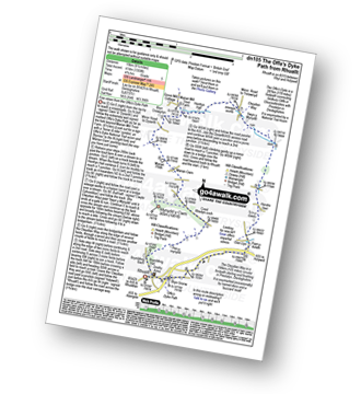
Route Summary:
Rhuallt - The Offa's Dyke Path - Brynllithrig Hall - Pen-y-mynydd - Coed Rhedyn-coch - Mynydd y Cwm (Coed Cwm) - Marian Cwm - Marian Ffrith - Bryn Cnewyllyn - Marian Mill Trout Farm - Henfryn Hall - The Clwydian Way - Swyn y Mynydd - Hendre Fawr - Glan Llyn - Bryn Gronw - Rhuallt


|
Vital Statistics:
| Length: | 7.5 miles (12 km) |
| Ascent: | 962ft (293m) |
| Time: | 3.75hrs |
| Grade: |  |

Route Summary:
Rhuallt - The Offa's Dyke Path - A55 - Bryn Gronw - Cobweb Cottage - Ty Hir - Rhos Onnen - Croes-wian - Ffrith Farm - Bryngwyn Hall - Coed Bron-fawr - The Offa's Dyke Path - Bryn Gronw - A55 - Rhuallt

|
Vital Statistics:
| Length: | 11 miles (17.5 km) |
| Ascent: | 2,389ft (728m) |
| Time: | 6½ hrs |
| Grade: |  |

Route Summary:
Moel Famau Country Park - Moel Famau - The Offa's Dyke Path - Moel Dywyll - Moel Llys-y-coed - Bwlch Arthur - Gronfoel Farm - Cilcain - Y Pentre - Crug Farm - Ffrith - Bryn Fynnon - Moel Famau Country Park

|
Vital Statistics:
| Length: | 10.75 miles (17 km) |
| Ascent: | 916ft (279m) |
| Time: | 4.75hrs |
| Grade: | |
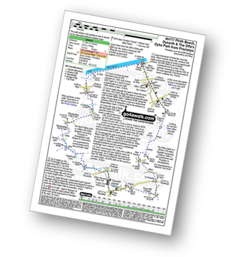
Route Summary:
Prestatyn - Ffrith Beach - Plas Newydd Farm - Rhydorddwy Goch Farm - Aberkinsey Farm - Dyserth - Dyserth Waterfall - The Offa's Dyke Path - Ty Newydd - Bryniau - Red Roofs - Crag y Fran - Prestatyn

|
Vital Statistics:
| Length: | 4 miles (6.5 km) |
| Ascent: | 715ft (218m) |
| Time: | 2.25hrs |
| Grade: |  |

Route Summary:
Rhuallt - The Offa's Dyke Path - Brynllithrig Hall - Pen-y-mynydd - Coed Jenny Morgan - Glan Llyn - Bryn Gronw - Rhuallt

|
Vital Statistics:
| Length: | 12.25 miles (19.5 km) |
| Ascent: | 1,874ft (571m) |
| Time: | 6.25hrs |
| Grade: | |

Route Summary:
Bodfari - The Offa's Dyke Path - Moel-y-Gaer - Pen y Bryn - Sodom Covert - Cefn Du - Pant Glas - Moel Maenefa - Bryn Gronw - Cobweb Cottage - Brick Kiln Rough - Ty Hir - Rhos Onnen - Croes-wian - Caerwys - Maes-mynan Hall - Candy Mill - Ty-draw - The Offa's Dyke Path - Bodfari

|
Vital Statistics:
| Length: | 7 miles (11 km) |
| Ascent: | 847ft (258m) |
| Time: | 3½ hrs |
| Grade: | |
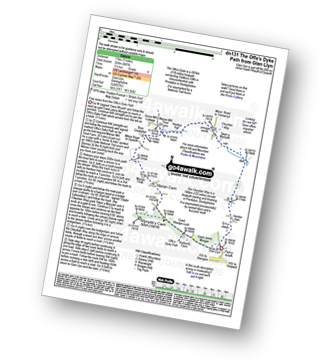
Route Summary:
Glan Llyn - Coed Jenny Morgan - The Offa's Dyke Path - Coed Rhedyn-coch - Mynydd y Cwm (Coed Cwm) - Marian Cwm - Marian Ffrith - Bryn Cnewyllyn - Marian Mill Trout Farm - Henfryn Hall - The Clwydian Way - Swyn y Mynydd - Hendre Fawr - Glan Llyn

|
Vital Statistics:
| Length: | 9.75 miles (15.5 km) |
| Ascent: | 1,447ft (441m) |
| Time: | 5 hrs |
| Grade: | |

Route Summary:
Bodfari - The Offa's Dyke Path - Moel-y-Gaer - Pen y Bryn - Sodom Covert - Cefn Du - Pant Glas - Coed Bron-fawr - Bryngwyn Hall - Ffrith Farm - Croes-wian - Caerwys - Maes-mynan Hall - Candy Mill - Ty-draw - The Offa's Dyke Path - Bodfari

|
Vital Statistics:
| Length: | 12 miles (19 km) |
| Ascent: | 2,409ft (734m) |
| Time: | 6.75hrs |
| Grade: |  |
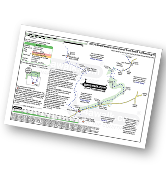
Route Summary:
Bwlch Penbarras - The Offa's Dyke Path - Moel Famau - Moel Dywyll - Moel Llys-y-coed - Bwlch Arthur - Gronfoel Farm - Cilcain - Y Pentre - Crug Farm - Ffrith - Bryn Fynnon - Moel Famua Country Park - Bwlch Penbarras

|
Vital Statistics:
| Length: | 3.75 miles (6 km) |
| Ascent: | 961ft (293m) |
| Time: | 2½ hrs |
| Grade: | |


|
Vital Statistics:
| Length: | 9.75 miles (15.5 km) |
| Ascent: | 1,303ft (397m) |
| Time: | 4.75hrs |
| Grade: | |
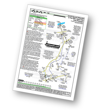
Route Summary:
Prestatyn - The North Wales Path - Dyserth - Dyserth Waterfall - The Offa's Dyke Path - Ty Newydd - Bryniau - Red Roofs - Crag y Fran - Prestatyn

|
Vital Statistics:
| Length: | 5.5 miles (9 km) |
| Ascent: | 1,362ft (415m) |
| Time: | 3½ hrs |
| Grade: | |


|
Vital Statistics:
| Length: | 8.25 miles (13 km) |
| Ascent: | 1,943ft (592m) |
| Time: | 5 hrs |
| Grade: | |

Route Summary:
Cilcain - Y Pentre - Crug Farm - Ffrith - Bryn Fynnon - Moel Famau Country Park - Moel Famau - The Offa's Dyke Path - Moel Dywyll - Moel Llys-y-coed - Bwlch Arthur - Gronfoel Farm - Cilcain

|
Vital Statistics:
| Length: | 14 miles (22.5 km) |
| Ascent: | 2,808ft (856m) |
| Time: | 8 hrs |
| Grade: | |
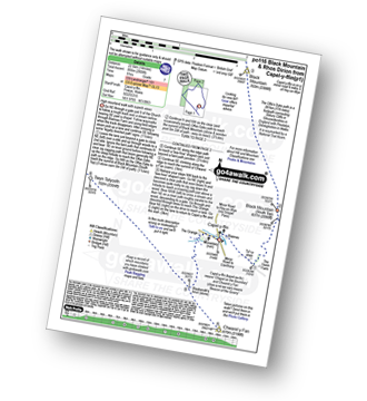
Route Summary:
Capel-y-ffin - The Offa's Dyke Path - Black Mountain (South Top) - Black Mountain - Hay Bluff - Gospel Pass - Twmpa (Lord Hereford's Knob) - Rhiw y Fan - Rhos Dirion - Twyn Talycefn - Blacksmith's Anvil - Chwarel y Fan - Capel-y-ffin

|
Vital Statistics:
| Length: | 7.75 miles (12.5 km) |
| Ascent: | 1,942ft (592m) |
| Time: | 4.75hrs |
| Grade: | |
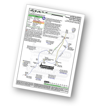
Route Summary:
Pen y Beacon Stone Circle - The Offa's Dyke Path - Hay Bluff - Fynnon y Parc - Gospel Pass - Twmpa (Lord Hereford's Knob) - Rhiw y Fan - Rhos Dirion - Rhiw Wen - Caemarchog - Three Rivers Ride - Pen y Beacon Stone Circle

|
Vital Statistics:
| Length: | 10 miles (16 km) |
| Ascent: | 2,050ft (625m) |
| Time: | 5½ hrs |
| Grade: | |

Route Summary:
Capel-y-ffin - The Offa's Dyke Path - Black Mountain (South Top) - Black Mountain - Hay Bluff - Gospel Pass - Twmpa (Lord Hereford's Knob) - Darren Lwyd - Capel-y-ffin
See this list of walks, routes & maps in:
Grade Order | Length Order | Time Order | Walk Number or Start Location Order
NB. To reverse (toggle) this order, click Grade Order again
Not familiar with The Offa's Dyke Path?
See these 16 walks that include part of The Offa's Dyke Path on an interactive Google Map





