2 easy to follow walk route maps of all grades that include part of The Severn Way
The Severn Way is a 338km (210 miles) linear footpath connecting Pen Pumlumon Fawr (Plynlimon) in Ceredigion, Wales with Bristol in Bristol, England.
The Severn Way is waymarked by a Severn Trow logo and named posts.
Not familiar with The Severn Way?
See these 2 walks that include part of The Severn Way on an interactive Google Map
   |
Vital Statistics:
| Length: | 5.25 miles (8.5 km) |
| Ascent: | 532ft (162m) |
| Time: | 2½ hrs |
| Grade: |  |
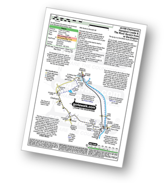
Route Summary:
Eardington - Dinney Barn - The Jack Mytton Way - Chelmarsh Reservoir - Chelmarsh - Hampton - The Jack Mytton Way - The Severn Valley Railway - Hampton Loade - The Hampton Loade Ferry - The River Severn - The Severn Way - Eardington
|
Vital Statistics:
| Length: | 10 miles (16 km) |
| Ascent: | 722ft (220m) |
| Time: | 4.25hrs |
| Grade: |  |

Route Summary:
Bridgnorth - Lower Town - River Severn - The Severn Way - Apley Forge - Nordley - Astley Abbots - Cross Lane Head - High Town - Bridgnorth - Lower Town - Bridgnorth
Not familiar with The Severn Way?
See these 2 walks that include part of The Severn Way on an interactive Google Map


