11 easy to follow walk route maps of all grades that include part of The Allerdale Ramble
The Allerdale Ramble is an 87km (54 miles) linear footpath connecting Seathwaite in Cumbria, with Grune Point in Cumbria, England.
The Allerdale Ramble is waymarked by named posts.
Not familiar with The Allerdale Ramble?
See these 11 walks that include part of The Allerdale Ramble on an interactive Google Map
See this list of walks, routes & maps in:
Grade Order | Length Order | Time Order | Walk Number or Start Location Order
NB. To reverse (toggle) this order, click Grade Order again

   |
Vital Statistics:
| Length: | 5.5 miles (9 km) |
| Ascent: | 1,384ft (422m) |
| Time: | 3½ hrs |
| Grade: |  |
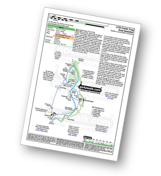
Route Summary:
Seatoller - The Allerdale Ramble - Longthwaite - Rosthwaite - New Bridge - The River Derwent - The Cumbria Way - Castle Crag - Seatoller


|
Vital Statistics:
| Length: | 10.5 miles (17 km) |
| Ascent: | 3,407ft (1,038m) |
| Time: | 7.25hrs |
| Grade: |  |

Route Summary:
Seatoller - Big Stanger Gill - Hanging Haystack Crag - Alisongrass Crag - Rosthwaite Fell (Bessyboot) - Tarn At Leaves - Rosthwaite Cam (Rosthwaite Fell) - Dovenest Top - Combe Door Top - Combe Head - Glaramara - Looking Steads (Glaramara) - Red Beck Top - High House Tarn Top - Allen Crags - Sprinking Tarn - Seathwaite Fell (South Top) - Seathwaite Fell - Grains Gill - The Allerdale Ramble - Stockley Bridge - Seathwaite (Borrowdale) - Thornythwaite Farm - Strands Bridge - The River Derwent - Seatoller

|
Vital Statistics:
| Length: | 8.25 miles (13 km) |
| Ascent: | 3,306ft (1,008m) |
| Time: | 6.25hrs |
| Grade: | |
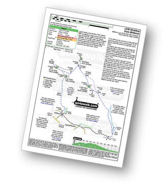
Route Summary:
Keswick - Millbeck - The Allerdale Ramble - Doups - White Stones - Carl Side - Longside Edge - Long Side - Skiddaw - Little Man (Skiddaw) - The Cumbria Way - Applethwaite - The Allerdale Ramble - Millbeck - Nr Keswick.

|
Vital Statistics:
| Length: | 8.25 miles (13 km) |
| Ascent: | 2,919ft (890m) |
| Time: | 6 hrs |
| Grade: |  |

Route Summary:
High Side - The Allerdale Ramble - Ling How - The Edge - Ullock Pike - Longside Edge - Long Side - Carl Side - Skiddaw - Bakestall - Birkett Edge - Whitewater Dash - Back O' Skiddaw - Melbecks - High Side

|
Vital Statistics:
| Length: | 9 miles (14 km) |
| Ascent: | 131ft (40m) |
| Time: | 3.25hrs |
| Grade: |  |
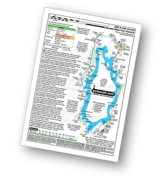
Route Summary:
Keswick - The Cumbria Way - The Allerdale Ramble - Portinscale - Nichol End - Derwent Water - Hawes End - Brandlehow Point - Park Neb - Strutta Wood - Calfclose Bay - Stable Hills - Friar's Crag - Keswick

|
Vital Statistics:
| Length: | 9.75 miles (15.5 km) |
| Ascent: | 3,046ft (928m) |
| Time: | 6½ hrs |
| Grade: | |

Route Summary:
Seatoller - Strands Bridge - Borrowdale - The Combe - Thornythwaite Fell - Comb Head - Glaramara - Looking Steads (Glaramara) - Red Beck - Red Beck Top - Allen Gill - High House Tarn - High House Tarn Top - Allen Crags - Esk Hause - Ruddy Gill - Sprinkling Tarn - Sty Head - Sty Head Tarn - Sty Head Gill - Stockley Bridge - Grains Gill - Seathwaite (Borrowdale) - The Allerdale Ramble - Seatoller

|
Vital Statistics:
| Length: | 7.25 miles (11.5 km) |
| Ascent: | 3,116ft (950m) |
| Time: | 5.75hrs |
| Grade: | |

Route Summary:
Old Sawmill Tearooms - Longside Wood - The Allerdale Ramble - Ling How - The Edge - Ullock Pike - Longside Edge - Long Side - Carl Side - White Stones - Skill Beck - Dodd (Skiddaw) - Dodd Wood - Old Sawmill Tearooms

|
Vital Statistics:
| Length: | 9.75 miles (15.5 km) |
| Ascent: | 3,529ft (1,076m) |
| Time: | 7 hrs |
| Grade: | |

Route Summary:
Keswick - Millbeck - The Allerdale Ramble - Doups - White Stones - Carl Side - Longside Edge - Long Side - Skiddaw - Little Man (Skiddaw) - Jenkin Hill - Lonscale Fell - Lonscale Crags - The Cumbria Way - Applethwaite - The Allerdale Ramble - Millbeck - Nr Keswick.

|
Vital Statistics:
| Length: | 3.5 miles (5.5 km) |
| Ascent: | 906ft (276m) |
| Time: | 2½ hrs |
| Grade: |  |
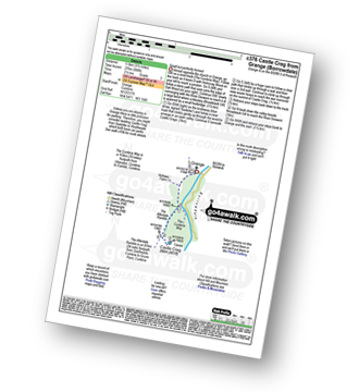
Route Summary:
Grange (Borrowdale) - Borrowdale - The Cumbria Way - Holmcrag Wood - River Derwent - The Allerdale Ramble - Castle Crag - River Derwent - Grange (Borrowdale)

|
Vital Statistics:
| Length: | 10 miles (16 km) |
| Ascent: | 3,349ft (1,082m) |
| Time: | 7.25hrs |
| Grade: | |

Route Summary:
Hawes End - Derwent Water - Skelgill Bank - Woodford's Path - Cat Bells (Catbells) - Maiden Moor - Narrow Moor - High Spy (North Top) - High Spy - Dale Head Tarn - Rigghead Quarries - The Allerdale Ramble - Castle Crag - River Derwent - Yewdale Knott - Manesty - Manesty Band - Hawes End - Derwent Water.

|
Vital Statistics:
| Length: | 15.25 miles (24.5 km) |
| Ascent: | 5,458ft (1,663m) |
| Time: | 11 hrs |
| Grade: |  |

Route Summary:
Keswick - Millbeck - The Allerdale Ramble - Doups - Dodd (Skiddaw) - White Stones (Skiddaw) - Carl Side - Longside Edge - Long Side - Ullock Pike - Carlside Tarn - Skiddaw - Blake Hill - Bakestall - Little Man (Skiddaw) - Jenkin Hill - Lonscale Fell - Lonscale Crags - The Cumbria Way - Latrigg - Applethwaite - The Allerdale Ramble - Millbeck - Nr Keswick.
See this list of walks, routes & maps in:
Grade Order | Length Order | Time Order | Walk Number or Start Location Order
NB. To reverse (toggle) this order, click Grade Order again
Not familiar with The Allerdale Ramble?
See these 11 walks that include part of The Allerdale Ramble on an interactive Google Map