11 easy to follow walk route maps of all grades that include part of The Staffordshire Way
The Staffordshire Way is a 153km (95 miles) linear footpath connecting Mow Cop in Cheshire, England with Kinver Edge in Staffordshire, England.
The Staffordshire Way is waymarked by a knotted rope motif.
Not familiar with The Staffordshire Way?
See these 11 walks that include part of The Staffordshire Way on an interactive Google Map
See this list of walks, routes & maps in:
Grade Order | Length Order | Time Order | Walk Number or Start Location Order
NB. To reverse (toggle) this order, click Grade Order again

   |
Vital Statistics:
| Length: | 9 miles (14.5 km) |
| Ascent: | 1,208ft (368m) |
| Time: | 4½ hrs |
| Grade: |  |

Route Summary:
Timbersbrook - The Gritstone Trail - Pool Bank - The Staffordshire Way - Folly Cottage - Cloud Plantation - The Cloud (Bosley Cloud) - Avona - The Dane Valley Way - River Dane - The Macclesfield Canal - The Cheshire Ring Canal Walk - Buglawton - Brook House Farm - Pool Bank - Timbersbrook


|
Vital Statistics:
| Length: | 4 miles (6.5 km) |
| Ascent: | 791ft (241m) |
| Time: | 2.25hrs |
| Grade: |  |

Route Summary:
Timbersbrook - The Gritstone Trail - Pool Bank - The Staffordshire Way - Folly Cottage - Cloud Plantation - The Cloud (Bosley Cloud) - Avona - Cloud Side Farm - Bridgestones Farm - Bridestones Burial Chamber - Timbersbrook

|
Vital Statistics:
| Length: | 5.5 miles (9 km) |
| Ascent: | 689ft (215m) |
| Time: | 2.75hrs |
| Grade: | |

Route Summary:
Ackers Crossing - The Macclesfield Canal - The Cheshire Ring Canal Walk - Scholar Green - Mount Pleasant - Mow Cop (Old Man of Mow) - The Gritstone Trail - The Staffordshire Way - The South Cheshire Way - Quarry Wood - Hanging Wood - Roe Park - Ackers Crossing

|
Vital Statistics:
| Length: | 8.25 miles (13 km) |
| Ascent: | 804ft (245m) |
| Time: | 3.75hrs |
| Grade: |  |

Route Summary:
Ackers Crossing - The Macclesfield Canal - The Cheshire Ring Canal Walk - Little Moreton Hall - Boarded Barn Farm - Rode Mill - Claphatches - Scholar Green - Mount Pleasant - Mow Cop (Old Man of Mow) - The Gritstone Trail - The Staffordshire Way - The South Cheshire Way - Quarry Wood - Hanging Wood - Roe Park - Ackers Crossing

|
Vital Statistics:
| Length: | 7.5 miles (12 km) |
| Ascent: | 1,359ft (414m) |
| Time: | 4.25hrs |
| Grade: | |

Route Summary:
Timbersbrook - The Gritstone Trail - Pool Bank - The Staffordshire Way - Folly Cottage - Cloud Plantation - The Cloud (Bosley Cloud) - Avona - The Dane Valley Way - Raven's Clough - Ravensclough Brook - Rushton Spencer - Oulton - Woodhouse Green - Bridgestones Farm - Bridestones Burial Chamber - Timbersbrook

|
Vital Statistics:
| Length: | 4.75 miles (7.5 km) |
| Ascent: | 742ft (226m) |
| Time: | 2½ hrs |
| Grade: | |

Route Summary:
Ipstones - Booth's Hall Farm - Cherryeye Bridge - Caldon Canal - The Staffordshire Way - Podmores Bridge - Booth's Wood - Consall New Lock - Crowgutter Wood - Churnet Valley Railway - Consall Forge - River Churnet - Devil's Staircase - Belmont Hall - Noonsun Common - Ipstones

|
Vital Statistics:
| Length: | 6.5 miles (10.5 km) |
| Ascent: | 738ft (225m) |
| Time: | 3.25hrs |
| Grade: | |
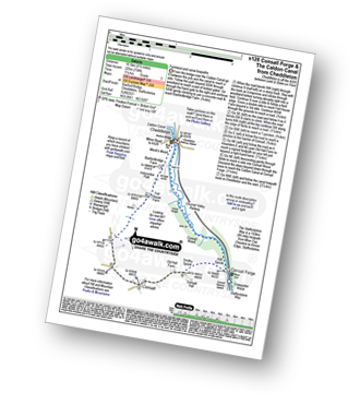
Route Summary:
Cheddleton - Basford Bridge - Monk's Wood - Basfordbridge Farm - Felt House Farm - Consall - Consall Forge - River Churnet - Churnet Valley Railway - Caldon Canal - The Staffordshire Way - Consall Wood - Cheddleton

|
Vital Statistics:
| Length: | 5.5 miles (8.5 km) |
| Ascent: | 896ft (273m) |
| Time: | 3 hrs |
| Grade: | |
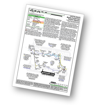
Route Summary:
Rushton Spencer - Oulton - Woodhouse Green - Wood Common Farm - Avona - The Staffordshire Way - The Gritstone Trail - The Cloud (Bosley Cloud) - Bosley Cloud - Avona - The Dane Valley Way - Raven's Clough - Ravensclough Brook - Rushton Spencer

|
Vital Statistics:
| Length: | 4.5 miles (7 km) |
| Ascent: | 295ft (90m) |
| Time: | 2 hrs |
| Grade: |  |

Route Summary:
Rudyard Reservoir - The Staffordshire Way - Rudyard - Rea Cliffe Wood - Cliffe Park Hall - Rudyard Reservoir

|
Vital Statistics:
| Length: | 6 miles (9.5 km) |
| Ascent: | 860ft (262m) |
| Time: | 3 hrs |
| Grade: | |
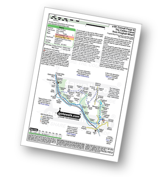
Route Summary:
Froghall Wharf - Moseymoor Wood - Ipstones - New House Wood - Booth's Farm - Booth's Hall Farm - Glenwood House - Crowgutter Wood - Caldon Canal - The Staffordshire Way - Consall Forge - Churnet Valley Railway - Consall New Lock - Booth's Wood - Podmores Bridge - Cherryeye Bridge - Ruelow Wood - Froghall - Froghall Wharf

|
Vital Statistics:
| Length: | 10 miles (16 km) |
| Ascent: | 1,404ft (428m) |
| Time: | 5 hrs |
| Grade: | |

Route Summary:
Rudyard Reservoir - The Staffordshire Way - Ryecroft Gate - Rushton Spencer - Heaton Lodge Farm - Weathercock Farm - Gun End House - Gun (Staffordshire) - Fould Farm - Fould Villa - Poolend - Willgate Farm - Rudyard - Black Wood - Rudyard Reservoir
See this list of walks, routes & maps in:
Grade Order | Length Order | Time Order | Walk Number or Start Location Order
NB. To reverse (toggle) this order, click Grade Order again
Not familiar with The Staffordshire Way?
See these 11 walks that include part of The Staffordshire Way on an interactive Google Map