81 easy-to-follow walk, route maps of all grades on OS Explorer Map OL6 The English Lakes - South Western area
Eighty-one easy-to-follow walk, route maps of all grades on OS Explorer Map OL6 The English Lakes - South Western area in Walk Grade OrderTap/mouse over a coloured circle (1-3 easy walks, 4-6 moderate walks, 7-9 hard walks) and click to select.
You can use these checkboxes to show only the grades of walk you are interested in:-
Eighty-one easy-to-follow walk, route maps of all grades on OS Explorer Map OL6 The English Lakes - South Western area in Walk Grade Order
Scroll down the list of walks below & click on each walk title (in blue) to locate it on the map above.
See this list of walks, routes & maps in:
Grade Order | Length Order | Time Order | Walk Number or Start Location Order
NB. To reverse (toggle) this order, click Grade Order again

   |
Vital Statistics:
| Length: | 11 miles (17.5 km) |
| Ascent: | 4,782ft (1,457m) |
| Time: | 8.75hrs |
| Grade: |  |

Route Summary:
Wasdale Head - Mosedale Beck - Black Sail Pass - Looking Stead (Pillar) - High Level Route - Robinson's Cairn - Pillar - Wind Gap - Black Crag (Pillar) - Scoat Fell (Little Scoat Fell) - Steeple - Red Pike (Wasdale) - Dore Head - Yewbarrow (North Top) - Yewbarrow - Dropping Crag - Bell Rib - Over Beck - Wasdale Head - Wast Water.


|
Vital Statistics:
| Length: | 7.75 miles (12.5 km) |
| Ascent: | 2,770ft (844m) |
| Time: | 5.75hrs |
| Grade: |  |

Route Summary:
Great Langdale - Old Dungeon Ghyll - Stool End - Oxendale Beck - Browney Gill - Red Tarn (Langdale) - Great Knott - Crinkle Crags (South Top) - Crinkle Crags (Long Top) - Crinkle Crags (Gunson Knott) - Shelter Crags - Shelter Crags (North Top) - Three Tarns - Earing Crag - White Stones - The Band - Oxendale - Stool End Farm - The Old Dungeon Ghyll - Great Langdale

|
Vital Statistics:
| Length: | 10 miles (16 km) |
| Ascent: | 3,428ft (1,045m) |
| Time: | 7 hrs |
| Grade: |  |

Route Summary:
Eskdale - Wha House Farm - Hare Crag - Quagrigg Moss - Slight Side - Sca Fell - Symonds Knott - Foxes Tarn - Cam Spout Crag - River Esk - Great Moss - Lingcove Bridge - Brotherilkeld - Hardknott Pass - Eskdale

|
Vital Statistics:
| Length: | 14 miles (22.5 km) |
| Ascent: | 6,009ft (1,832m) |
| Time: | 9 hrs |
| Grade: |  |

Route Summary:
Eskdale - Wha House Farm - Hare Crag - Quagrigg Moss - Slight Side - Sca Fell - Symonds Knott - Mickledore - Scafell Pike - Broad Crag - Ill Crag - Great End - Esk Hause - Esk Pike - Ore Gap - Bow Fell (Bowfell) (North Top) - Bow Fell (Bowfell) - Bowfell Buttress - Cambridge Crag - Flat Crag - Climbers' Traverse (optional) - Three Tarns - Great Moss - Brotherikeld - Eskdale

|
Vital Statistics:
| Length: | 6.25 miles (10 km) |
| Ascent: | 3,187ft (971m) |
| Time: | 5½ hrs |
| Grade: | |

Route Summary:
Wasdale Head - Lingmell Gill - Brown Tongue - Hollow Stones - Mickledore - Scafell Pike - Mickledore - Lingmell Beck - Wasdale Head - Wast Water.

|
Vital Statistics:
| Length: | 9 miles (14.5 km) |
| Ascent: | 2,402ft (732m) |
| Time: | 5.75hrs |
| Grade: | |
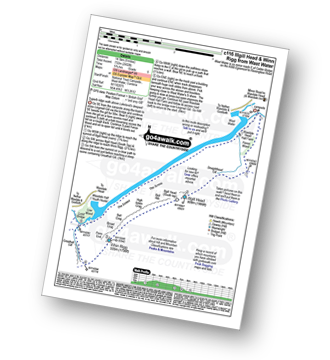
Route Summary:
Wasdale Head - (National Trust Campsite) - Wast Water - Lingmell Gill - Illgill Head - Whin Rigg - Greathall Gill - Wasdale Hall Youth Hostel - Wast Water - Wasdale Head

|
Vital Statistics:
| Length: | 11 miles (17.5 km) |
| Ascent: | 804ft (245m) |
| Time: | 4.75hrs |
| Grade: |  |
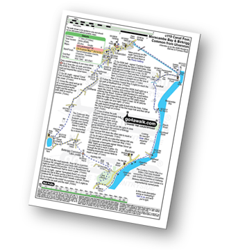
Route Summary:
Ulverston - Ulverston Canal - Canal Foot - The Cumbria Coastal Way - Hammerside Point - Salt Cotes - Sandhall - Beach Wood - Morecambe Bay - Conishead Bank - Wadhead Scar - Bardsea - Ulverston Sands - Sea Wood - Birkrigg Stone Circle - Birkrigg Common - Great Unswick - Urswick Tarn - The Cistercian Way - Croftlands - Swarthmoor Hall - Kilner Park - Levy Beck - Ulverston

|
Vital Statistics:
| Length: | 8.25 miles (13 km) |
| Ascent: | 2,778ft (847m) |
| Time: | 5.75hrs |
| Grade: | |

Route Summary:
Coniston - Walna Scar Road - Goat's Water - The Old Man of Coniston - Brim Fell - Levers Hawse - Swirl Band - Swirl How - Prison Band - Levers Water - Walna Scar Road - Coniston

|
Vital Statistics:
| Length: | 11.25 miles (18 km) |
| Ascent: | 3,604ft (1,098m) |
| Time: | 7.75hrs |
| Grade: | |

Route Summary:
Great Langdale - The Old Dungeon Ghyll - Stool End Farm - Oxendale - Oxendale Beck - Browney Gill - Red Tarn (Langdale) - Great Knott - Crinkle Crags (South Top) - Crinkle Crags (Long Top) - Crinkle Crags (Gunson Knott) - Shelter Crags - Shelter Crags (North Top) - Three Tarns - Climbers' Traverse (optional) - Flat Crag - Cambridge Crag - Bowfell Buttress - Bow Fell (Bowfell) - Bow Fell (Bowfell) (North Top) - Ore Gap - Angle Tarn (Langdale) - Rossett Pike - Rossett Beck - Mickleden - Mickleden Beck - The Cumbria Way - The Old Dungeon Ghyll - Great Langdale

|
Vital Statistics:
| Length: | 11.25 miles (18 km) |
| Ascent: | 5,100ft (1,554m) |
| Time: | 9.25hrs |
| Grade: | |

Route Summary:
Greendale Farm - Middle Fell (Wasdale) - Seatallan - Pots of Ashness - Gowder Crag - Haycock - Great Scoat Fell - Steeple - Scoat Fell (Little Scoat Fell) - Red Pike (Wasdale) - Dore Head - Yewbarrow (North Top) - Yewbarrow - Bell Rib - Dropping Crag - Overbeck Bridge - Wast Water - Greendale Farm

|
Vital Statistics:
| Length: | 10.5 miles (17 km) |
| Ascent: | 3,407ft (1,038m) |
| Time: | 7.25hrs |
| Grade: | |

Route Summary:
Seatoller - Big Stanger Gill - Hanging Haystack Crag - Alisongrass Crag - Rosthwaite Fell (Bessyboot) - Tarn At Leaves - Rosthwaite Cam (Rosthwaite Fell) - Dovenest Top - Combe Door Top - Combe Head - Glaramara - Looking Steads (Glaramara) - Red Beck Top - High House Tarn Top - Allen Crags - Sprinking Tarn - Seathwaite Fell (South Top) - Seathwaite Fell - Grains Gill - The Allerdale Ramble - Stockley Bridge - Seathwaite (Borrowdale) - Thornythwaite Farm - Strands Bridge - The River Derwent - Seatoller

|
Vital Statistics:
| Length: | 4.75 miles (7.5 km) |
| Ascent: | 945ft (288m) |
| Time: | 2.75hrs |
| Grade: |  |
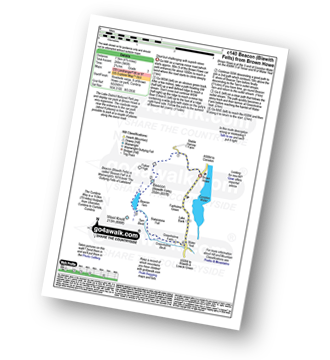
Route Summary:
Brown Howe Car Park - Coniston Water - Beacon (Blawith Fells) - Beacon Tarn - Tarn Beck - Slaterstone Fell - Greenholme Farm - Water Yeat - Lake Bank - Fairholme Green - Brown Howe - Coniston Water.

|
Vital Statistics:
| Length: | 11.25 miles (18 km) |
| Ascent: | 5,819ft (1,773m) |
| Time: | 10 hrs |
| Grade: | |

Route Summary:
Wasdale Head - Moses' Trod - Lingmell Beck - Gable Beck Bridge - Sty Head - Great Gable - Westmorland Cairn - Beck Head - Beckhead Tarn - Kirk Fell (East Top) - Kirk Fell - Black Sail Pass - Looking Stead (Pillar) - High Level Route - Robinson's Cairn - Pillar - Wind Gap - Black Crag (Pillar) - Scoat Fell (Little Scoat Fell) - Steeple - Red Pike (Wasdale) - Dore Head - Mosedale Beck - Wasdale Head - Wast Water.

|
Vital Statistics:
| Length: | 10 miles (16 km) |
| Ascent: | 2,936ft (895m) |
| Time: | 6½ hrs |
| Grade: | |
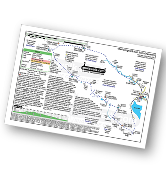
Route Summary:
Grasmere - Sour Milk Gill - Sourmilk Gill Falls - Tarn Crag (Easedale) - Sergeant Man - Blea Rigg - Great Castle How - Little Castle How - Raw Pike - Swinescar Pike - Lang How - Silver How - Spedding Crag - Dow Bank - Huntingstile Crag - Grasmere

|
Vital Statistics:
| Length: | 4 miles (6.5 km) |
| Ascent: | 1,651ft (503m) |
| Time: | 3.25hrs |
| Grade: | |
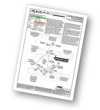
Route Summary:
Birks Bridge - Birks Farm - Harter Fell (Eskdale) - Dunnerdale Forest - River Duddon - Birks Bridge

|
Vital Statistics:
| Length: | 8.5 miles (13.5 km) |
| Ascent: | 1,447ft (441m) |
| Time: | 4½ hrs |
| Grade: |  |

Route Summary:
Elterwater - Elterwater Bridge - Little Langdale - Little Langdale Tarn - Bridge End - Fell Foot Bridge - Castle Howe - Blea Tarn (Langdale) - Great Langdale - Oak Howe - Chapel Stile - Elterwater

|
Vital Statistics:
| Length: | 7.75 miles (12.5 km) |
| Ascent: | 1,758ft (536m) |
| Time: | 4.75hrs |
| Grade: | |
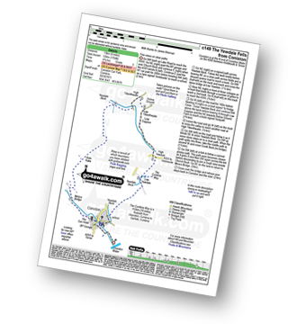
Route Summary:
Coniston - The Cumbria Way - Low Yewdale - Yewdale Beck - High Yewdale - Yew Band - Low Tilberthwaite - High Tilberthwaite - Low Coppice - Tilberthwaite Gill - Crook Beck - Hole Rake - Miners Bridge - Church Beck - Coniston

|
Vital Statistics:
| Length: | 8.75 miles (14 km) |
| Ascent: | 2,307ft (703m) |
| Time: | 5½ hrs |
| Grade: | |
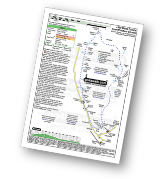
Route Summary:
Silecroft - Whicham Church - Kirkbank Farm - Townend Knotts - Black Combe - Blackcombe Screes - William Gill - Hentoe Hill - Butcher's Breast - Littlefell Crags - Tarn Dimples - Whitbeck Mill - Townend Hall - Whitebeck - Throstlerake Crag Fell Brow - Whicham Church - Silecroft

|
Vital Statistics:
| Length: | 8.75 miles (14 km) |
| Ascent: | 2,212ft (674m) |
| Time: | 5½ hrs |
| Grade: | |

Route Summary:
Grasmere - Goody Bridge - High Raven Crag - Helm Crag - The Lion and The Lamb - The Howitzer - Gibson Knott - Calf Crag - Wainwright's Coast to Coast Walk - Brownrigg Moss - Moor Moss - Far Easdale Gill - Goody Bridge - Grasmere

|
Vital Statistics:
| Length: | 5.5 miles (9 km) |
| Ascent: | 1,706ft (520m) |
| Time: | 3.75hrs |
| Grade: | |
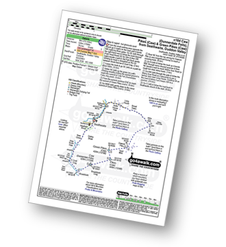
Route Summary:
Seathwaite (Duddon Valley) - Newfield Wood - Dobby Shaw - New Close - How Scale Haw - Old Park Beck - Broadslack - Caw (Dunnerdale Fells) - Pikes (Caw) - Green Pikes (Caw) - Dawson Pike - Walna Scar Road - Broad Haws - Hollin House Haw - Tarn Beck - Seathwaite (Duddon Valley)

|
Vital Statistics:
| Length: | 13.75 miles (22 km) |
| Ascent: | 4,982ft (1,519m) |
| Time: | 10 hrs |
| Grade: | |

Route Summary:
Eskdale - Wha House Farm - Hare Crag - Quagrigg Moss - Slight Side - Sca Fell - Symonds Knott - Scafell Pike - Broad Crag - Ill Crag - Great End - Esk Hause - Lingcove Bridge - Great Moss - Eskdale

|
Vital Statistics:
| Length: | 8.75 miles (14 km) |
| Ascent: | 3,584ft (1,092m) |
| Time: | 6.75hrs |
| Grade: | |

Route Summary:
Low Tilberthwaite - Above Beck Fells - Hole Rake - Red Gill Head Moss - Steel Edge - Lad Stones - Wetherlam - Red Dell Head Moss - Black Sails - Keld Gill Head - Swirl Hawse - Prison Band - Swirl How - Great Carrs - Little Carrs - Hell Gill Pike - Wet Side Edge - High End - Greenburn Beck - Low Tilberthwaite

|
Vital Statistics:
| Length: | 7.5 miles (12 km) |
| Ascent: | 3,218ft (981m) |
| Time: | 6 hrs |
| Grade: | |

Route Summary:
Wasdale Head - Lingmell Gill - Brown Tongue - Hollow Stones - Mickledore - Scafell Pike - The Corridor Route - Sty Head - Lingmell Beck - Gable Beck Bridge - Wasdale Head - Wast Water.

|
Vital Statistics:
| Length: | 10.5 miles (17 km) |
| Ascent: | 4,693ft (1,430m) |
| Time: | 8½ hrs |
| Grade: | |

Route Summary:
Seatoller - Strands Bridge - Borrowdale - The Combe - Thornythwaite Fell - Comb Head - Glaramara - Looking Steads (Glaramara) - Red Beck - Red Beck Top - Allen Gill - High House Tarn - High House Tarn Top - Allen Crags - Esk Hause - Ruddy Gill - Sprinkling Tarn - Sty Head - Great Gable - Westmorland Cairn - Windy Gap - Green Gable - Gillercomb Head - Brandreth - Grey Knotts - Honister Hause - Honister Pass - Wainwright's Coast to Coast Walk - Seatoller

|
Vital Statistics:
| Length: | 10 miles (16 km) |
| Ascent: | 3,401ft (1,037m) |
| Time: | 7 hrs |
| Grade: | |

Route Summary:
Eskdale - Wha House Farm - Hare Crag - Goat Crag - Dawsonground Crags - Cat Crag - Quagrigg Moss - Slight Side - Sca Fell - Symonds Knott - Hard Rigg - Burnmoor Tarn - Eel Tarn - Christcliff - Wha House Farm - Eskdale

|
Vital Statistics:
| Length: | 9.5 miles (15 km) |
| Ascent: | 3,523ft (1,074m) |
| Time: | 7 hrs |
| Grade: | |

Route Summary:
Walna Scar Road (nr Seathwaite (Duddon Valley) - Long Houses - Brown Pike - Dow Crag - Goat's Hawse - The Old Man of Coniston - Brim Fell - Levers Hawse - Swirl Band - Swirl How - Great Carrs - Grey Friar - Seathwaite Tarn - Walna Scar Road.

|
Vital Statistics:
| Length: | 10 miles (16 km) |
| Ascent: | 1,364ft (416m) |
| Time: | 5 hrs |
| Grade: | |
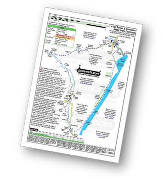
Route Summary:
Coniston - Walna Scar Road - Banishead - Torver Beck - Torver - Beckstones - The Cumbria Way - Coniston Water - Coniston Sailing Club - Coniston Hall - Coniston

|
Vital Statistics:
| Length: | 6.25 miles (10 km) |
| Ascent: | 601ft (183m) |
| Time: | 3 hrs |
| Grade: | |

Route Summary:
Eskdale - Boot - Dalegarth Station - River Esk - Doctor Bridge - Jubilee Bridge - Hardknott Pass - Brotherilkeld - Taw House Farm - Boot - Eskdale

|
Vital Statistics:
| Length: | 12.5 miles (20 km) |
| Ascent: | 4,684ft (1,428m) |
| Time: | 9.25hrs |
| Grade: | |

Route Summary:
Great Langdale - The Old Dungeon Ghyll - The Cumbria Way - Mickleden Beck - Mickleden - Rossett Beck - Rossett Pike - Angle Tarn (Langdale) - Esk Hause - Great End - Ill Crag - Broad Crag - Scafell Pike - Esk Hause - Esk Pike - Ore Gap - Bow Fell (Bowfell) (North Top) - Bow Fell (Bowfell) - Bowfell Buttress - Cambridge Crag - Flat Crag - Climbers' Traverse (optional) - Three Tarns - The Band - Oxendale - Stool End Farm - The Old Dungeon Ghyll - Great Langdale

|
Vital Statistics:
| Length: | 8.5 miles (13.5 km) |
| Ascent: | 2,402ft (732m) |
| Time: | 5½ hrs |
| Grade: | |
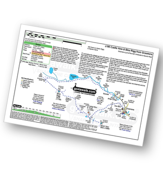
Route Summary:
Grasmere - Castle How - Blea Rigg - Easedale Tarn - Sour Milk Gill - Easedale - Goody Bridge - Grasmere

|
Vital Statistics:
| Length: | 9 miles (14.5 km) |
| Ascent: | 3,696ft (1,126m) |
| Time: | 7 hrs |
| Grade: | |

Route Summary:
Wasdale Head - Wast Water - Lingmell - Lingmell Col - Scafell Pike - Broad Crag - Ill Crag - Great End - Esk Hause - Sty Head - Lingmell Beck - Gable Beck Bridge - Wasdale Head - Wast Water.

|
Vital Statistics:
| Length: | 8.5 miles (13.5 km) |
| Ascent: | 1,953ft (595m) |
| Time: | 5 hrs |
| Grade: | |

Route Summary:
Stanley Force NT Car Park - Eskdale - Boot - River Esk - Low Birker - Crook Crag - Green Crag (Ulpha Fell) - Great Worm Crag - Brown Rigg - Sike Moss - Birkerthwaite - Low Ground Cottages - Stanley Force - River Esk - Stanley Force NT Car Park - Eskdale

|
Vital Statistics:
| Length: | 7 miles (11 km) |
| Ascent: | 1,920ft (585m) |
| Time: | 4½ hrs |
| Grade: | |

Route Summary:
Elterwater - Blea Tarn (Langdale) - Side Pike - Fat Man's Agony (or Fat Man's Struggle) - Lingmoor Fell - Dale End - Birk Howe - Slater Bridge - Little Langdale Tarn - Bridge End - Fell Foot Bridge - Castle Howe - Blea Tarn (Langdale) - Elterwater

|
Vital Statistics:
| Length: | 7.25 miles (11.5 km) |
| Ascent: | 3,046ft (928m) |
| Time: | 5.75hrs |
| Grade: | |

Route Summary:
Great Langdale - The New Dungeon Ghyll - Stickle Ghyll - Whitegill Crag - Blea Rigg - Sergeant Man - High Raise (Langdale) - The Langdale Pikes - Thunacar Knott - Pavey Ark - Harrison Stickle - Pike of Stickle (Pike O' Stickle) - Loft Crag - Mark Gate - The New Dungeon Ghyll - Great Langdale

|
Vital Statistics:
| Length: | 5 miles (8 km) |
| Ascent: | 1,935ft (590m) |
| Time: | 4 hrs |
| Grade: | |

Route Summary:
Coniston - Walna Scar Road - Goat's Water - The Old Man of Coniston - Low Water - Walna Scar Road - Coniston

|
Vital Statistics:
| Length: | 9.5 miles (15 km) |
| Ascent: | 3,477ft (1,060m) |
| Time: | 7 hrs |
| Grade: | |

Route Summary:
Seathwaite (Borrowdale) - Grains Gill - Styhead Gill - Styhead Tarn - Corridor Route - Scafell Pike - Broad Crag - Ill Crag - Great End - Esk Hause - Grains Gill - Seathwaite (Borrowdale)

|
Vital Statistics:
| Length: | 5.5 miles (9 km) |
| Ascent: | 1,962ft (598m) |
| Time: | 4 hrs |
| Grade: | |

Route Summary:
Broughton Mills - River Lickle - Green Bank Farm - The Nursery - Hovel Knott - Dunnerdale Fell (Broughton Mills) - Great Stickle (Dunnerdale Fells) - Stickle Pike (Dunnerdale Fells) - Kiln Bank Cross - Park Head Road - Stainton Ground Quarry - Stephenson Haw - Raven's Crag (Stickle Pike) - The Knott (Dunnerdale Fells) - Broughton Mills

|
Vital Statistics:
| Length: | 10 miles (16 km) |
| Ascent: | 3,584ft (1,092m) |
| Time: | 7 hrs |
| Grade: | |

Route Summary:
Coniston - Church Beck - Levers Water Beck - Crowberry Haws - Low Water - Brim Fell - Levers Hawse - Swirl Band - Swirl How - Prison Band - Swirl Hawse - Keld Gill Head - Black Sails - Red Dell Head Moss - Wetherlam - Furness Fells - Coniston

|
Vital Statistics:
| Length: | 4.5 miles (7.5 km) |
| Ascent: | 2,645ft (806m) |
| Time: | 4½ hrs |
| Grade: | |

Route Summary:
Great Langdale - The New Dungeon Ghyll - Great Langdale - Stickle Ghyll - Stickle Tarn - Jack's Rake - The Langdale Pikes - Pavey Ark - Thunacar Knott - Harrison Stickle - Pike of Stickle (Pike O' Stickle) - Loft Crag - Mark Gate - The New Dungeon Ghyll - Great Langdale

|
Vital Statistics:
| Length: | 7.5 miles (12 km) |
| Ascent: | 4,195ft (1,279m) |
| Time: | 7 hrs |
| Grade: | |

Route Summary:
Wasdale Head - (National Trust Campsite) - Wast Water - Lingmell - Corridor Route - Scafell Pike - Mickledore - Foxes Tarn - Symonds Knott - Sca Fell - Lingmell Gill - Wasdale Head - Wast Water.

|
Vital Statistics:
| Length: | 7 miles (11 km) |
| Ascent: | 1,976ft (602m) |
| Time: | 4½ hrs |
| Grade: | |

Route Summary:
Elterwater - Elterwater Bridge - Dale End - Lingmoor Fell - Fat Man's Agony (or Fat Man's Struggle) - Side Pike - Great Langdale - Side House Farm - The Cumbria Way - Oak Howe - Chapel Stile - Elterwater Bridge - Elterwater

|
Vital Statistics:
| Length: | 7.75 miles (12.5 km) |
| Ascent: | 4,808ft (1,465m) |
| Time: | 7.75hrs |
| Grade: | |

Route Summary:
Wasdale Head - Kirk Fell - Kirk Fell (East Top) - Black Sail Pass - Looking Stead (Pillar) - High Level Route - Robinson's Cairn - Pillar - Wind Gap - Black Crag (Pillar) - Scoat Fell (Little Scoat Fell) - Steeple - Red Pike (Wasdale) - Dore Head - Mosedale Beck - Wasdale Head - Wast Water.

|
Vital Statistics:
| Length: | 7.5 miles (12 km) |
| Ascent: | 2,762ft (842m) |
| Time: | 5.25hrs |
| Grade: | |

Route Summary:
Coniston - Walna Scar Road - Boo Tarn - The Old Man of Coniston - Brim Fell - Levers Water - Boulder Valley - Crowberry Haws - Miners Bridge - Coniston

|
Vital Statistics:
| Length: | 4.5 miles (7 km) |
| Ascent: | 1,902ft (580m) |
| Time: | 3½ hrs |
| Grade: | |

Route Summary:
Great Langdale - The Old Dungeon Ghyll - Wall End Farm - Redacre Gill - Wrynose Fell - Pike of Blisco (Pike O' Blisco) - Red Tarn (Langdale) - Browney Gill - Oxendale Beck - Oxendale - Stool End Farm - The Old Dungeon Ghyll - Great Langdale

|
Vital Statistics:
| Length: | 6.5 miles (10.5 km) |
| Ascent: | 1,453ft (443m) |
| Time: | 4 hrs |
| Grade: | |

Route Summary:
Seathwaite (Duddon Valley) - Hollin House Haw - Tarn Beck - Worm How - Trountal Tongue - Throng Close - Foss How - Brow Side - Pike How - Birks Bridge - Birks Farm Field Centre - Dunnerdale Forest - Grassguards Farm - Basin Barrow - Rowantree How - Wallowbarrow Crag - Wallowbarrow Farm - Seathwaite (Duddon Valley)

|
Vital Statistics:
| Length: | 9.75 miles (15.5 km) |
| Ascent: | 5,140ft (1,567m) |
| Time: | 8.75hrs |
| Grade: | |

Route Summary:
Wasdale Head - (National Trust Campsite) - Wast Water - Lingmell - Middleboot Knotts - Round How (Scafell) - Great End - Ill Crag - Broad Crag - Scafell Pike - Mickledore - Foxes Tarn - Symonds Knott - Sca Fell - Wast Water.

|
Vital Statistics:
| Length: | 10 miles (16 km) |
| Ascent: | 4,007ft (1,221m) |
| Time: | 7½ hrs |
| Grade: | |

Route Summary:
Great Langdale - The Old Dungeon Ghyll - Wall End Farm - Redacre Gill - Wrynose Fell - Pike of Blisco (Pike O' Blisco) - Red Tarn (Langdale) - Cold Pike - Cold Pike (West Top) - Cold Pike (Far West Top) - Great Knott - Little Stand - Great Knott - Crinkle Crags (South Top) - Crinkle Crags (Long Top) - Crinkle Crags (Gunson Knott) - Shelter Crags - Shelter Crags - (North Top) - Three Tarns - Earing Crag - White Stones - The Band - Oxendale - Stool End Farm - The Old Dungeon Ghyll - Great Langdale

|
Vital Statistics:
| Length: | 6.25 miles (10 km) |
| Ascent: | 1,756ft (535m) |
| Time: | 4 hrs |
| Grade: | |
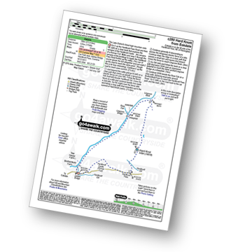
Route Summary:
Eskdale - Jubilee Bridge - Hardknott Pass - Hardknott Castle. (Roman Fort) - Hardknott Pass - Hard Knott - Yew Bank - Lingcove Beck - Lingcove Bridge - Great Moss - River Esk - Jubilee Bridge - Eskdale

|
Vital Statistics:
| Length: | 8.25 miles (13 km) |
| Ascent: | 2,924ft (891m) |
| Time: | 6 hrs |
| Grade: | |

Route Summary:
Great Langdale - The New Dungeon Ghyll - Stickle Ghyll - Stickle Tarn - North Rake - The Langdale Pikes - Pavey Ark - Thunacar Knott - Harrison Stickle - Loft Crag - Pike of Stickle (Pike O' Stickle) - Martcrag Moor - Stake Pass - The Cumbria Way - Stake Gill - Mickleden - Mickleden Beck - The New Dungeon Ghyll - Great Langdale

|
Vital Statistics:
| Length: | 5 miles (8 km) |
| Ascent: | 2,002ft (610m) |
| Time: | 4 hrs |
| Grade: | |
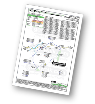
Route Summary:
Eskdale - Jubilee Bridge - Eskdale - Dobknott Gill - Spothow Gill - Harter Fell (Eskdale) - Dunnerdale Forest - Hardknott Pass - Hardknott Castle (Roman Fort) - Jubilee Bridge - Eskdale

|
Vital Statistics:
| Length: | 6.25 miles (10 km) |
| Ascent: | 1,968ft (600m) |
| Time: | 4.25hrs |
| Grade: | |
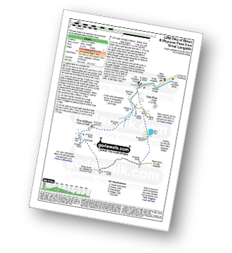
Route Summary:
Great Langdale - The Old Dungeon Ghyll - Wall End Farm - Redacre Gill - Wrynose Fell - Pike of Blisco (Pike O' Blisco) - Red Tarn (Langdale) - Wrynose Pass - Blea Tarn (Langdale) - The Old Dungeon Ghyll - Great Langdale

|
Vital Statistics:
| Length: | 9.75 miles (15.5 km) |
| Ascent: | 3,046ft (928m) |
| Time: | 6½ hrs |
| Grade: | |

Route Summary:
Seatoller - Strands Bridge - Borrowdale - The Combe - Thornythwaite Fell - Comb Head - Glaramara - Looking Steads (Glaramara) - Red Beck - Red Beck Top - Allen Gill - High House Tarn - High House Tarn Top - Allen Crags - Esk Hause - Ruddy Gill - Sprinkling Tarn - Sty Head - Sty Head Tarn - Sty Head Gill - Stockley Bridge - Grains Gill - Seathwaite (Borrowdale) - The Allerdale Ramble - Seatoller

|
Vital Statistics:
| Length: | 10.25 miles (16.5 km) |
| Ascent: | 3,128ft (953m) |
| Time: | 6.75hrs |
| Grade: | |

Route Summary:
Grasmere - Goody Bridge - High Raven Crag - Helm Crag - The Lion and The Lamb - The Howitzer - Gibson Knott - Calf Crag - Brownrigg Moss - Greenup Edge - High Raise (Langdale) - Sergeant Man - Belles Knott - Coledale Tarn - Easedale Tarn - Sour Milk Gill - Easedale - Grasmere

|
Vital Statistics:
| Length: | 8 miles (12 km) |
| Ascent: | 3,042ft (927m) |
| Time: | 5.75hrs |
| Grade: | |

Route Summary:
Fell Foot Bridge - Little Langdale - Hollin Crag - Wet Side Edge - Little Carrs - Great Carrs - Swirl How - Swirl Hawse - Keld Gill Head - Black Sails - Red Dell Head Moss - Wetherlam - Wetherlam Edge - Birk Fell - Greenburn Beck - Fell Foot Bridge

|
Vital Statistics:
| Length: | 9.75 miles (15.5 km) |
| Ascent: | 3,664ft (1,117m) |
| Time: | 7.25hrs |
| Grade: | |

Route Summary:
Coniston - Church Beck - Levers Water Beck - Crowberry Haws - Low Water - The Old Man of Coniston - Brim Fell - Levers Hawse - Swirl Band - Swirl How - Prison Band - Swirl Hawse - Keld Gill Head - Black Sails - Red Dell Head Moss - Wetherlam - Furness Fells - Coniston

|
Vital Statistics:
| Length: | 11 miles (17.5 km) |
| Ascent: | 1,418ft (432m) |
| Time: | 5½ hrs |
| Grade: | |
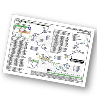
Route Summary:
Gosforth - Rowend Bridge - River Bleng - Bleng Bridge - Hall Bolton - Bolton Head - Low Thistleton Farm - High Thistleton Farm - Guards Head Farm - Hollow Moor - Brown Edge - Blengdale Forest - River Bleng - Scalderskew Beck - Ponsonby Fell - Scargreen Farm - Gidd Hall Farm - Ponsonby Old Hall - Middle Boonwood - Gosforth

|
Vital Statistics:
| Length: | 6 miles (9.5 km) |
| Ascent: | 2,504ft (763m) |
| Time: | 4.75hrs |
| Grade: | |

Route Summary:
Greendale Farm - Gill Farm - Gill Beck - Buckbarrow - Glade How - Cat Bields - Nether Wasdale Common - Seatallan - Pots of Ashness - Windscale Hows - Middle Fell (Wasdale) - Greendale Gill - Greendale Farm

|
Vital Statistics:
| Length: | 12 miles (19 km) |
| Ascent: | 3,502ft (1,067m) |
| Time: | 7.75hrs |
| Grade: | |

Route Summary:
Stonethwaite - Wainwright's Coast to Coast Walk - Stonethwaite Beck - Galleny Force - The Cumbria Way - Langstrath Beck - Stake Pass - Pike of Stickle (Pike O' Stickle) - Harrison Stickle - Thunacar Knott - High Raise (Langdale) - Low White Stones - Greenup Edge - Ullscarf - Low Saddle (Coldbarrow Fell) - Willygrass Gill - Dock Tarn.

|
Vital Statistics:
| Length: | 11 miles (17 km) |
| Ascent: | 4,001ft (1,219m) |
| Time: | 8 hrs |
| Grade: | |

Route Summary:
Wasdale Head - Mosedale Beck - Black Sail Pass - High Level Route - Robinson's Cairn - Pillar - Wind Gap - Black Crag (Pillar) - Scoat Fell (Little Scoat Fell) - Red Pike (Wasdale) - Dore Head - Over Beck - Wasdale Head - Wast Water.

|
Vital Statistics:
| Length: | 7 miles (11 km) |
| Ascent: | 2,422ft (738m) |
| Time: | 5 hrs |
| Grade: | |
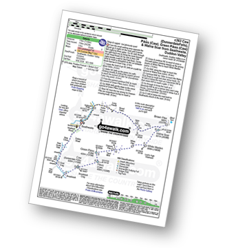
Route Summary:
Seathwaite (Duddon Valley) - Newfield Wood - Dobby Shaw - New Close - How Scale Haw - Old Park Beck - Broadslack - Caw (Dunnerdale Fells) - Pikes (Caw) - Green Pikes (Caw) - Dawson Pike - White Pike - White Maiden - Walna Scar - Walna Scar Road - Broad Haws - Hollin House Haw - Tarn Beck - Seathwaite (Duddon Valley)

|
Vital Statistics:
| Length: | 9.75 miles (15.5 km) |
| Ascent: | 3,236ft (986m) |
| Time: | 6.75hrs |
| Grade: | |
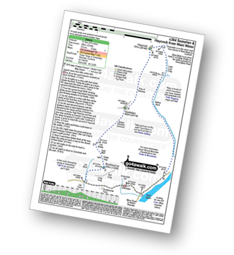
Route Summary:
Greendale Farm - Gill Farm - Buckbarrow - Seatallan - Pots of Ashness - Gowder Crag - Haycock - Little Lad Crag - Nether Beck - Wast Water - Wasdale - Greendale Farm

|
Vital Statistics:
| Length: | 8.5 miles (13.5 km) |
| Ascent: | 3,289ft (1,020m) |
| Time: | 6½ hrs |
| Grade: | |
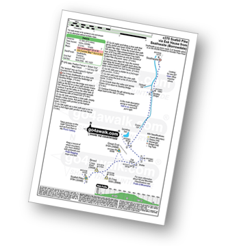
Route Summary:
Seathwaite (Borrowdale) - Stockley Bridge - Grains Gill - Ruddy Gill - Sprinkling Tarn - Esk Hause - Scafell Pike - Esk Hause - Grains Gill - Stockley Bridge - Seathwaite (Borrowdale)

|
Vital Statistics:
| Length: | 9 miles (14.5 km) |
| Ascent: | 3,459ft (1,054m) |
| Time: | 6.75hrs |
| Grade: | |

Route Summary:
Great Langdale - Old Dungeon Ghyll - The Cumbria Way - Mickleden Beck - Mickleden (Langdale) - Rossett Beck - Rossett Pike - Angle Tarn (Langdale) - Esk Hause - Esk Pike - Ore Gap - Bow Fell (Bowfell) (North Top) - Bow Fell (Bowfell) - Bowfell Buttress - Cambridge Crag - Flat Crag - Climbers' Traverse (optional) - Three Tarns - Earing Crag - White Stones - The Band - Oxendale - Stool End Farm - The Old Dungeon Ghyll - Great Langdale

|
Vital Statistics:
| Length: | 10.25 miles (16.5 km) |
| Ascent: | 2,198ft (670m) |
| Time: | 6 hrs |
| Grade: | |
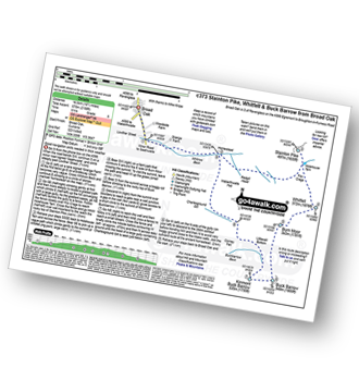
Route Summary:
Broad Oak - Whitrow Beck - Waberthwaite Fell - Rowantree Falls - Stainton Pike - Whitfell (Whit Fell) - Burn Moor - Buck Barrow - Kinmont Buck Barrow - Whitrow Beck - Broad Oak

|
Vital Statistics:
| Length: | 5.25 miles (8.5 km) |
| Ascent: | 2,123ft (647m) |
| Time: | 4 hrs |
| Grade: | |

Route Summary:
Wasdale Head - Mosedale Beck - Dore Head - Yewbarrow (North Top) - Yewbarrow - Bell Rib - Dropping Crag - Over Beck - Overbeck Bridge - Wasdale Head - Wast Water.

|
Vital Statistics:
| Length: | 10.5 miles (17 km) |
| Ascent: | 3,384ft (1,031m) |
| Time: | 7.25hrs |
| Grade: | |

Route Summary:
Stonethwaite - Big Stanger Gill - Hanging Haystack Crag - Alisongrass Crag - Rosthwaite Fell (Bessyboot) - Tarn At Leaves - Rosthwaite Cam (Rosthwaite Fell) - Dovenest Top - Combe Door Top - Combe Head - Glaramara - Looking Steads (Glaramara) - Red Beck Top - High House Tarn Top - Allen Crags - Esk Hause - Allencrags Gill - Langstrath - Stonethwaite

|
Vital Statistics:
| Length: | 6.25 miles (10 km) |
| Ascent: | 1,382ft (421m) |
| Time: | 4 hrs |
| Grade: | |
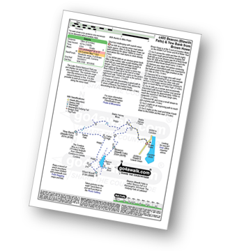
Route Summary:
Brown Howe Car Park - Coniston Water - Beacon (Blawith Fells) - Beacon Tarn - Tarn Beck - The Cumbria Way - Wool Knott - Fisher High - Rattan Haw - Yew Bank (Blawith Fells) - Stable Harvey Moss - Brown Howe - Coniston Water.

|
Vital Statistics:
| Length: | 12.25 miles (19.5 km) |
| Ascent: | 3,568ft (1,087m) |
| Time: | 8 hrs |
| Grade: | |

Route Summary:
Eskdale - The Woolpack Inn - Doctor Bridge - Low Birker - Birker Force - Low Birker Tarn - Green Crag (Ulpha Fell) - Crook Crag - Harter Fell (Eskdale) - Dunnerdale Forest - Hardknott Pass - Hardknott Gill - Hard Knott - Yew Bank - Lingcove Beck - Lingcove Bridge - Great Moss - Brotherilkeld - Taw House Farm - Wha House Farm - The River Esk - The Woolpack Inn - Eskdale

|
Vital Statistics:
| Length: | 9 miles (14.5 km) |
| Ascent: | 3,387ft (1,032m) |
| Time: | 6.75hrs |
| Grade: | |

Route Summary:
Great Langdale - The Old Dungeon Ghyll - Oxendale - Oxendale Beck - Red Tarn (Langdale) - Great Knott - Crinkle - Crags (South Top) - Bad Step - Crinkle Crags (Long Top) - Crinkle Crags (Gunson Knott) - Shelter Crags - Shelter Crags (North Top) - Three Tarns - Climbers' Traverse (optional) - Flat Crag - Cambridge Crag - Bowfell Buttress - Bow Fell (Bowfell) - Three Tarns - Earing Crag - White Stones - The Band - Stool End Farm - Mickleden Beck - Mickleden - The Old Dungeon Ghyll - Great Langdale

|
Vital Statistics:
| Length: | 11.25 miles (18 km) |
| Ascent: | 3,883ft (1,183m) |
| Time: | 8 hrs |
| Grade: | |

Route Summary:
Great Langdale - The Old Dungeon Ghyll - The Cumbria Way - Mickleden Beck - Rossett Gill - Rossett Pike - Angle Tarn (Langdale) - Esk Hause - Scafell Pike - Ill Crag - Broad Crag - Great End - Esk Hause - Angle Tarn - Rossett Gill - Mickleden - Mickleden Beck - The Cumbria Way - The Old Dungeon Ghyll - Great Langdale

|
Vital Statistics:
| Length: | 10 miles (16 km) |
| Ascent: | 3,580ft (1,091m) |
| Time: | 7.25hrs |
| Grade: | |

Route Summary:
Great Langdale - The New Dungeon Ghyll - Stickle Ghyll - Stickle Tarn - North Rake - The Langdale Pikes - Pavey Ark - Thunacar Knott - Harrison Stickle - Loft Crag - Pike of Stickle (Pike o' Stickle) - Martcrag Moor - Stake Pass - Black Crags (Langdale) - Little Gill Head - Rossett Pike - Rossett Gill - The Cumbria Way - Mickleden - Mickleden Beck - The New Dungeon Ghyll - Great Langdale

|
Vital Statistics:
| Length: | 12.75 miles (20.5 km) |
| Ascent: | 4,191ft (1,277m) |
| Time: | 8.75hrs |
| Grade: | |

Route Summary:
Coniston - Walna Scar Road - Boo Tarn - Torver Beck - Cove Bridge - Goat's Water - Goat's Hawse - Dow Crag - Goat's Hawse - The Old Man of Coniston - Brim Fell - Levers Hawse - Grey Friar - Great Carrs - Swirl How - Prison Band - Keld Gill Head - Black Sails - Wetherlam - Swirl Hawse - Levers Water - Crowberry Haws - Walna Scar Road - Coniston

|
Vital Statistics:
| Length: | 15.25 miles (24.5 km) |
| Ascent: | 4,841ft (1,475m) |
| Time: | 10½ hrs |
| Grade: | |

Route Summary:
Wasdale Head - (National Trust Campsite) - Wast Water - Lingmell Gill - Illgill Head - Whin Rigg - Greathall Gill - Low Wood - Lund Bridge - Woodhow Farm - Woodhow Tarn - Scale Farm - Tosh Tarn - Gill Farm - Gill Beck - Buckbarrow - Cold Well - Nether Wasdale Common - Seatallan - Windscale Hows - Middle Fell (Wasdale) - Greendale Farm - Nether Beck - Overbeck Bridge - Wasdale Head - Wast Water.

|
Vital Statistics:
| Length: | 11.75 miles (19 km) |
| Ascent: | 4,680ft (1,426m) |
| Time: | 9 hrs |
| Grade: | |

Route Summary:
Great Langdale - The Old Dungeon Ghyll - Wall End Farm - Redacre Gill - Wrynose Fell - Pike of Blisco (Pike O' Blisco) - Red Tarn (Langdale) - Great Knott - Crinkle Crags (South Top) - Crinkle Crags (Long Top) - Crinkle Crags (Gunson Knott) - Shelter Crags - Shelter Crags (North Top) - Three Tarns - Climbers' Traverse (optional) - Flat Crag - Cambridge Crag - Bowfell Buttress - Bow Fell (Bowfell) - Bow Fell (Bowfell) (North Top) - Ore Gap - Angle Tarn (Langdale) - Rossett Pike - Rossett Beck - Mickleden - Mickleden Beck - The Cumbria Way - The Old Dungeon Ghyll - Great Langdale

|
Vital Statistics:
| Length: | 8.5 miles (13.5 km) |
| Ascent: | 2,645ft (806m) |
| Time: | 5.75hrs |
| Grade: | |

Route Summary:
Silecroft - Whicham Church - Kirkbank Farm - Townend Knotts - Black Combe - Blackcombe Screes - Whitcombe Screes - Stoupdale Head - White Combe - White Hall Knott - Whitecombe Beck - Parsonage Breast - Kirkbank Farm - Whicham Church.

|
Vital Statistics:
| Length: | 8.75 miles (14 km) |
| Ascent: | 2,347ft (715m) |
| Time: | 5½ hrs |
| Grade: | |

Route Summary:
Miterdale Bridge - Porterthwaite - Miterdale Forest - Irton Fell - Greathall Gill - Whin Rigg - Illgill Head - Burnmoor Tarn - Burnmoor Lodge - Eskdale Moor - Ellerhow Moss - Boat How - Low Longrigg - River Mite - Low Place Farm - Miterdale Bridge

|
Vital Statistics:
| Length: | 11 miles (17.5 km) |
| Ascent: | 5,409ft (1,648m) |
| Time: | 9½ hrs |
| Grade: | |

Route Summary:
Wasdale Head - (National Trust Campsite) - Wast Water - Lingmell - Corridor Route - Great End - Ill Crag - Broad Crag - Scafell Pike - Mickledore - Foxes Tarn - Symonds Knott - Sca Fell - Slight Side - Broad Tongue - Hardrigg Gill - Wasdale Head - Wast Water.

|
Vital Statistics:
| Length: | 9 miles (14.5 km) |
| Ascent: | 3,236ft (986m) |
| Time: | 6.75hrs |
| Grade: | |

Route Summary:
Seathwaite (Borrowdale) - Grains Gill - Stockley Bridge - Styhead Gill - Styhead Tarn - Sty Head - The Corridor Route - Skew Gill - Greta Gill - Piers Gill - Scafell Pike - The Corridor Route - Sty Head - Stockley Bridge - Seathwaite (Borrowdale)

|
Vital Statistics:
| Length: | 6.25 miles (10 km) |
| Ascent: | 1,611ft (491m) |
| Time: | 4 hrs |
| Grade: | |

Route Summary:
Birker Fell - Tewit Moss - Rough Crag (Birker Fell) - Water Crag (Birker Fell) - Linbeck Gill - Birkby Fell - The Knott (Stainton Fell) - White Pike (Birkby Fell) - Yoadcastle - Woodend Height (Yoadcastle) - Cockly Moss - Rowantree How - Devoke Water - Washfold Point - Seat How (Birker Fell) - Tewit Moss - Birker Fell

|
Vital Statistics:
| Length: | 4.5 miles (7 km) |
| Ascent: | 1,559ft (475m) |
| Time: | 3.25hrs |
| Grade: | |
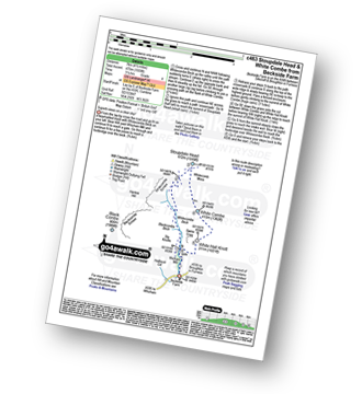
Route Summary:
Beckside Farm - Whitecombe Beck - Whitcombe Screes - Stoupdale Head - White Combe - White Hall Knott - Whitecombe Beck - Beckside Farm

|
Vital Statistics:
| Length: | 8.75 miles (14 km) |
| Ascent: | 2,271ft (692m) |
| Time: | 5½ hrs |
| Grade: | |

Route Summary:
Great Langdale - Old Dungeon Ghyll - The Cumbria Way - Mickleden Beck - Mickleden (Langdale) - Rossett Beck - Rossett Pike - Little Gill Head - Black Crags (Langdale) - Stake Pass - The Cumbria Way - Stake Gill - Mickleden - Mickleden Beck - The New Dungeon Ghyll - Great Langdale
See this list of walks, routes & maps in:
Grade Order | Length Order | Time Order | Walk Number or Start Location Order
NB. To reverse (toggle) this order, click Grade Order again