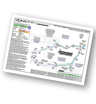
14 easy to follow walk route maps of all grades that include part of The St Cuthbert's Way

The St Cuthbert's Way is a 100km (62 miles) linear footpath connecting Melrose Abbey in The Borders, Scotland with Holy Island (Lindisfarne) in Northumberland, England.

The St Cuthbert's Way is waymarked by a Celtic Cross.


See this list of walks, routes & maps in:

Grade Order | Length Order | Time Order | Walk Number or Start Location Order
NB. To reverse (toggle) this order, click Start Order again


Walk 1 Walking Bootprint Icon

Walk n146 Wooler Common and Happy Valley (Low Level Route) from Wooler

Lovely Happy Valley

Download GPS Waypoint Data for walk n146
Download GPX Waypoint Data for walk n146
Download Map and Route Details for walk n146

Vital Statistics:

Length:6.5 miles (10.5 km)
Ascent:1,043ft (318m)
Time:3½ hrs
Grade:Grade 4 Walking Moderate
Walk 2 Walking Bootprint Icon

Walk n107 Wooler Common and Happy Valley (High Level Route) from Wooler

Fine views down into Happy Valley

Download GPS Waypoint Data for walk n107
Download GPX Waypoint Data for walk n107
Download Map and Route Details for walk n107

Vital Statistics:

Length:7.5 miles (12 km)
Ascent:1,257ft (383m)
Time:4½ hrs
Grade:Grade 5 Walking Moderate
Walk 3 Walking Bootprint Icon

Walk n204 Commonburn House from Wooler

Fine wild walk in the Cheviot foothills

Download GPS Waypoint Data for walk n204
Download GPX Waypoint Data for walk n204
Download Map and Route Details for walk n204

Vital Statistics:

Length:10.75 miles (17 km)
Ascent:1,746ft (532m)
Time:5.75hrs
Grade:Grade 6 Walking Moderate
Walk 4 Walking Bootprint Icon

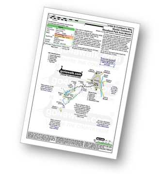
Walk n164 St Cuthbert's Way, Wooler Common and Woodland Park from Wooler

Easy walk to a delightful pool

Download GPS Waypoint Data for walk n164
Download GPX Waypoint Data for walk n164
Download Map and Route Details for walk n164

Vital Statistics:

Length:3.25 miles (5 km)
Ascent:525ft (160m)
Time:1.75hrs
Grade:Grade 2 Walking Easy
Walk 5 Walking Bootprint Icon

Walk n135 Weetwood Moor, Dod Law and Doddington from Wooler

Fine views of The Cheviot Hills

Download GPS Waypoint Data for walk n135
Download GPX Waypoint Data for walk n135
Download Map and Route Details for walk n135

Vital Statistics:

Length:8.5 miles (13.5 km)
Ascent:1,093ft (333m)
Time:4.25hrs
Grade:Grade 4 Walking Moderate
Walk 6 Walking Bootprint Icon

Walk n170 Weetwood Moor, Dod Law, Doddington and The River Glen from Wooler

Fine views of The Cheviot Hills

Download GPS Waypoint Data for walk n170
Download GPX Waypoint Data for walk n170
Download Map and Route Details for walk n170

Vital Statistics:

Length:10.25 miles (16.5 km)
Ascent:1,182ft (360m)
Time:5 hrs
Grade:Grade 5 Walking Moderate
Walk 7 Walking Bootprint Icon

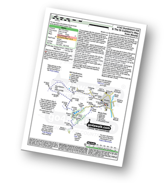
Walk n143 Humbleton Hill and The St Cuthbert's Way from Wooler

Steep but short climb to superb views

Download GPS Waypoint Data for walk n143
Download GPX Waypoint Data for walk n143
Download Map and Route Details for walk n143

Vital Statistics:

Length:5.75 miles (9 km)
Ascent:1,214ft (370m)
Time:3½ hrs
Grade:Grade 4 Walking Moderate
Walk 8 Walking Bootprint Icon

Walk bo124 Hownam Law from Morebattle

Superb, extensive views over the Merse of Scotland and the Border hills

Download GPS Waypoint Data for walk bo124
Download GPX Waypoint Data for walk bo124
Download Map and Route Details for walk bo124

Vital Statistics:

Length:8.75 miles (14 km)
Ascent:1,260ft (384m)
Time:4½ hrs
Grade:Grade 5 Walking Moderate
Walk 9 Walking Bootprint Icon

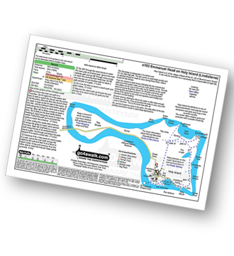
Walk n103 Emmanuel Head on Holy Island (Lindisfarne)

One of the centres of the ancient Christian world

Download GPS Waypoint Data for walk n103
Download GPX Waypoint Data for walk n103
Download Map and Route Details for walk n103

Vital Statistics:

Length:5 miles (8 km)
Ascent:180ft (55m)
Time:2 hrs
Grade:Grade 1 Walking Easy
Walk 10 Walking Bootprint Icon

Walk n158 Ring Chesters, Eccles Cairn and The Border from Hethpool

Superb Northumberland Views

Download GPS Waypoint Data for walk n158
Download GPX Waypoint Data for walk n158
Download Map and Route Details for walk n158

Vital Statistics:

Length:7.5 miles (12 km)
Ascent:1,316ft (401m)
Time:4 hrs
Grade:Grade 5 Walking Moderate
Walk 11 Walking Bootprint Icon

Walk n141 Ring Chesters from Hethpool

Lovely walk to an ancient hilltop fort

Download GPS Waypoint Data for walk n141
Download GPX Waypoint Data for walk n141
Download Map and Route Details for walk n141

Vital Statistics:

Length:5 miles (8 km)
Ascent:1,021ft (311m)
Time:3 hrs
Grade:Grade 3 Walking Easy
Walk 12 Walking Bootprint Icon

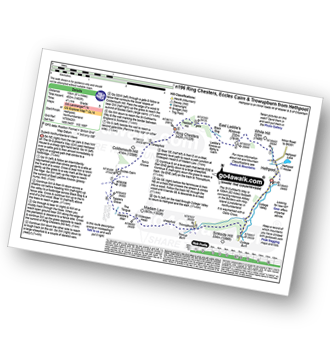
Walk n196 Ring Chesters, Eccles Cairn and Trowupburn from Hethpool

Superb Northumberland views and ancient forts

Download GPS Waypoint Data for walk n196
Download GPX Waypoint Data for walk n196
Download Map and Route Details for walk n196

Vital Statistics:

Length:8.25 miles (13 km)
Ascent:1,483ft (452m)
Time:4½ hrs
Grade:Grade 5 Walking Moderate
Walk 13 Walking Bootprint Icon

Walk n200 The Schil from Hethpool

Superb High Level Northumberland Mountain Walk

Download GPS Waypoint Data for walk n200
Download GPX Waypoint Data for walk n200
Download Map and Route Details for walk n200

Vital Statistics:

Length:13.75 miles (22 km)
Ascent:2,665ft (812m)
Time:7.75hrs
Grade:Grade 7 Walking Hard
Walk 14 Walking Bootprint Icon

Walk n110 The St Cuthbert's Way and Eccles Cairn from Hethpool

Superb Northumberland Views

Download GPS Waypoint Data for walk n110
Download GPX Waypoint Data for walk n110
Download Map and Route Details for walk n110

Vital Statistics:

Length:7.25 miles (11.5 km)
Ascent:1,165ft (355m)
Time:3.75hrs
Grade:Grade 4 Walking Moderate

See this list of walks, routes & maps in:

Grade Order | Length Order | Time Order | Walk Number or Start Location Order
NB. To reverse (toggle) this order, click Start Order again


Follow go4awalk.com on Twitter Follow go4awalk.com on Facebook


Home


Find new Friends to go walking with

Walk all 214 Wainwrights in just 59 Walks. Download GPS Waypoints - Great Walks you must not miss!

Walk The Yorkshire Three Peaks Challenge Walk - All the Latest Route Information, GPS Waypoints and Split Times to keep you on Schedule

Walk The British Three Peaks Challenge Walk - All the Latest Route Information and GPS Waypoints

See our pick of The Best Walks in The Lake District - Great Walks you must not miss!

Walk our pick of the Best Lake District Ridge Walks - Great Walks you must not miss!

Walk our pick of the Best Lake District Walks to do in the rain - Great Walks you must not miss!

Walk our pick of The Best Walks in Snowdonia - Great Walks you must not miss!

Walk our pick of The Best Ridge Walks in Wales - Walks you must not miss!

Walk our pick of The Best Walks in The Brecon Beacons - Great Walks you must not miss!

Walk our pick of The Best Walks in The Yorkshire Dales - Walks you must not miss!

Walk our pick of The Best Walks in The Peak District - Walks you must not miss!

Walk our pick of The Best Walks in The Forest of Bowland - Walks you must not miss!

Walk our pick of The Best Walks in Shropshire - Walks you must not miss!

Walk our pick of The Best Walks in Cheshire - Walks you must not miss!

Walk our pick of The Best Walks in Lancashire - Walks you must not miss!

Not sure where to walk next? Try Peak Bagging - Great Walks you must not miss!

Not sure where to walk next? Walk part of a National Trail - Great Walks you must not miss!

Walks with Downloadable and Uploadable GPS Waypoint Data

Walking Kit and Gear Tested by Walkers

Full Site Search