12 easy to follow walk route maps of all grades that include part of The Shropshire Way

The Shropshire Way is a 224km (139 miles) circular footpath starting and finishing in Wem in Shropshire, England.

The Shropshire Way is waymarked by a buzzard motif.


See this list of walks, routes & maps in:

Grade Order | Length Order | Time Order | Walk Number or Start Location Order
NB. To reverse (toggle) this order, click Number Order again


Walk 1 Walking Bootprint Icon

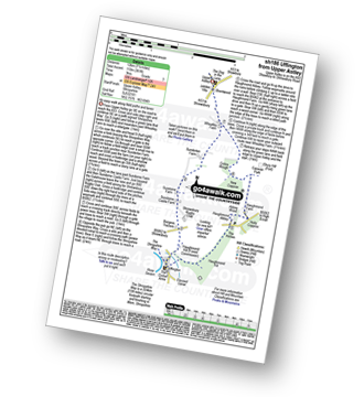
Walk sh186 Uffington from Upper Astley

An easy walk along paths and lanes

Download GPS Waypoint Data for walk sh186
Download GPX Waypoint Data for walk sh186
Download Map and Route Details for walk sh186

Vital Statistics:

Length:7.5 miles (12 km)
Ascent:361ft (110m)
Time:3 hrs
Grade:Grade 3 Walking Easy
Walk 2 Walking Bootprint Icon

Walk sh161 Yorton Heath from Grinshill

Fields and quiet lanes - can be overgrown

Download GPS Waypoint Data for walk sh161
Download GPX Waypoint Data for walk sh161
Download Map and Route Details for walk sh161

Vital Statistics:

Length:6 miles (9.5 km)
Ascent:351ft (107m)
Time:2½ hrs
Grade:Grade 2 Walking Easy
Walk 3 Walking Bootprint Icon

Walk sh157 Sundorme from Upper Astley

An easy walk along paths and lanes

Download GPS Waypoint Data for walk sh157
Download GPX Waypoint Data for walk sh157
Download Map and Route Details for walk sh157

Vital Statistics:

Length:5 miles (8 km)
Ascent:161ft (49m)
Time:2 hrs
Grade:Grade 1 Walking Easy
Walk 4 Walking Bootprint Icon

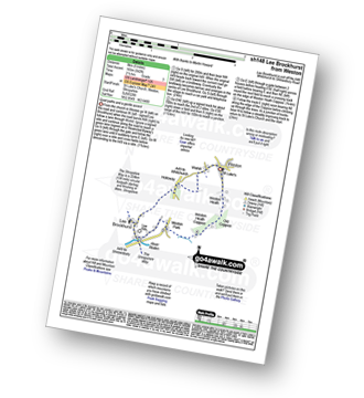
Walk sh148 Lee Brockhurst from Weston

Quiet paths and a gentle ascent

Download GPS Waypoint Data for walk sh148
Download GPX Waypoint Data for walk sh148
Download Map and Route Details for walk sh148

Vital Statistics:

Length:5 miles (8 km)
Ascent:542ft (165m)
Time:2½ hrs
Grade:Grade 3 Walking Easy
Walk 5 Walking Bootprint Icon

Walk sh142 The Stiperstones Ridge (South) from nr Pennerley

Fine ridge walk

Download GPS Waypoint Data for walk sh142
Download GPX Waypoint Data for walk sh142
Download Map and Route Details for walk sh142

Vital Statistics:

Length:5.25 miles (8.5 km)
Ascent:876ft (267m)
Time:3 hrs
Grade:Grade 3 Walking Easy
Walk 6 Walking Bootprint Icon

Walk sh136 The Stiperstones Ridge (North) from nr Pennerley

Shropshire's 2nd highest point

Download GPS Waypoint Data for walk sh136
Download GPX Waypoint Data for walk sh136
Download Map and Route Details for walk sh136

Vital Statistics:

Length:3.25 miles (5 km)
Ascent:479ft (146m)
Time:1.75hrs
Grade:Grade 2 Walking Easy
Walk 7 Walking Bootprint Icon

Walk sh133 Clive, Myddle, Webscott and Yorton from Grinshill

Gentle gradients to fine views

Download GPS Waypoint Data for walk sh133
Download GPX Waypoint Data for walk sh133
Download Map and Route Details for walk sh133

Vital Statistics:

Length:9 miles (14.5 km)
Ascent:797ft (243m)
Time:4.25hrs
Grade:Grade 4 Walking Moderate
Walk 8 Walking Bootprint Icon

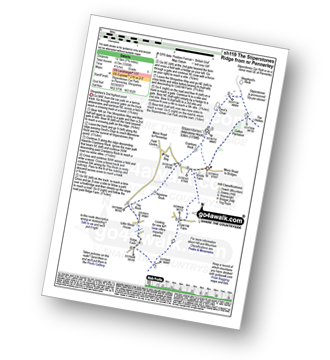
Walk sh119 The Stiperstones Ridge from nr Pennerley

Shropshire's 2nd highest point

Download GPS Waypoint Data for walk sh119
Download GPX Waypoint Data for walk sh119
Download Map and Route Details for walk sh119

Vital Statistics:

Length:7.75 miles (12.5 km)
Ascent:1,355ft (413m)
Time:4.25hrs
Grade:Grade 5 Walking Moderate
Walk 9 Walking Bootprint Icon

Walk sh115 Titterstone Clee Hill from Dhustone

Shropshire's 2nd highest point

Download GPS Waypoint Data for walk sh115
Download GPX Waypoint Data for walk sh115
Download Map and Route Details for walk sh115

Vital Statistics:

Length:4 miles (6.5 km)
Ascent:1,011ft (308m)
Time:2½ hrs
Grade:Grade 3 Walking Easy
Walk 10 Walking Bootprint Icon

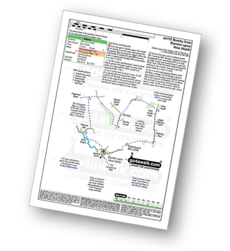
Walk sh110 Booley and Blakeleyhill from Stanton upon Hine Heath

Quiet lanes and field paths

Download GPS Waypoint Data for walk sh110
Download GPX Waypoint Data for walk sh110
Download Map and Route Details for walk sh110

Vital Statistics:

Length:6.25 miles (10 km)
Ascent:295ft (90m)
Time:2½ hrs
Grade:Grade 2 Walking Easy
Walk 11 Walking Bootprint Icon

Walk sh101 Brown Clee Hill from Cleobury North

Shropshire's highest point

Download GPS Waypoint Data for walk sh101
Download GPX Waypoint Data for walk sh101
Download Map and Route Details for walk sh101

Vital Statistics:

Length:6.5 miles (10.5 km)
Ascent:1,152ft (351m)
Time:3½ hrs
Grade:Grade 4 Walking Moderate
Walk 12 Walking Bootprint Icon

Walk sh100 The Wrekin from Buckatree Farm Reservoir

Superb expansive Shropshire views

Download GPS Waypoint Data for walk sh100
Download GPX Waypoint Data for walk sh100
Download Map and Route Details for walk sh100

Vital Statistics:

Length:3.75 miles (6 km)
Ascent:1,004ft (306m)
Time:2½ hrs
Grade:Grade 3 Walking Easy

See this list of walks, routes & maps in:

Grade Order | Length Order | Time Order | Walk Number or Start Location Order
NB. To reverse (toggle) this order, click Number Order again


Follow go4awalk.com on Twitter Follow go4awalk.com on Facebook


Home


Find new Friends to go walking with

Walk all 214 Wainwrights in just 59 Walks. Download GPS Waypoints - Great Walks you must not miss!

Walk The Yorkshire Three Peaks Challenge Walk - All the Latest Route Information, GPS Waypoints and Split Times to keep you on Schedule

Walk The British Three Peaks Challenge Walk - All the Latest Route Information and GPS Waypoints

See our pick of The Best Walks in The Lake District - Great Walks you must not miss!

Walk our pick of the Best Lake District Ridge Walks - Great Walks you must not miss!

Walk our pick of the Best Lake District Walks to do in the rain - Great Walks you must not miss!

Walk our pick of The Best Walks in Snowdonia - Great Walks you must not miss!

Walk our pick of The Best Ridge Walks in Wales - Walks you must not miss!

Walk our pick of The Best Walks in The Brecon Beacons - Great Walks you must not miss!

Walk our pick of The Best Walks in The Yorkshire Dales - Walks you must not miss!

Walk our pick of The Best Walks in The Peak District - Walks you must not miss!

Walk our pick of The Best Walks in The Forest of Bowland - Walks you must not miss!

Walk our pick of The Best Walks in Shropshire - Walks you must not miss!

Walk our pick of The Best Walks in Cheshire - Walks you must not miss!

Walk our pick of The Best Walks in Lancashire - Walks you must not miss!

Not sure where to walk next? Try Peak Bagging - Great Walks you must not miss!

Not sure where to walk next? Walk part of a National Trail - Great Walks you must not miss!

Walks with Downloadable and Uploadable GPS Waypoint Data

Walking Kit and Gear Tested by Walkers

Full Site Search