Walk sh157 Sundorme from Upper Astley

This 5 mile, Grade 1 (Easy), easy-to-follow, hand-crafted walk, complete with GPS Waypoints, starts at Upper Astley & will take about 2 hrs to complete.

Download Walk PDF Icon
Download GPX Track Icon
Download GPS Waypoints Icon

Vital Statistics:

Length:5mls (8km)
Ascent:161ft (49m)
Time:2hrs
Grade:Walk Grade 1_23_with_text.png Icon

Route outline for walk sh157:

Upper Astley  -  The Shropshire Way  -  Wheatley Farm  -  Sunderton Farm  -  Sundorne Farm  -  Sundorne Castle Farm  -  Shrewsbury Rugby Club  -  New Coppice  -  Colin's Rough  -  Wheatley Farm  -  Upper Astley

Peaks, Summits and Tops reached on this walk:

Hewitt Icon
0
English
Mountains
Wainwright Icon
0
Wainwrights
English Nuttall Icon
0
English
Nuttalls
Dewey Icon
0
English
Deweys
Wainwright Outlying Fell Icon
0
Wainwright
Outlying Fells
Marilyn Icon
0
Marilyns
Bridget Icon
0
Bridgets

National Trails & Long Paths included on this walk:

Part of this walk follows a section of The Shropshire Way, a 224km (139 miles) circular footpath starting and finishing in Wem in Shropshire, England. The Shropshire Way is waymarked by a buzzard motif. For more walks that include a section of this trail see The Shropshire Way.


You can find this walk and other nearby walks on these unique Interactive Walk Planning Maps:

(worth a look if you're new to go4awalk.com & have never seen one of these before.)


1:25,000 scale OS Explorer Map (orange/yellow covers):

OS Explorer 241 Shrewsbury


1:50,000 scale OS Landranger Map (pink/magenta covers):

OS Landranger 126 Shrewsbury & Oswestry


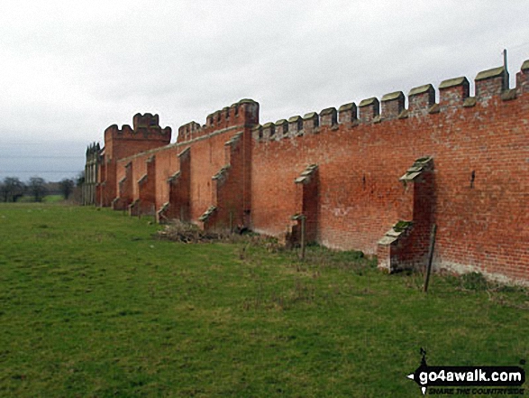
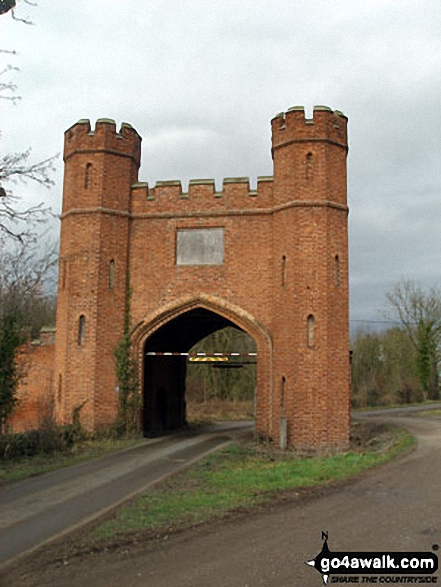
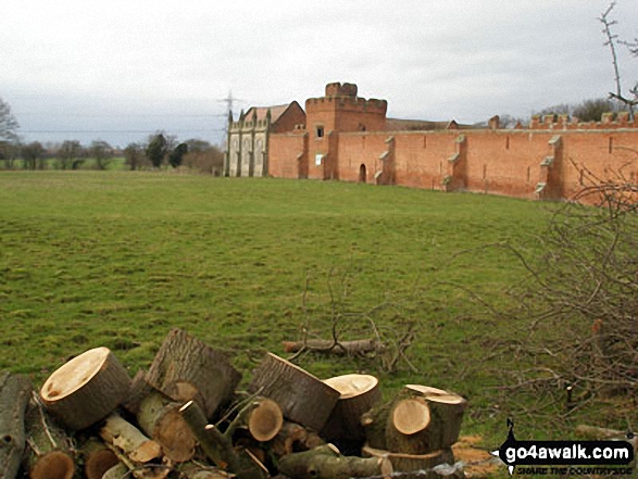
Some Photos and Pictures from Walk sh157 Sundorme from Upper Astley

In no particular order . . .

Sundorne Castle Farm

Sundorne Castle Farm

Photo: Keith Watson (3)

Sundorne Castle Farm

Sundorne Castle Farm

Photo: Keith Watson (2)

Sundorne Castle Farm

Sundorne Castle Farm

Photo: Keith Watson (1)


Send us your photographs and pictures from your walks and hikes

Send them in to us as email attachments (configured for any computer) along with your name/username and where the picture was taken to:

and we shall do our best to publish them.

(Guide Resolution = 300dpi. At least = 660 pixels (wide) x 440 pixels (high).)

Facebook Logo

You can also submit photos via our Facebook Page.

NB. Please indicate where each photo was taken so we can match it to a walk route.


How pleasant, as the sun declines, to view, the spacious landscape change in form to hue - William Wordsworth: 1770-1850
Follow go4awalk.com on Twitter Follow go4awalk.com on Facebook


Find new Friends to go walking with

Walk all 214 Wainwrights in just 59 Walks. Download GPS Waypoints - Great Walks you must not miss!

Walk The Yorkshire Three Peaks Challenge Walk - All the Latest Route Information, GPS Waypoints and Split Times to keep you on Schedule

Walk The British Three Peaks Challenge Walk - All the Latest Route Information and GPS Waypoints

See our pick of The Best Walks in The Lake District - Great Walks you must not miss!

Walk our pick of the Best Lake District Ridge Walks - Great Walks you must not miss!

Walk our pick of the Best Lake District Walks to do in the rain - Great Walks you must not miss!

Walk our pick of The Best Walks in Snowdonia - Great Walks you must not miss!

Walk our pick of The Best Ridge Walks in Wales - Walks you must not miss!

Walk our pick of The Best Walks in The Brecon Beacons - Great Walks you must not miss!

Walk our pick of The Best Walks in The Yorkshire Dales - Walks you must not miss!

Walk our pick of The Best Walks in The Peak District - Walks you must not miss!

Walk our pick of The Best Walks in The Forest of Bowland - Walks you must not miss!

Walk our pick of The Best Walks in Shropshire - Walks you must not miss!

Walk our pick of The Best Walks in Cheshire - Walks you must not miss!

Walk our pick of The Best Walks in Lancashire - Walks you must not miss!

Not sure where to walk next? Try Peak Bagging - Great Walks you must not miss!

Not sure where to walk next? Walk part of a National Trail - Great Walks you must not miss!

Walks with Downloadable and Uploadable GPS Waypoint Data

Walking Kit and Gear Tested by Walkers

Full Site Search