86 easy-to-follow walk, route maps of all grades on OS Explorer Map OL5 The English Lakes - North Eastern area
Eighty-six easy-to-follow walk, route maps of all grades on OS Explorer Map OL5 The English Lakes - North Eastern area in Walk Grade OrderTap/mouse over a coloured circle (1-3 easy walks, 4-6 moderate walks, 7-9 hard walks) and click to select.
You can use these checkboxes to show only the grades of walk you are interested in:-
Eighty-six easy-to-follow walk, route maps of all grades on OS Explorer Map OL5 The English Lakes - North Eastern area in Walk Grade Order
Scroll down the list of walks below & click on each walk title (in blue) to locate it on the map above.
See this list of walks, routes & maps in:
Grade Order | Length Order | Time Order | Walk Number or Start Location Order
NB. To reverse (toggle) this order, click Grade Order again

   |
Vital Statistics:
| Length: | 9.5 miles (15 km) |
| Ascent: | 2,140ft (652m) |
| Time: | 5½ hrs |
| Grade: |  |
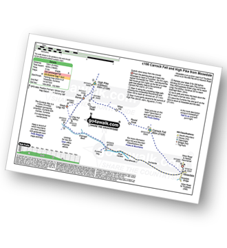
Route Summary:
Stone Ends Farm - Apronful of Stones - Rake Trod - Further Gill Sike - Scurth - The Trough - Carrock Fell - Round Knott (Caldbeck) - Miton Hill (Caldbeck) - Red Gate (Track) - High Pike (Caldbeck) - Hare Stones - Great Lingy Hill - Miller Moss - Lingy Hut - Grainsgill Beck - The Cumbria Way - River Caldew - Swineside - Mosedale (Mungrisdale) - Stone Ends Farm


|
Vital Statistics:
| Length: | 11.25 miles (18 km) |
| Ascent: | 2,736ft (834m) |
| Time: | 6.75hrs |
| Grade: |  |

Route Summary:
St Peter's Church (Martindale) - Howtown - Swarthbeck Gill - White Knott - Barton Fell - Whinny Crag - Arthur's Pike - Swarth Beck - Bonscale Tower - Bonscale Pike - Loadpot Hill - Wether Hill - Wether Hill (South Top) - Keasgill Head - Steel Knotts (Pikeawassa) - Steel End - St Peter's Church (Martindale) - Howtown

|
Vital Statistics:
| Length: | 8.75 miles (14 km) |
| Ascent: | 3,296ft (1,005m) |
| Time: | 6½ hrs |
| Grade: | |

Route Summary:
The Swirls Car Park Thirlmere - Browncove Crags - Lower Man (Helvellyn) - Helvellyn - White Side - Raise (Helvellyn) - Sticks Pass - Sticks Gill - Stanah Gill - Legburthwaite - Thirlmere - Thirlspot - The Swirls Car Park Thirlmere.

|
Vital Statistics:
| Length: | 14.5 miles (23 km) |
| Ascent: | 3,364ft (1,025m) |
| Time: | 8½ hrs |
| Grade: |  |
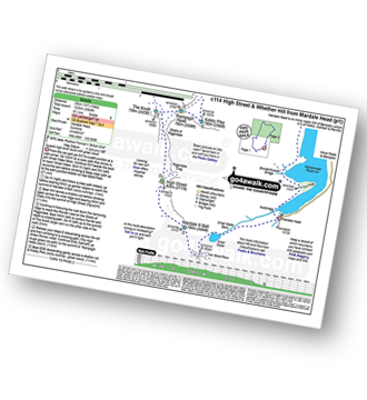
Route Summary:
Mardale Head (Haweswater Reservoir) - Small Water - Nan Bield Pass - Mardale Ill Bell - High Street - Straits of Riggindale - The Knott - Rampsgill Head - Kidsty Pike - High Raise (Mardale) - Raven Howe - Red Crag - Keasgill Head - Wether Hill (South Top) - Wether Hill - Bampton Common - Low Kop - Measand Beck - Haweswater Reservoir - Wainwright's Coast to Coast Walk - Bowderthwaite Bridge - The Rigg - Mardale Head

|
Vital Statistics:
| Length: | 6.25 miles (10 km) |
| Ascent: | 2,565ft (782m) |
| Time: | 4.75hrs |
| Grade: | |

Route Summary:
Scales - Mousthwaite Comb - Scales Fell - Brunt Knott - Scales Beck - Scales Tarn - Sharp Edge - Atkinson Pike - Blencathra or Saddleback (Hallsfell Top) - Gategill Fell Top - Knowe Crag (Blease Fell) - Scales

|
Vital Statistics:
| Length: | 7.75 miles (12.5 km) |
| Ascent: | 2,453ft (748m) |
| Time: | 5.25hrs |
| Grade: | |
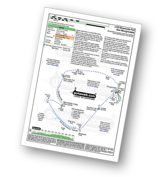
Route Summary:
Mungrisdale - Souther Fell - River Glendermackin - Bannerdale Crags - Bowscale Fell - Mungrisdale

|
Vital Statistics:
| Length: | 10.5 miles (17 km) |
| Ascent: | 3,575ft (1,090m) |
| Time: | 7½ hrs |
| Grade: | |

Route Summary:
The Swirls Car Park Thirlmere - Browncove Crags - Lower Man (Helvellyn) - Helvellyn - White Side - Raise (Helvellyn) - Sticks Pass - Stybarrow Dodd - Watson's Dodd - Great Dodd - Legburthwaite - Thirlmere - Thirlspot - The Swirls Car Park Thirlmere.

|
Vital Statistics:
| Length: | 4.75 miles (7.5 km) |
| Ascent: | 1,292ft (394m) |
| Time: | 3 hrs |
| Grade: |  |
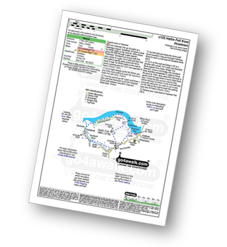
Route Summary:
Howtown - St Peter's Church - Hallin Fell - Geordie's Crag - Hallinhag Wood - Sandwick - Sandwick Beck - Howtown

|
Vital Statistics:
| Length: | 9.5 miles (15 km) |
| Ascent: | 1,250ft (381m) |
| Time: | 4.75hrs |
| Grade: |  |

Route Summary:
Keswick - Friar's Crag - Borrowdale Road - Spring Farm - Brockle Beck - Castlerigg - High Nest Farm - Castlerigg Stone Circle - Naddle Bridge - Threlkeld - River Greta - Keswick

|
Vital Statistics:
| Length: | 11.25 miles (18 km) |
| Ascent: | 3,843ft (1,171m) |
| Time: | 8 hrs |
| Grade: | |

Route Summary:
Cow Bridge - Brothers Water - Hartsop - Hartsop Dodd - Caudale Moor - Stony Cove Pike (Caudale Moor) - Caudale Head - Stony Cove Pike - Threshthwaite Mouth - Thornthwaite Crag - High Street - Straits of Riggindale - Rampsgill Head - Kidsty Pike - High Raise (Mardale) - The Knott - Hayeswater Reservoir - Hayeswater Gill - Hartsop - Cow Bridge - Brothers Water.

|
Vital Statistics:
| Length: | 7.5 miles (12 km) |
| Ascent: | 2,283ft (696m) |
| Time: | 5.25hrs |
| Grade: | |

Route Summary:
Howtown - Steel Knotts (Pikeawassa) - Brownthwaite Crag - Keasgill Head - Wether Hill (South Top) - Wether Hill - Loadpot Hill - Bonscale Pike - Bonscale Tower - Swarthbeck Gill - Howtown

|
Vital Statistics:
| Length: | 6.5 miles (10.5 km) |
| Ascent: | 643ft (196m) |
| Time: | 3 hrs |
| Grade: |  |
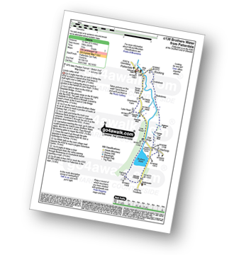
Route Summary:
Patterdale - Noran Bank Farm - Greenbank Farm - Lane Head - Deepdale Bridge - Low Wood - Cow Bridge - Brothers Water - Hartsop Hall - Sykeside - Brothers Water - Hartsop - Eden Beck - Hartsop Fold - Angletarn Beck - Beckstones - Crookabeck - Dubhow - Rooking - Patterdale

|
Vital Statistics:
| Length: | 8.75 miles (14 km) |
| Ascent: | 2,129ft (649m) |
| Time: | 5½ hrs |
| Grade: | |

Route Summary:
Red Moss Nr Dockray - Matterdale Common - Wolf Crags - Bruts Moss - Randerside - Great Dodd - Watson's Dodd - Stybarrow Dodd - Green Side (White Stones) - Hart Side - Dowthwaitehead - Red Moss.

|
Vital Statistics:
| Length: | 12.25 miles (19.5 km) |
| Ascent: | 4,194ft (1,278m) |
| Time: | 8.75hrs |
| Grade: | |
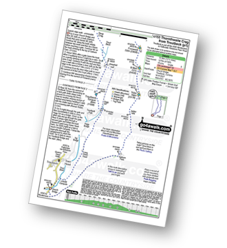
Route Summary:
Troutbeck Bridge - Garburn Pass - Yoke - Ill Bell - Froswick - Thornthwaite Crag - Stony Cove Pike (Caudale Moor) - Doup Crag - Trout Beck - Troutbeck Tongue - Hagg Gill - Lowther Brow - Long Green Head - Limefitt Campsite - Troutbeck - Troutbeck Bridge

|
Vital Statistics:
| Length: | 15.5 miles (25 km) |
| Ascent: | 4,293ft (1,308m) |
| Time: | 10 hrs |
| Grade: |  |

Route Summary:
Patterdale - Rooking - Crookabeck - Beckstones - Dubhow - Hartsop - Hayswater Gill - Hayswater - The Knott - Brock Crags - Angle Tarn (Martindale) - Angletarn Pikes - Boredale Hause - Place Fell - High Dodd (Sleet Fell) - Sandwick - Long Crag - Silver Point - Ullswater - Blowick - Rooking - Side Farm - Patterdale

|
Vital Statistics:
| Length: | 8.5 miles (13.5 km) |
| Ascent: | 2,181ft (665m) |
| Time: | 5.25hrs |
| Grade: | |

Route Summary:
Watendlath - High Tove - Cockrigg Crags - Thirlmere - Harrop Tarn - Blea Tarn (Watendlath Fell) - Brimming Knott - Robinbank Crag - Rough Knott - Watendlath

|
Vital Statistics:
| Length: | 12.5 miles (20 km) |
| Ascent: | 3,769ft (1,149m) |
| Time: | 8½ hrs |
| Grade: | |

Route Summary:
Christy Bridge - Martindale - Dale Head Farm - Heck Crag - Angle Tarn - Buck Crag - Brock Crags - Satura Crag - The Nab (Martindale) - Rest Dodd - The Knott - Rampsgill Head - Kidsty Pike - High Raise (Mardale) - Red Crag - Keasgill Head - Christy Bridge

|
Vital Statistics:
| Length: | 13.75 miles (22 km) |
| Ascent: | 5,501ft (1,676m) |
| Time: | 10½ hrs |
| Grade: | |
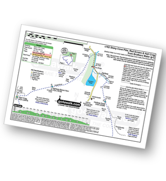
Route Summary:
Cow Bridge Car Park - Brothers Water - Hartsop - Hartsop Dodd - Caudale Moor - Stony Cove Pike (Caudale Moor) - Caudale Head - Pike How - St Raven's Edge - The Kirkstone Pass - Red Screes - Smallthwaite Band - Middle Dodd - Scandale Pass - Little Hart Crag - High Hartsop Dodd - Little Hart Crag - Scandale Head - Dove Crag - Hart Crag - Blake Brow - Hartsop Above How - Hoggill Brow - Gale Crag - Bleaberry Knott - Cockley How - Cow Bridge

|
Vital Statistics:
| Length: | 3 miles (5 km) |
| Ascent: | 1,145ft (349m) |
| Time: | 2½ hrs |
| Grade: | |


|
Vital Statistics:
| Length: | 3.75 miles (6 km) |
| Ascent: | 2,398ft (731m) |
| Time: | 3.75hrs |
| Grade: | |

Route Summary:
Threlkeld - Gategill Farm - Hall's Fell - Hall's Fell Ridge - Blencathra or Saddleback (Hallsfell Top) - Gategill Fell Top - Knowe Crags (Blease Fell) - Threlkeld

|
Vital Statistics:
| Length: | 8.25 miles (13 km) |
| Ascent: | 2,011ft (613m) |
| Time: | 5 hrs |
| Grade: | |

Route Summary:
Red Moss Nr Dockray - Barbary Rigg - Matterdale Common - Mariel Bridge - White Pike (Clough Head) - Clough Head - Calfhow Pike - Little Dodd (St John's Common) - Great Dodd - Randerside - Bruts Moss - Wolf Crags - Red Moss.

|
Vital Statistics:
| Length: | 6 miles (9.5 km) |
| Ascent: | 1,814ft (553m) |
| Time: | 4 hrs |
| Grade: | |

Route Summary:
Glenridding - Glenridding Dodd - Sheffield Pike - Nick Head - Lucy's Tongue - Glenridding Beck - Glenridding

|
Vital Statistics:
| Length: | 10 miles (16 km) |
| Ascent: | 3,979ft (1,213m) |
| Time: | 7½ hrs |
| Grade: | |

Route Summary:
Patterdale - Grisedale Bridge - Ruthwaite Lodge - The Tongue - Dollywaggon Pike - Seat Sandal - Grisedale Tarn - Deepdale Hause - St Sunday Crag - Birks - Patterdale

|
Vital Statistics:
| Length: | 7 miles (11 km) |
| Ascent: | 1,860ft (567m) |
| Time: | 4½ hrs |
| Grade: | |
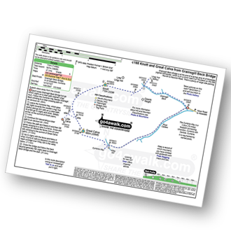
Route Summary:
Grainsgill Bridge - Swineside - Grainsgill Beck - Knott (Uldale Fells) - Little Calva - Great Calva - The Cumbria Way - Wiley Beck - River Caldew - Burdell - Gill - Wet Swine Gill - Grainsgill Beck - Swineside.

|
Vital Statistics:
| Length: | 9.5 miles (15 km) |
| Ascent: | 3,070ft (936m) |
| Time: | 6½ hrs |
| Grade: | |

Route Summary:
Mungrisdale - Souther Fell - River Glendermackin - Brunt Knott - Scales Beck - Scales Tarn - Sharp Edge - Atkinson Pike - Blencathra or Saddleback (Hallsfell Top) - Foule Crag - Bannerdale Crags - Bowscale Fell - Tarn Crags Top - Raven Crags - Mungrisdale

|
Vital Statistics:
| Length: | 13 miles (21 km) |
| Ascent: | 4,359ft (1,329m) |
| Time: | 9.25hrs |
| Grade: | |

Route Summary:
Glenridding - Glenridding Dodd - Sheffield Pike - Green Side - Stybarrow Dodd - Sticks Pass - Raise (Helvellyn) - White Side - Lower Man (Helvellyn) - Helvellyn - Nethermost Pike - High Crag (Helvellyn) - Dollywaggon Pike - Grisdale Tarn - Grisedale Beck - Brownend Plantation - Lanty's Tarn - Keldas - Glenridding

|
Vital Statistics:
| Length: | 7.25 miles (11.5 km) |
| Ascent: | 1,752ft (534m) |
| Time: | 4½ hrs |
| Grade: | |

Route Summary:
Aira Force National Trust Car Park (nr Glenridding) - Aira Force - Riddings Beck - Waterfalls - High Force - Dockray - Aira Beck - Matterdale Common - Dowthwaitehead - Brown Hills - Swineside Knott - Glencoyne Park - Aira Force Car Park.

|
Vital Statistics:
| Length: | 7 miles (11 km) |
| Ascent: | 1,299ft (396m) |
| Time: | 3.75hrs |
| Grade: | |
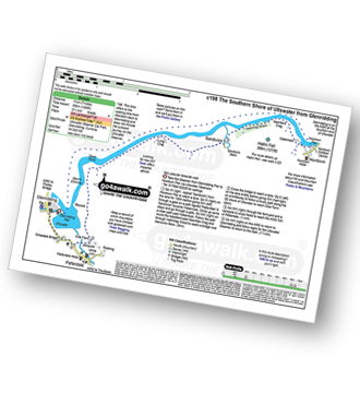
Route Summary:
Glenridding - Glenridding Pier - Ullswater Steamer - Howtown Pier - Geordie's Crag - Halinhag Wood - Sandwick - Long Crag (Ullswater) - Silver Point - Ullswater - Blowick - Rooking - Side Farm - Patterdale

|
Vital Statistics:
| Length: | 14 miles (22.5 km) |
| Ascent: | 2,978ft (908m) |
| Time: | 8.25hrs |
| Grade: | |

Route Summary:
Stone Ends Farm - Apronful of Stones - Rake Trod - Further Gill Sike - Scurth - The Trough - Carrock Fell - Round Knott (Caldbeck) - Miton Hill (Caldbeck) - Red Gate (Track) - High Pike (Caldbeck) - Hare Stones - Great Lingy Hill - Miller Moss - Lingy Hut - Grainsgill Beck - Knott (Uldale Fells) - Litle Calva - Great Calva - The Cumbria Way - Wiley Beck - River Caldew - Burdell - Gill - Wet Swine Gill - Grainsgill Beck - Swineside - Mosedale (Mungrisdale) - Stone Ends Farm

|
Vital Statistics:
| Length: | 3.75 miles (6 km) |
| Ascent: | 1,571ft (479m) |
| Time: | 3 hrs |
| Grade: | |

Route Summary:
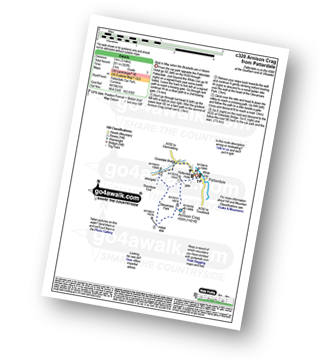
Patterdale - Arnison Crag - Glenamara Park - Birks - Thornhow End - Grisedale Bridge - Patterdale

|
Vital Statistics:
| Length: | 8.5 miles (13.5 km) |
| Ascent: | 3,278ft (999m) |
| Time: | 6½ hrs |
| Grade: | |

Route Summary:
Glenridding - Birkhouse Moor - Hole-in-the-Wall - Red Tarn (Helvellyn) - Bleaberry Crag - Low Spying How - High Spying How - Striding Edge (High Spying How) - Helvellyn - Swirral Edge - Catstye Cam - Hole-in-the-Wall - Brownend Plantation - Grisedale Beck - Lanty's Tarn - Keldas - Glenridding

|
Vital Statistics:
| Length: | 10 miles (16 km) |
| Ascent: | 2,635ft (803m) |
| Time: | 6.25hrs |
| Grade: | |

Route Summary:
Dob Gill Car Park (Thirlmere) - Harrop Tarn - Standing Crag - Ullscarf - Greenup Edge - Low White Stones - High Raise (Langdale) - Sergeant Man - Codale Head - Broadstone Head - Mere Beck - Brownrigg Moss - Calf Crag - Wyth Burn - Stockhow Bridge - Thirlmere

|
Vital Statistics:
| Length: | 10 miles (16 km) |
| Ascent: | 3,382ft (1,031m) |
| Time: | 7 hrs |
| Grade: | |

Route Summary:
Glenridding - Birkhouse Moor - Hole-in-the-Wall - Red Tarn (Helvellyn) - Bleaberry Crag - Low Spying How - High Spying How - Striding Edge (High Spying How) - Helvellyn - Nethermost Pike - High Crag (Helvellyn) - Dollywaggon Pike - Grisdale Tarn - Ruthwaite Lodge - Grisedale Beck - Brownend Plantation - Lanty's Tarn - Keldas - Glenridding

|
Vital Statistics:
| Length: | 10.75 miles (17 km) |
| Ascent: | 3,449ft (1,051m) |
| Time: | 7.25hrs |
| Grade: | |

Route Summary:
Glenridding - Birkhouse Moor - Hole-in-the-Wall - Red Tarn (Helvellyn) - Catstye Cam - Swirral Edge - Helvellyn - Lower Man (Helvellyn) - White Side - Raise (Helvellyn) - Sticks Pass - Lucy's Tongue - Glenridding Beck - Glenridding

|
Vital Statistics:
| Length: | 8.5 miles (13.5 km) |
| Ascent: | 2,552ft (778m) |
| Time: | 6 hrs |
| Grade: | |
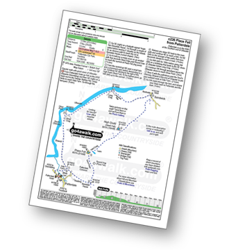
Route Summary:
Patterdale - Rooking - Boredale Hause - Place Fell - High Dodd (Sleet Fell) - Martindale - Sandwick - Long Crag (Ullswater) - Silver Point - Ullswater - Blowick - Rooking - Side Farm - Patterdale

|
Vital Statistics:
| Length: | 5 miles (8 km) |
| Ascent: | 912ft (278m) |
| Time: | 2.75hrs |
| Grade: | |
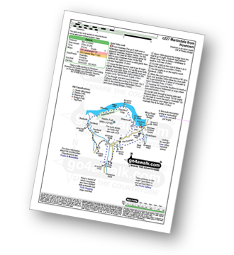
Route Summary:
Howtown - The Coombs - St Peter's Church - Lanty Tarn - Martindale - Christy Bridge - Howegrain Beck - Sandwick Beck - Sandwick - Hallinhag Wood - Geordie's Crag - Waternook - Howtown

|
Vital Statistics:
| Length: | 12.5 miles (20 km) |
| Ascent: | 3,411ft (1,040m) |
| Time: | 8 hrs |
| Grade: | |

Route Summary:
Ambleside - Rydal - Nab Scar - Heron Pike - Rydal Fell (Heron Pike North Top) - Great Rigg - Fairfield - Rydal Head - Hart Crag - Dove Crag - Little Hart Crag - Scandale Pass - Red Screes - Snarker Pike - Ambleside

|
Vital Statistics:
| Length: | 7.5 miles (12 km) |
| Ascent: | 3,131ft (954m) |
| Time: | 5.75hrs |
| Grade: | |

Route Summary:
Cow Bridge - Brothers Water - Hartsop - Hartsop Dodd - Caudale Moor - Caudale Head - Stony Cove Pike (Caudale Moor) - Threshthwaite Mouth - Thornthwaite Crag - Gray Crag (Hayeswater) - Hayeswater Gill - Hartsop - Cow Bridge

|
Vital Statistics:
| Length: | 9.75 miles (15.5 km) |
| Ascent: | 3,516ft (1,072m) |
| Time: | 7 hrs |
| Grade: | |

Route Summary:
Patterdale - Arnison Crag - Birks - St Sunday Crag - Deepdale Hause - Cofa Pike - Fairfield - Rydal Head - Hart Crag - Blake Brow - Hartsop Above How - Hoggill Brow - Gale Crag - Bleaberry Knott - Cockley How - Bridgend - Patterdale

|
Vital Statistics:
| Length: | 7 miles (11 km) |
| Ascent: | 1,273ft (388m) |
| Time: | 3.75hrs |
| Grade: | |

Route Summary:
Patterdale - Glenamara Park - Braesteads Farm - Elmhow Farm - Grisedale Bridge - Grisedale Beck - Ruthwaite Lodge (Bothy) - Grisedale Beck - Nethermostcove Beck - Grisedale Bridge - Patterdale

|
Vital Statistics:
| Length: | 11.25 miles (18 km) |
| Ascent: | 2,680ft (817m) |
| Time: | 6.75hrs |
| Grade: | |

Route Summary:
Red Moss Nr Dockray - Barbary Rigg - Matterdale Common - Mariel Bridge - White Pike (Clough Head) - Clough Head - Calfhow Pike - Little Dodd (St John's Common) - Great Dodd - Watson's Dodd - Stybarrow Dodd - Green Side (White Stones) - Hart Side - Dowthwaitehead - Red Moss.

|
Vital Statistics:
| Length: | 11 miles (17.5 km) |
| Ascent: | 3,264ft (995m) |
| Time: | 7.25hrs |
| Grade: | |

Route Summary:
Mungrisdale - Souther Fell - River Glendermackin - Brunt Knott - Scales Beck - Scales Tarn - Sharp Edge - Atkinson Pike - Blencathra or Saddleback (Hallsfell Top) - Mungrisdale Common - Bannerdale Crags - Bowscale Fell - Tarn Crags Top - Raven Crags - Mungrisdale

|
Vital Statistics:
| Length: | 11 miles (17.5 km) |
| Ascent: | 3,633ft (1,107m) |
| Time: | 7.75hrs |
| Grade: | |

Route Summary:
Ambleside - Rydal - Nab Scar - Heron Pike - Rydal Fell (Heron Pike North Top) - Great Rigg - Fairfield - Rydal Head - Hart Crag - Dove Crag - High Pike (Scandale) - Low Pike (Scandale) - High Sweden Bridge - High Sweden Coppice - Ambleside

|
Vital Statistics:
| Length: | 9 miles (14.5 km) |
| Ascent: | 2,619ft (798m) |
| Time: | 6 hrs |
| Grade: | |
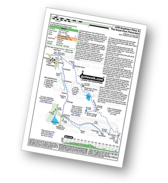
Route Summary:
Patterdale - Side Farm - Boredale Hause - Angletarn Pikes - Angle Tarn (Martindale) - Satura Crag - Brock Crags - Satura Crag - The Knott - Hayeswater Reservoir - Hayeswater Gill - Hartsop - Dubhow - Beckstones - Crookabeck - Rooking - Side Farm - Patterdale

|
Vital Statistics:
| Length: | 12.5 miles (20 km) |
| Ascent: | 3,814ft (1,162m) |
| Time: | 8½ hrs |
| Grade: | |

Route Summary:
Mardale Head - Haweswater - Rowantreethwaite Beck - Old Corpse Road - Selside Pike - Branstree (North East Top) - Branstree (Artlecrag Pike) - Gatescarth Pass - Adam Seat - Harter Fell (Mardale) - Nan Bield Pass - Mardale Ill Bell - High Street - Riggindale - Rampsgill Head - Wainwright's Coast to Coast Walk - Kidsty Pike - Kidsty Howes - Bowderthaite Bridge - The Rigg - Mardale Head

|
Vital Statistics:
| Length: | 10 miles (16 km) |
| Ascent: | 492ft (150m) |
| Time: | 4 hrs |
| Grade: | |

Route Summary:
The Swirls Car Park - Thirlmere - Dalehead Hall - Thirlspot - Valve Houses - Beech Grove - Armboth - Hause Point - Dobgill Bridge - Wythburn - Stockhow Bridge - Wyth Burn - Helvellyn Screes - Highpark Wood - The Swirls Car Park - Thirlmere

|
Vital Statistics:
| Length: | 13.25 miles (21 km) |
| Ascent: | 5,189ft (1,581m) |
| Time: | 10 hrs |
| Grade: | |

Route Summary:
Patterdale - Grisedale Bridge - Grisedale Beck - Brownend Plantation - Hole-in-the-Wall - Birkhouse Moor - Hole-in-the-Wall - Red Tarn (Helvellyn) - Bleaberry Crag - Low Spying How - High Spying How - Striding Edge (High Spying How) - Helvellyn - Nethermost Pike - High Crag (Helvellyn) - Dollywaggon Pike - Seat Sandal - Grisedale Tarn - St Sunday Crag - Birks - Arnison Crag - Patterdale

|
Vital Statistics:
| Length: | 7.5 miles (12 km) |
| Ascent: | 3,116ft (950m) |
| Time: | 6 hrs |
| Grade: | |

Route Summary:
Grasmere - Wainwright's Coast to Coast Walk - Mill Bridge - Little Tongue - Seat Sandal - Grisedale Tarn - Fairfield - Rydal Head - Great Rigg - Stone Arthur - Grasmere

|
Vital Statistics:
| Length: | 11.5 miles (18.5 km) |
| Ascent: | 4,582ft (1,396m) |
| Time: | 8.75hrs |
| Grade: | |

Route Summary:
Patterdale - Grisedale Bridge - Grisedale Beck - Brownends Plantation - Hole-in-the-Wall - Birkhouse Moor - Hole-in-the-Wall - Red Tarn (Helvellyn) - Bleaberry Crag - Low Spying How - High Spying How - Striding Edge (High Spying How) - Helvellyn - Nethermost Pike - High Crag (Helvellyn) - Dollywaggon Pike - Grisedale Tarn - Deepdale Hause - St Sunday Crag - Birks - Patterdale

|
Vital Statistics:
| Length: | 12.5 miles (20 km) |
| Ascent: | 3,889ft (1,185m) |
| Time: | 8½ hrs |
| Grade: | |
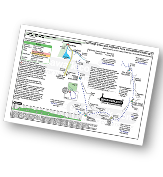
Route Summary:
Cow Bridge - Brothers Water - Hartsop - Hartsop Dodd - Stony Cove Pike - Caudale Head - Caudale Moor - Stony Cove Pike (Caudale Moor) - Threshthwaite Mouth - Thornthwaite Crag - High Street - Straits of Riggindale - The Knott - Angle Tarn (Martindale) - Angletarn Pikes - Boredale Hause - Patterdale

|
Vital Statistics:
| Length: | 7.25 miles (11.5 km) |
| Ascent: | 2,745ft (837m) |
| Time: | 5½ hrs |
| Grade: | |

Route Summary:
Mardale Head - Haweswater Reservoir - The Rigg - Dudderwick - Swine Crag (Riggindale) - Heron Crag (Riggindale) - Rough Crag (Riggindale) - Caspel Gate - Riggindale Crag - Long Stile - High Street - Mardale Ill Bell - Nan Bield Pass - Harter Fell (Mardale) - Adam Seat - Gatescarth Pass - Mardale Head

|
Vital Statistics:
| Length: | 8.5 miles (13.5 km) |
| Ascent: | 1,994ft (608m) |
| Time: | 5 hrs |
| Grade: | |

Route Summary:
Howtown - Lock Bank - White Knott - Barton Fell - Whinny Crag - Arthur's Pike - Loadpot Hill - Bonscale Pike - Swarthbeck Gill - Howtown

|
Vital Statistics:
| Length: | 7.75 miles (12.5 km) |
| Ascent: | 2,198ft (670m) |
| Time: | 5 hrs |
| Grade: | |
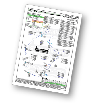
Route Summary:
Fell Side - Dale Beck - Brae Fell - Little Sca Fell - Great Sca Fell - Knott (Uldale Fells) - Grainsgill Beck - The Cumbria Way - Lingy Hut - Miller Moss - Great Lingy Hill - Hare Stones - High Pike (Caldbeck) - Long Grain Beck - Fell Side

|
Vital Statistics:
| Length: | 6 miles (9.5 km) |
| Ascent: | 295ft (90m) |
| Time: | 2½ hrs |
| Grade: |  |
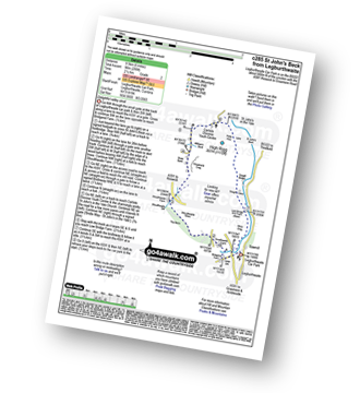
Route Summary:
Legburthwaite Car Park - Bridgend Farm - Shoulthwaite Farm - Shaw Bank - Carlisle Diocese Youth Centre - St John's in The Vale Church - Low Bridge End Farm - Legburthwaite Car Park

|
Vital Statistics:
| Length: | 11.5 miles (18.5 km) |
| Ascent: | 4,418ft (1,346m) |
| Time: | 8½ hrs |
| Grade: | |

Route Summary:
Glenridding - Glenridding Dodd - Sheffield Pike - Nick Head - Glencoyne Head - Hart Side - Green Side (White Stones) - Stybarrow Dodd - Sticks Pass - Raise (Helvellyn) - White Side - Lower Man (Helvellyn) - Helvellyn - Swirral Edge - Catstye Cam - Red Tarn Beck - Glenridding Beck - Glenridding Youth Hostel - Glenridding

|
Vital Statistics:
| Length: | 8.5 miles (13.5 km) |
| Ascent: | 2,435ft (742m) |
| Time: | 5½ hrs |
| Grade: | |

Route Summary:
Grasmere - Goody Bridge - Ghyll Foot Farm - Green Burn - Greenburn Bottom - Contra Breast - Dead Pike - Steel Fell (Dead Pike) - Brownrigg Moss - Calf Crag - Gibson Knott - Helm Crag - The Lion and The Lamb - The Howitzer - High Raven Crag - Grasmere

|
Vital Statistics:
| Length: | 14.5 miles (23 km) |
| Ascent: | 4,555ft (1,388m) |
| Time: | 9.75hrs |
| Grade: | |

Route Summary:
St Peter's Church (Martindale) - Howtown - Steel Knotts (Pikeawassa) - Keasgill Head - High Raise (Mardale) - Kidsty Pike - Rampsgill Head - The Knott - Rest Dodd - The Nab - Satura Crag - Brock Crags - Angle Tarn (Martindale) - Angletarn Pikes - Bedafel Knott - Beda Head (Beda Fell) - Winter Crag - Christy Bridge - Howegrain Beck - Martindale - St Peter's Church (Martindale) - Howtown

|
Vital Statistics:
| Length: | 9.75 miles (15.5 km) |
| Ascent: | 3,470ft (1,058m) |
| Time: | 7 hrs |
| Grade: | |
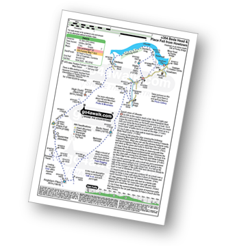
Route Summary:
St Peter's Church (Martindale) - Howtown - Howegrain Beck - Christy Bridge - Beda Head (Beda Fell) - Martindale Common - Angletarn Pikes - Angle Tarn (Martindale) - Boredale Hause - Steel Edge - Place Fell - High Dodd (Sleet Fell) - Sandwick - Hallinhag Wood - Geordies Crag - Hallin Fell (Martindale) - Howtown

|
Vital Statistics:
| Length: | 9.75 miles (15.5 km) |
| Ascent: | 3,699ft (1,127m) |
| Time: | 7.25hrs |
| Grade: | |
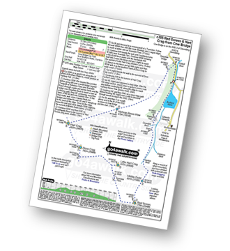
Route Summary:
Cow Bridge Car Park - Brothers Water - Hartsop Hall - Kirkstone Beck - Caiston Beck - Middle Dodd - Red Screes - Scandale Pass - Little Hart Crag - Dove Crag - Hart Crag - Blake Brow - Hartsop Above How - Hoggill Brow - Gale Crag - Bleaberry Knott - Cockley How - Cow Bridge

|
Vital Statistics:
| Length: | 12.25 miles (19.5 km) |
| Ascent: | 3,254ft (992m) |
| Time: | 7½ hrs |
| Grade: | |

Route Summary:
Brownrigg Farm - Great Mell Fell - Greenrow Great Barn - Lowthwaite - Little Mell Fell - The Hause - Underwood - Cove Park Campsite - Watermillock - Priest's Crag - Great Meldrum - Gowbarrow Fell (Airy Crag) - Norman Crag - Ulcat Row - Matterdale End - Brownrigg Farm

|
Vital Statistics:
| Length: | 7 miles (11 km) |
| Ascent: | 2,373ft (723m) |
| Time: | 5 hrs |
| Grade: | |
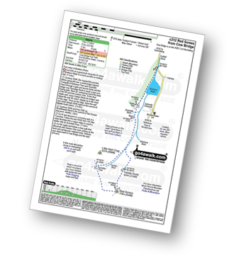
Route Summary:
Cow Bridge - Brothers Water - Hartsop Hall - Kirkstone Beck - Caiston Beck - Middle Dodd - Red Screes - Scandale Pass - Caiston Beck - Brothers Water.

|
Vital Statistics:
| Length: | 8.5 miles (13.5 km) |
| Ascent: | 2,368ft (722m) |
| Time: | 5½ hrs |
| Grade: | |
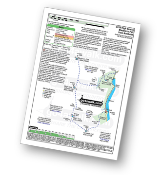
Route Summary:
Thirlmere - Armboth - Armboth Fell - High Tove - High Seat (Ashness Fell) - Bleaberry Fell - Raven Crag (Thirlmere) - Thirlmere

|
Vital Statistics:
| Length: | 3 miles (5 km) |
| Ascent: | 922ft (281m) |
| Time: | 2 hrs |
| Grade: | |

|
Vital Statistics:
| Length: | 7.75 miles (12.5 km) |
| Ascent: | 2,800ft (853m) |
| Time: | 5.75hrs |
| Grade: | |

Route Summary:
Cow Bridge Car Park - Brothers Water - Hartsop Hall - Kirkstone Beck - High Hartsop Dodd - Little Hart Crag - Dove Crag - Hart Crag - Blake Brow - Hartsop Above How - Hoggill Brow - Gale Crag - Bleaberry Knott - Cockley How - Cow Bridge

|
Vital Statistics:
| Length: | 5.25 miles (8.5 km) |
| Ascent: | 1,414ft (431m) |
| Time: | 3½ hrs |
| Grade: | |
Route Summary:
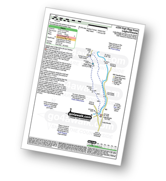
Legburthwaite Car Park - A591 - Long Band - Cowrake Head - Moss Crag - High Rigg - Carlisle Diocese Youth Centre - St John's In The Vale Church - Low Bridge Farm - Legburthwaite Car Park

|
Vital Statistics:
| Length: | 6 miles (9.5 km) |
| Ascent: | 2,202ft (671m) |
| Time: | 4½ hrs |
| Grade: | |

Route Summary:
Mardale Head - Haweswater Reservoir - The Rigg - Swine Crag (Riggindale) - Heron Crag (Riggindale) - Eagle Crag (Riggindale) - Rough Crag (Riggindale) - Caspel Gate - Riggindale Crag - Long Stile - High Street - Rough Crag (Riggindale) - Eagle Crag (Riggindale) - Heron Crag (Riggindale) - Swine Crag (Riggindale) - Dudderwick - The Rigg - Mardale Head

|
Vital Statistics:
| Length: | 7 miles (11 km) |
| Ascent: | 2,737ft (834m) |
| Time: | 5.25hrs |
| Grade: | |
Route Summary:
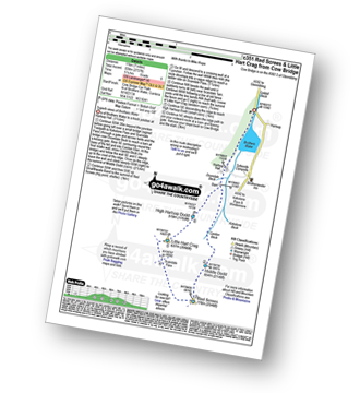
Cow Bridge - Brothers Water - Hartsop Hall - Kirkstone Beck - Caiston Beck - Middle Dodd - Red Screes - Scandale Pass - Little Hart Crag - High Hartsop Dodd - Caiston Beck - Cow Bridge - Brothers Water.

|
Vital Statistics:
| Length: | 4.5 miles (7 km) |
| Ascent: | 1,204ft (367m) |
| Time: | 3 hrs |
| Grade: | |

Route Summary:
Aira Force National Trust Car Park (nr Glenridding) - Aira Force - Riddings Beck - Waterfalls - High Force - Gowbarrow Fell (Airy Crag) - Gowbarrow Park - Green Hill (Gowbarrow Fell) - Aira Force Car Park.

|
Vital Statistics:
| Length: | 9.5 miles (15 km) |
| Ascent: | 3,682ft (1,122m) |
| Time: | 7.25hrs |
| Grade: | |

Route Summary:
Grasmere - Mill Bridge - Little Tongue - Seat Sandal - Grisedale Tarn - Fairfield - Rydal Head - Great Rigg - Rydal Fell (Heron Pike North Top) - Heron Pike - Alcock Tarn - Grasmere

|
Vital Statistics:
| Length: | 11.25 miles (18 km) |
| Ascent: | 3,436ft (1,047m) |
| Time: | 7½ hrs |
| Grade: | |

Route Summary:
Mardale Head - Haweswater Reservoir - Rowantreethwaite Beck - Old Corpse Road - Selside Pike - Branstree (North East Top) - Branstree (Artlecrag Pike) - Gatescarth Pass - Adam Seat - Harter Fell (Mardale) - Nan Bield Pass - Mardale Ill Bell - High Street - Riggindale Crag - Caspel Gate - Rough Crag (Riggindale) - Eagle Crag (Riggindale) - Heron Crag (Riggindale) - Swine Crag (Riggindale) - Dudderwick - The Rigg - Mardale Head

|
Vital Statistics:
| Length: | 4.5 miles (7 km) |
| Ascent: | 584ft (178m) |
| Time: | 2.25hrs |
| Grade: | |
Route Summary:
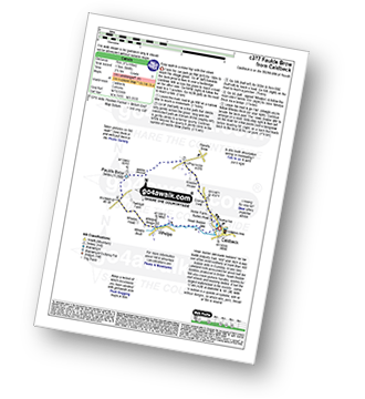
Caldbeck - Caldbeck Duck Pond - Ratten Row - Grange View - Knocker House - Faulds Brow - Whelpo - Whelpo Bridge - Whelpo Beck - Howk Bobbin Mill - Caldbeck

|
Vital Statistics:
| Length: | 1.5 miles (2.5 km) |
| Ascent: | 705ft (215m) |
| Time: | 1½ hrs |
| Grade: | |
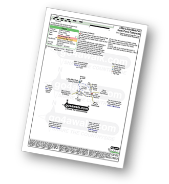
Route Summary:
Cove Park Campsite - Watermillock - Mellfell House - Little Mell Fell - The Hause - Cove Campsite - Watermillock.

|
Vital Statistics:
| Length: | 5.25 miles (8.5 km) |
| Ascent: | 2,255ft (687m) |
| Time: | 4½ hrs |
| Grade: | |

Route Summary:
Scales - Mousthwaite Comb - Scales Fell - Brunt Knott - Scales Beck - Scales Tarn - Sharp Edge - Atkinson Pike - Blencathra or Saddleback (Hallsfell Top) - Scales Fell - Mousthwaite Comb - Scales

|
Vital Statistics:
| Length: | 12.25 miles (19.5 km) |
| Ascent: | 3,984ft (1,214m) |
| Time: | 8½ hrs |
| Grade: | |

Route Summary:
Ambleside - Rydal - Nab Scar - Heron Pike - Rydal Fell (Heron Pike North Top) - Greenhead Gill Head - Stone Arthur - Great Rigg - Fairfield - Rydal Head - Hart Crag - Dove Crag - High Pike (Scandale) - Low Pike (Scandale) - High Sweden Bridge - High Sweden Coppice - Ambleside

|
Vital Statistics:
| Length: | 11 miles (17.5 km) |
| Ascent: | 2,655ft (809m) |
| Time: | 6.75hrs |
| Grade: | |

Route Summary:
Swindale - Swindale Foot Farm - Swindale Beck - Starling Gill - Stubby Hest - Bracken Howe - Thiefstead - Langhowe Pike - High Katelade - Rowantree Crag - Blea Moss - Stone Howe - Glede Howe - Willy Winder Hill - Haskew Beck - Fewling Stones - Swindale Common - Mosedale Beck (Swindale) - Nabs Moor - Nabs Crag - Howes (Mosedale) - Captain Whelter Bog - Branstree (North East Top) - Branstree (Artlecrag Pike) - Swirle Crag - Selside Pike - High Blake Dodd - Selside End - High Birkin Knott - Low Birkin Knott - Old Corpse Road - Thorny Knott - Swindale Head Farm - Truss Gap - Swindale Foot Farm - Swindale

|
Vital Statistics:
| Length: | 10 miles (16 km) |
| Ascent: | 4,020ft (1,225m) |
| Time: | 8 hrs |
| Grade: | |

Route Summary:
Glenridding - Glenridding Dodd - Sheffield Pike - Nick Head - Sticks Pass - Raise (Helvellyn) - White Side - Lower Man (Helvellyn) - Helvellyn - Swirral Edge - Catstye Cam - Glenridding Beck - Glenridding Youth Hostel - Glenridding

|
Vital Statistics:
| Length: | 8 miles (12.5 km) |
| Ascent: | 2,990ft (911m) |
| Time: | 6 hrs |
| Grade: | |

Route Summary:
Patterdale - Patterdale Church - Grisedale Bridge - Grisedale Beck - Brownend Plantation - Lanty's Tarn - Hole-in-the-Wall - Red Tarn (Helvellyn) - Bleaberry Crag - Low Spying How - High Spying How - Striding Edge (High Spying How) - Helvellyn - Swirral Edge (optional) - Hole-in-the-Wall - Grisedale Beck - Patterdale

|
Vital Statistics:
| Length: | 1.5 miles (2.5 km) |
| Ascent: | 351ft (107m) |
| Time: | 1 hrs |
| Grade: |  |
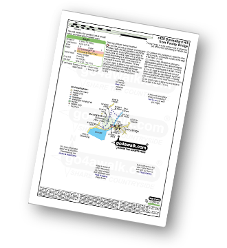
Route Summary:
Pooley Bridge - Dunmallet Woods - Dunmallard Hill (Dunmallet) - River Eamont - Pooley Bridge

|
Vital Statistics:
| Length: | 11.25 miles (18 km) |
| Ascent: | 1,614ft (492m) |
| Time: | 5.75hrs |
| Grade: | |

Route Summary:
Wet Sladdale Reservoir - Poor Hag Wood - Poorhag Gill - Wetsleddale Moor Lunch House - Howe Gill - The Shap Fells - Gray Bull - Sherry Gill - Sleddale Pike - Wasdale Pike - Great Yarlside - Great Saddle Crag - Ulthwaite Rigg - Scam Matthew - High Wether Howe - Haskew Tarn - Seat Robert - Gambling Crag - Willy Winder Hill - Great Ladstones - Bleak Hill - Willy Fold - White Crag - Michael Moss - Sleddale Hall - Sleddale Beck - Wet Sladdale Reservoir.

|
Vital Statistics:
| Length: | 5 miles (8 km) |
| Ascent: | 2,649ft (807m) |
| Time: | 4½ hrs |
| Grade: | |
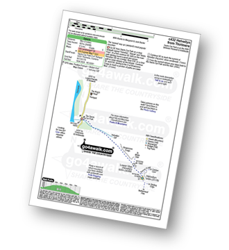
Route Summary:
The Swirls - Helvellyn Gill - Browncove Crags - Lower Man (Helvellyn) - Helvellyn - Lower Man (Helvellyn) - Browncove Crags - Helvellyn Gill - The Swirls

|
Vital Statistics:
| Length: | 11.25 miles (18 km) |
| Ascent: | 3,965ft (1,208m) |
| Time: | 8.25hrs |
| Grade: | |

Route Summary:
Legburthwaite Car Park - A591 - Long Band - Cowrake Head - Moss Crag - High Rigg - Carlisle Diocese Youth Centre - St John's In The Vale Church - B5322 - Wanthwaite Bank - Threlkeld Knotts - Buck Castles - Clough Head - Calfhow Pike - Great Dodd - Watson's Dodd - Stybarrow Dodd - Sticks Pass - Legburthwaite Car Park

|
Vital Statistics:
| Length: | 8.5 miles (13.5 km) |
| Ascent: | 1,952ft (595m) |
| Time: | 5 hrs |
| Grade: | |

Route Summary:
Swindale - Swindale Foot Farm - Swindale Beck - Starling Gill - Stubby Hest - Bracken Howe - Thiefstead - Langhowe Pike - High Katelade - Rowantree Crag - Blea Moss - Stone Howe - Glede Howe - Willy Winder Hill - Haskew Beck - Fewling Stones - Swindale Common - Mosedale Beck (Swindale) - Nabs Moor - Nabs Crag - Howes (Mosedale) - Nabs Crag - Nabs Moor - Dodd Bottom - Hobgrumble Gill - Swindale Head Farm - Truss Gap - Swindale Foot Farm - Swindale

|
Vital Statistics:
| Length: | 7.75 miles (12.5 km) |
| Ascent: | 1,168ft (356m) |
| Time: | 4 hrs |
| Grade: | |
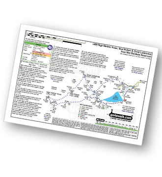
Route Summary:
Wet Sleddale Reservoir - Selside Beck - Michael Moss - Selside Hall - Scam Matthew - High Wether Howe - Haskew Tarn - Seat Robert - Great Ladstones - Bleak Hill - Willy Fold - White Crag - Peat Hill - Stackhouse Brow - Green Farm - Throney Bank Farm - River Lowther - Cooper Green Farm - eddale Reservoir.

|
Vital Statistics:
| Length: | 7.75 miles (12.5 km) |
| Ascent: | 1,483ft (452m) |
| Time: | 4½ hrs |
| Grade: | |

Route Summary:
Hazel Shaw Parking Area - Rosgill Moor - Scalebarrow Knott - Harper Hills - Low Goat Gill - Long Rigg - Powley's Hill - Hare Shaw - Woodhowe Moss - Kit Crag (Naddle Forest) - Wallow Crag (Naddle Forest) - Hugh's Laithes Pike - Hugh's Laithes Pike (North East Top) - Highfield Crag - Naddle Farm - Naddle Beck - Mirkside Wood - Scalebarrow Knott - Hazel Shaw Parking Area

|
Vital Statistics:
| Length: | 10.5 miles (17 km) |
| Ascent: | 1,411ft (430m) |
| Time: | 2.25hrs |
| Grade: | |
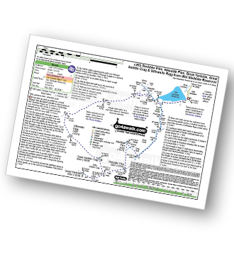
Route Summary:
Wet Sleddale Reservoir - Poor Hag Wood - Poorhag Gill - Wetsleddale Moor Lunch House - Howe Gill - The Shap Fells - Gray Bull - Sherry Gill - Sleddale Pike - Wasdale Pike - Great Yarlside - Great Saddle Crag - Ulthwaite Rigg - Sleddale Hall - Michael Moss - Sleddale Beck - Wet Sleddale Reservoir

|
Vital Statistics:
| Length: | 6.25 miles (10 km) |
| Ascent: | 1,352ft (412m) |
| Time: | 3.75hrs |
| Grade: | |
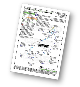
Route Summary:
Swindale - Swindale Foot Farm - Swindale Beck - Starling Gill - Stubby Hest - Bracken Howe - Thiefstead - Langhowe Pike - High Katelade - Rowantree Crag - Blea Moss - Stone Howe - Glede Howe - Willy Winder Hill - Haskew Beck - Fewling Stones - Swindale Common - Mosedale Beck (Swindale) - Dodd Bottom - Hobgrumble Gill - Swindale Head Farm - Truss Gap - Swindale Foot Farm - Swindale
See this list of walks, routes & maps in:
Grade Order | Length Order | Time Order | Walk Number or Start Location Order
NB. To reverse (toggle) this order, click Grade Order again