The North Pennines - a fully detailed list of all the Mountains, Peaks, Tops and Hills (Page 1 of 2)
The North Pennines is located in Northern England covering parts of Cumbria, County Durham and Northumberland.
If you include just the Mountains (Hewitts) and the Nuttalls there are 37 tops to climb, bag & conquer and the highest point is Cross Fell at 893m (2,931ft).
To see these Mountains, Peaks, Tops and Hills displayed in different ways - see the options in the left-hand column and towards the bottom of this page.
LOG ON and RELOAD this page to show which Mountains, Peaks, Tops and Hills you have already climbed, bagged & conquered [. . . more details]
Page 1 of 2 Go to page: 1 2 |
See this list in: Alphabetical Order‡
| Height Order
To reverse the order select the link again.
Mountain, Peak, Top or Hill:
Bagged
1. Westernhope Moor
675m (2,215ft)
See the location of Westernhope Moor and walks up it on a google Map Westernhope Moor is on interactive maps:
Westernhope Moor is on downloadable PDF you can Print or Save to your Phone: |
2. Viewing Hill
649m (2,130ft)
See the location of Viewing Hill and walks up it on a google Map Viewing Hill is on interactive maps:
Viewing Hill is on downloadable PDF you can Print or Save to your Phone: |
3. Tom Smith's Stone Top
637m (2,091ft)
See the location of Tom Smith's Stone Top and walks up it on a google Map Tom Smith's Stone Top is on interactive maps:
Tom Smith's Stone Top is on downloadable PDF you can Print or Save to your Phone: |
4. Tinside Rigg
624m (2,048ft)
See the location of Tinside Rigg and walks up it on a google Map Tinside Rigg is on interactive maps:
Tinside Rigg is on downloadable PDF you can Print or Save to your Phone: |
5. Three Pikes
650m (2,134ft)
See the location of Three Pikes and walks up it on a google Map Three Pikes is on interactive maps:
Three Pikes is on downloadable PDF you can Print or Save to your Phone: |
6. The Dodd
614m (2,015ft)
The Dodd is on interactive maps:
The Dodd is on downloadable PDF you can Print or Save to your Phone: |
7. Round Hill (Tyne Head)
686m (2,251ft)
See the location of Round Hill (Tyne Head) and walks up it on a google Map Round Hill (Tyne Head) is on interactive maps:
Round Hill (Tyne Head) is on downloadable PDF you can Print or Save to your Phone: |
8. Renwick Fell (Thack Moor)
609m (2,000ft)
See the location of Renwick Fell (Thack Moor) and walks up it on a google Map Renwick Fell (Thack Moor) is on interactive maps:
Renwick Fell (Thack Moor) is on downloadable PDF you can Print or Save to your Phone: |
9. Redgleam (Harwood Common)
715m (2,346ft)
See the location of Redgleam (Harwood Common) and walks up it on a google Map Redgleam (Harwood Common) is on interactive maps:
Redgleam (Harwood Common) is on downloadable PDF you can Print or Save to your Phone: |
10. Nine Standards Rigg
662m (2,172ft)
See the location of Nine Standards Rigg and walks up it on a google Map Nine Standards Rigg is on interactive maps:
Nine Standards Rigg is on downloadable PDF you can Print or Save to your Phone: |
11. Murton Fell
673m (2,210ft)
See the location of Murton Fell and walks up it on a google Map Murton Fell is on interactive maps:
Murton Fell is on downloadable PDF you can Print or Save to your Phone: |
12. Middlehope Moor
612m (2,008ft)
See the location of Middlehope Moor and walks up it on a google Map Middlehope Moor is on interactive maps:
Middlehope Moor is on downloadable PDF you can Print or Save to your Phone: |
13. Mickle Fell
788m (2,586ft)
See the location of Mickle Fell and walks up it on a google Map Mickle Fell is on interactive maps:
Mickle Fell is on downloadable PDF you can Print or Save to your Phone: |
14. Melmerby Fell
709m (2,326ft)
See the location of Melmerby Fell and walks up it on a google Map Melmerby Fell is on interactive maps:
Melmerby Fell is on downloadable PDF you can Print or Save to your Phone: |
15. Meldon Hill (Dufton Fell)
767m (2,517ft)
See the location of Meldon Hill (Dufton Fell) and walks up it on a google Map Meldon Hill (Dufton Fell) is on interactive maps:
Meldon Hill (Dufton Fell) is on downloadable PDF you can Print or Save to your Phone: |
16. Long Man Hill
658m (2,159ft)
See the location of Long Man Hill and walks up it on a google Map Long Man Hill is on interactive maps:
Long Man Hill is on downloadable PDF you can Print or Save to your Phone: |
17. Long Fell
623m (2,045ft)
See the location of Long Fell and walks up it on a google Map Long Fell is on interactive maps:
Long Fell is on downloadable PDF you can Print or Save to your Phone: |
18. Little Fell (Burton Fell)
748m (2,455ft)
See the location of Little Fell (Burton Fell) and walks up it on a google Map Little Fell (Burton Fell) is on interactive maps:
Little Fell (Burton Fell) is on downloadable PDF you can Print or Save to your Phone: |
19. Little Dun Fell
842m (2,763ft)
See the location of Little Dun Fell and walks up it on a google Map Little Dun Fell is on interactive maps:
Little Dun Fell is on downloadable PDF you can Print or Save to your Phone: |
20. Knock Fell
794m (2,606ft)
See the location of Knock Fell and walks up it on a google Map Knock Fell is on interactive maps:
Knock Fell is on downloadable PDF you can Print or Save to your Phone: |
21. Killhope Law
673m (2,208ft)
See the location of Killhope Law and walks up it on a google Map Killhope Law is on interactive maps:
Killhope Law is on downloadable PDF you can Print or Save to your Phone: |
22. Grey Nag
656m (2,153ft)
See the location of Grey Nag and walks up it on a google Map Grey Nag is on interactive maps:
Grey Nag is on downloadable PDF you can Print or Save to your Phone: |
23. Great Stony Hill
708m (2,323ft)
See the location of Great Stony Hill and walks up it on a google Map Great Stony Hill is on interactive maps:
Great Stony Hill is on downloadable PDF you can Print or Save to your Phone: |
24. Great Dun Fell
848m (2,783ft)
See the location of Great Dun Fell and walks up it on a google Map Great Dun Fell is on interactive maps:
Great Dun Fell is on downloadable PDF you can Print or Save to your Phone: |
25. Flinty Fell
614m (2,016ft)
See the location of Flinty Fell and walks up it on a google Map Flinty Fell is on interactive maps:
Flinty Fell is on downloadable PDF you can Print or Save to your Phone: |
26. Fiend's Fell
634m (2,081ft)
See the location of Fiend's Fell and walks up it on a google Map Fiend's Fell is on interactive maps:
Fiend's Fell is on downloadable PDF you can Print or Save to your Phone: |
27. Fendrith Hill
697m (2,287ft)
See the location of Fendrith Hill and walks up it on a google Map Fendrith Hill is on interactive maps:
Fendrith Hill is on downloadable PDF you can Print or Save to your Phone: |
28. Dead Stones
710m (2,330ft)
Dead Stones is on interactive maps:
Dead Stones is on downloadable PDF you can Print or Save to your Phone: |
29. Cross Fell
893m (2,931ft)
See the location of Cross Fell and walks up it on a google Map Cross Fell is on interactive maps:
Cross Fell is on downloadable PDF you can Print or Save to your Phone: |
30. Cold Fell Pike (Geltsdale)
621m (2,038ft)
See the location of Cold Fell Pike (Geltsdale) and walks up it on a google Map Cold Fell Pike (Geltsdale) is on interactive maps:
Cold Fell Pike (Geltsdale) is on downloadable PDF you can Print or Save to your Phone: |
Page 1 of 2 Go to page: 1 2 |
View these 37 Mountains, Peaks, Tops and Hills:
- On a Downloadable PDF you can Print or Save to your Phone#
- On an Interactive Google Map with a list of tops below it.
(makes it easier to locate a particular top) - On a Detailed List in:
Alphabetical Order | Height Order - On one page with 'yet-to-be-bagged' listed 1st
& then 'already-bagged' tops listed 2nd in:
Alphabetical Order | Height Order - On one page with 'already-bagged' tops listed 1st
& then 'yet-to-be-bagged' tops listed 2nd in:
Alphabetical Order | Height Order
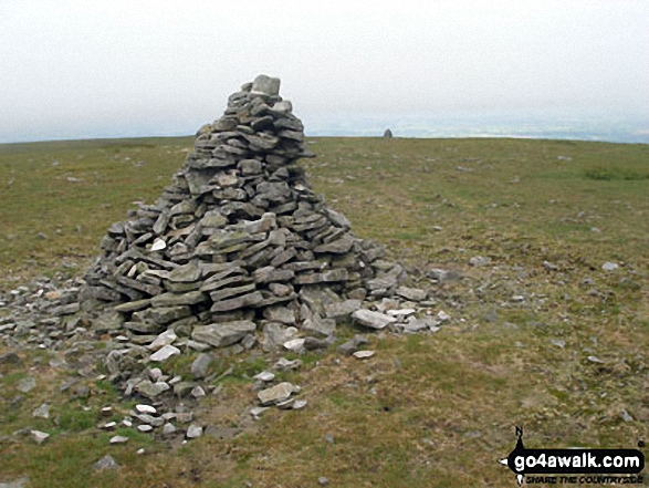
 The summit of Cross Fell in The North Pennines
Photo: Ryan Pearson
# Whether you print a copy or download it to your phone, this Peak Baggers' Map will prove incredibly useful if you want to know what's what when you are up in the mountains and cannot get a phone signal.
Is there a Mountain, Peak, Top or Hill missing from the above google map or list?
Let us know an we will add it to our database.


