Fiend's Fell
634m (2081ft)
The North Pennines, Cumbria, England
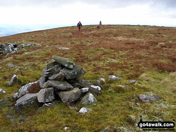
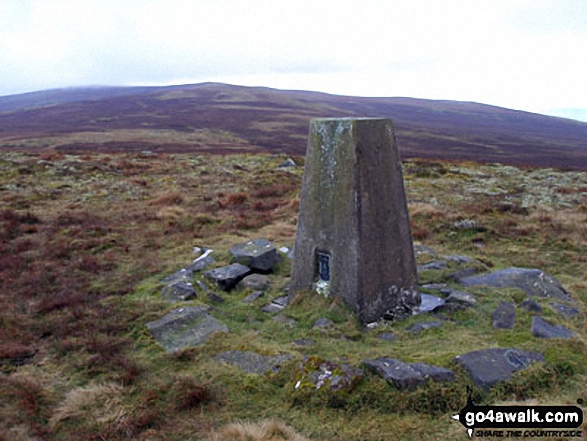
The summit of Fiend's Fell is marked by an Ordnance Survey Trig Point.
Not familiar with this top?
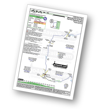
You can walk/hike to the top of Fiend's Fell by using this easy‑to‑follow route map:
See Fiend's Fell and the surrounding tops on our free-to-access 'Google Style' Peak Bagging Map:
The North Pennines
Less data - quicker to download
See Fiend's Fell and the surrounding tops on our unique, downloadable, PDF Peak Bagging Map:
NB: Whether you print off a copy or download it to your phone, this PDF Peak Baggers' Map might prove incredibly useful when your are up there on the tops and you cannot get a phone signal.
You can find Fiend's Fell & all the walks that climb it on these unique free-to-access Interactive Walk Planning Maps:
1:25,000 scale OS Explorer Map (orange/yellow covers):
1:50,000 scale OS Landranger Map (pink/magenta covers):
 Fellow go4awalkers who have already walked, climbed, scaled, summited, hiked & bagged Fiend's Fell
Sam Jones walked up Fiend's Fell on February 13th, 2023 [from/via/route] From Hartside [with] Solo [weather] Bright Sunny day low cloud in valley & over tops - Awesome views
Adrian Howard climbed it on August 31st, 2012 [from/via/route] Working at Twotops radio station so nipped up at lunchtime.
Angela Moroney bagged it on May 18th, 2021 [from/via/route] kirkstone [with] Jane ludders [weather] sun wind
Kevin Foster hiked Fiend's Fell on March 16th, 2018 [from/via/route] Melmerby Fell [with] Henry [weather] Wet & very windy. Hill fog. - By now the weather had turned very wet as well as windy as I descended off Melmerby Fell. Route finding was already difficult hampered by the conditions and, with my hood up & head down, I must have veered off the broad summit ridge too far to the right. Realising my mistake, at one of the largest sheepfolds I have ever seen, I checked my position on the OS Land Ranger map using my trusty OS locate app & corrected my direction of travel towards Little Knapside Hill. Back on the right route, a sharp descent to the col beyond Little Knapside Hill, followed by a brief climb took me to the wind shelter & trig point on the aptly named Fiends Fell. The freezing conditions meant I didn't hang around long. Continuing my rapid descent I saw the buildings of the Hartside Cafe looming out of the mist & turned left before the road to take the old original road down the fell side. I eventually reached the relative sanctuary of the A686 (Penrith to Alston road) which I immediately crossed to descend the farm access road to Hazel Rigg. A quiet muddy back lane, taken left just past Hazel Rigg, took me after several miles all the way back to Melmerby. In dry (less windy) conditions this walk would be amazing. I'd love to visit these tops again someday.
Mark Davidson summited on February 21st, 2007 [with] Mike & his friend [weather] Cloudy, cold with mist
Christine Shepherd conquered it on August 16th, 2016 [from/via/route] Walked from Melmerby using walk c430 after Melmerby Fell. [with] On my own [weather] Glorious sunshine with a pleasant breeze. - Enjoyed the walk to this fell from Melmerby Fell. A little wet in places but no problem bogs to contend with. Good views & a good path back to Melmerby.
Chris Faulkner scaled it on August 30th, 2014 [from/via/route] Walk Route Summary: - Melmerby, Meikle Awfell, Cuns Fell, Maiden Way (Roman Road), Meg's Cairn, Melmerby Fell, Knapside Hill, Little Knapside Hill, Fiend's Fell, Twotop Bridge, Hazel Rigg Farm, Gamblesby, Gill Beck, Melmerby. [with] Michelle Chandler [weather] Very Windy. - Managed to not get shot by game shooters who hadn't posted warnings!
Ray O'hara walked up Fiend's Fell on February 5th, 2013 [from/via/route] Melmerby - Melmerby Fell - Fiends Fell - Melmerby [weather] Mist above 1900', snow on the ground, full blown blizzard at times on the ridge
Patrick Rogozinski and Matthew Thomas have both walked, climbed & bagged Fiend's Fell.
To add (or remove) your name and experiences on this page - Log On and edit your Personal Mountain Bagging Record
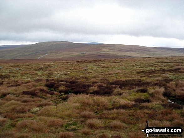
More Photographs & Pictures of views from, on, or of, Fiend's Fell
Send us your photographs and pictures on, of, or from Fiend's Fell
If you would like to add your walk photographs and pictures to this page, please send them as email attachments (configured for any computer) along with your name to:
and we shall do our best to publish them.
(Guide Resolution = 300dpi. At least = 660pixels (wide) x 440 pixels (high).)
You can also submit photos via our Facebook Page.
NB. Please indicate where each photo was taken and whether you wish us to credit your photos with a Username or your First Name/Last Name.
 (Moderate)