Cold Fell Pike (Geltsdale)
621m (2038ft)
The North Pennines, Cumbria, England
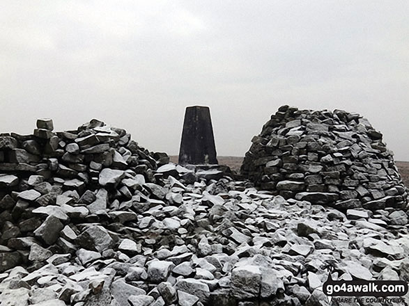
The summit of Cold Fell Pike (Geltsdale) is marked by an Ordnance Survey Trig Point.
Not familiar with this top?
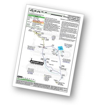
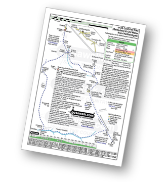
You can walk/hike to the top of Cold Fell Pike (Geltsdale) by using either of these 2 easy‑to‑follow route maps:
See Cold Fell Pike (Geltsdale) and the surrounding tops on our free-to-access 'Google Style' Peak Bagging Map:
The North Pennines
Less data - quicker to download
See Cold Fell Pike (Geltsdale) and the surrounding tops on our unique, downloadable, PDF Peak Bagging Map:
NB: Whether you print off a copy or download it to your phone, this PDF Peak Baggers' Map might prove incredibly useful when your are up there on the tops and you cannot get a phone signal.
You can find Cold Fell Pike (Geltsdale) & all the walks that climb it on these unique free-to-access Interactive Walk Planning Maps:
1:25,000 scale OS Explorer Map (orange/yellow covers):
1:50,000 scale OS Landranger Map (pink/magenta covers):
 Fellow go4awalkers who have already walked, climbed, scaled, summited, hiked & bagged Cold Fell Pike (Geltsdale)
Caroline Winter walked up Cold Fell Pike (Geltsdale) on September 3rd, 2022 [from/via/route] Clasketts RSPB CP, track past Tortie, through gates, Howgill beck, col between Tindale Fell & Cold Fell, Cold Fell, cairns on Tindale Fell [with] Becky [weather] Drizzle at times & windy approaching the top - Followed online instructions to find route after passing through gate. Quite gentle walk up, with good defined track. Nice shelter at cairn. Visited the tall cairn stones on way back. Unable to do circular route as path closed for repairs at the tarn. Headed off to visit Carlisle.
Sam Jones climbed it on November 4th, 2021 [from/via/route] From RSPB Geltsdale via Carrock/Tindale fell [with] Solo [weather] Bright sunny November day - Awesome 360 views good visibility
Mark Davidson bagged it on March 28th, 2007 [from/via/route] Walk c434 Cold Fell Pike (Geltsdale) & Old Water Bridge from Clesketts [with] MK [weather] Nice day - great views & not a soul to be found
Kevin Foster hiked Cold Fell Pike (Geltsdale) on July 31st, 2018 [from/via/route] Clesketts. [with] Henry. [weather] Cloudy with sun shining through. - I really enjoyed this walk, albeit as short as it was, & the drive along the A69 to get there. Route finding (and guidance) were straightforward for a change. The top had a massive stone cairn, trig point & a 5-star wind shelter. The remoteness of this fell meant the views all-round were spectacular but long distance. Northwards the views were of the border country & Scotland. Westwards & South westwards the Lakeland Fells were prominent. To the South & East I could make out Croglin Fell, Thack Moor, Watch Hill, Black Fell (and Grey Nag which I'd done only last week). This last view brought home to me that I was standing on the most northern fell of the Pennine hills which got me thinking that this fell & the descent into Hallbanksgate would have made a more fitting end to The Pennine Way....maybe? I varied my return to take in another ancient cairn marking the top of Tindale Fell. From here the ground fell away roughly & steeply to the shores of Tindale Tarn & then it was only a short walk back to the car park at Clesketts.
Darren Mortimer summited on January 13th, 2018 [with] Dermot Palmer [weather] cold & windy
Christine Shepherd conquered it on January 22nd, 2017 [from/via/route] Walked from Clesketts using walk c348. [with] On my own [weather] Cold with snow in the wind but fairly dry & clear - There was a really good path to the summit which I had no problem following. Didn't enjoy the walk over tussocky grass to Tindale Fell & down to the reservoir but was rewarded by unexpectedly coming upon the RSPB centre at the bottom with welcome loos & a great variety of birds on the feeders.
Ray O'hara scaled it on February 8th, 2013 [from/via/route] Clesketts [weather] Blue skies, snow lying on the ground, no wind. Absolutely perfect.
Iain Taylor walked up Cold Fell Pike (Geltsdale) on July 30th, 2012 [from/via/route] Nr Hallbankgate (NY 58873 58464)
Patrick Rogozinski, Leon Potts, Tony Rogerson and Paul Woodburn have all walked, climbed & bagged Cold Fell Pike (Geltsdale).
To add (or remove) your name and experiences on this page - Log On and edit your Personal Mountain Bagging Record
More Photographs & Pictures of views from, on, or of, Cold Fell Pike (Geltsdale)
Send us your photographs and pictures on, of, or from Cold Fell Pike (Geltsdale)
If you would like to add your walk photographs and pictures to this page, please send them as email attachments (configured for any computer) along with your name to:
and we shall do our best to publish them.
(Guide Resolution = 300dpi. At least = 660pixels (wide) x 440 pixels (high).)
You can also submit photos via our Facebook Page.
NB. Please indicate where each photo was taken and whether you wish us to credit your photos with a Username or your First Name/Last Name.

 (Moderate)
 (Moderate)


