Walk Grey Nag from Gilderdale Bridge
Easy walk on wild quiet moorland
This 6¼ mile, Grade 4 (Moderate), easy-to-follow, hand-crafted walk, complete with GPS Waypoints, starts at Gilderdale Bridge in the North Pennines & will take you about 3½ hrs to complete.
   |
Detailed walk route map PDF | |
Vital Statistics: | ||
| Walk No.: | n139 | |
| Length: | 6¼ miles (10km) | |
| Ascent: | 1325 ft (404m) | |
| Time: | 3½ hours | |
| Grade: |  | |

Route outline for this walk:
Gilderdale Bridge - Gilderdale Burn - The Pennine Way - Whitley Castle - Black Hill (Whitley Common) - Grey Nag - Black Hill (Whitley Common) - Whitley Castle - The Pennine Way - Gilderdale Burn - Gilderdale Bridge
Peaks, Summits and Tops reached on this walk:
 1 English Mountain |
 0 Wainwrights |
 1 English Nuttall |
 0 English Deweys |
 0 Wainwright Outlying Fells |
 0 Marilyns |
 0 Bridgets |
Peak Bagging Statistics for this walk:
The highest point of this walk is Grey Nag at 656m (2153ft). Grey Nag is classified as an English Mountain (Hewitt) (138th highest in England, 239th highest in England & Wales)
Grey Nag is also known as an English Nuttall (185th highest in England, 320th highest in England & Wales). The summit of Grey Nag is marked by an Ordnance Survey Trig Point.
National Trails & Long Paths included on this walk:
Part of this walk follows a section of The Pennine Way, a 404km (251 miles) linear footpath connecting Edale in Derbyshire, England with Kirk Yetholm in The Borders, Scotland. The Pennine Way is waymarked by a National Trail Acorn. For more walks that include a section of this trail see The Pennine Way.
You can find this walk and other nearby walks on these unique Interactive Walk Planning Maps:
(worth a look if you're new to go4awalk.com & have never seen one of these before.)
1:25,000 scale OS Explorer Map (orange/yellow covers):
1:50,000 scale OS Landranger Map (pink/magenta covers):
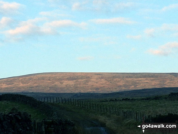
Some Photos and Pictures from Walk Grey Nag from Gilderdale Bridge
In no particular order . . .




Send us your photographs and pictures from your walks and hikes
Send them in to us as email attachments (configured for any computer) along with your name/username and where the picture was taken to:
and we shall do our best to publish them.
(Guide Resolution = 300dpi. At least = 660 pixels (wide) x 440 pixels (high).)

You can also submit photos via our Facebook Page.
NB. Please indicate where each photo was taken so we can match it to a walk route.