England - a fully detailed list of all the Mountains, Peaks, Tops and Hills (Page 1 of 9)
England is defined as the whole of the country of England which includes the National Parks of Dartmoor, Exmoor, The Lake District, The Peak District, The North York Moors, Northumberland, The South Downs and The Yorkshire Dales, as well as The Chilterns, The Cotswolds, The Forest of Bowland, The North Peninnes, The Shropshire Hills and The South Peninnes.
If you count only the Nuttalls there are 254 tops to climb, bag & conquer and the highest point is Scafell Pike at 978m (3,210ft).
To see these Mountains, Peaks, Tops and Hills displayed in different ways - see the options in the left-hand column and towards the bottom of this page.
LOG ON and RELOAD this page to show which Mountains, Peaks, Tops and Hills you have already climbed, bagged & conquered [. . . more details]
See this list in: Alphabetical Order‡
| Height Order
To reverse the order select the link again.
Mountain, Peak, Top or Hill:
Bagged
1. Yoke
706m (2,317ft)
See the location of Yoke and walks up it on a google Map Yoke is on interactive maps:
Yoke is on downloadable PDF you can Print or Save to your Phone: *Version including the walk routes marked on it that you need to follow to Walk all 214 Wainwrights in just 59 walks. |
2. Yockenthwaite Moor
643m (2,110ft)
See the location of Yockenthwaite Moor and walks up it on a google Map Yockenthwaite Moor is on interactive maps:
Yockenthwaite Moor is on downloadable PDF you can Print or Save to your Phone: |
3. Yewbarrow (North Top)
616m (2,023ft)
See the location of Yewbarrow (North Top) and walks up it on a google Map Yewbarrow (North Top) is on interactive maps:
Yewbarrow (North Top) is on downloadable PDF you can Print or Save to your Phone: *Version including the walk routes marked on it that you need to follow to Walk all 214 Wainwrights in just 59 walks. |
4. Yewbarrow
628m (2,062ft)
See the location of Yewbarrow and walks up it on a google Map Yewbarrow is on interactive maps:
Yewbarrow is on downloadable PDF you can Print or Save to your Phone: *Version including the walk routes marked on it that you need to follow to Walk all 214 Wainwrights in just 59 walks. |
5. Yes Tor
619m (2,031ft)
See the location of Yes Tor and walks up it on a google Map Yes Tor is on interactive maps:
Yes Tor is on downloadable PDF you can Print or Save to your Phone: |
6. Yarlside
639m (2,097ft)
See the location of Yarlside and walks up it on a google Map Yarlside is on interactive maps:
Yarlside is on downloadable PDF you can Print or Save to your Phone: |
7. Windy Gyle
619m (2,031ft)
See the location of Windy Gyle and walks up it on a google Map Windy Gyle is on interactive maps:
A downloadable go4awalk.com PDF Peak Bagging Map featuring Windy Gyle will be available soon. |
8. Wild Boar Fell
708m (2,323ft)
See the location of Wild Boar Fell and walks up it on a google Map Wild Boar Fell is on interactive maps:
Wild Boar Fell is on downloadable PDF you can Print or Save to your Phone: |
9. Whiteside (Crummock) (West Top)
707m (2,320ft)
See the location of Whiteside (Crummock) (West Top) and walks up it on a google Map Whiteside (Crummock) (West Top) is on interactive maps:
Whiteside (Crummock) (West Top) is on downloadable PDF you can Print or Save to your Phone: *Version including the walk routes marked on it that you need to follow to Walk all 214 Wainwrights in just 59 walks. |
10. Whiteside (Crummock)
719m (2,360ft)
See the location of Whiteside (Crummock) and walks up it on a google Map Whiteside (Crummock) is on interactive maps:
Whiteside (Crummock) is on downloadable PDF you can Print or Save to your Phone: *Version including the walk routes marked on it that you need to follow to Walk all 214 Wainwrights in just 59 walks. |
11. Whiteless Pike
660m (2,166ft)
See the location of Whiteless Pike and walks up it on a google Map Whiteless Pike is on interactive maps:
Whiteless Pike is on downloadable PDF you can Print or Save to your Phone: *Version including the walk routes marked on it that you need to follow to Walk all 214 Wainwrights in just 59 walks. |
12. White Side
863m (2,832ft)
See the location of White Side and walks up it on a google Map White Side is on interactive maps:
White Side is on downloadable PDF you can Print or Save to your Phone: *Version including the walk routes marked on it that you need to follow to Walk all 214 Wainwrights in just 59 walks. |
13. White Maiden
612m (2,010ft)
See the location of White Maiden and walks up it on a google Map White Maiden is on interactive maps:
A downloadable go4awalk.com PDF Peak Bagging Map featuring White Maiden will be available soon. |
14. Whernside
736m (2,416ft)
See the location of Whernside and walks up it on a google Map Whernside is on interactive maps:
Whernside is on downloadable PDF you can Print or Save to your Phone: |
15. Wetherlam
763m (2,504ft)
See the location of Wetherlam and walks up it on a google Map Wetherlam is on interactive maps:
Wetherlam is on downloadable PDF you can Print or Save to your Phone: *Version including the walk routes marked on it that you need to follow to Walk all 214 Wainwrights in just 59 walks. |
16. Wether Hill (South Top)
674m (2,212ft)
See the location of Wether Hill (South Top) and walks up it on a google Map Wether Hill (South Top) is on interactive maps:
Wether Hill (South Top) is on downloadable PDF you can Print or Save to your Phone: *Version including the walk routes marked on it that you need to follow to Walk all 214 Wainwrights in just 59 walks. |
17. Westernhope Moor
675m (2,215ft)
See the location of Westernhope Moor and walks up it on a google Map Westernhope Moor is on interactive maps:
Westernhope Moor is on downloadable PDF you can Print or Save to your Phone: |
18. Water Crag (Arkengarthdale)
668m (2,192ft)
See the location of Water Crag (Arkengarthdale) and walks up it on a google Map Water Crag (Arkengarthdale) is on interactive maps:
Water Crag (Arkengarthdale) is on downloadable PDF you can Print or Save to your Phone: |
19. Wandope
773m (2,539ft)
See the location of Wandope and walks up it on a google Map Wandope is on interactive maps:
Wandope is on downloadable PDF you can Print or Save to your Phone: *Version including the walk routes marked on it that you need to follow to Walk all 214 Wainwrights in just 59 walks. |
20. Walna Scar
621m (2,038ft)
See the location of Walna Scar and walks up it on a google Map Walna Scar is on interactive maps:
A downloadable go4awalk.com PDF Peak Bagging Map featuring Walna Scar will be available soon. |
21. Viewing Hill
649m (2,130ft)
See the location of Viewing Hill and walks up it on a google Map Viewing Hill is on interactive maps:
Viewing Hill is on downloadable PDF you can Print or Save to your Phone: |
22. Ullscarf
723m (2,372ft)
See the location of Ullscarf and walks up it on a google Map Ullscarf is on interactive maps:
Ullscarf is on downloadable PDF you can Print or Save to your Phone: *Version including the walk routes marked on it that you need to follow to Walk all 214 Wainwrights in just 59 walks. |
23. Tom Smith's Stone Top
637m (2,091ft)
See the location of Tom Smith's Stone Top and walks up it on a google Map Tom Smith's Stone Top is on interactive maps:
Tom Smith's Stone Top is on downloadable PDF you can Print or Save to your Phone: |
24. Tinside Rigg
624m (2,048ft)
See the location of Tinside Rigg and walks up it on a google Map Tinside Rigg is on interactive maps:
Tinside Rigg is on downloadable PDF you can Print or Save to your Phone: |
25. Thunacar Knott
723m (2,373ft)
See the location of Thunacar Knott and walks up it on a google Map Thunacar Knott is on interactive maps:
Thunacar Knott is on downloadable PDF you can Print or Save to your Phone: *Version including the walk routes marked on it that you need to follow to Walk all 214 Wainwrights in just 59 walks. |
26. Three Pikes
650m (2,134ft)
See the location of Three Pikes and walks up it on a google Map Three Pikes is on interactive maps:
Three Pikes is on downloadable PDF you can Print or Save to your Phone: |
27. Thornthwaite Crag
784m (2,573ft)
See the location of Thornthwaite Crag and walks up it on a google Map Thornthwaite Crag is on interactive maps:
Thornthwaite Crag is on downloadable PDF you can Print or Save to your Phone: *Version including the walk routes marked on it that you need to follow to Walk all 214 Wainwrights in just 59 walks. |
28. The Old Man of Coniston
802m (2,633ft)
See the location of The Old Man of Coniston and walks up it on a google Map The Old Man of Coniston is on interactive maps:
The Old Man of Coniston is on downloadable PDF you can Print or Save to your Phone: *Version including the walk routes marked on it that you need to follow to Walk all 214 Wainwrights in just 59 walks. |
29. The Dodd
614m (2,015ft)
The Dodd is on interactive maps:
The Dodd is on downloadable PDF you can Print or Save to your Phone: |
30. The Cheviot
815m (2,674ft)
See the location of The Cheviot and walks up it on a google Map The Cheviot is on interactive maps:
A downloadable go4awalk.com PDF Peak Bagging Map featuring The Cheviot will be available soon. |
View these 254 Mountains, Peaks, Tops and Hills:
- On an Interactive Google Map with a list of tops below it.
(makes it easier to locate a particular top) - On a Detailed List in:
Alphabetical Order | Height Order - On one page with 'yet-to-be-bagged' listed 1st
& then 'already-bagged' tops listed 2nd in:
Alphabetical Order | Height Order - On one page with 'already-bagged' tops listed 1st
& then 'yet-to-be-bagged' tops listed 2nd in:
Alphabetical Order | Height Order
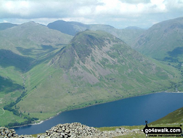
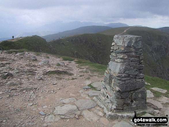
 The view from Scafell Pike in England
Photo: David Cochrane
Is there a Mountain, Peak, Top or Hill missing from the above google map or list?
Let us know an we will add it to our database.

