![]()
Yockenthwaite Moor
643m (2110ft)
The Southern Dales Area, The Yorkshire Dales, North Yorkshire, England
Tap/mouse over a coloured circle (1-3 easy walks, 4-6 moderate walks, 7-9 hard walks) and click to select.
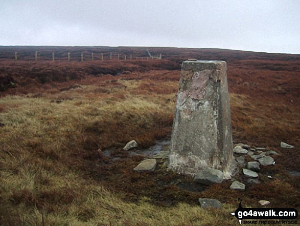
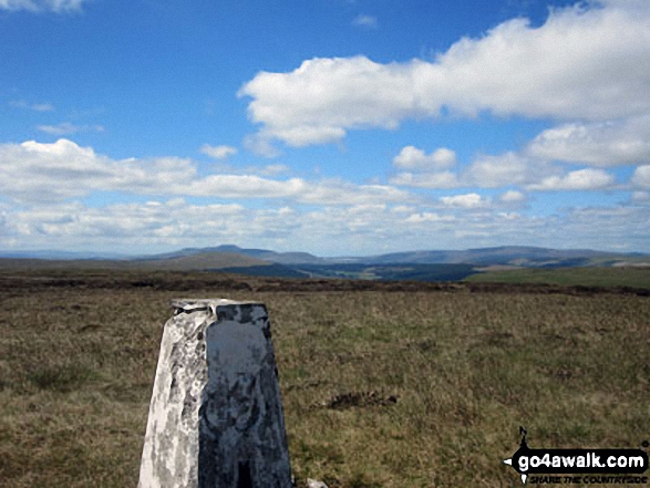
The summit of Yockenthwaite Moor is marked by an Ordnance Survey Trig Point.
Not familiar with this top?
   |
|---|
Vital Statistics:
| Length: | 9.5ml (15km) |
|---|---|
| Ascent: | 1,906ft (581m) |
| Time: | 5½ hrs |
| Grade: |  (Moderate) (Moderate) |

Route Summary:
Buckden - Rakes Wood - Buckden Rake - Cray Gill - Cray - Crook Gill - Todd's Wood - Scar House - Strans Gill - Strans Wood - Yockenthwaite Moor - Yockenthwaite - The Dales Way - Hubberholme - The River Wharfe - Wharfedale - Buckden
See Yockenthwaite Moor and the surrounding tops on our free-to-access 'Google Style' Peak Bagging Maps:
The Southern Dales Area of The Yorkshire Dales National Park
Less data - quicker to download
The Whole of The Yorkshire Dales National Park
More data - might take a little longer to download
See Yockenthwaite Moor and the surrounding tops on our downloadable Peak Bagging Map in PDF format:

NB: Whether you print off a copy or download it to your phone, this PDF Peak Baggers' Map might prove incredibly useful when your are up there on the tops and you cannot get a phone signal.
You can find Yockenthwaite Moor & all the walks that climb it on these unique free-to-access Interactive Walk Planning Maps:
1:25,000 scale OS Explorer Map (orange/yellow covers):
1:50,000 scale OS Landranger Map (pink/magenta covers):
 Fellow go4awalkers who have already walked, climbed, summited & bagged Yockenthwaite Moor
Mark Davidson walked up Yockenthwaite Moor on April 3rd, 2004 [from/via/route] Walk ny207 Yockenthwaite Moor from Buckden [with] Alone [weather] Dry & bright. The climb up to the summit of Yockenthwaite Moor was a struggle . . . but the view from there is magnificent.
Kevin Foster climbed it on July 16th, 2017 [from/via/route] Hubberholme (Strans Gill) [with] By myself (and Henry my Labrador) [weather] Hot & Sunny (but with a pleasant cool breeze on the tops). - I took the described route via Strans Gill, which was the recommended & easiest route to the summit of Yockenthwaite Moor, but it was still very tough as there was no clear path that I could see. This shows that relatively few people do this fell & it was obvious why when the trig point came into view. this was probably the longest 1/4 mile walking I've ever done as I tried to thread a route through the peat hags & bogs. The view South made it worth it.......Just!
Tony Rogerson bagged it on May 2nd, 2016 [from/via/route] Buckden Hubberholme Yockenthwaite Moor Cray Moss Cray Buckden [with] Caz Floss [weather] Clear & breezy - Beware the peat haggs!
Caroline Winter hiked Yockenthwaite Moor on August 9th, 2015 [from/via/route] Huberholme, Scar House, Strans Gill, yockenthwaite moor summit, South towards Yockenthwaite hamlet, Dales Way, Huberholme [with] solo [weather] cloudy, light Westerly wind, warm at 19 degrees C - Worried about this Walk; comments of horrendous bog, but locals not phased so decision made to tackle today as rain setting in tomorrow. Navigation easy to reach summit & beacon white trig point stood proud. Northerly wall/fence handrail but water ravines & hidden holes & water courses caused reason for wits & careful footing. Bog leaping to summit. A casual descent caused veering to South West & dropping low too quickly but route traced & delightful walk back along river bank
Darren Mortimer summited on May 30th, 2015 [from/via/route] Buckden [with] Dermot Palmer [weather] Sunny & a nice breeze - The peat hags are nowhere near as bad as been made out.
To add (or remove) your name and experiences on this page - Log On and edit your Personal Mountain Bagging Record
. . . [see more walk reports]
More Photographs & Pictures of views from, on or of Yockenthwaite Moor

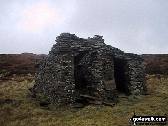
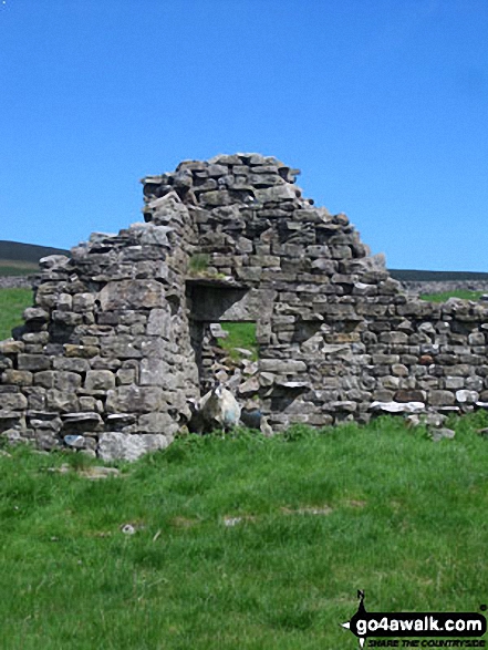
Ruin in the lower slopes of Yockenthwaite Moor near Yockenthwaite village
Send us your photographs and pictures on, of, or from Yockenthwaite Moor
If you would like to add your walk photographs and pictures to this page, please send them as email attachments (configured for any computer) along with your name to:
and we shall do our best to publish them.
(Guide Resolution = 300dpi. At least = 660pixels (wide) x 440 pixels (high).)

You can also submit photos via our Facebook Page.
NB. Please indicate where each photo was taken and whether you wish us to credit your photos with a Username or your First Name/Last Name.