Wetherlam
763m (2504ft)
The Southern Fells, The Lake District, Cumbria, England
Tap/mouse over a coloured circle (1-3 easy walks, 4-6 moderate walks, 7-9 hard walks) and click to select.


Not familiar with this top?
You can walk/hike to the top of Wetherlam by using any of these 5 easy‑to‑follow route maps:

Walk c303 Swirl How and Wetherlam from Little Langdale
A quieter alternative to the Coniston crowds.
   |
|---|
Vital Statistics:
| Length: | 8ml (12km) |
|---|---|
| Ascent: | 3,042ft (927m) |
| Time: | 5.75hrs |
| Grade: |  (Moderate) (Moderate) |

Route Summary:
Fell Foot Bridge - Little Langdale - Hollin Crag - Wet Side Edge - Little Carrs - Great Carrs - Swirl How - Swirl Hawse - Keld Gill Head - Black Sails - Red Dell Head Moss - Wetherlam - Wetherlam Edge - Birk Fell - Greenburn Beck - Fell Foot Bridge


Walk c167 Wetherlam and Swirl How from Low Tilberthwaite
A quiet alternative to the usual honey pots
|
|---|
Vital Statistics:
| Length: | 8.75ml (14km) |
|---|---|
| Ascent: | 3,584ft (1,092m) |
| Time: | 6.75hrs |
| Grade: |  (Hard) (Hard) |

Route Summary:
Low Tilberthwaite - Above Beck Fells - Hole Rake - Red Gill Head Moss - Steel Edge - Lad Stones - Wetherlam - Red Dell Head Moss - Black Sails - Keld Gill Head - Swirl Hawse - Prison Band - Swirl How - Great Carrs - Little Carrs - Hell Gill Pike - Wet Side Edge - High End - Greenburn Beck - Low Tilberthwaite

Walk c306 The Old Man of Coniston and Wetherlam from Coniston
Superb views of Coniston Water
|
|---|
Vital Statistics:
| Length: | 9.75ml (15.5km) |
|---|---|
| Ascent: | 3,664ft (1,117m) |
| Time: | 7.25hrs |
| Grade: | (Hard) |

Route Summary:
Coniston - Church Beck - Levers Water Beck - Crowberry Haws - Low Water - The Old Man of Coniston - Brim Fell - Levers Hawse - Swirl Band - Swirl How - Prison Band - Swirl Hawse - Keld Gill Head - Black Sails - Red Dell Head Moss - Wetherlam - Furness Fells - Coniston

Walk c222 Swirl How and Wetherlam from Coniston
The Consiton fells without the crowds
|
|---|
Vital Statistics:
| Length: | 10ml (16km) |
|---|---|
| Ascent: | 3,584ft (1,092m) |
| Time: | 7 hrs |
| Grade: | (Hard) |

Route Summary:
Coniston - Church Beck - Levers Water Beck - Crowberry Haws - Low Water - Brim Fell - Levers Hawse - Swirl Band - Swirl How - Prison Band - Swirl Hawse - Keld Gill Head - Black Sails - Red Dell Head Moss - Wetherlam - Furness Fells - Coniston

Walk c420 The Coniston Fells from Walna Scar Road, Coniston
Superb high level route
|
|---|
Vital Statistics:
| Length: | 12.75ml (20.5km) |
|---|---|
| Ascent: | 4,191ft (1,277m) |
| Time: | 8.75hrs |
| Grade: |  (Hard) (Hard) |

Route Summary:
Coniston - Walna Scar Road - Boo Tarn - Torver Beck - Cove Bridge - Goat's Water - Goat's Hawse - Dow Crag - Goat's Hawse - The Old Man of Coniston - Brim Fell - Levers Hawse - Grey Friar - Great Carrs - Swirl How - Prison Band - Keld Gill Head - Black Sails - Wetherlam - Swirl Hawse - Levers Water - Crowberry Haws - Walna Scar Road - Coniston
See Wetherlam and the surrounding tops on our free-to-access 'Google Style' Peak Bagging Maps:

The Southern Fells of The Lake District National Park
Less data - quicker to download
The Whole of The Lake District National Park
More data - might take a little longer to download
See Wetherlam and the surrounding tops on our unique, downloadable, PDF Peak Bagging Maps:

NB: Whether you print off a copy or download it to your phone, these PDF Peak Baggers' Maps might prove incredibly useful when your are up there on the tops and you cannot get a phone signal.
*This version is marked with the walk routes you need to follow to Walk all 214 Wainwrights in just 59 walks.
You can find Wetherlam & all the walks that climb it on these unique free-to-access Interactive Walk Planning Maps:
1:25,000 scale OS Explorer Map (orange/yellow covers):
1:50,000 scale OS Landranger Maps (pink/magenta covers):
 Fellow go4awalkers who have already walked, climbed, scaled, summited, hiked & bagged Wetherlam
Nick Tippins walked up Wetherlam on September 26th, 2025 [from/via/route] c306: The Old Man of Coniston & Wetherlam from Coniston [with] Fran
Sarah Gunn climbed it on July 27th, 2025 [with] Martin Gunn
Chris Faulkner bagged it on August 24th, 2024 [from/via/route] From Coniston via Levers Water & Black Sails [weather] Bright & blustery.
Ian Ashton hiked Wetherlam on July 6th, 2024 [with] Solo - Ì
Callum Wilson summited on January 13th, 2024 [from/via/route] Route c306 [with] Solo [weather] Mixed
To add (or remove) your name and experiences on this page - Log On and edit your Personal Mountain Bagging Record
. . . [see more walk reports]
More Photographs & Pictures of views from, on, or of, Wetherlam

Coniston Water from the summit of Brock Barrow (Top o' Selside) with Beacon (Blawith Fells) prominent (centre) and the Coniston Fells: White Maiden, Walna Scar, Dow Crag, The Old Man of Coniston, Brim Fell, Swirl How and Wetherlam in the background (right)

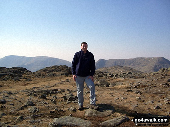
The Old Man of Coniston (left) and Swirl How (right) from Wetherlam summit
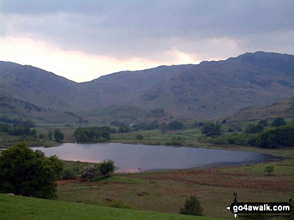

Little Stand (foreground), Pike of Blisco (Pike o' Blisco) (left), Wetherlam and The Old Man of Coniston (right) from Slight Side
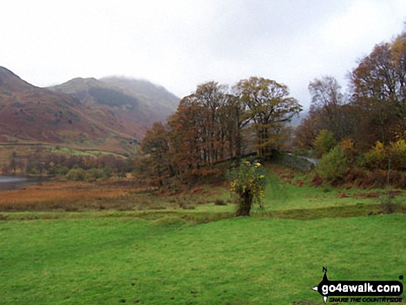

Looking across Little Langdale to the Langdale Pikes (with Pike of Stickle prominent to the left) from Wetherlam
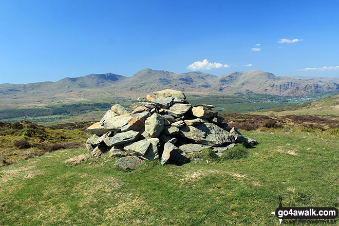
Top o' Selside summit cairn with the Coniston Fells: White Maiden, Walna Scar, Dow Crag, The Old Man of Coniston, Brim Fell, Swirl How and Wetherlam as a backdrop
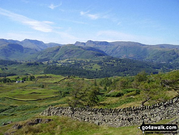
Wetherlam and Pike of Blisco (Pike o' Blisco) from Black Fell (Black Crag)
. . . see all 45 walk photographs & pictures of views from, on, or of, Wetherlam
Send us your photographs and pictures on, of, or from Wetherlam
If you would like to add your walk photographs and pictures to this page, please send them as email attachments (configured for any computer) along with your name to:
and we shall do our best to publish them.
(Guide Resolution = 300dpi. At least = 660pixels (wide) x 440 pixels (high).)

You can also submit photos via our Facebook Page.
NB. Please indicate where each photo was taken and whether you wish us to credit your photos with a Username or your First Name/Last Name.