Walna Scar
621m (2038ft)
The Southern Marches, The Lake District, Cumbria, England
Tap/mouse over a coloured circle (1-3 easy walks, 4-6 moderate walks, 7-9 hard walks) and click to select.
Not familiar with this top?
See Walna Scar and the surrounding tops on our free-to-access 'Google Style' Peak Bagging Maps:
The Southern Marches area of The Lake District National Park
Less data - quicker to download
The Whole of The Lake District National Park
More data - might take a little longer to download
A go4awalk.com downloadable Peak Bagging Map in PDF format featuring Walna Scar should be available soon.
You can find Walna Scar & all the walks that climb it on these unique free-to-access Interactive Walk Planning Maps:
1:25,000 scale OS Explorer Map (orange/yellow covers):
1:50,000 scale OS Landranger Maps (pink/magenta covers):
 Fellow go4awalkers who have already walked, climbed, summited & bagged Walna Scar
Kevin Foster walked up Walna Scar on September 16th, 2021 [from/via/route] Coniston. [with] By myself. [weather] Sunny with some high cloud cover. Perfect conditions really. - I decided to revisit Swirl How & Great Carrs after the low cloud on the previous week's visit blotted out all the views. A brief summary of the route was: Coppermines valley, Levers water, Swirl Hause, Swirl How, Great Carrs, Grey Friars, Levers Hause, Brim Fell, Old Man, Goats Hause, Dow crag, Buck Pike, Brown Pike, Walna Scar, White Maiden & return to the Walna Scar road for the long descent back into Coniston. The clear visibility really opened up the views as far as Morecambe Bay, the Isle of Man & possibly Blackpool Tower!? A superb day's walking from start to finish.
Trevor Williams climbed Walna Scar on January 11th, 2018 [from/via/route] Torver [with] Paul
Mark Davidson bagged Walna Scar on April 30th, 2015 [with] Alone [weather] Cloudy with sunny spells - cold wind
Leon Harvey hiked Walna Scar on April 5th, 2015 [from/via/route] Walna Scar Road [with] Solo [weather] foggy & Sunny
Ray O'hara summited Walna Scar on February 26th, 2014 [from/via/route] Walna Scar from Coniston including White Maiden [weather] Mist on the summits, persistent rain throughout.
Christine Shepherd conquered Walna Scar on October 12th, 2013 [from/via/route] Walked from Coniston using Wainwright's Outlying Fells book. [with] On my own [weather] Beautiful Autumn sunshine with a hearty breeze on top.
Iain Taylor scaled Walna Scar on July 25th, 2010 [from/via/route] Coniston (SD 30001 97460)
Paul Macey walked up Walna Scar on August 14th, 2012 [from/via/route] Old Man Coniston , Dow Crag [with] Luke Macey [weather] Sunny
Jeanette Coward, Louise Sandwith, David Kelley, David Preston, Paul Booth, Louis Smith, Jan Dixon, John Kendall and Matthew Thomas have all walked, climbed & bagged Walna Scar.
To add (or remove) your name and experiences on this page - Log On and edit your Personal Mountain Bagging Record
More Photographs & Pictures of views from, on or of Walna Scar
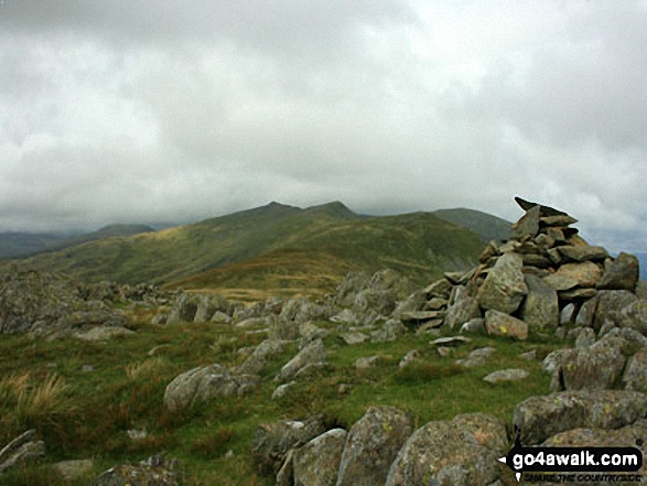
Dow Crag, Buck Pike, Brown Pike and The Old Man of Coniston from White Maiden the high point on Walna Scar
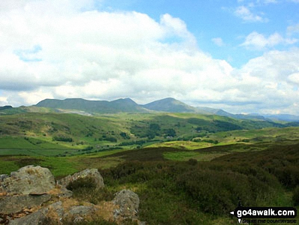
Walna Scar, Dow Crag and The Old Man of Coniston from the summit of Yew Bank

Coniston Water with Beacon (Blawith Fells), Caw (Dunnerdale Fells), White Maiden, Walna Scar, Dow Crag and The Old Man of Coniston (right) from Great Hill (Consiton)
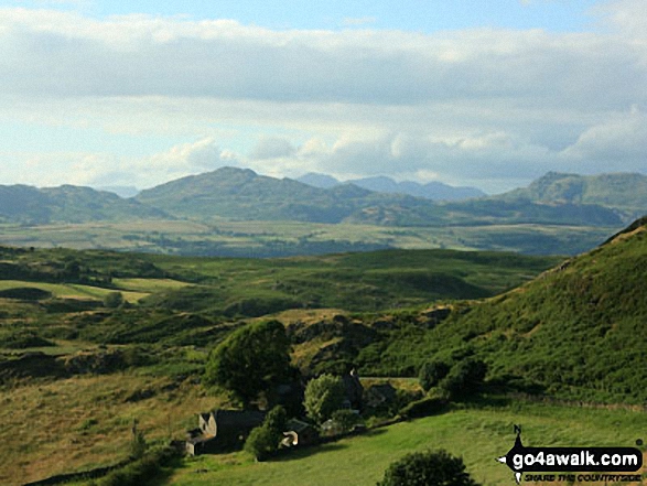
Burney Farm and a distant view of the northernmost Southern Fells from between Caw (centre) and Walna Scar (right) from Burney (Great Burney)

Coniston Water from the summit of Brock Barrow (Top o' Selside) with Beacon (Blawith Fells) prominent (centre) and the Coniston Fells: White Maiden, Walna Scar, Dow Crag, The Old Man of Coniston, Brim Fell, Swirl How and Wetherlam in the background (right)
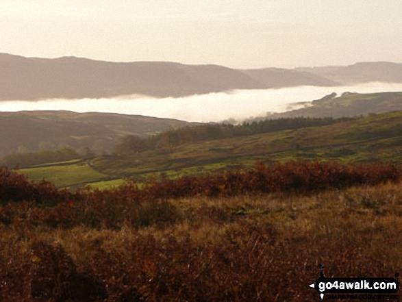
Lake Coniston under a temperature inversion from the car park at Walna Scar Road
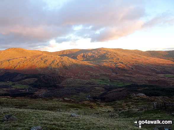
Sun setting in the Duddon Valley and the Seathwaite Fells (Dow Crag, Brown Pike & Walna Scar) from the path up Harter Fell (Eskdale)
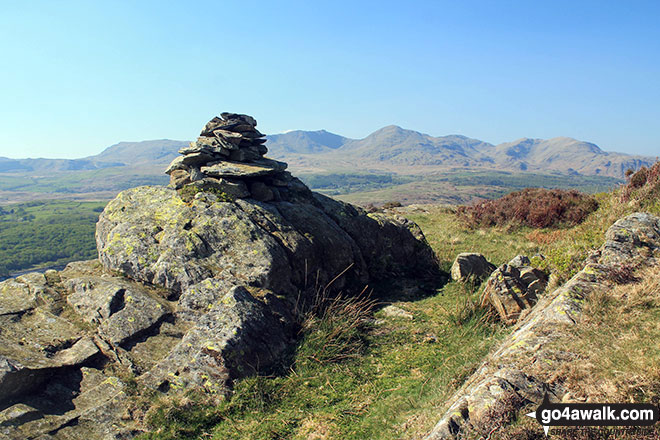
High Light Haw (Top o' Selside) summit cairn with the Coniston Fells: White Maiden, Walna Scar, Dow Crag, The Old Man of Coniston, Brim Fell, Swirl How and Wetherlam in the background
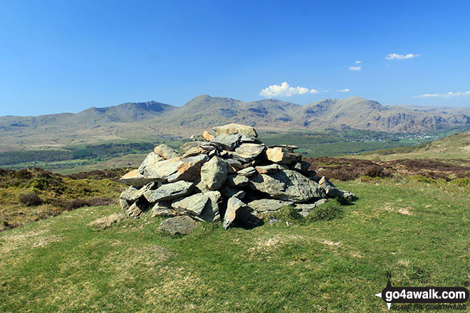
Top o' Selside summit cairn with the Coniston Fells: White Maiden, Walna Scar, Dow Crag, The Old Man of Coniston, Brim Fell, Swirl How and Wetherlam as a backdrop
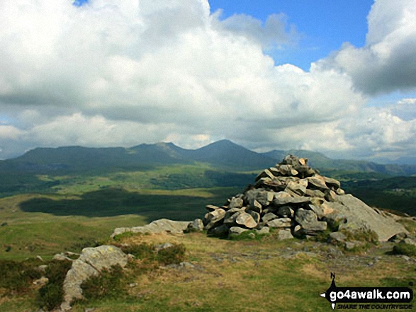
Walna Scar, Dow Crag and The Old Man of Coniston from Beacon (Blawith Fells)
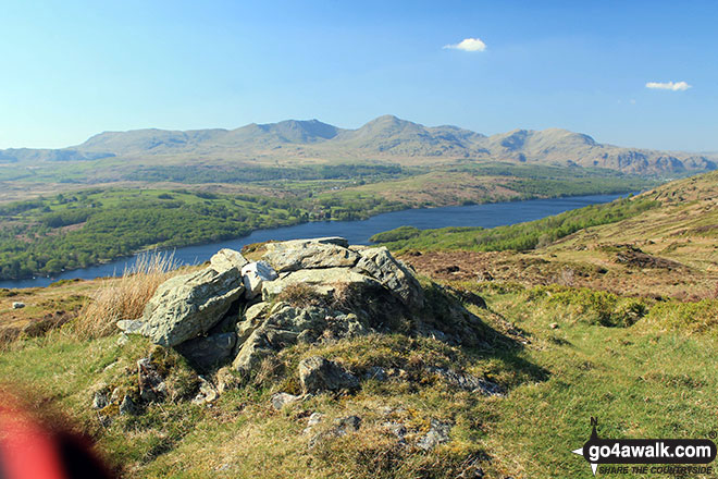
Low Light Haw (Top o' Selside) summit cairn with the Coniston Fells: White Maiden, Walna Scar, Dow Crag, The Old Man of Coniston, Brim Fell, Swirl How and Wetherlam in the background
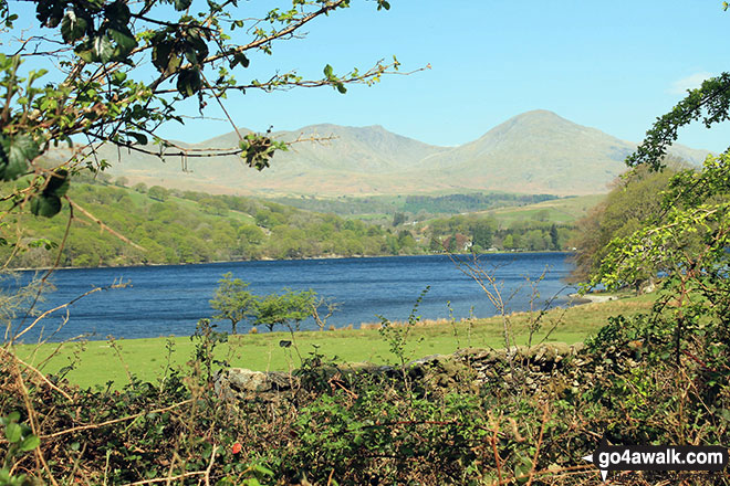
White Maiden, Walna Scar, Dow Crag and The Old Man of Coniston across Coniston Water from Crab Haws Woods
Send us your photographs and pictures on, of, or from Walna Scar
If you would like to add your walk photographs and pictures featuring views from, on or of Walna Scar to this page, please send them as email attachments (configured for any computer) along with your name to:
and we shall do our best to publish them.
(Guide Resolution = 300dpi. At least = 660pixels (wide) x 440 pixels (high).)
You can also submit photos via our Facebook Page.
NB. Please indicate where each photo was taken and whether you wish us to credit your photos with a Username or your First Name/Last Name.
Not familiar with this top?
 (Moderate)