UK Postcode CA12 - The 30 nearest easy-to-follow, circular walk route maps to you
The thirty nearest easy-to-follow, circular walk route maps to you in UK Postcode CA12 in Walk Grade Order
The UK cities, towns and villages in Cumbria, England that have CA12 in their UK Postcode include:
• Applethwaite • Bassenthwaite • Borrowdale • Braithwaite • Grange • Keswick • Little Town • Millbeck • Portinscale • Rosthwaite • Scales • Seathwaite • Seatoller • Stair • Thornthwaite • Threlkeld • Wythburn •
Not familiar with the area around CA12?
See these 30 nearest walks to UK Postcode CA12 on a google map

   |
Vital Statistics:
| Length: | 6.25 miles (10 km) |
| Ascent: | 1,230ft (375m) |
| Time: | 3½ hrs |
| Grade: |  |

Route Summary:
Keswick - Friar's Crag - Calfclose Bay - Barrow Bay - Derwent Water - Ashness Bridge - Walla Crag - Rakefoot - Castlerigg - Brockle Beck - Spring Farm - Keswick


|
Vital Statistics:
| Length: | 6.25 miles (10 km) |
| Ascent: | 941ft (287m) |
| Time: | 3 hrs |
| Grade: | |


|
Vital Statistics:
| Length: | 6 miles (9.5 km) |
| Ascent: | 900ft (274m) |
| Time: | 3.24hrs |
| Grade: | |
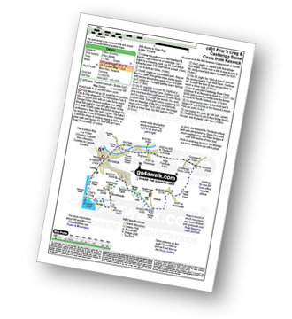
Route Summary:
Keswick - Friar's Crag - Borrowdale Road - Spring Farm - Brockle Beck - Castlerigg - High Nest Farm - Castlerigg Stone Circle - Brigham - River Greta - Keswick

|
Vital Statistics:
| Length: | 9.5 miles (15 km) |
| Ascent: | 1,250ft (381m) |
| Time: | 4.75hrs |
| Grade: |  |

Route Summary:
Keswick - Friar's Crag - Borrowdale Road - Spring Farm - Brockle Beck - Castlerigg - High Nest Farm - Castlerigg Stone Circle - Naddle Bridge - Threlkeld - River Greta - Keswick

|
Vital Statistics:
| Length: | 4.5 miles (7 km) |
| Ascent: | 361ft (110m) |
| Time: | 2 hrs |
| Grade: |  |

Route Summary:
Keswick - Keswick Station - Former Keswick Railway Line - A591 - Chestnut Hill - Castlerigg Stone Circle - High Nest Farm - Castlerigg - Brockle Beck - Springs Farm - Keswick

|
Vital Statistics:
| Length: | 9.5 miles (15 km) |
| Ascent: | 2,257ft (688m) |
| Time: | 5½ hrs |
| Grade: |  |
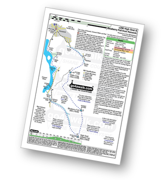
Route Summary:
Keswick - Derwent Water - Friar's Crag - Calfclose Bay - Barrow Bay - Derwent Water - Ashness Bridge - High Seat (Ashness Fell) - Bleaberry Fell - Walla Crag - Rakefoot - Castlerigg - Keswick

|
Vital Statistics:
| Length: | 9 miles (14 km) |
| Ascent: | 131ft (40m) |
| Time: | 3.25hrs |
| Grade: | |
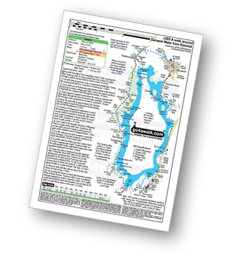
Route Summary:
Keswick - The Cumbria Way - The Allerdale Ramble - Portinscale - Nichol End - Derwent Water - Hawes End - Brandlehow Point - Park Neb - Strutta Wood - Calfclose Bay - Stable Hills - Friar's Crag - Keswick

|
Vital Statistics:
| Length: | 3.75 miles (6 km) |
| Ascent: | 1,628ft (496m) |
| Time: | 3 hrs |
| Grade: | |

Route Summary:
Keswick - Derwent Water Launch - Nichol End Pier - Hawes End Pier - Newlands Valley - Woodford's Path - Cat Bells (Catbells) - Hawes End Pier - Derwent Water Launch - Keswick

|
Vital Statistics:
| Length: | 10.25 miles (16.5 km) |
| Ascent: | 2,850ft (869m) |
| Time: | 6½ hrs |
| Grade: |  |
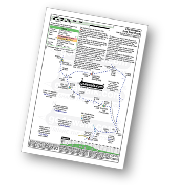
Route Summary:
Keswick - Gale Road (Underscar) Nr Keswick - Lonscale Fell - Jenkin Hill - Little Man (Skiddaw) - Skiddaw - Sale How (Skiddaw) - Skiddaw House - Gale Road (Underscar) Nr Keswick.

|
Vital Statistics:
| Length: | 11.5 miles (18.5 km) |
| Ascent: | 3,214ft (980m) |
| Time: | 7½ hrs |
| Grade: | |
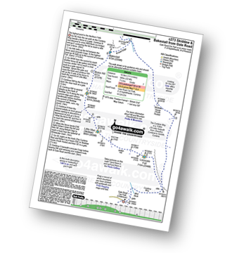
Route Summary:
Keswick - Gale Road - Lonscale Fell - Jenkin Hill - Little Man (Skiddaw) - Skiddaw - Bakestall - Birkett Edge - Whitewater Dash - Back O' Skiddaw - The Cumbria Way - Skiddaw House - Gale Road (Underscar) Nr Keswick.

|
Vital Statistics:
| Length: | 2 miles (3 km) |
| Ascent: | 413ft (126m) |
| Time: | 1 hrs |
| Grade: |  |

Route Summary:
Keswick - Gale Road (Underscar) - The Cumbria Way - Latrigg - Gale Road (Underscar) - Nr Keswick.

|
Vital Statistics:
| Length: | 9.75 miles (15.5 km) |
| Ascent: | 886ft (270m) |
| Time: | 4.25hrs |
| Grade: | |
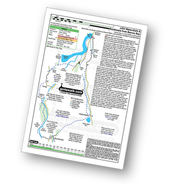
Route Summary:
Barrow Bay - Derwent Water - Ashness Bridge - Surprise View - Watendlath - Bracken Platt - Puddingstone Bank - The Cumbria Way - Rosthwaite - River Derwent - High Hows Wood - Low Hows Wood - Broadslack Gill - Hollows Farm - Borrowdale Gates - Ellers Beck Lodore Falls - Barrow Bay - Derwent Water

|
Vital Statistics:
| Length: | 9.75 miles (15.5 km) |
| Ascent: | 3,529ft (1,076m) |
| Time: | 7 hrs |
| Grade: | |

Route Summary:
Keswick - Millbeck - The Allerdale Ramble - Doups - White Stones - Carl Side - Longside Edge - Long Side - Skiddaw - Little Man (Skiddaw) - Jenkin Hill - Lonscale Fell - Lonscale Crags - The Cumbria Way - Applethwaite - The Allerdale Ramble - Millbeck - Nr Keswick.

|
Vital Statistics:
| Length: | 15.25 miles (24.5 km) |
| Ascent: | 5,458ft (1,663m) |
| Time: | 11 hrs |
| Grade: |  |

Route Summary:
Keswick - Millbeck - The Allerdale Ramble - Doups - Dodd (Skiddaw) - White Stones (Skiddaw) - Carl Side - Longside Edge - Long Side - Ullock Pike - Carlside Tarn - Skiddaw - Blake Hill - Bakestall - Little Man (Skiddaw) - Jenkin Hill - Lonscale Fell - Lonscale Crags - The Cumbria Way - Latrigg - Applethwaite - The Allerdale Ramble - Millbeck - Nr Keswick.

|
Vital Statistics:
| Length: | 8.25 miles (13 km) |
| Ascent: | 3,306ft (1,008m) |
| Time: | 6.25hrs |
| Grade: | |
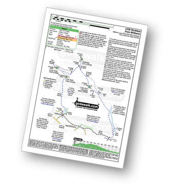
Route Summary:
Keswick - Millbeck - The Allerdale Ramble - Doups - White Stones - Carl Side - Longside Edge - Long Side - Skiddaw - Little Man (Skiddaw) - The Cumbria Way - Applethwaite - The Allerdale Ramble - Millbeck - Nr Keswick.
Not familiar with the area around CA12?
See these 30 nearest walks to UK Postcode CA12 on a google map

|
Vital Statistics:
| Length: | 14.5 miles (23 km) |
| Ascent: | 5,409ft (1,648m) |
| Time: | 11 hrs |
| Grade: | |

Route Summary:
Hawes End - Derwent Water - Skelgill Bank - Woodford's Path - Cat Bells (Catbells) - Maiden Moor - High Spy (North Top) - High Spy - Dalehead Tarn - Dale Head (Newlands) - Hindscarth - Littledale Edge - Robinson - High Snockrigg - Moss Force - Newlands Hause - Knott Rigg - Ard Crags - Birkrigg - Keskerdale Beck - Newlands Church - Newlands Beck - Little Town - Skelgill Farm - Hawes End Derwent Water.

|
Vital Statistics:
| Length: | 5 miles (8 km) |
| Ascent: | 649ft (198m) |
| Time: | 2.75hrs |
| Grade: |  |

Route Summary:
Hawes End - Gutherscale - Derwent Water - Skelgill Farm - Yewthwaite Gill - Little Town - Parrocks Gill - Goldscope Lead Mine - Newlands Beck - Low Snab Farm - Newlands Church - Newlands Valley - Rigg Beck - Rowling End Farm - Newlands Beck - Ghyll Bank - Skelgill Farm - Gutherscale - Hawes End

|
Vital Statistics:
| Length: | 10.25 miles (16.5 km) |
| Ascent: | 3,585ft (1,093m) |
| Time: | 7½ hrs |
| Grade: | |

Route Summary:
Hawes End - Derwent Water - Skelgill Bank - Woodford's Path - Cat Bells (Catbells) - Maiden Moor - High Spy (North Top) - High Spy - Dalehead Tarn - Dale Head (Newlands) - Hindscarth - High Crags - Scope End - Low Snab Farm - Newlands Church - Little Town - Newlands Valley - Hawes End - Derwent Water.

|
Vital Statistics:
| Length: | 8.25 miles (13 km) |
| Ascent: | 2,512ft (766m) |
| Time: | 5½ hrs |
| Grade: | |

Route Summary:
Hawes End - Derwent Water - Newlands Valley - Skelgill Bank - Woodford's Path - Cat Bells (Catbells) - Maiden Moor - High Spy (North Top) - High Spy - Dalehead Tarn - Newlands Valley - Newlands Church - Little Town - Hawes End

|
Vital Statistics:
| Length: | 12 miles (19 km) |
| Ascent: | 4,152ft (1,266m) |
| Time: | 8½ hrs |
| Grade: |  |

Route Summary:
Hawes End - Derwent Water - Skelgill Bank - Woodford's Path - Cat Bells (Catbells) - Maiden Moor - High Spy (North Top) - High Spy - Dale Head Tarn - Dale Head (Newlands) - Hindscarth Edge - Hindscarth - Littledale Edge - Robinson - High Snab Bank - Newlands Church - Little Town - Hawes End - Derwent Water.

|
Vital Statistics:
| Length: | 10 miles (16 km) |
| Ascent: | 3,349ft (1,082m) |
| Time: | 7.25hrs |
| Grade: | |

Route Summary:
Hawes End - Derwent Water - Skelgill Bank - Woodford's Path - Cat Bells (Catbells) - Maiden Moor - Narrow Moor - High Spy (North Top) - High Spy - Dale Head Tarn - Rigghead Quarries - The Allerdale Ramble - Castle Crag - River Derwent - Yewdale Knott - Manesty - Manesty Band - Hawes End - Derwent Water.

|
Vital Statistics:
| Length: | 10 miles (16 km) |
| Ascent: | 4,641ft (1,414m) |
| Time: | 8½ hrs |
| Grade: | |
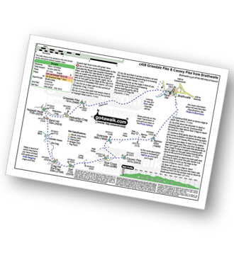
Route Summary:
Braithwaite - Sleet How - Grisedale Pike - Hobcarton Crag - Hopegill Head - Sand Hill - Coledale Hause - Crag Hill (Eel Crag) - Sail (Derwent Fells) - Scar Crags - Causey Pike - Outerside - Stile End - Barrow (Newlands) - Braithwaite

|
Vital Statistics:
| Length: | 12 miles (19 km) |
| Ascent: | 5,261ft (1,603m) |
| Time: | 9.75hrs |
| Grade: | |

Route Summary:
Braithwaite - Sleet How - Grisedale Pike - Hobcarton Crag - Hopegill Head - Sand Hill - Coledale Hause - Grasmoor - Wandope - Crag Hill (Eel Crag) - Sail (Derwent Fells) - Scar Crags - Causey Pike - Outerside - Stile End - Barrow (Newlands) - Braithwaite

|
Vital Statistics:
| Length: | 8.5 miles (13.5 km) |
| Ascent: | 3,840ft (1,170m) |
| Time: | 7 hrs |
| Grade: | |

Route Summary:
Braithwaite - Sleet How - Grisedale Pike - Hobcarton Crag - Hopegill Head - Sand Hill - Coldale Hause - Eel Crag - Crag Hill (Eel Crag) - Sail (Derwent Fells) - Long Comb - High Moss - Low Moss - Barrow Door - Braithwaite

|
Vital Statistics:
| Length: | 7.25 miles (11.5 km) |
| Ascent: | 3,013ft (918m) |
| Time: | 5.75hrs |
| Grade: | |
Route Summary:
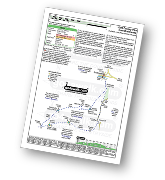
Braithwaite - Barrow (Newlands) - Stile End - Low Moss - Outerside - High Moss - Scar Crags - Causey Pike - Sleet Hause - Rowling End - Stoneycroft - Braithwaite

|
Vital Statistics:
| Length: | 3.75 miles (6 km) |
| Ascent: | 2,398ft (731m) |
| Time: | 3.75hrs |
| Grade: | |

Route Summary:
Threlkeld - Gategill Farm - Hall's Fell - Hall's Fell Ridge - Blencathra or Saddleback (Hallsfell Top) - Gategill Fell Top - Knowe Crags (Blease Fell) - Threlkeld

|
Vital Statistics:
| Length: | 6 miles (9.5 km) |
| Ascent: | 1,894ft (577m) |
| Time: | 4 hrs |
| Grade: | |

Route Summary:
Little Town - Newlands Church - Keskerdale Farm - Knott Rigg - Ard Crags - Rigg Beck - Birkrigg - Gillbrow - Little Town

|
Vital Statistics:
| Length: | 7.25 miles (11.5 km) |
| Ascent: | 2,654ft (809m) |
| Time: | 5½ hrs |
| Grade: | |

Route Summary:
Little Town - Newlands Valley - Low Snab Farm - Scope End - High Crags - Hindscarth - Littledale Edge - Robinson - Blea Crags - High Snab Bank - High Snab Farm - Newlands Church - Little Town

|
Vital Statistics:
| Length: | 8.75 miles (14 km) |
| Ascent: | 3,073ft (937m) |
| Time: | 6.25hrs |
| Grade: | |

Route Summary:
Little Town - High Snab Bank - Blea Crags - Robinson - Littledale Edge - Hindscarth - Hindscarth Edge - Dale Head (Newlands) - Dalehead Tarn - Newlands Valley - Newlands Church - Little Town

|
Vital Statistics:
| Length: | 11.25 miles (18 km) |
| Ascent: | 3,965ft (1,208m) |
| Time: | 8.25hrs |
| Grade: | |

Route Summary:
Legburthwaite Car Park - A591 - Long Band - Cowrake Head - Moss Crag - High Rigg - Carlisle Diocese Youth Centre - St John's In The Vale Church - B5322 - Wanthwaite Bank - Threlkeld Knotts - Buck Castles - Clough Head - Calfhow Pike - Great Dodd - Watson's Dodd - Stybarrow Dodd - Sticks Pass - Legburthwaite Car Park
Not familiar with the area around CA12?
See these 30 nearest walks to UK Postcode CA12 on a google map