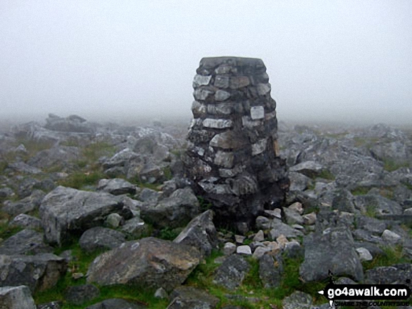
All the Mountains, Peaks, Tops and Hills in The Brecon Beacons Area of Bannau Brycheiniog (The Brecon Beacons), Wales as a detailed list

The Brecon Beacons Area of Bannau Brycheiniog (The Brecon Beacons National Park) is the Western half of the National Park. It is enclosed by:


If you count only the Nuttalls there are 22 tops to climb, bag & conquer and the highest point is Pen y Fan at 886m (2,907ft).


Wainwright
0/0
Wainwrights
Hewitt
14/0
Welsh
Mountains
Dewey
12/0
Welsh
Deweys
nuttall
22/0
Welsh
Nuttalls
Wainwright Outlying Fell
0/0
Wainwright
Outlying Fells
marilyn
7/0
Welsh
Marilyns
Bridget
25/0
Welsh
Bridgets
Trig Point
26/0
Trig
Points


To see all Mountains, Peaks, Tops and Hills displayed in different ways - see the options in the left-hand column and towards the bottom of this page.


LOG ON and RELOAD this page to show which Mountains, Peaks, Tops and Hills you have already climbed, bagged & conquered [. . . more]


See this list in: Alphabetical Order | Height Order
To reverse the order select the link again.


Mountain, Peak, Top or Hill:

Bagged


1. Pen y Fan

886m (2,907ft)

  • Mountain (19th in Wales, 31st in England & Wales)
  • Nuttall (21st in Wales, 36th in England & Wales)
  • Marilyn (10th in Wales, 259th in GB)
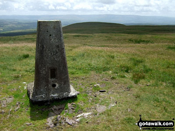
  • OS Trig Point
  • Pen y Fan is the highest point in The Brecon Beacons National Park and the highest point in the county of Powys.


    To walk, climb & bag Pen y Fan use any of these easy to follow walks:

    Google Maps Icon
    See the location of Pen y Fan and walks up it on a google Map

    Pen y Fan is on interactive maps:

  • OS Explorer (Orange Covers): OL12
  • OS Landranger (Pink Covers): 160

  • Pen y Fan is on Peak Bagging Map and Hill Tick List:


    2. Corn Du

    871m (2,859ft)

  • Nuttall (25th in Wales, 43rd in England & Wales)

  • To walk, climb & bag Corn Du use any of these easy to follow walks:

    Google Maps Icon
    See the location of Corn Du and walks up it on a google Map

    Corn Du is on interactive maps:

  • OS Explorer (Orange Covers): OL12
  • OS Landranger (Pink Covers): 160

  • Corn Du is on Peak Bagging Map and Hill Tick List:


    3. Craig Gwaun Taf (Bwlch Duwynt)

    826m (2,710ft)

  • Nuttall (35th in Wales, 74th in England & Wales)
  • Craig Gwaun Taf [Duwynt] was promoted to 'Nuttall' status in November 2016


    To walk, climb & bag Craig Gwaun Taf (Bwlch Duwynt) use any of these easy to follow walks:

    Google Maps Icon
    See the location of Craig Gwaun Taf (Bwlch Duwynt) and walks up it on a google Map

    Craig Gwaun Taf (Bwlch Duwynt) is on interactive maps:

  • OS Explorer (Orange Covers): OL12
  • OS Landranger (Pink Covers): 160

  • Craig Gwaun Taf (Bwlch Duwynt) is on Peak Bagging Map and Hill Tick List:


    4. Fan Brycheiniog (Twr y Fan Foel)

    802m (2,632ft)

  • Mountain (34th in Wales, 76th in England & Wales)
  • Nuttall (43rd in Wales, 91st in England & Wales)
  • Marilyn (15th in Wales, 390th in GB)
  • OS Trig Point
  • Fan Brycheiniog (Twr y Fan Foel) became the local Mountain (Hewitt) and 'Nuttall' after a survey found the top to be 0.75m higher than the Trig Point.


    To walk, climb & bag Fan Brycheiniog (Twr y Fan Foel) use either of these easy to follow walks:

    Google Maps Icon
    See the location of Fan Brycheiniog (Twr y Fan Foel) and walks up it on a google Map

    Fan Brycheiniog (Twr y Fan Foel) is on interactive maps:

  • OS Explorer (Orange Covers): OL12
  • OS Landranger (Pink Covers): 160

  • Fan Brycheiniog (Twr y Fan Foel) is on Peak Bagging Map and Hill Tick List:


    5. Cribyn

    795m (2,609ft)

  • Mountain (37th in Wales, 82nd in England & Wales)
  • Nuttall (47th in Wales, 99th in England & Wales)

  • To walk, climb & bag Cribyn use any of these easy to follow walks:

    Google Maps Icon
    See the location of Cribyn and walks up it on a google Map

    Cribyn is on interactive maps:

  • OS Explorer (Orange Covers): OL12
  • OS Landranger (Pink Covers): 160

  • Cribyn is on Peak Bagging Map and Hill Tick List:


    6. Waun Rydd

    769m (2,524ft)

  • Mountain (44th in Wales, 105th in England & Wales)
  • Nuttall (55th in Wales, 129th in England & Wales)
  • Marilyn (20th in Wales, 452nd in GB)
  • OS Trig Point

  • To walk, climb & bag Waun Rydd use any of these easy to follow walks:

    Google Maps Icon
    See the location of Waun Rydd and walks up it on a google Map

    Waun Rydd is on interactive maps:

  • OS Explorer (Orange Covers): OL12
  • OS Landranger (Pink Covers): 160

  • Waun Rydd is on Peak Bagging Map and Hill Tick List:


    7. Fan Hir

    760m (2,494ft)

  • Mountain (46th in Wales, 112th in England & Wales)
  • Nuttall (57th in Wales, 136th in England & Wales)

  • To walk, climb & bag Fan Hir use either of these easy to follow walks:

    Google Maps Icon
    See the location of Fan Hir and walks up it on a google Map

    Fan Hir is on interactive maps:

  • OS Explorer (Orange Covers): OL12
  • OS Landranger (Pink Covers): 160

  • Fan Hir is on Peak Bagging Map and Hill Tick List:


    8. Gwaun Cerrig Llwydion (Bwlch y Ddwyallt)

    754m (2,475ft)

  • Nuttall (60th in Wales, 143rd in England & Wales)

  • To walk, climb & bag Gwaun Cerrig Llwydion (Bwlch y Ddwyallt) use any of these easy to follow walks:

    Google Maps Icon
    See the location of Gwaun Cerrig Llwydion (Bwlch y Ddwyallt) and walks up it on a google Map

    Gwaun Cerrig Llwydion (Bwlch y Ddwyallt) is on interactive maps:

  • OS Explorer (Orange Covers): OL12
  • OS Landranger (Pink Covers): 160

  • Gwaun Cerrig Llwydion (Bwlch y Ddwyallt) is on Peak Bagging Map and Hill Tick List:


    9. Picws Du (Bannau Sir Gaer)

    749m (2,458ft)

  • Mountain (52nd in Wales, 121st in England & Wales)
  • Nuttall (64th in Wales, 148th in England & Wales)

  • To walk, climb & bag Picws Du (Bannau Sir Gaer) use any of these easy to follow walks:

    Google Maps Icon
    See the location of Picws Du (Bannau Sir Gaer) and walks up it on a google Map

    Picws Du (Bannau Sir Gaer) is on interactive maps:

  • OS Explorer (Orange Covers): OL12
  • OS Landranger (Pink Covers): 160

  • Picws Du (Bannau Sir Gaer) is on Peak Bagging Map and Hill Tick List:


    10. Fan Fawr

    734m (2,409ft)

  • Mountain (56th in Wales, 135th in England & Wales)
  • Nuttall (70th in Wales, 167th in England & Wales)
  • Marilyn (26th in Wales, 517th in GB)
  • OS Trig Point

  • To walk, climb & bag Fan Fawr use either of these easy to follow walks:

    Google Maps Icon
    See the location of Fan Fawr and walks up it on a google Map

    Fan Fawr is on interactive maps:

  • OS Explorer (Orange Covers): OL12
  • OS Landranger (Pink Covers): 160

  • Fan Fawr is on Peak Bagging Map and Hill Tick List:


    11. Fan Gyhirych

    725m (2,379ft)

  • Mountain (60th in Wales, 143rd in England & Wales)
  • Nuttall (74th in Wales, 177th in England & Wales)
  • Marilyn (29th in Wales, 538th in GB)
  • OS Trig Point

  • To walk, climb & bag Fan Gyhirych use either of these easy to follow walks:

    Google Maps Icon
    See the location of Fan Gyhirych and walks up it on a google Map

    Fan Gyhirych is on interactive maps:

  • OS Explorer (Orange Covers): OL12
  • OS Landranger (Pink Covers): 160

  • Fan Gyhirych is on Peak Bagging Map and Hill Tick List:


    12. Fan y Big

    716m (2,351ft)

  • Nuttall (79th in Wales, 189th in England & Wales)
  • Fan y Big was removed from the list of Welsh Hewitts (Welsh Mountains) due to insufficient prominence - August, 2018


    To walk, climb & bag Fan y Big use any of these easy to follow walks:

    Google Maps Icon
    See the location of Fan y Big and walks up it on a google Map

    Fan y Big is on interactive maps:

  • OS Explorer (Orange Covers): OL12
  • OS Landranger (Pink Covers): 160

  • Fan y Big is on Peak Bagging Map and Hill Tick List:


    13. Waun Lefrith (Bannau Sir Gaer)

    677m (2,221ft)

  • Nuttall (110th in Wales, 264th in England & Wales)

  • To walk, climb & bag Waun Lefrith (Bannau Sir Gaer) use any of these easy to follow walks:

    Google Maps Icon
    See the location of Waun Lefrith (Bannau Sir Gaer) and walks up it on a google Map

    Waun Lefrith (Bannau Sir Gaer) is on interactive maps:

  • OS Explorer (Orange Covers): OL12
  • OS Landranger (Pink Covers): 160

  • Waun Lefrith (Bannau Sir Gaer) is on Peak Bagging Map and Hill Tick List:


    14. Fan Fraith

    668m (2,192ft)

  • Nuttall (119th in Wales, 290th in England & Wales)

  • To walk, climb & bag Fan Fraith use either of these easy to follow walks:

    Google Maps Icon
    See the location of Fan Fraith and walks up it on a google Map

    Fan Fraith is on interactive maps:

  • OS Explorer (Orange Covers): OL12
  • OS Landranger (Pink Covers): 160

  • Fan Fraith is on Peak Bagging Map and Hill Tick List:


    15. Fan Nedd

    663m (2,175ft)

  • Mountain (93rd in Wales, 226th in England & Wales)
  • Nuttall (124th in Wales, 302nd in England & Wales)
  • Marilyn (44th in Wales, 670th in GB)
  • OS Trig Point

  • To walk, climb & bag Fan Nedd use this easy to follow walk:

    Google Maps Icon
    See the location of Fan Nedd and walks up it on a google Map

    Fan Nedd is on interactive maps:

  • OS Explorer (Orange Covers): OL12
  • OS Landranger (Pink Covers): 160

  • Fan Nedd is on Peak Bagging Map and Hill Tick List:


    16. Allt Lwyd

    654m (2,146ft)

  • Nuttall (137th in Wales, 324th in England & Wales)

  • To walk, climb & bag Allt Lwyd use any of these easy to follow walks:

    Google Maps Icon
    See the location of Allt Lwyd and walks up it on a google Map

    Allt Lwyd is on interactive maps:

  • OS Explorer (Orange Covers): OL12
  • OS Landranger (Pink Covers): 160

  • Allt Lwyd is on Peak Bagging Map and Hill Tick List:


    17. Garreg Las (Twyn Swnd)

    635m (2,084ft)

  • Mountain (109th in Wales, 266th in England & Wales)
  • Nuttall (150th in Wales, 357th in England & Wales)

  • To walk, climb & bag Garreg Las (Twyn Swnd) use this easy to follow walk:

    Google Maps Icon
    See the location of Garreg Las (Twyn Swnd) and walks up it on a google Map

    Garreg Las (Twyn Swnd) is on interactive maps:

  • OS Explorer (Orange Covers): OL12
  • OS Landranger (Pink Covers): 160

  • Garreg Las (Twyn Swnd) is on Peak Bagging Map and Hill Tick List:


    18. Fan Llia

    631m (2,073ft)

  • Mountain (112th in Wales, 272nd in England & Wales)
  • Nuttall (154th in Wales, 368th in England & Wales)

  • To walk, climb & bag Fan Llia use any of these easy to follow walks:

    Google Maps Icon
    See the location of Fan Llia and walks up it on a google Map

    Fan Llia is on interactive maps:

  • OS Explorer (Orange Covers): OL12
  • OS Landranger (Pink Covers): 160

  • Fan Llia is on Peak Bagging Map and Hill Tick List:


    19. Craig Cerrig-gleisiad

    629m (2,064ft)

  • Mountain (114th in Wales, 275th in England & Wales)
  • Nuttall (159th in Wales, 374th in England & Wales)

  • To walk, climb & bag Craig Cerrig-gleisiad use any of these easy to follow walks:

    Google Maps Icon
    See the location of Craig Cerrig-gleisiad and walks up it on a google Map

    Craig Cerrig-gleisiad is on interactive maps:

  • OS Explorer (Orange Covers): OL12
  • OS Landranger (Pink Covers): 160

  • Craig Cerrig-gleisiad is on Peak Bagging Map and Hill Tick List:


    20. Fan Frynych

    628m (2,062ft)

  • Mountain (115th in Wales, 276th in England & Wales)
  • Nuttall (162nd in Wales, 377th in England & Wales)
  • OS Trig Point

  • To walk, climb & bag Fan Frynych use any of these easy to follow walks:

    Google Maps Icon
    See the location of Fan Frynych and walks up it on a google Map

    Fan Frynych is on interactive maps:

  • OS Explorer (Orange Covers): OL12
  • OS Landranger (Pink Covers): 160

  • Fan Frynych is on Peak Bagging Map and Hill Tick List:


    21. Y Gyrn

    619m (2,032ft)

  • Nuttall (174th in Wales, 409th in England & Wales)

  • To walk, climb & bag Y Gyrn use either of these easy to follow walks:

    Google Maps Icon
    See the location of Y Gyrn and walks up it on a google Map

    Y Gyrn is on interactive maps:

  • OS Explorer (Orange Covers): OL12
  • OS Landranger (Pink Covers): 160

  • Y Gyrn is on Peak Bagging Map and Hill Tick List:


    22. Moel Gornach (Garreg Lwyd)

    616m (2,021ft)

  • Mountain (127th in Wales, 301st in England & Wales)
  • Nuttall (176th in Wales, 418th in England & Wales)
  • OS Trig Point

  • To walk, climb & bag Moel Gornach (Garreg Lwyd) use this easy to follow walk:

    Google Maps Icon
    See the location of Moel Gornach (Garreg Lwyd) and walks up it on a google Map

    Moel Gornach (Garreg Lwyd) is on interactive maps:

  • OS Explorer (Orange Covers): OL12
  • OS Landranger (Pink Covers): 160

  • Moel Gornach (Garreg Lwyd) is on Peak Bagging Map and Hill Tick List:


    View all 61 Mountains, Peaks, Tops and Hills in The Brecon Beacons Area of The Brecon Beacons:


    Is there a Mountain, Peak, Top or Hill missing from the above google map or list?

    Let us know an we will add it to our database.


    Do not miss our pick of the Best Walks in Britain


    Follow go4awalk.com on Twitter Follow go4awalk.com on Facebook


    Home


    Find new Friends to go walking with

    Walk all 214 Wainwrights in just 59 Walks. Download GPS Waypoints - Great Walks you must not miss!

    Walk The Yorkshire Three Peaks Challenge Walk - All the Latest Route Information, GPS Waypoints and Split Times to keep you on Schedule

    Walk The British Three Peaks Challenge Walk - All the Latest Route Information and GPS Waypoints

    See our pick of The Best Walks in The Lake District - Great Walks you must not miss!

    Walk our pick of the Best Lake District Ridge Walks - Great Walks you must not miss!

    Walk our pick of the Best Lake District Walks to do in the rain - Great Walks you must not miss!

    Walk our pick of The Best Walks in Snowdonia - Great Walks you must not miss!

    Walk our pick of The Best Ridge Walks in Wales - Walks you must not miss!

    Walk our pick of The Best Walks in The Brecon Beacons - Great Walks you must not miss!

    Walk our pick of The Best Walks in The Yorkshire Dales - Walks you must not miss!

    Walk our pick of The Best Walks in The Peak District - Walks you must not miss!

    Walk our pick of The Best Walks in The Forest of Bowland - Walks you must not miss!

    Walk our pick of The Best Walks in Shropshire - Walks you must not miss!

    Walk our pick of The Best Walks in Cheshire - Walks you must not miss!

    Walk our pick of The Best Walks in Lancashire - Walks you must not miss!

    Not sure where to walk next? Try Peak Bagging - Great Walks you must not miss!

    Not sure where to walk next? Walk part of a National Trail - Great Walks you must not miss!

    Walks with Downloadable and Uploadable GPS Waypoint Data

    Walking Kit and Gear Tested by Walkers

    Full Site Search
    Do not miss our pick of the Best Walks in Britain