Nuttall Icon

Craig Gwaun Taf (Bwlch Duwynt)
826m (2710ft)

The Brecon Beacons Area, The Brecon Beacons, Powys, Wales

Craig Gwaun Taf [Duwynt] was promoted to 'Nuttall' status in November 2016

The summit of Craig Gwaun Taf (Bwlch Duwynt) is marked by a small cairn..


Record Craig Gwaun Taf (Bwlch Duwynt) as Bagged, Climbed & Conquered


Welsh Nuttall Icon

Welsh Nuttall
35th highest in Wales,
74th in England & Wales

Walk Craig Gwaun Taf (Bwlch Duwynt) walking UK Mountains in The Brecon Beacons Area The Brecon Beacons National Park Powys, Wales

Craig Gwaun Taf (Bwlch Duwynt) Summit

Photo: Calvin Hobbs

You can find Craig Gwaun Taf (Bwlch Duwynt) & all the walks that climb it on these unique free-to-access Interactive Walk Planning Maps: (click/TAP to select)

The Brecon Beacons National Park


1:25,000 scale OS Explorer Map (the ones with orange/yellow covers):

OL12 Brecon Beacons National Park - Western & Central areas


1:50,000 scale OS Landranger Map (the ones with pink/magenta covers):

160 Brecon Beacons


See Craig Gwaun Taf (Bwlch Duwynt) and the surrounding tops on our free-to-access 'Google Style' Peak Bagging Maps:

See Craig Gwaun Taf (Bwlch Duwynt) and the surrounding tops on our downloadable PDF Peak Bagging Map:


You can walk to the top of Craig Gwaun Taf (Bwlch Duwynt) by using any of these 5 easy‑to‑follow route maps:
Walking Boot Print Icon

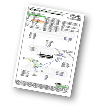
Walk po101 Pen y Fan from Pont ar Daf

The shortest, easiest way up Pen y Fan

Walk GPS Icon
Walk GPX Icon
Walk PDF Icon

Vital Statistics:

Length: 4ml (6.25km)
Ascent:1,736ft (487m)
Time:3.25hrs
Grade:Walk Grade 4 Icon (Moderate)
Walking Boot Print Icon

Walk po107 Y Gyrn, Corn Du and Pen y Fan from The Storey Arms Outdoor Centre

A less travelled route up Pen y Fan

Walk GPS Icon
Walk GPX Icon
Walk PDF Icon

Vital Statistics:

Length: 5ml (8km)
Ascent:1,736ft (529m)
Time:3.75hrs
Grade:Walk Grade 4 Icon (Moderate)
Walking Boot Print Icon

Walk po158 Pen y Fan from The Storey Arms Outdoor Centre

The easiest(!) way to climb Pen y Fan

Walk GPS Icon
Walk GPX Icon
Walk PDF Icon

Vital Statistics:

Length: 5.25ml (8.5km)
Ascent:1,736ft (529m)
Time:3.75hrs
Grade:Walk Grade 4 Icon (Moderate)
Walking Boot Print Icon

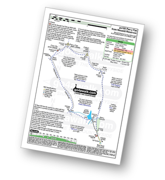
Walk po100 Pen y Fan from Neuadd Reservoir

Popular classic walk

Walk GPS Icon
Walk GPX Icon
Walk PDF Icon

Vital Statistics:

Length: 8.5ml (13.5km)
Ascent:2,402ft (732m)
Time:5½ hrs
Grade:Walk Grade 6 Icon (Moderate)
Walking Boot Print Icon

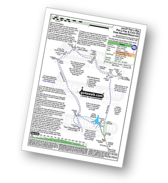
Walk po127 Fan y Big, Cribyn, Pen y Fan and Corn Du from Neuadd Reservoir

Unsurpassed views from this high level route - pick a clear day

Walk GPS Icon
Walk GPX Icon
Walk PDF Icon

Vital Statistics:

Length: 10ml (16km)
Ascent:2,850ft (869m)
Time:6½ hrs
Grade:Walk Grade 7 Icon (Hard)

Other walkers who hiked, climbed, bagged and summited Craig Gwaun Taf (Bwlch Duwynt) Fellow go4awalkers who have already walked, climbed, summited & bagged Craig Gwaun Taf (Bwlch Duwynt)

Melfyn Parry walked up Craig Gwaun Taf (Bwlch Duwynt) on September 4th, 2024 [from/via/route] Started walk from car park in the Tar Fechan forest, SO 036170. Tarmac road taken up to Lower Neuadd reservoir, which is now disused, crossed a footbridge & climbed up the grassy slope to reach the ridge at a cairn SO 019182, turned right & followed easy path for about 2 miles to reach the summit of Craig Gwaun Taf. From here it is an easy walk to the top of Corn Du & then Pen y Fan (about 25mins to gain the two tops). From Pen y Fan dropped down steep path to meet Beacons Way & then steep ascent to the top of Cribyn. Turned right & followed ridge, along Cambrian Way to Bwlch ar y Fan before another steep path up to Fan y Big. From here continue along ridge to the junction of the path back to Bwlch y Fan along Craig Cwmoergwm. From this junction I dropped down the grassy slope to the Roman Road at SO 034196 & followed the path back to the car park. [with] On my own [weather] Cool breeze with sunny spells & dry. Excellent visibility. - A really nice walk, would definitely do this one again. Stunning views.

Christina Lander climbed Craig Gwaun Taf (Bwlch Duwynt) on March 12th, 2014 [from/via/route] From Storey Arms [with] Alethea [weather] Hot & sunny day

Erin Ryan bagged Craig Gwaun Taf (Bwlch Duwynt) on August 31st, 2021 [weather] Cloudy on top

Mark Davidson hiked Craig Gwaun Taf (Bwlch Duwynt) on October 21st, 2004 [from/via/route] Walk po127 Fan y Big, Cribyn, Pen y Fan & Corn Du from Neuadd Reservoir [with] Theresa [weather] Rain & Mist!

Rich Jenkins summited Craig Gwaun Taf (Bwlch Duwynt) on December 29th, 2021 [from/via/route] Pontsticill reservoir [weather] Low cloud around peak height. Windy on top. - Wet underfoot & water running off slopes. Lovely route along escarpment edge.

Sion Britton conquered Craig Gwaun Taf (Bwlch Duwynt) on August 9th, 2020 [from/via/route] Brecon Beacons horse shoe walk [with] Rhiannon [weather] Mist

Andy Buxton scaled Craig Gwaun Taf (Bwlch Duwynt) during May, 2011 [from/via/route] From Neuadd reservoir

Bay Wan walked up Craig Gwaun Taf (Bwlch Duwynt) on May 20th, 2018 [from/via/route] Part of the horseshoe starting from the Storey Arms encompassing Corn Du, Pen-Y-Fan & Cribyn [with] Cocoa dog [weather] Very sunny & hot!

Andrew Joss climbed Craig Gwaun Taf (Bwlch Duwynt) on August 27th, 2017 [from/via/route] Pont Ar Daf car park [with] Barbara [weather] Sunny

Jonathan Morris, Paul Roddam, Matthew Thomas and Michael Rygol have all walked, climbed & bagged Craig Gwaun Taf (Bwlch Duwynt).

To add (or remove) your name and experiences on this page - Log On and edit your Personal Mountain Bagging Record


Send us your photographs and pictures on, of, or from Craig Gwaun Taf (Bwlch Duwynt)

If you would like to add your walk photographs and pictures featuring views from, on or of Craig Gwaun Taf (Bwlch Duwynt) to this page, please send them as email attachments (configured for any computer) along with your name to:


and we shall do our best to publish them.

(Guide Resolution = 300dpi. At least = 660pixels (wide) x 440 pixels (high).)

Send us your photographs and pictures on, of, or from Craig Gwaun Taf (Bwlch Duwynt) via Facebook

You can also submit photos via our Facebook Page.

NB. Please indicate where each photo was taken.


Do not miss our pick of the Best Walks in the UK


Follow go4awalk.com on Twitter Follow go4awalk.com on Facebook


Home


Find new Friends to go walking with

Walk all 214 Wainwrights in just 59 Walks. Download GPS Waypoints - Great Walks you must not miss!

Walk The Yorkshire Three Peaks Challenge Walk - All the Latest Route Information, GPS Waypoints and Split Times to keep you on Schedule

Walk The British Three Peaks Challenge Walk - All the Latest Route Information and GPS Waypoints

See our pick of The Best Walks in The Lake District - Great Walks you must not miss!

Walk our pick of the Best Lake District Ridge Walks - Great Walks you must not miss!

Walk our pick of the Best Lake District Walks to do in the rain - Great Walks you must not miss!

Walk our pick of The Best Walks in Snowdonia - Great Walks you must not miss!

Walk our pick of The Best Ridge Walks in Wales - Walks you must not miss!

Walk our pick of The Best Walks in The Brecon Beacons - Great Walks you must not miss!

Walk our pick of The Best Walks in The Yorkshire Dales - Walks you must not miss!

Walk our pick of The Best Walks in The Peak District - Walks you must not miss!

Walk our pick of The Best Walks in The Forest of Bowland - Walks you must not miss!

Walk our pick of The Best Walks in Shropshire - Walks you must not miss!

Walk our pick of The Best Walks in Cheshire - Walks you must not miss!

Walk our pick of The Best Walks in Lancashire - Walks you must not miss!

Not sure where to walk next? Try Peak Bagging - Great Walks you must not miss!

Not sure where to walk next? Walk part of a National Trail - Great Walks you must not miss!

Walks with Downloadable and Uploadable GPS Waypoint Data

Walking Kit and Gear Tested by Walkers

Full Site Search
Do not miss our pick of the Best Walks in the UK