Interactive Peak Bagging and Mountain/Hill Tick Lists for The Yorkshire Dales National Park

The Yorkshire Dales National Park includes The Howgills Fells, The Northern Dales and The Southern Dales areas of The Yorkshire Dales National Park.
Designated in 1954, The Yorkshire Dales National Park covers an area 2,178 km² (841 sq mi) mostly in the county of North Yorkshire but with small areas in Cumbria and Lancashire.
The Yorkshire Dales National Park is home to England's highest above-ground unbroken waterfall - Hardraw Force and the largest underground chamber naturally open to the surface - Gaping Gill.
In the southern part of the park is Malham Cove, an 80m (262 ft) high x 300m (984 ft) wide limestone cliff 1km (0.6 mi). Close by is Gordale Scar, a dramatic 100m (328 ft) limestone ravine with overhanging cliffs.
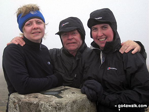 Bagging Whernside in The Yorkshire Dales
Photo: David Buckley
Further north is the Settle and Carlisle Railway. Built in the 1870s it crosses the more remote and scenic areas of the Yorkshire Dales including the famous Ribblehead Viaduct.
Nearby are the three peaks that form the infamous Yorkshire Three Peaks Challenge Walk. While Wernside and Ingleborough are the two highest peaks in the Yorkshire Dales National Park, the third member of the trio, Pen-y-ghent, is only the ninth highest. For more details, including the very latest route information, see Walking the Yorkshire Three Peaks
Places to go walking from include: Aysgarth Falls, Bolton Abbey, Chapel-le-Dale, Clapham, Gargrave, Grassington, Hawes, Horton-in-Ribblesdale, Ingleton, Keld, Kirkby Lonsdale, Kirkby Stephen, Malham, Orton, Reeth, Sedbergh, Settle, Skipton and Thwaite.
There are 126 classified Mountains, Fells, Peak, Tops and Hills that lie within the boundary of The Yorkshire Dales National Park National Park. All are within the capabilities of an averagely fit walker, hiker or rambler.
To make your peak bagging records easier to manage, we have divided The Yorkshire Dales National Park into three distinct areas which are listed below:
- The Howgill Fells area of The Yorkshire Dales
31 tops including The Calf, Calders, Yarlside . . . - The Northern Dales area of The Yorkshire Dales
26 tops including Great Shunner Fell, Wild Boar Fell . . . - The Southern Dales area of The Yorkshire Dales
69 tops including Whernside, Ingleborough, Pen-y-ghent . . . - The Whole of The Yorkshire Dales National Park
126 tops including Howgill Fells, Northern Dales, Southern Dales . . .