   |
Vital Statistics:
| Length: | 1½mls (2.5km) |
| Ascent: | 440ft (134m) |
| Time: | 1hrs |
| Grade: |  |

Route outline for walk cm101:
Foel Fawr (A4069) - Disused Quarry - Moel Gornach (Garreg Lwyd) - Foel Fawr (A4069)
Peaks, Summits and Tops reached on this walk:
 1 Welsh Mountain |
 0 Wainwrights |
 1 Welsh Nuttall |
 0 Welsh Deweys |
 0 Wainwright Outlying Fells |
 0 Welsh Marilyns |
 0 Bridgets |
Peak Bagging Statistics for this walk:
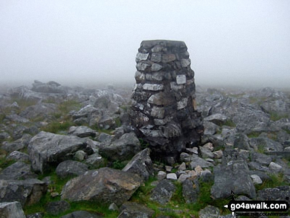
The highest point of this walk is Moel Gornach (Garreg Lwyd) at 616m (2021ft). Moel Gornach (Garreg Lwyd) is classified as a Welsh Mountain (Hewitt) (127th highest in Wales, 301st highest in England & Wales)
Moel Gornach (Garreg Lwyd) is also known as a Welsh Nuttall (176th highest in Wales, 418th highest in England & Wales). The summit of Moel Gornach (Garreg Lwyd) is marked by an Ordnance Survey Trig Point.
You can find this walk and other nearby walks on these unique free-to-access Interactive Walk Planning Maps:
1:25,000 scale OS Explorer Map (orange/yellow covers):
1:50,000 scale OS Landranger Map (pink/magenta covers):
Some Photos and Pictures from Walk cm101 Moel Gornach (Garreg Lwyd) from Foel Fawr (A4069)
In no particular order . . .
Send us your photographs and pictures from your walks and hikes
We would love to see your photographs and pictures from walk cm101 Moel Gornach (Garreg Lwyd) from Foel Fawr (A4069). Send them in to us as email attachments (configured for any computer) along with your name and where the picture was taken to:
and we shall do our best to publish them.
(Guide Resolution = 300dpi. At least = 660 pixels (wide) x 440 pixels (high).)

You can also submit photos from walk cm101 Moel Gornach (Garreg Lwyd) from Foel Fawr (A4069) via our Facebook Page.
NB. Please indicate where each photo was taken.


