Bowfell, Esk Pike and (the end of) The Scafell Massif from Langdale
The Southern Fells,
The Lake District National Park,
Cumbria, England

See views like this by using any of these 28 easy-to-follow circular walk route maps:

   |
Vital Statistics:
| Length: | 5.5 miles (9 km) |
| Ascent: | 893ft (272m) |
| Time: | 3 hrs |
| Grade: |  |
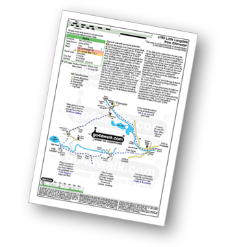
Route Summary:
Elterwater - The Cumbria Way - Elter Water - Skelwith Force - River Brathay - Skelwith Bridge - Low Park - High Park - High Colwith - Colwith Force - Stang End - Little Langdale - Slater Bridge - Little Langdale Tarn - Dale End - Elterwater


|
Vital Statistics:
| Length: | 4.5 miles (7 km) |
| Ascent: | 1,902ft (580m) |
| Time: | 3½ hrs |
| Grade: |  |

Route Summary:
Great Langdale - The Old Dungeon Ghyll - Wall End Farm - Redacre Gill - Wrynose Fell - Pike of Blisco (Pike O' Blisco) - Red Tarn (Langdale) - Browney Gill - Oxendale Beck - Oxendale - Stool End Farm - The Old Dungeon Ghyll - Great Langdale

|
Vital Statistics:
| Length: | 8.5 miles (13.5 km) |
| Ascent: | 1,447ft (441m) |
| Time: | 4½ hrs |
| Grade: |  |

Route Summary:
Elterwater - Elterwater Bridge - Little Langdale - Little Langdale Tarn - Bridge End - Fell Foot Bridge - Castle Howe - Blea Tarn (Langdale) - Great Langdale - Oak Howe - Chapel Stile - Elterwater

|
Vital Statistics:
| Length: | 7 miles (11 km) |
| Ascent: | 1,920ft (585m) |
| Time: | 4½ hrs |
| Grade: | |

Route Summary:
Elterwater - Blea Tarn (Langdale) - Side Pike - Fat Man's Agony (or Fat Man's Struggle) - Lingmoor Fell - Dale End - Birk Howe - Slater Bridge - Little Langdale Tarn - Bridge End - Fell Foot Bridge - Castle Howe - Blea Tarn (Langdale) - Elterwater

|
Vital Statistics:
| Length: | 4.5 miles (7.5 km) |
| Ascent: | 2,645ft (806m) |
| Time: | 4½ hrs |
| Grade: | |

Route Summary:
Great Langdale - The New Dungeon Ghyll - Great Langdale - Stickle Ghyll - Stickle Tarn - Jack's Rake - The Langdale Pikes - Pavey Ark - Thunacar Knott - Harrison Stickle - Pike of Stickle (Pike O' Stickle) - Loft Crag - Mark Gate - The New Dungeon Ghyll - Great Langdale

|
Vital Statistics:
| Length: | 7 miles (11 km) |
| Ascent: | 1,976ft (602m) |
| Time: | 4½ hrs |
| Grade: | |

Route Summary:
Elterwater - Elterwater Bridge - Dale End - Lingmoor Fell - Fat Man's Agony (or Fat Man's Struggle) - Side Pike - Great Langdale - Side House Farm - The Cumbria Way - Oak Howe - Chapel Stile - Elterwater Bridge - Elterwater

|
Vital Statistics:
| Length: | 6.25 miles (10 km) |
| Ascent: | 1,968ft (600m) |
| Time: | 4.25hrs |
| Grade: | |
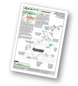
Route Summary:
Great Langdale - The Old Dungeon Ghyll - Wall End Farm - Redacre Gill - Wrynose Fell - Pike of Blisco (Pike O' Blisco) - Red Tarn (Langdale) - Wrynose Pass - Blea Tarn (Langdale) - The Old Dungeon Ghyll - Great Langdale

|
Vital Statistics:
| Length: | 7.75 miles (12.5 km) |
| Ascent: | 2,770ft (844m) |
| Time: | 5.75hrs |
| Grade: |  |

Route Summary:
Great Langdale - Old Dungeon Ghyll - Stool End - Oxendale Beck - Browney Gill - Red Tarn (Langdale) - Great Knott - Crinkle Crags (South Top) - Crinkle Crags (Long Top) - Crinkle Crags (Gunson Knott) - Shelter Crags - Shelter Crags (North Top) - Three Tarns - Earing Crag - White Stones - The Band - Oxendale - Stool End Farm - The Old Dungeon Ghyll - Great Langdale

|
Vital Statistics:
| Length: | 9 miles (14.5 km) |
| Ascent: | 2,780ft (847m) |
| Time: | 6 hrs |
| Grade: | |
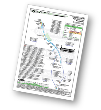
Route Summary:
Rosthwaite - Stonethwaite - Wainwright's Coast to Coast Walk - Stonethwaite Beck - Galleny Force - The Cumbria Way - Langstrath Beck - Eagle Crag - Sergeant's Crag - High Raise (Langdale) - Low White Stones - Greenup Edge - Lining Crag - Greenup Gill - Stonethwaite Beck - Stonethwaite - Rosthwaite

|
Vital Statistics:
| Length: | 7.25 miles (11.5 km) |
| Ascent: | 3,046ft (928m) |
| Time: | 5.75hrs |
| Grade: | |

Route Summary:
Great Langdale - The New Dungeon Ghyll - Stickle Ghyll - Whitegill Crag - Blea Rigg - Sergeant Man - High Raise (Langdale) - The Langdale Pikes - Thunacar Knott - Pavey Ark - Harrison Stickle - Pike of Stickle (Pike O' Stickle) - Loft Crag - Mark Gate - The New Dungeon Ghyll - Great Langdale

|
Vital Statistics:
| Length: | 10 miles (16 km) |
| Ascent: | 2,635ft (803m) |
| Time: | 6.25hrs |
| Grade: | |

Route Summary:
Dob Gill Car Park (Thirlmere) - Harrop Tarn - Standing Crag - Ullscarf - Greenup Edge - Low White Stones - High Raise (Langdale) - Sergeant Man - Codale Head - Broadstone Head - Mere Beck - Brownrigg Moss - Calf Crag - Wyth Burn - Stockhow Bridge - Thirlmere

|
Vital Statistics:
| Length: | 8.25 miles (13 km) |
| Ascent: | 2,924ft (891m) |
| Time: | 6 hrs |
| Grade: | |

Route Summary:
Great Langdale - The New Dungeon Ghyll - Stickle Ghyll - Stickle Tarn - North Rake - The Langdale Pikes - Pavey Ark - Thunacar Knott - Harrison Stickle - Loft Crag - Pike of Stickle (Pike O' Stickle) - Martcrag Moor - Stake Pass - The Cumbria Way - Stake Gill - Mickleden - Mickleden Beck - The New Dungeon Ghyll - Great Langdale

|
Vital Statistics:
| Length: | 8 miles (12 km) |
| Ascent: | 3,042ft (927m) |
| Time: | 5.75hrs |
| Grade: | |

Route Summary:
Fell Foot Bridge - Little Langdale - Hollin Crag - Wet Side Edge - Little Carrs - Great Carrs - Swirl How - Swirl Hawse - Keld Gill Head - Black Sails - Red Dell Head Moss - Wetherlam - Wetherlam Edge - Birk Fell - Greenburn Beck - Fell Foot Bridge

|
Vital Statistics:
| Length: | 8.75 miles (14 km) |
| Ascent: | 2,271ft (692m) |
| Time: | 5½ hrs |
| Grade: | |

Route Summary:
Great Langdale - Old Dungeon Ghyll - The Cumbria Way - Mickleden Beck - Mickleden (Langdale) - Rossett Beck - Rossett Pike - Little Gill Head - Black Crags (Langdale) - Stake Pass - The Cumbria Way - Stake Gill - Mickleden - Mickleden Beck - The New Dungeon Ghyll - Great Langdale

|
Vital Statistics:
| Length: | 11.25 miles (18 km) |
| Ascent: | 3,604ft (1,098m) |
| Time: | 7.75hrs |
| Grade: |  |

Route Summary:
Great Langdale - The Old Dungeon Ghyll - Stool End Farm - Oxendale - Oxendale Beck - Browney Gill - Red Tarn (Langdale) - Great Knott - Crinkle Crags (South Top) - Crinkle Crags (Long Top) - Crinkle Crags (Gunson Knott) - Shelter Crags - Shelter Crags (North Top) - Three Tarns - Climbers' Traverse (optional) - Flat Crag - Cambridge Crag - Bowfell Buttress - Bow Fell (Bowfell) - Bow Fell (Bowfell) (North Top) - Ore Gap - Angle Tarn (Langdale) - Rossett Pike - Rossett Beck - Mickleden - Mickleden Beck - The Cumbria Way - The Old Dungeon Ghyll - Great Langdale

|
Vital Statistics:
| Length: | 11.25 miles (18 km) |
| Ascent: | 3,371ft (1,027m) |
| Time: | 7½ hrs |
| Grade: | |

Route Summary:
Rosthwaite - Stonethwaite - Wainwright's Coast to Coast Walk - Stonethwaite Beck - Galleny Force - The Cumbria Way - Langstrath Beck - Eagle Crag - Sergeant's Crag - High Raise (Langdale) - Low White Stones - Greenup Edge - Ullscarf - High Saddle (Coldbarrow Fell) - Low Saddle (Coldbarrow Fell) - Lord's How - Dock Tarn - Willygrass Gill - Great Crag - Rosthwaite

|
Vital Statistics:
| Length: | 10 miles (16 km) |
| Ascent: | 4,007ft (1,221m) |
| Time: | 7½ hrs |
| Grade: | |

Route Summary:
Great Langdale - The Old Dungeon Ghyll - Wall End Farm - Redacre Gill - Wrynose Fell - Pike of Blisco (Pike O' Blisco) - Red Tarn (Langdale) - Cold Pike - Cold Pike (West Top) - Cold Pike (Far West Top) - Great Knott - Little Stand - Great Knott - Crinkle Crags (South Top) - Crinkle Crags (Long Top) - Crinkle Crags (Gunson Knott) - Shelter Crags - Shelter Crags - (North Top) - Three Tarns - Earing Crag - White Stones - The Band - Oxendale - Stool End Farm - The Old Dungeon Ghyll - Great Langdale

|
Vital Statistics:
| Length: | 10.25 miles (16.5 km) |
| Ascent: | 3,128ft (953m) |
| Time: | 6.75hrs |
| Grade: | |

Route Summary:
Grasmere - Goody Bridge - High Raven Crag - Helm Crag - The Lion and The Lamb - The Howitzer - Gibson Knott - Calf Crag - Brownrigg Moss - Greenup Edge - High Raise (Langdale) - Sergeant Man - Belles Knott - Coledale Tarn - Easedale Tarn - Sour Milk Gill - Easedale - Grasmere

|
Vital Statistics:
| Length: | 9 miles (14.5 km) |
| Ascent: | 3,459ft (1,054m) |
| Time: | 6.75hrs |
| Grade: | |

Route Summary:
Great Langdale - Old Dungeon Ghyll - The Cumbria Way - Mickleden Beck - Mickleden (Langdale) - Rossett Beck - Rossett Pike - Angle Tarn (Langdale) - Esk Hause - Esk Pike - Ore Gap - Bow Fell (Bowfell) (North Top) - Bow Fell (Bowfell) - Bowfell Buttress - Cambridge Crag - Flat Crag - Climbers' Traverse (optional) - Three Tarns - Earing Crag - White Stones - The Band - Oxendale - Stool End Farm - The Old Dungeon Ghyll - Great Langdale

|
Vital Statistics:
| Length: | 9 miles (14.5 km) |
| Ascent: | 3,387ft (1,032m) |
| Time: | 6.75hrs |
| Grade: | |

Route Summary:
Great Langdale - The Old Dungeon Ghyll - Oxendale - Oxendale Beck - Red Tarn (Langdale) - Great Knott - Crinkle - Crags (South Top) - Bad Step - Crinkle Crags (Long Top) - Crinkle Crags (Gunson Knott) - Shelter Crags - Shelter Crags (North Top) - Three Tarns - Climbers' Traverse (optional) - Flat Crag - Cambridge Crag - Bowfell Buttress - Bow Fell (Bowfell) - Three Tarns - Earing Crag - White Stones - The Band - Stool End Farm - Mickleden Beck - Mickleden - The Old Dungeon Ghyll - Great Langdale

|
Vital Statistics:
| Length: | 10 miles (16 km) |
| Ascent: | 3,580ft (1,091m) |
| Time: | 7.25hrs |
| Grade: | |

Route Summary:
Great Langdale - The New Dungeon Ghyll - Stickle Ghyll - Stickle Tarn - North Rake - The Langdale Pikes - Pavey Ark - Thunacar Knott - Harrison Stickle - Loft Crag - Pike of Stickle (Pike o' Stickle) - Martcrag Moor - Stake Pass - Black Crags (Langdale) - Little Gill Head - Rossett Pike - Rossett Gill - The Cumbria Way - Mickleden - Mickleden Beck - The New Dungeon Ghyll - Great Langdale

|
Vital Statistics:
| Length: | 11 miles (17.5 km) |
| Ascent: | 4,430ft (1,350m) |
| Time: | 8½ hrs |
| Grade: |  |

Route Summary:
Carlingill Bridge - The Howgills - Carlingill Beck - Carlin Gill - Screes of Black Force - Carlingill Spout - Blakethwaite Bottom - Docker Knott - Great Blea Gill - Simon's Seat (Howgills) - Langdale Beck (Howgills) - Hazelgill Knott - Bowderdale Beck - Bowderdale Head - Cautley Spout - Cautley Crag - Great Dummacks - Little Dummacks - Calders - Bram Rigg Top - The Calf - White Fell Head - Bush Howe - Windscarth Wyke - Breaks Head - Fell Head (Howgills) - Fell Head Scar - Linghaw - Knowles - Back Balk - Gibbet Hill - Carlingill Bridge - The Howgill Fells.

|
Vital Statistics:
| Length: | 12.5 miles (20 km) |
| Ascent: | 4,684ft (1,428m) |
| Time: | 9.25hrs |
| Grade: | |

Route Summary:
Great Langdale - The Old Dungeon Ghyll - The Cumbria Way - Mickleden Beck - Mickleden - Rossett Beck - Rossett Pike - Angle Tarn (Langdale) - Esk Hause - Great End - Ill Crag - Broad Crag - Scafell Pike - Esk Hause - Esk Pike - Ore Gap - Bow Fell (Bowfell) (North Top) - Bow Fell (Bowfell) - Bowfell Buttress - Cambridge Crag - Flat Crag - Climbers' Traverse (optional) - Three Tarns - The Band - Oxendale - Stool End Farm - The Old Dungeon Ghyll - Great Langdale

|
Vital Statistics:
| Length: | 12 miles (19 km) |
| Ascent: | 3,502ft (1,067m) |
| Time: | 7.75hrs |
| Grade: | |

Route Summary:
Stonethwaite - Wainwright's Coast to Coast Walk - Stonethwaite Beck - Galleny Force - The Cumbria Way - Langstrath Beck - Stake Pass - Pike of Stickle (Pike O' Stickle) - Harrison Stickle - Thunacar Knott - High Raise (Langdale) - Low White Stones - Greenup Edge - Ullscarf - Low Saddle (Coldbarrow Fell) - Willygrass Gill - Dock Tarn.

|
Vital Statistics:
| Length: | 12.25 miles (19.5 km) |
| Ascent: | 3,781ft (1,152m) |
| Time: | 8½ hrs |
| Grade: | |
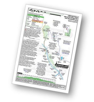
Route Summary:
Rosthwaite - The Cumbria Way - Stonethwaite - Wainwright's Coast to Coast Walk - Stonethwaite Beck - Galleny Force - The Cumbria Way - Langstrath Beck - Eagle Crag - Sergeant's Crag - High Raise (Langdale) - Low White Stones - Greenup Edge - Ullscarf - Low Saddle (Coldbarrow Fell) - Lord's How - Dock Tarn - Great Crag - Puddingstone Bank - Jopplety How - Joppletyhow Moss - Grange Fell (Brund Fell) - King's How - Rosthwaite

|
Vital Statistics:
| Length: | 11.25 miles (18 km) |
| Ascent: | 3,883ft (1,183m) |
| Time: | 8 hrs |
| Grade: | |

Route Summary:
Great Langdale - The Old Dungeon Ghyll - The Cumbria Way - Mickleden Beck - Rossett Gill - Rossett Pike - Angle Tarn (Langdale) - Esk Hause - Scafell Pike - Ill Crag - Broad Crag - Great End - Esk Hause - Angle Tarn - Rossett Gill - Mickleden - Mickleden Beck - The Cumbria Way - The Old Dungeon Ghyll - Great Langdale

|
Vital Statistics:
| Length: | 11.75 miles (19 km) |
| Ascent: | 4,680ft (1,426m) |
| Time: | 9 hrs |
| Grade: | |

Route Summary:
Great Langdale - The Old Dungeon Ghyll - Wall End Farm - Redacre Gill - Wrynose Fell - Pike of Blisco (Pike O' Blisco) - Red Tarn (Langdale) - Great Knott - Crinkle Crags (South Top) - Crinkle Crags (Long Top) - Crinkle Crags (Gunson Knott) - Shelter Crags - Shelter Crags (North Top) - Three Tarns - Climbers' Traverse (optional) - Flat Crag - Cambridge Crag - Bowfell Buttress - Bow Fell (Bowfell) - Bow Fell (Bowfell) (North Top) - Ore Gap - Angle Tarn (Langdale) - Rossett Pike - Rossett Beck - Mickleden - Mickleden Beck - The Cumbria Way - The Old Dungeon Ghyll - Great Langdale

|
Vital Statistics:
| Length: | 13.75 miles (22 km) |
| Ascent: | 3,991ft (1,216m) |
| Time: | 9 hrs |
| Grade: | |

Route Summary:
Grasmere - Allan Bank - Wray Gill - Silver How - Lang How - Sinescar Pike - Little Castle How - Great Castle How - Blea Rigg - Sergeant Man - Thunacar Knott - Pavey Ark - Harrison Stickle - Loft Crag - Pike of Stickle (Pike O' Stickle) - High Raise (Langdale) - Codale Head - Tarn Crag (Easedale) - Far Easedale Gill - Sourmilk Falls - Far Easedale Beck - Goody Bridge - Grasmere
Send us your photographs and pictures of walks and hikes in the British countryside
If you would like to see your digital photographs as part of this collection, please send them as email attachments (configured for any computer) along with your name to:
and we shall do our best to publish them.
(Guide Resolution = 300dpi. At least = 587 pixels (wide) x 440 pixels (high).)

You can also submit photos via our Facebook Page.
NB. Please indicate where each photo was taken.
NB. To see photographs and pictures from a particular walk choose your walk from Walks or use our Walk Search facility.
To see photographs and pictures on, of or from a particular Mountain, Peak, Top or Hill select from Peaks & Mountains' or enter the Mountain, Peak, Top or Hill Name into our 'Photo Search facility.