UK Postcode TS23 - The 30 nearest easy-to-follow, circular walk route maps to you
The thirty nearest easy-to-follow, circular walk route maps to you in UK Postcode TS23 in Walk Grade Order
The UK cities, towns and villages in Staffordshire, England that have TS23 in their UK Postcode include:
• Billingham • Cowpen Bewley • Haverton Hill •
Not familiar with the area around TS23?
See these 30 nearest walks to UK Postcode TS23 on a google map

   |
Vital Statistics:
| Length: | 5 miles (8 km) |
| Ascent: | 689ft (210m) |
| Time: | 2½ hrs |
| Grade: |  |
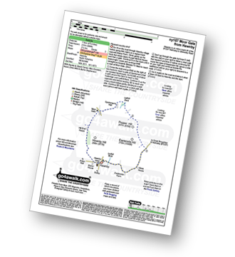
Route Summary:
Hawnby - Hill End House - Moor Gate - Sportsman's Hall - Ladhill Beck - Pepper Hill - Easterside Hill - Wass House - Easterside Farm - Ladhill Beck - Hawnby


|
Vital Statistics:
| Length: | 6.5 miles (10.5 km) |
| Ascent: | 932ft (284m) |
| Time: | 3.25hrs |
| Grade: |  |
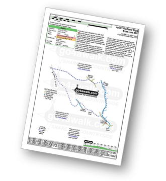
Route Summary:
Low Mill - Horn End Farm - Crow Wood - West Gill Beck - Westside Road (Track) - West Gill Head - Rudland Rigg - Dickon Howe - Monket House Bank (Track) - Monket House - Thorn Wath Bridge - Church Houses - High Mill - River Dove - Ferndale Nature Reserve - Low Mill

|
Vital Statistics:
| Length: | 17.5 miles (28 km) |
| Ascent: | 1,591ft (485m) |
| Time: | 7.75hrs |
| Grade: |  |

Route Summary:
Barningham - Birk Hills Farm - Brown Hill - Cathaw Stoop - Carter Allotment - Badger Way - Badger Way Stoop - How Tallon - How Tallon Gate - How Tallon Ridge - High Moor - Arndale Springs - Frankinshaw How - Holgate Moor - Arndale hole - Kexwith Beck - Kexwith Farm - Moresdale Gill - Moresdale - Moresdale Road - Fair Seat Hill - Moresdale Ridge - Stony Man (St Andrew's Cross) - Booze Moor - Low Moor - Windeg Vein - Little Windeg - Dry Gill Bottom - Shaw Farm - Stang Side - Stang House - Freestone Ridge - Stang Top - Hope Moor - The Stang - Woodcote Gill - Black Hill Gate - Haythwaite Farm - Moorcock Farm - Bragg House - Barningham

|
Vital Statistics:
| Length: | 12.75 miles (20.5 km) |
| Ascent: | 1,056ft (322m) |
| Time: | 5.75hrs |
| Grade: |  |

Route Summary:
Hutton-le-Hole - Lodge Road - Wheat Lund - Hutton Ridge - High Snapes - Loskey Beck - Loskey Ridge - Ana Cross - Spaunton Moor - Spring Heads Turn - Barker Slack - Lastingham Ridge - Lastingham - St Chad's Well - St Cedd's Well - Ings beck - Hagg Wood - Lower Askew - Birk Head - Scarth Wood - Tenterhill End - Appleton Mill Farm - The Tabular Hills Walk - Hamley Lane - Appleton-le-Moors - South Ings Lane (Track) - Ings Balk (Track) - Lingmoor Lane (Track) - Spring Wood - Bottom Fields Lane - Austin Head - Hutton-le-Hole

|
Vital Statistics:
| Length: | 4.5 miles (7 km) |
| Ascent: | 623ft (190m) |
| Time: | 2.25hrs |
| Grade: | |

Route Summary:
Hutton-le-Hole - The Lund - Fairy Call Beck - High Cross Plain - Mary Magdalene Well - Lastingham - St Chad's Well - St Cedd's Well - Ings Beck - Hagg Wood - Spaunton - Grange Farm - Austin Head - Hutton-le-Hole

|
Vital Statistics:
| Length: | 8.5 miles (13.5 km) |
| Ascent: | 1,089ft (332m) |
| Time: | 4 hrs |
| Grade: | |

Route Summary:
Hutton-le-Hole - Lodge Road - Wheat Lund - Hutton Ridge - High Snapes - Loskey Beck - Loskey Ridge - Ana Cross - Spaunton Moor - Spring Heads Turn - Barker Slack - Lastingham Ridge - Lastingham - St Chad's Well - St Cedd's Well - Ings beck - Hagg Wood - Spaunton - Grange Farm - Austin Head - Hutton-le-Hole

|
Vital Statistics:
| Length: | 8.75 miles (14 km) |
| Ascent: | 590ft (180m) |
| Time: | 3.75hrs |
| Grade: | |
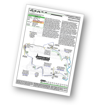
Route Summary:
Hutton-le-Hole - The Lund - Fairy Call Beck - High Cross Plain - Mary Magdalene Well - Lastingham - St Chad's Well - St Cedd's Well - Ings beck - Hagg Wood - Lower Askew - Birk Head - Scarth Wood - Tenterhill End - Appleton Mill Farm - The Tabular Hills Walk - Hamley Lane - Appleton-le-Moors - South Ings Lane (Track) - Ings Balk (Track) - Lingmoor Lane (Track) - Spring Wood - Bottom Fields Lane - Austin Head - Hutton-le-Hole

|
Vital Statistics:
| Length: | 10.5 miles (17 km) |
| Ascent: | 853ft (260m) |
| Time: | 4½ hrs |
| Grade: | |

Route Summary:
Wolsingham - River Wear - Weardale - The Weardale Way - Ashes House - Towdy Potts - Spence Hill - Harthope - Sunnyside Edge - Elephant Trees - Pikestone Fell - Allotment House - Folly Plantation - Harehope Farm - White Kirkley Farm - Bolihope Burn - Lower Bishopley Farm - Miln House Farm - Bridge End - Frosterley - Weardale - Wolsingham

|
Vital Statistics:
| Length: | 8.5 miles (13.5 km) |
| Ascent: | 1,093ft (333m) |
| Time: | 4.25hrs |
| Grade: | |
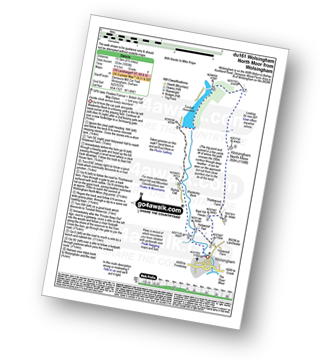
Route Summary:
Wolsingham - Waskerley Beck - Holywood House - Bael Hill House - Thistlewood Farm - Wolsingham North Moor - Tunstall Reservoir - Bishop Oak - Wolsingham

|
Vital Statistics:
| Length: | 6.25 miles (10 km) |
| Ascent: | 1,355ft (413m) |
| Time: | 3.75hrs |
| Grade: | |
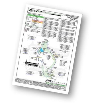
Route Summary:
Kilburn White Horse - Hoodhill Feld Plantation - Hood Hill Plantation - Hood Grange - Kennycow - High Cleavers Farm - Gormire Rigg - Gormire Lake - Southwoods Lodge - Garbutt Wood - The Cleveland Way - Whitestone Cliff - White Mare Crag - Great Relief Pot - Cliff Plantation - Sutton Brow - Sutton Bank - Knowlson's Drop - Roulston Scar - Ivy Scar - Kilburn White Horse

|
Vital Statistics:
| Length: | 5.5 miles (8.5 km) |
| Ascent: | 46ft (14m) |
| Time: | 2 hrs |
| Grade: |  |

Route Summary:
Baltic Square - Gateshead - Millennium Bridge - Newcastle - Quayside Walk - The Hadrian's Way - The Hadrian's Wall Path - Byker Ouseburn Regeneration Centre - Ouse Burn - Spillars Tyne Mill - Hadrian's Cycle Way - St Anthony's - Pottery Bank - St Peters Marina - Quayside Walk - Newcastle - Millennium Bridge - Gateshead.

|
Vital Statistics:
| Length: | 11 miles (17 km) |
| Ascent: | 1,246ft (380m) |
| Time: | 5.25hrs |
| Grade: | |

Route Summary:
Frosterley - Wireless Mast - Fatherley Currick - Collier Law - Weatherhill Engine - Heathery Burn - Stanhope Burn - Stanhope - River Wear - Stepping Stones - Weardale - The Weardale Way - Dryburnside Farm - Frosterley

|
Vital Statistics:
| Length: | 8.75 miles (14 km) |
| Ascent: | 1,870ft (570m) |
| Time: | 5 hrs |
| Grade: |  |
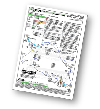
Route Summary:
Reeth - Arkle Beck - High Fremington - White House Farm - Fremington Edge - Fremington Edge Top - Fell End Lead Mine - Storthwaite Hall - Arkengarthdale - Langthwaite - Arken Town - Calver Hill - Riddings Farm - Skelgate Lane - Wainwright's Coast to Coast Walk - The Herriot Way - Reeth

|
Vital Statistics:
| Length: | 12.75 miles (20.5 km) |
| Ascent: | 1,935ft (590m) |
| Time: | 6½ hrs |
| Grade: | |

Route Summary:
Reeth - River Swale - Harkerside Place Farm - Harker Mires - The Herriot Way - Low Harker Hill - High Harker Hill - Blue Hill - Beldow Hill - Green Hill Ends - Whitaside Moor - ashpot Gutters - Apedale Road (Track) Apedale - Dent's House - Greets Hill - How Hill - Grinton Lodge - The Herriot Way - Grinton - Arkle Beck - Reeth

|
Vital Statistics:
| Length: | 9 miles (14.5 km) |
| Ascent: | 1,674ft (510m) |
| Time: | 5 hrs |
| Grade: | |

Route Summary:
Reeth - Wainwright's Coast to Coast Walk - Arkle Beck - High Fremington - White House Farm - Fremington Edge - Fremington Edge Top - Fell End Lead Mine - Storthwaite Hall - Arkengarthdale - Langthwaite - Castle Farm House - Cuckoo Hill - The Herriot Way - Reeth
Not familiar with the area around TS23?
See these 30 nearest walks to UK Postcode TS23 on a google map

|
Vital Statistics:
| Length: | 7 miles (11 km) |
| Ascent: | 1,674ft (411m) |
| Time: | 4 hrs |
| Grade: | |

Route Summary:
Reeth - Wainwright's Coast to Coast Walk - Arkle Beck - High Fremington - White House Farm - Fremington Edge - Fremington Edge Top - Fell End Lead Mine - Storthwaite Hall - Arkengarthdale - Castle Farm House - Cuckoo Hill - The Herriot Way - Reeth

|
Vital Statistics:
| Length: | 14.5 miles (23 km) |
| Ascent: | 1,805ft (550m) |
| Time: | 7.25hrs |
| Grade: | |

Route Summary:
Stanhope - River Wear - Weardale - The Weardale Way - River Wear - Eastgate - Rookhope Burn - Rookhope - C2C Cycle Route - Longlaw End - Bolt's Law (Hunstanworth) - Weatherhill Engine - East Whitely Beck - Stanhope Burn - Stanhope

|
Vital Statistics:
| Length: | 8.75 miles (14 km) |
| Ascent: | 1,398ft (426m) |
| Time: | 4½ hrs |
| Grade: | |
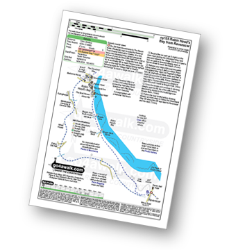
Route Summary:
Robin Hood's Bay - The Cleveland Way - Cowfield Hill - Boggle Hole - Stoupe Beck - Stoupe Bank Farm - Stoupebrow Cottage Farm - Ravenscar - Dismantled Railway - Stoupe Brow Farm - Home Farm - Brownside Farm - Howdale Wood - Alison Head Wood - Fyling Old Hall Farm - White House - Fylingthorpe - Robin Hood's Bay

|
Vital Statistics:
| Length: | 9 miles (14.5 km) |
| Ascent: | 1,730ft (527m) |
| Time: | 5 hrs |
| Grade: | |

Route Summary:
Middleton-in-Teesdale - Hudeshope Beck - Skears Lime Kilns - Club Gill Farm - Coldberry Mine - Coldberry Gutter - Hardberry Hill - Stable Edge - Newbiggin - Newbiggin Bridge - The Pennine Way - Park End Wood - Knott Hill - Middle Crossthwaite - The River Tees - Middleton-in-Teesdale

|
Vital Statistics:
| Length: | 8.25 miles (13 km) |
| Ascent: | 1,172ft (357m) |
| Time: | 4.25hrs |
| Grade: | |

Route Summary:
Middleton-in-Teesdale - River Tees - River Lune - Eller Brook - Grassholme Reservoir - Lunedale - The Pennine Way - Crossthwaite Common - Harter Fell (Crossthwaite Common) - River Tees - Middleton-in-Teesdale

|
Vital Statistics:
| Length: | 7.75 miles (12.5 km) |
| Ascent: | 988ft (301m) |
| Time: | 4 hrs |
| Grade: | |

Route Summary:
Balderhead Reservoir - High Birk Hat Farm - The Pennine Way - Hannah's Meadow - Birk Hat Farm - Blackton Reservoir - Baldsersdale - Willoughby Hall - Scoon Bank - West Brisco - Coproal Hill - East Brisco - How Beck - Lathe Haw - Lathehaw Rigg - Goldsborough Rigg - Goldsborough - East Friar House - Mawmon Sike - Balckton Grange - Balderhead Reservoir

|
Vital Statistics:
| Length: | 5.25 miles (8.5 km) |
| Ascent: | 380ft (116m) |
| Time: | 2.25hrs |
| Grade: |  |
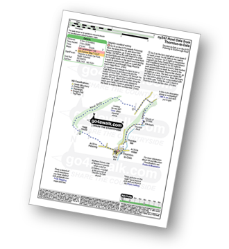
Route Summary:
Thornton-le-Dale - Hagg House - Howl Dale Wood - Howl Dale - Orchan Dale - Pexton Moor Plantation - Kirkdale Slack - Ellerburn - Thornton-le-Dale

|
Vital Statistics:
| Length: | 12.5 miles (20 km) |
| Ascent: | 1,279ft (390m) |
| Time: | 5.75hrs |
| Grade: | |

Route Summary:
Bowlees - Wynch Bridge - River Tees - Holwick - Low Currick Rigg - Blea Beck - Whiteholm Bank - Dry Beck - Skyer Beck - Birk Rigg - Thistle Green - White Well Green - River Tees - Fox Earths - Raven Scar - Cronkley Scar - Green Hill - Cronkley Pasture - High House - The Pennine Way - Cronkley Farm - Bracken Rigg - Bleabeck Force - High Force - Saur Hill Bridge - Low Force - Wynch Bridge - Bowlees

|
Vital Statistics:
| Length: | 8.5 miles (13.5 km) |
| Ascent: | 1,231ft (375m) |
| Time: | 4½ hrs |
| Grade: | |
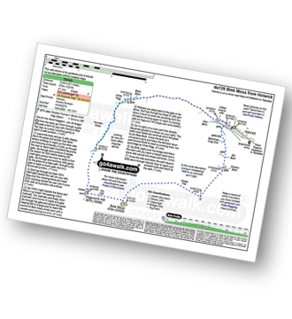
Route Summary:
Holwick - Holwick Scars - Rowton Beck - Green Fell - Bink Moss - Dry Gill - Hagworm Hill - Howden Moss - Black Beck - White Rigg - Holwick

|
Vital Statistics:
| Length: | 3 miles (4.5 km) |
| Ascent: | 367ft (112m) |
| Time: | 1½ hrs |
| Grade: | |
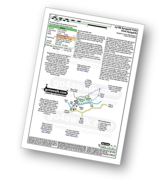
Route Summary:
Aysgarth - Aysgarth Falls - High Force - The Herriot Way - Aysgarth Falls - Middle Force - Aysgarth Falls - Low Force - St Josephs Wood - Freeholders' Wood - Aysgarth

|
Vital Statistics:
| Length: | 14 miles (22.5 km) |
| Ascent: | 1,979ft (603m) |
| Time: | 7 hrs |
| Grade: | |

Route Summary:
St John's Chapel - Thatch Mires - Chapelfell Top - Fendrith Hill - Swinhope Moor - Dora's Seat - Swinhope Head - Westernhope Moor - Black Hill (Westernhope Moor) - Littlewood Farm - Brotherlee - Shield - River Wear - Weardale - The Weardale Way - Westgate - Daddry - St John's Chapel

|
Vital Statistics:
| Length: | 9 miles (14.5 km) |
| Ascent: | 1,651ft (503m) |
| Time: | 5 hrs |
| Grade: | |

Route Summary:
St John's Chapel - Thatch Mires - Chapelfell Top - Fendrith Hill - Swinhope Moor - Dora's Seat - Swinhope Head - Swinside House - Daddry Shield - River Wear - Weardale - The Weardale Way - St John's Chapel

|
Vital Statistics:
| Length: | 4.5 miles (7 km) |
| Ascent: | 870ft (265m) |
| Time: | 2½ hrs |
| Grade: | |

Route Summary:
Thornton Rust - Thornton Rust Moor - Addlebrough - Swallow Hole - Worton Scar - Thornton Scar - Thornton Rust

|
Vital Statistics:
| Length: | 9.75 miles (15.5 km) |
| Ascent: | 1,388ft (423m) |
| Time: | 5 hrs |
| Grade: | |
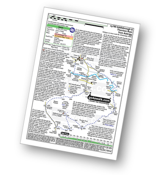
Route Summary:
Askrigg - Askrigg Bottoms - The River Ure - Wensleysdale - Worton Bridge - Worton - Cubeck - Carpley Green Road - Worton Pasture - Carpley Green Farm - Addlebrough - Thornton Rust Moor - Thornton Rust - River Ure - Wensleydale - Nappa Mill Farm - Askrigg

|
Vital Statistics:
| Length: | 7.75 miles (12.5 km) |
| Ascent: | 1,214ft (370m) |
| Time: | 4.25hrs |
| Grade: | |

Route Summary:
Askrigg - Askrigg Bottoms - The River Ure - Wensleysdale - Worton Bridge - Worton - Cubeck - Carpley Green Road - Worton Pasture - Carpley Green Farm - Addlebrough - Swallow Hole - Worton Scar - Worton - Wensleydale - Askrigg Bottoms - Askrigg
Not familiar with the area around TS23?
See these 30 nearest walks to UK Postcode TS23 on a google map