UK Postcode SA47 - The 30 nearest easy-to-follow, circular walk route maps to you
The thirty nearest easy-to-follow, circular walk route maps to you in UK Postcode SA47 in Walk Grade Order
The UK cities, towns and villages in Ceredigion, Wales that have SA47 in their UK Postcode include:
• Llanarth • Oakford •
Not familiar with the area around SA47?
See these 30 nearest walks to UK Postcode SA47 on a google map
   |
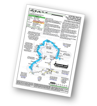
Vital Statistics:
| Length: | 4 miles (6 km) |
| Ascent: | 830ft (253m) |
| Time: | 2.25hrs |
| Grade: |  |
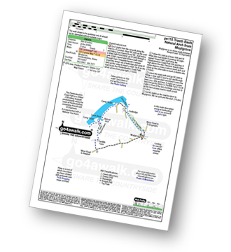
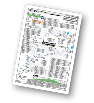
Route Summary:
Moylgrove - Cwm Trewyddel - Ceibwr Bay - The Pembrokeshire Coast Path - Careg Wylan - Traeth Bach - Careg Yspar - Cwm Flynnon-alwm - Treriffith Farm - Moylgrove
|
Vital Statistics:
| Length: | 6 miles (9.5 km) |
| Ascent: | 1,194ft (364m) |
| Time: | 3.25hrs |
| Grade: |  |

Route Summary:
The Arch - Coed Yr Arch - Coed y Cwm - Bryn-llwyd - Coed y Ceuleth - Truman - Rhos Peiran - Craig U Ceffyl - Pen Y Garn (Bryn Garw) - Banc Myheryn - Rhos Nantperfedd - Glemast Farm - Rhos y Cwm - The Arch
|
Vital Statistics:
| Length: | 3.75 miles (6 km) |
| Ascent: | 499ft (152m) |
| Time: | 2 hrs |
| Grade: |  |

Route Summary:
Llandeilo - Llandeilo Bridge - River Towy - Afon Tywi - Pen Lan-fawr - Castle Wood - Dinefwr Castle/Dynevor Castle - Bog Wood - Newton House - Dinefwr Park - Llandeilo
|
Vital Statistics:
| Length: | 5.25 miles (8.5 km) |
| Ascent: | 807ft (246m) |
| Time: | 2.75hrs |
| Grade: | |

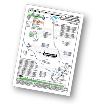
Route Summary:
Newport - Newport Sands - The Pembrokeshire Coast Path - Cat Rock - Aber Step - Aber Rhigian - Hendre Farm - Hill House - Castle Hill - Newport
|
Vital Statistics:
| Length: | 4.75 miles (7.5 km) |
| Ascent: | 643ft (196m) |
| Time: | 2½ hrs |
| Grade: | |
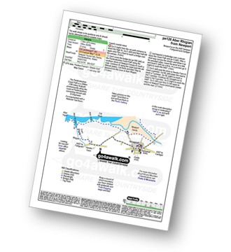
Route Summary:
Newport - Newport Sands - The Pembrokeshire Coast Path - Cat Rock - Aber Step - Aber Rhigian - Newport
|
Vital Statistics:
| Length: | 7 miles (11 km) |
| Ascent: | 1,437ft (438m) |
| Time: | 4 hrs |
| Grade: |  |

Route Summary:
Newport - Newport Sands - The Pembrokeshire Coast Path - Cat Rock - Aber Step - Aber Rhigian - Hendre Farm - Mynydd Carningli - Castle Hill - Newport
|
Vital Statistics:
| Length: | 10 miles (16 km) |
| Ascent: | 2,353ft (717m) |
| Time: | 6 hrs |
| Grade: |  |

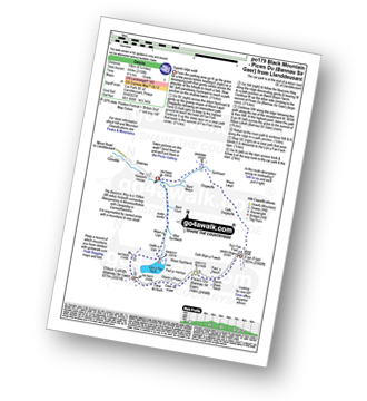
Route Summary:
Nant-y-moch Reservoir - Nant-y-moch - Y Garn (Pumlumon) - Dyll Faen - Pen y Drawsallt - Pen Pumlumon Fawr (Plynlimon) - Pumlumon Fach - Pumlumon Fach (East Top) - Pen Pumlumon Llygad-bychan - Pen Pumlumon Arwystli - Craig y March - Cwm Gwerin - Lluest y Graig - Afon Hengwm - Pantau'r Brwyn - Nant y Llyn - Maesnant - Bryn y Beddau - Nant-y-moch Reservoir
|
Vital Statistics:
| Length: | 6.25 miles (10 km) |
| Ascent: | 1,096ft (334m) |
| Time: | 3½ hrs |
| Grade: | |
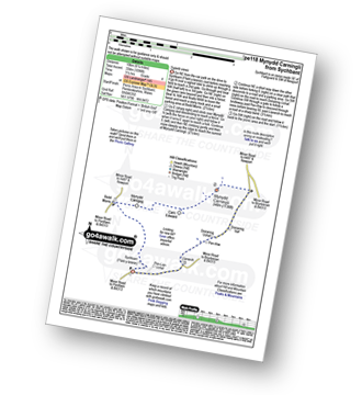
Route Summary:
Sychbant - (Ffald-y-brenin) - Bedd Morris - Mynydd Caregog - Carn Edward - Mynydd Carningli - Doirannig - Llanerch - Sychbant
|
Vital Statistics:
| Length: | 3 miles (5 km) |
| Ascent: | 735ft (224m) |
| Time: | 2 hrs |
| Grade: | |
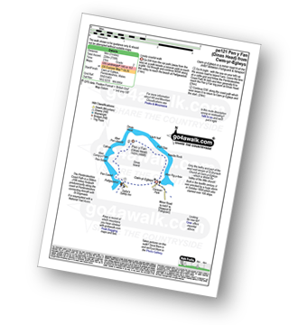
Route Summary:
Cwm-yr-Eglwys - The Pembrokeshire Coast Path - Aber Pig-y-baw - Needle Rock - Llech Isaf - Pen y Fan (Dinas Head) - Aber Pen-clawdd - Cafnau - Aber Careg-y-Fran - Pen Sidan - Pen Castell - Pwllgwaelod - Cwm-yr-Eglwys
|
Vital Statistics:
| Length: | 5.75 miles (9 km) |
| Ascent: | 1,397ft (426m) |
| Time: | 3½ hrs |
| Grade: | |
Route Summary:
Cwm-yr-Eglwys - The Pembrokeshire Coast Path - Bryn-henllan - Dinas Cross - Aber Bach - Pwllgwaelod - Pen Castell - Pen Sidan - Aber Careg-y-Fran - Cafnau - Aber Pen-clawdd - Pen y Fan (Dinas Head) - Llech Isaf - Pell Glas - Needle Rock - Aber Pig-y-baw - Cwm-yr-Eglwys
|
Vital Statistics:
| Length: | 11 miles (17.5 km) |
| Ascent: | 1,900ft (579m) |
| Time: | 6 hrs |
| Grade: | |
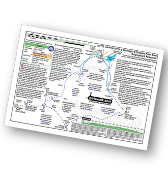
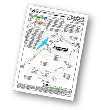
Route Summary:
Dolymynach Reservoir - Afon Claerwen - Llanerch Cawr - Llywdnant - Marchnant - Gorllwyn (Pen y Gorllwyn) - Bwlch Ddau Faen - Carnau - Bryn Rhudd - Drygarn Fawr (North East Top) - Drygarn Fawr - Carreg Yr Ast - Nant Paradwys - Rhiwnant - Dolymynach Reservoir
|
Vital Statistics:
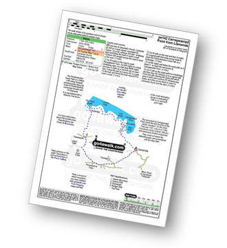
| Length: | 1.5 miles (2.5 km) |
| Ascent: | 440ft (134m) |
| Time: | 1 hrs |
| Grade: |  |

|
Vital Statistics:
| Length: | 7.5 miles (12 km) |
| Ascent: | 1,588ft (484m) |
| Time: | 4½ hrs |
| Grade: | |
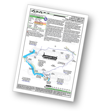
Route Summary:
Penygarreg Reservoir - Nant y Blymbren - Penygarreg Farm - Esgair Penygarreg (Crugyn Ci) - Banc Trehesglog - Briddell Fell - Esgair Perfedd - Cwm Garw - Rhiw Caws - Craig Goch Reservoir - Craig Yr Allt-goch - Coed Yr Allt-goch - Penygarreg Reservoir
|
Vital Statistics:
| Length: | 8.5 miles (13.5 km) |
| Ascent: | 2,914ft (888m) |
| Time: | 6 hrs |
| Grade: | |
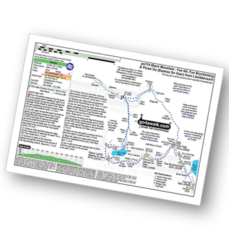
Route Summary:
Car Park SE of Llanddeusant - Nant Melyn - Sychnant - Disgwylfa - Cefn Disgwylfa - Tro'r Fan Foel - Fan Foel - The Beacons Way - Twr y Fan Foel - Fan Brycheiniog - Fan Hir - Fan Brycheiniog (Twr y Fan Foel) - Fan Foel - Bwlch Blaen Twrch - Pant y Bwlch - Picws Du (Bannau Sir Gaer) - Glastir y Picws - Cwar Du Mawr - Cwar Du Bach - Waun Lefrith (Bannau Sir Gaer) - Llyn y Fan Fach - Llethr y Llyn - Waun y Llyn - Nant Coch - Car Park SE of Llanddeusant
|
Vital Statistics:
| Length: | 6.25 miles (10 km) |
| Ascent: | 2,130ft (649m) |
| Time: | 4½ hrs |
| Grade: | |
Route Summary:
Car Park SE of Llanddeusant - Nant Melyn - Sychnant - Disgwylfa - Cefn Disgwylfa - Tro'r Fan Foel - Fan Foel - The Beacons Way - Twr y Fan Foel - Bwlch Blaen Twrch - Pant y Bwlch - Picws Du (Bannau Sir Gaer) - Glastir y Picws - Cwar Du Mawr - Cwar Du Bach - Waun Lefrith (Bannau Sir Gaer) - Llyn y Fan Fach - Llethr y Llyn - Waun y Llyn - Nant Coch - Car Park SE of Llanddeusant
Not familiar with the area around SA47?
See these 30 nearest walks to UK Postcode SA47 on a google map
|
Vital Statistics:
| Length: | 7.75 miles (12.5 km) |
| Ascent: | 1,575ft (480m) |
| Time: | 4½ hrs |
| Grade: | |

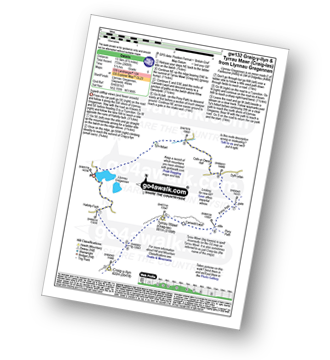
Route Summary:
Elan Valley Visitor Centre - Caban-coch Reservoir Dam - Caban-coch Reservoir - Craig Cnwch - Nant-y-Gro Dam - Ty'n-y-pant - Dolymynach Reservoir - Llanerch Cawr Longhouse - Craig y Mynach - Nant Gwyllt - Penglaneinon Farm - Coed Aberelan - Garreg-ddu Reservoir - Caban-coch Reservoir - Elan Valley Visitor Centre
|
Vital Statistics:
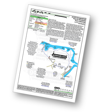
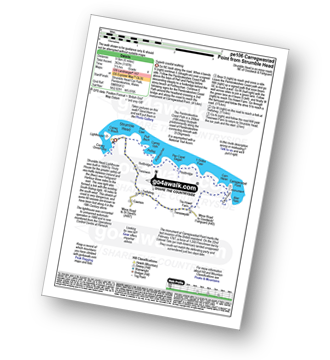
| Length: | 4.75 miles (7.5 km) |
| Ascent: | 863ft (263m) |
| Time: | 2½ hrs |
| Grade: | |
Route Summary:
Llanwnda - Cwm Felin - Carregwastad Point - The Pembrokeshire Coast Path - Aber Felin - Carn Helen - Y Globa Fawr - Pen Capel Degan - Treneewydd - Garn Folch - Llanwnda
|
Vital Statistics:
| Length: | 4.75 miles (8.5 km) |
| Ascent: | 1,007ft (307m) |
| Time: | 3 hrs |
| Grade: | |
Route Summary:
Llanwnda - Cwm Felin - Carregwastad Point - Aber Felin - The Pembrokeshire Coast Path - Pant y Dwr - Porth Maen - Anglas Bay - Pen Anglas - Crincoed Point - Pwll Hir - Goodwick - Llanwnda
|
Vital Statistics:
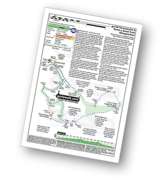
| Length: | 7.75 miles (12.5 km) |
| Ascent: | 2,281ft (695m) |
| Time: | 5.25hrs |
| Grade: | |
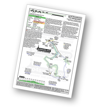
Route Summary:
Abergynolwyn - Nant Gwernol - Nant Gwernol Station - Drum House - Nant Moelfre - Moelfre - Tarrenhendre - Pant Gwyn (Tarrenhendre) - Bryn-Eglwys Quarry - Abergynolwyn
|
Vital Statistics:
| Length: | 10.5 miles (17 km) |
| Ascent: | 3,328ft (1,014m) |
| Time: | 7.25hrs |
| Grade: |  |
Route Summary:
Abergynolwyn - Nant Gwernol - Nant Gwernol Station - Drum House - Nant Moelfre - Moelfre - Tarrenhendre - Pant Gwyn (Tarrenhendre) - Mynydd Rhyd-galed - Foel y Geifr - Tarren y Gesail - Bryn-Eglwys Quarry - Abergynolwyn
|
Vital Statistics:
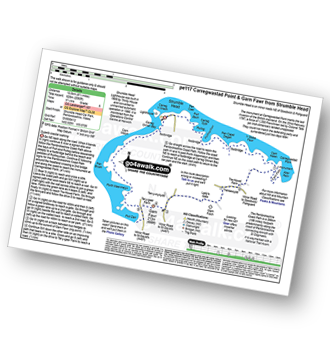
| Length: | 6 miles (9.5 km) |
| Ascent: | 1,187ft (362m) |
| Time: | 3½ hrs |
| Grade: | |
Route Summary:
Strumble Head - The Pembrokeshire Coast Path - Porthsychan - Carregwastad Point - Aber Felin - Cwm Felin - Treneewydd - Trefisheg - Tresirwen - Strumble Head
|
Vital Statistics:
| Length: | 8.5 miles (13.5 km) |
| Ascent: | 2,060ft (628m) |
| Time: | 5.25hrs |
| Grade: | |
Route Summary:
Strumble Head - The Pembrokeshire Coast Path - Porthsychan - Carregwastad Point - Aber Felin - Cwm Felin - Garn Folch - Garn Fawr (Strumble Head) - Pwll Deri - Porth Maenmelyn - Pen Brush - Carn Melyn - Carreg Onnen Bay - Strumble Head
|
Vital Statistics:
| Length: | 5 miles (8 km) |
| Ascent: | 1,168ft (356m) |
| Time: | 3 hrs |
| Grade: | |
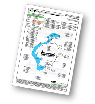
Route Summary:
Strumble Head - The Pembrokeshire Coast Path - Carreg Onnen Bay - Carn Melyn - Pen Brush - Porth Maenmelyn - Pwll Deri - Garn Fawr (Strumble Head) - Trefisheg - Tresirwen - Strumble Head
|
Vital Statistics:
| Length: | 10.5 miles (17 km) |
| Ascent: | 3,627ft (1,105m) |
| Time: | 7½ hrs |
| Grade: | |
Route Summary:
Llanfihangel-y-pennant - Afon Cadair - Tynyfach - Gwastadfryn - Hafotty Gwastaffryn - Rhiw Gwerdydd - The Pony Path - Cyfrwy - Cadair Idris (Penygadair) - Craig Cau - Craig Cwm Amarch - Mynydd Pencoed - Pencoed - Llanfihangel-y-pennant
|
Vital Statistics:
| Length: | 10 miles (16 km) |
| Ascent: | 2,737ft (834m) |
| Time: | 6½ hrs |
| Grade: | |

Route Summary:
Llanfihangel-y-pennant - Tynyfach - Gwastadfryn - Hafotty Gwastaffryn - Rhiw Gwerdydd - Carnedd Lwyd - Tyrrau Mawr (Craig-las) - Tyrau Mawr (Craig-las) - Craig-y-llyn - Twll y Ogof - Bodilan Fach - Afon Cadair - Llanfihangel-y-pennant
|
Vital Statistics:
| Length: | 15 miles (24 km) |
| Ascent: | 3,673ft (1,119m) |
| Time: | 9.25hrs |
| Grade: |  |
Route Summary:
Glyntawe - Afon Tawe - Ty Hendrey - Allt Fach - Fan Fechan - Fan Hir - Bwlch Giedd - The Beacons Way - Fan Brycheiniog (Twr y Fan Foel) - Fan Foel - Tro'r Fan Foel - Bwlch Blaen Twrch - Pant y Bwlch - Picws Du (Bannau Sir Gaer) - Glastir y Picws - Cwar Du Mawr - Cwar Du Bach - Waun Lefrith (Bannau Sir Gaer) - Afon Mihartfach - Carreg yr Ogof - Garreg Las (Twyn Swnd) - Pen Rhiw-goch - Twrch Fechan - Cwterydd Blaen-Twrch Fechag - Esgair Ddu (Black Mountains) - Carnau Nant-Menyn - Nant Lluestau - Afon Twrch - Afon Giedd - Pwll y Cig - Waun Fignen Felen - Disgwylfa - Twynwalter - Twyn Spratt - Afon Haffes - Dan-yr-Ogog Campsite and Showcaves - Glyntawe
|
Vital Statistics:
| Length: | 8.5 miles (13.5 km) |
| Ascent: | 1,792ft (546m) |
| Time: | 5 hrs |
| Grade: | |
Route Summary:
Pont Gihirych (Cray Reservoir) - Heol Senni (Fan Bwlch Chwyth) - Yr Allt (Forest Fawr) - Bwlch y Duwynt - Fan Fraith - Fan Gyhirych - Bwlch Bryn-fhudd - Pont Gihirych.
|
Vital Statistics:
| Length: | 5 miles (8 km) |
| Ascent: | 1,375ft (419m) |
| Time: | 3.25hrs |
| Grade: | |

Route Summary:
Arthog - Afon Arthog - Arthog Waterfalls - Pant Phylip - Llys-Bradwen - Llynnau Cregennan - Cregennen Lakes - Pared y Cefn hir - Pant y Cae - Tan y Coed - Arthog
|
Vital Statistics:
| Length: | 8.5 miles (13.5 km) |
| Ascent: | 2,406ft (733m) |
| Time: | 5½ hrs |
| Grade: | |
Route Summary:
Llynnau Cregennen - Hafotty-fach - Craig-y-llyn - Tyrrau Mawr (Craig-las) - Tyrau Mawr (Craig-las) - Carnedd Lwyd - Rhiw Gwerdydd - Pony Path - Dyffr-ydan - Cefn-yr-Owen Isaf - Ty'n-llidiart - Llynnau Cregennen
|
Vital Statistics:
| Length: | 15 miles (24 km) |
| Ascent: | 3,157ft (962m) |
| Time: | 8½ hrs |
| Grade: | |
Route Summary:
Maen Llia Standing Stone - Fan Nedd - Bwlch y Duwynt - Fan Fraith - Fan Gyhirych - Bwlch Bryn-rhudd - Penwyllt - Carreg Cadno - Sand Hill - Coed-y-Garreg - Sarn Helen Roman Road - Maen Madoc Standing Stone - Plas-y-gors - Blaen Llia - Maen Llia.
Not familiar with the area around SA47?
See these 30 nearest walks to UK Postcode SA47 on a google map


