UK Postcode CA21 - The 30 nearest easy-to-follow, circular walk route maps to you
The thirty nearest easy-to-follow, circular walk route maps to you in UK Postcode CA21 in Walk Grade Order
The UK cities, towns and villages in Cumbria, England that have CA21 in their UK Postcode include:
• Beckermet •
Not familiar with the area around CA21?
See these 30 nearest walks to UK Postcode CA21 on a google map

   |
Vital Statistics:
| Length: | 11 miles (17.5 km) |
| Ascent: | 1,418ft (432m) |
| Time: | 5½ hrs |
| Grade: |  |
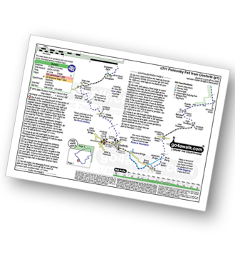
Route Summary:
Gosforth - Rowend Bridge - River Bleng - Bleng Bridge - Hall Bolton - Bolton Head - Low Thistleton Farm - High Thistleton Farm - Guards Head Farm - Hollow Moor - Brown Edge - Blengdale Forest - River Bleng - Scalderskew Beck - Ponsonby Fell - Scargreen Farm - Gidd Hall Farm - Ponsonby Old Hall - Middle Boonwood - Gosforth


|
Vital Statistics:
| Length: | 8.75 miles (14 km) |
| Ascent: | 1,854ft (565m) |
| Time: | 5 hrs |
| Grade: | |

Route Summary:
Friar Well - Friar Gill - River Calder - Tongue How - Town Bank - Lank Rigg - Whoap - Whoap Beck - Stinking Gill - Lankrigg Moss - Latterbrow Moss - Latterbrow Beck - Friar Well

|
Vital Statistics:
| Length: | 8.25 miles (13 km) |
| Ascent: | 1,549ft (472m) |
| Time: | 4½ hrs |
| Grade: |  |
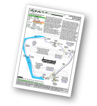
Route Summary:
St Bees Beach - Wainwright's Coast to Coast Walk - Pattering Holes - South Head - Tomlin - St Bees Head - Fleswick - Cloven Barth - St Bees Lighthouse - North Head - Sandwith - Townhead - Demesne Farm - Bell House - Stanley - Pow Beck - Abbey Wood - St Bees - St Bees Beach

|
Vital Statistics:
| Length: | 6.25 miles (10 km) |
| Ascent: | 1,523ft (464m) |
| Time: | 3.75hrs |
| Grade: | |
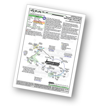
Route Summary:
Wath Bridge - Cleator Moor - River Ehen - Ramsgill Wood - Old Wood - Black How - Wainwright's Coast to Coast Walk - Blackhow Wood - Weather Slacks - Dent (Long Barrow) - Uldale Plantation - Kirk Beck - Uldale - Nannycatch Gate - Flat Fell - Brown Bank - Wath Bridge

|
Vital Statistics:
| Length: | 7.75 miles (12.5 km) |
| Ascent: | 2,028ft (618m) |
| Time: | 5½ hrs |
| Grade: | |
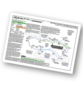
Route Summary:
Scaly Moss - Blackely Moss - Heckbarley Wood - Red Moss - Grike - Crag Fell - Black Pots - Whoap - Lank Rigg - Whoap Beck - Lankrigg Moss - Stinking Gill - Blackeley Raise - Whorl Gill - Scaly Moss

|
Vital Statistics:
| Length: | 15.25 miles (24.5 km) |
| Ascent: | 4,125ft (1,257m) |
| Time: | 9.75hrs |
| Grade: |  |

Route Summary:
Ennerdale Weir - Ennerdale Water - Silver Cove Beck - Woundell Beck - Little Gowder Crag - Haycock - Caw Fell - Silver Cove - Iron Crag - Whoap - Lank Rigg - Crag Fell - Grike - Ennerdale Weir

|
Vital Statistics:
| Length: | 11.75 miles (19 km) |
| Ascent: | 2,970ft (905m) |
| Time: | 7½ hrs |
| Grade: |  |
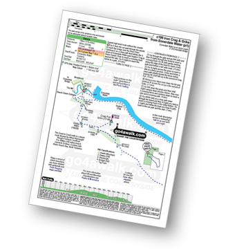
Route Summary:
Ennerdale Weir - Ennerdale Water - Silver Cove Beck - Woundell Beck - Caw Fell - Silver Cove - Iron Crag - Crag Fell - Grike - Ennerdale Weir

|
Vital Statistics:
| Length: | 6 miles (9.5 km) |
| Ascent: | 2,504ft (763m) |
| Time: | 4.75hrs |
| Grade: | |

Route Summary:
Greendale Farm - Gill Farm - Gill Beck - Buckbarrow - Glade How - Cat Bields - Nether Wasdale Common - Seatallan - Pots of Ashness - Windscale Hows - Middle Fell (Wasdale) - Greendale Gill - Greendale Farm

|
Vital Statistics:
| Length: | 11.25 miles (18 km) |
| Ascent: | 5,100ft (1,554m) |
| Time: | 9.25hrs |
| Grade: |  |

Route Summary:
Greendale Farm - Middle Fell (Wasdale) - Seatallan - Pots of Ashness - Gowder Crag - Haycock - Great Scoat Fell - Steeple - Scoat Fell (Little Scoat Fell) - Red Pike (Wasdale) - Dore Head - Yewbarrow (North Top) - Yewbarrow - Bell Rib - Dropping Crag - Overbeck Bridge - Wast Water - Greendale Farm

|
Vital Statistics:
| Length: | 9.75 miles (15.5 km) |
| Ascent: | 3,236ft (986m) |
| Time: | 6.75hrs |
| Grade: | |
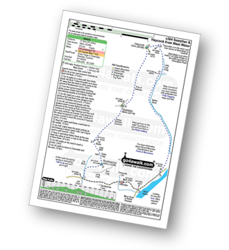
Route Summary:
Greendale Farm - Gill Farm - Buckbarrow - Seatallan - Pots of Ashness - Gowder Crag - Haycock - Little Lad Crag - Nether Beck - Wast Water - Wasdale - Greendale Farm

|
Vital Statistics:
| Length: | 18.75 miles (30 km) |
| Ascent: | 7,309ft (2,408m) |
| Time: | 14.75hrs |
| Grade: | |

Route Summary:
Bowness Knott Car Park Ennerdale - Low Gillerthwaite Field Centre - High Gillerthwaite Yourth Hostel - Red Pike (Buttermere) - High Stile - High Crag (Buttermere) - Seat (Buttermere) - Scarth Gap - Hay Stacks (Haystacks) - Innominate Tarn - Blackbeck Tarn - Black Beck - Green Crag (Buttermere) - Great Round How - Brandreth - Gillercomb Head - Green Gable - Windy Gap - Great Gable - Westmorland Cairn - Beck Head - Beckhead Tarn - Kirk Fell (East Top) - Kirk Fell - Black Sail Pass - Looking Stead (Pillar) - High Level Route - Robinson's Cairn - Pillar - Wind Gap - Black Crag (Pillar) - High Beck - Low Beck - Ennerdale.

|
Vital Statistics:
| Length: | 11.25 miles (18 km) |
| Ascent: | 3,275ft (998m) |
| Time: | 7½ hrs |
| Grade: | |

Route Summary:
Bowness Knott Car Park Ennerdale Water - Char Dub - Silver Cove Beck - Woundell Beck - Caw Fell - Little Gowder Crag - Haycock - Great Scoat Fell - Scoat Fell (Little Scoat Fell) - Steeple - Long Crag - Moss Dub - Lingmell Plantation - Bowness Knott Car Park Ennerdale Water.

|
Vital Statistics:
| Length: | 7.25 miles (11.5 km) |
| Ascent: | 683ft (208m) |
| Time: | 3.25hrs |
| Grade: |  |

Route Summary:
Bowness Knott Car Park - Bowness Plantations - River Liza - Ennerdale Water - Coast To Coast Path - Robin Hood's Chair - Anglers' Crag - Ennerdale Weir - River Ehen - Ennerdale Water - Bowness Knott Car Park

|
Vital Statistics:
| Length: | 8.75 miles (14 km) |
| Ascent: | 2,347ft (715m) |
| Time: | 5½ hrs |
| Grade: | |

Route Summary:
Miterdale Bridge - Porterthwaite - Miterdale Forest - Irton Fell - Greathall Gill - Whin Rigg - Illgill Head - Burnmoor Tarn - Burnmoor Lodge - Eskdale Moor - Ellerhow Moss - Boat How - Low Longrigg - River Mite - Low Place Farm - Miterdale Bridge

|
Vital Statistics:
| Length: | 10.25 miles (16.5 km) |
| Ascent: | 2,198ft (670m) |
| Time: | 6 hrs |
| Grade: | |
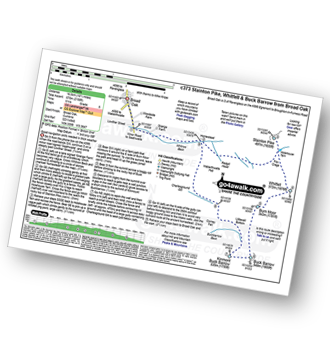
Route Summary:
Broad Oak - Whitrow Beck - Waberthwaite Fell - Rowantree Falls - Stainton Pike - Whitfell (Whit Fell) - Burn Moor - Buck Barrow - Kinmont Buck Barrow - Whitrow Beck - Broad Oak
Not familiar with the area around CA21?
See these 30 nearest walks to UK Postcode CA21 on a google map

|
Vital Statistics:
| Length: | 8.5 miles (13.5 km) |
| Ascent: | 1,953ft (595m) |
| Time: | 5 hrs |
| Grade: | |

Route Summary:
Stanley Force NT Car Park - Eskdale - Boot - River Esk - Low Birker - Crook Crag - Green Crag (Ulpha Fell) - Great Worm Crag - Brown Rigg - Sike Moss - Birkerthwaite - Low Ground Cottages - Stanley Force - River Esk - Stanley Force NT Car Park - Eskdale

|
Vital Statistics:
| Length: | 6.25 miles (10 km) |
| Ascent: | 601ft (183m) |
| Time: | 3 hrs |
| Grade: | |

Route Summary:
Eskdale - Boot - Dalegarth Station - River Esk - Doctor Bridge - Jubilee Bridge - Hardknott Pass - Brotherilkeld - Taw House Farm - Boot - Eskdale

|
Vital Statistics:
| Length: | 7.5 miles (12 km) |
| Ascent: | 4,195ft (1,279m) |
| Time: | 7 hrs |
| Grade: | |

Route Summary:
Wasdale Head - (National Trust Campsite) - Wast Water - Lingmell - Corridor Route - Scafell Pike - Mickledore - Foxes Tarn - Symonds Knott - Sca Fell - Lingmell Gill - Wasdale Head - Wast Water.

|
Vital Statistics:
| Length: | 11 miles (17.5 km) |
| Ascent: | 5,409ft (1,648m) |
| Time: | 9½ hrs |
| Grade: | |

Route Summary:
Wasdale Head - (National Trust Campsite) - Wast Water - Lingmell - Corridor Route - Great End - Ill Crag - Broad Crag - Scafell Pike - Mickledore - Foxes Tarn - Symonds Knott - Sca Fell - Slight Side - Broad Tongue - Hardrigg Gill - Wasdale Head - Wast Water.

|
Vital Statistics:
| Length: | 9 miles (14.5 km) |
| Ascent: | 2,402ft (732m) |
| Time: | 5.75hrs |
| Grade: | |
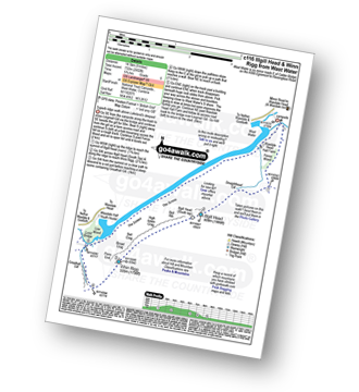
Route Summary:
Wasdale Head - (National Trust Campsite) - Wast Water - Lingmell Gill - Illgill Head - Whin Rigg - Greathall Gill - Wasdale Hall Youth Hostel - Wast Water - Wasdale Head

|
Vital Statistics:
| Length: | 15.25 miles (24.5 km) |
| Ascent: | 4,841ft (1,475m) |
| Time: | 10½ hrs |
| Grade: | |

Route Summary:
Wasdale Head - (National Trust Campsite) - Wast Water - Lingmell Gill - Illgill Head - Whin Rigg - Greathall Gill - Low Wood - Lund Bridge - Woodhow Farm - Woodhow Tarn - Scale Farm - Tosh Tarn - Gill Farm - Gill Beck - Buckbarrow - Cold Well - Nether Wasdale Common - Seatallan - Windscale Hows - Middle Fell (Wasdale) - Greendale Farm - Nether Beck - Overbeck Bridge - Wasdale Head - Wast Water.

|
Vital Statistics:
| Length: | 9.75 miles (15.5 km) |
| Ascent: | 5,140ft (1,567m) |
| Time: | 8.75hrs |
| Grade: | |

Route Summary:
Wasdale Head - (National Trust Campsite) - Wast Water - Lingmell - Middleboot Knotts - Round How (Scafell) - Great End - Ill Crag - Broad Crag - Scafell Pike - Mickledore - Foxes Tarn - Symonds Knott - Sca Fell - Wast Water.

|
Vital Statistics:
| Length: | 7.5 miles (12 km) |
| Ascent: | 3,218ft (981m) |
| Time: | 6 hrs |
| Grade: | |

Route Summary:
Wasdale Head - Lingmell Gill - Brown Tongue - Hollow Stones - Mickledore - Scafell Pike - The Corridor Route - Sty Head - Lingmell Beck - Gable Beck Bridge - Wasdale Head - Wast Water.

|
Vital Statistics:
| Length: | 5.25 miles (8.5 km) |
| Ascent: | 2,123ft (647m) |
| Time: | 4 hrs |
| Grade: | |

Route Summary:
Wasdale Head - Mosedale Beck - Dore Head - Yewbarrow (North Top) - Yewbarrow - Bell Rib - Dropping Crag - Over Beck - Overbeck Bridge - Wasdale Head - Wast Water.

|
Vital Statistics:
| Length: | 11.25 miles (18 km) |
| Ascent: | 5,819ft (1,773m) |
| Time: | 10 hrs |
| Grade: | |

Route Summary:
Wasdale Head - Moses' Trod - Lingmell Beck - Gable Beck Bridge - Sty Head - Great Gable - Westmorland Cairn - Beck Head - Beckhead Tarn - Kirk Fell (East Top) - Kirk Fell - Black Sail Pass - Looking Stead (Pillar) - High Level Route - Robinson's Cairn - Pillar - Wind Gap - Black Crag (Pillar) - Scoat Fell (Little Scoat Fell) - Steeple - Red Pike (Wasdale) - Dore Head - Mosedale Beck - Wasdale Head - Wast Water.

|
Vital Statistics:
| Length: | 9 miles (14.5 km) |
| Ascent: | 3,696ft (1,126m) |
| Time: | 7 hrs |
| Grade: | |

Route Summary:
Wasdale Head - Wast Water - Lingmell - Lingmell Col - Scafell Pike - Broad Crag - Ill Crag - Great End - Esk Hause - Sty Head - Lingmell Beck - Gable Beck Bridge - Wasdale Head - Wast Water.

|
Vital Statistics:
| Length: | 11 miles (17.5 km) |
| Ascent: | 4,782ft (1,457m) |
| Time: | 8.75hrs |
| Grade: | |

Route Summary:
Wasdale Head - Mosedale Beck - Black Sail Pass - Looking Stead (Pillar) - High Level Route - Robinson's Cairn - Pillar - Wind Gap - Black Crag (Pillar) - Scoat Fell (Little Scoat Fell) - Steeple - Red Pike (Wasdale) - Dore Head - Yewbarrow (North Top) - Yewbarrow - Dropping Crag - Bell Rib - Over Beck - Wasdale Head - Wast Water.

|
Vital Statistics:
| Length: | 7.75 miles (12.5 km) |
| Ascent: | 4,808ft (1,465m) |
| Time: | 7.75hrs |
| Grade: | |

Route Summary:
Wasdale Head - Kirk Fell - Kirk Fell (East Top) - Black Sail Pass - Looking Stead (Pillar) - High Level Route - Robinson's Cairn - Pillar - Wind Gap - Black Crag (Pillar) - Scoat Fell (Little Scoat Fell) - Steeple - Red Pike (Wasdale) - Dore Head - Mosedale Beck - Wasdale Head - Wast Water.

|
Vital Statistics:
| Length: | 11 miles (17 km) |
| Ascent: | 4,001ft (1,219m) |
| Time: | 8 hrs |
| Grade: | |

Route Summary:
Wasdale Head - Mosedale Beck - Black Sail Pass - High Level Route - Robinson's Cairn - Pillar - Wind Gap - Black Crag (Pillar) - Scoat Fell (Little Scoat Fell) - Red Pike (Wasdale) - Dore Head - Over Beck - Wasdale Head - Wast Water.

|
Vital Statistics:
| Length: | 6.25 miles (10 km) |
| Ascent: | 3,187ft (971m) |
| Time: | 5½ hrs |
| Grade: | |

Route Summary:
Wasdale Head - Lingmell Gill - Brown Tongue - Hollow Stones - Mickledore - Scafell Pike - Mickledore - Lingmell Beck - Wasdale Head - Wast Water.
Not familiar with the area around CA21?
See these 30 nearest walks to UK Postcode CA21 on a google map