The head of Ennerdale
The Western Fells,
The Lake District National Park,
Cumbria, England
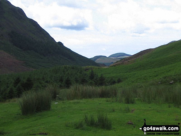
See views like this by using any of these 11 easy-to-follow circular walk route maps:

   |
Vital Statistics:
| Length: | 7.25 miles (11.5 km) |
| Ascent: | 683 ft (208 m) |
| Time: | 3.25 hrs |
| Grade: |  |

Detailed walk route map PDF
complete with GPS Waypoints
Route Summary:
Bowness Knott Car Park - Bowness Plantations - River Liza - Ennerdale Water - Coast To Coast Path - Robin Hood's Chair - Anglers' Crag - Ennerdale Weir - River Ehen - Ennerdale Water - Bowness Knott Car Park


|
Vital Statistics:
| Length: | 5.25 miles (8.5 km) |
| Ascent: | 2,301 ft (701 m) |
| Time: | 4½ hrs |
| Grade: |  |
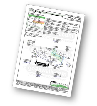
Detailed walk route map PDF
complete with GPS Waypoints
Route Summary:
Black Sail Hut (Youth Hostel) - Ennerdale - Black Sail Beck - Black Sail Pass - Looking Stead (Pillar) - Pillar - Black Sail Pass - Black Sail Beck - Black Sail Hut (Youth Hostel) - Ennerdale.

|
Vital Statistics:
| Length: | 9.75 miles (15.5 km) |
| Ascent: | 2,734 ft (833 m) |
| Time: | 6.25 hrs |
| Grade: |  |

Detailed walk route map PDF
complete with GPS Waypoints
Route Summary:
Buttermere - Buttermere Dubbs - Scale Bridge - Scale Force - Scale Beck - Blea Crag - Lingcomb Edge - Ling Comb - Little Dodd (Ennerdale) - Starling Dodd - Great Borne - Floutern Tarn - Black Beck (Mosedale) - Scale Force - Scale Beck (Crummock Water) - Crummock Water - Buttermere

|
Vital Statistics:
| Length: | 11.25 miles (18 km) |
| Ascent: | 3,275 ft (998 m) |
| Time: | 7½ hrs |
| Grade: |  |

Detailed walk route map PDF
complete with GPS Waypoints
Route Summary:
Bowness Knott Car Park Ennerdale Water - Char Dub - Silver Cove Beck - Woundell Beck - Caw Fell - Little Gowder Crag - Haycock - Great Scoat Fell - Scoat Fell (Little Scoat Fell) - Steeple - Long Crag - Moss Dub - Lingmell Plantation - Bowness Knott Car Park Ennerdale Water.

|
Vital Statistics:
| Length: | 8.5 miles (13.5 km) |
| Ascent: | 4,260 ft (1,298 m) |
| Time: | 7.25 hrs |
| Grade: | |

Detailed walk route map PDF
complete with GPS Waypoints
Route Summary:
Honister Pass - Honister Hause - Green Crag (Buttermere) - Black Beck - Blackbeck Tarn - Innominate Tarn - Hay Stacks (Haystacks) - Scarth Gap - Ennerdale - River Liza - Black Sail Hut (Youth Hostel) - Black Sail Path - Kirk Fell - Kirk Fell (East Top) - Beckhead Tarn - Beck Head - Great Gable - Westmorland Cairn - Windy Gap - Green Gable - Gillercomb Head - Brandreth - Grey Knotts - Honister Hause.

|
Vital Statistics:
| Length: | 11.75 miles (19 km) |
| Ascent: | 2,970 ft (905 m) |
| Time: | 7½ hrs |
| Grade: | |
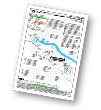
Detailed walk route map PDF
complete with GPS Waypoints
Route Summary:
Ennerdale Weir - Ennerdale Water - Silver Cove Beck - Woundell Beck - Caw Fell - Silver Cove - Iron Crag - Crag Fell - Grike - Ennerdale Weir

|
Vital Statistics:
| Length: | 9.75 miles (15.5 km) |
| Ascent: | 3,157 ft (962 m) |
| Time: | 6½ hrs |
| Grade: | |

Detailed walk route map PDF
complete with GPS Waypoints
Route Summary:
Buttermere - Sourmilk Gill - Bleaberry Tarn - Dodd (Buttermere) - The Saddle - Red Pike (Buttermere) - Ling Comb - Little Dodd (Ennerdale) - Starling Dodd - Great Borne - Floutern Tarn - Black Beck (Mosedale) - Blea Crag - Scale Force - Scale Beck (Crummock Water) - Crummock Water - Buttermere Dubs - Buttermere

|
Vital Statistics:
| Length: | 10.25 miles (16.5 km) |
| Ascent: | 4,611 ft (1,405 m) |
| Time: | 8½ hrs |
| Grade: |  |

Detailed walk route map PDF
complete with GPS Waypoints
Route Summary:
Buttermere - Gatesgarth - Peggy's Bridge - Scarth Gap Pass - Scarth Gap - Black Sail Hut (Youth Hostel) - Black Sail Pass - Looking Stead (Pillar) - High Level Route - Robinson's Cairn - Pillar - Wind Gap - Black Crag (Pillar) - High Beck - Ennerdale - Scarth Gap Pass - Peggy's Bridge - Gatescarth - Buttermere

|
Vital Statistics:
| Length: | 18.75 miles (30 km) |
| Ascent: | 7,309 ft (2,408 m) |
| Time: | 14.75 hrs |
| Grade: |  |

Detailed walk route map PDF
complete with GPS Waypoints
Route Summary:
Bowness Knott Car Park Ennerdale - Low Gillerthwaite Field Centre - High Gillerthwaite Yourth Hostel - Red Pike (Buttermere) - High Stile - High Crag (Buttermere) - Seat (Buttermere) - Scarth Gap - Hay Stacks (Haystacks) - Innominate Tarn - Blackbeck Tarn - Black Beck - Green Crag (Buttermere) - Great Round How - Brandreth - Gillercomb Head - Green Gable - Windy Gap - Great Gable - Westmorland Cairn - Beck Head - Beckhead Tarn - Kirk Fell (East Top) - Kirk Fell - Black Sail Pass - Looking Stead (Pillar) - High Level Route - Robinson's Cairn - Pillar - Wind Gap - Black Crag (Pillar) - High Beck - Low Beck - Ennerdale.

|
Vital Statistics:
| Length: | 15.25 miles (24.5 km) |
| Ascent: | 4,125 ft (1,257 m) |
| Time: | 9.75 hrs |
| Grade: | |

Detailed walk route map PDF
complete with GPS Waypoints
Route Summary:
Ennerdale Weir - Ennerdale Water - Silver Cove Beck - Woundell Beck - Little Gowder Crag - Haycock - Caw Fell - Silver Cove - Iron Crag - Whoap - Lank Rigg - Crag Fell - Grike - Ennerdale Weir

|
Vital Statistics:
| Length: | 16 miles (25.5 km) |
| Ascent: | 6,285 ft (1,915 m) |
| Time: | 12.25 hrs |
| Grade: | |
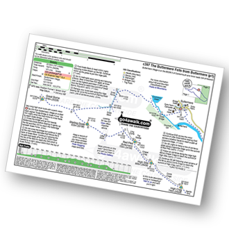
Detailed walk route map PDF
complete with GPS Waypoints
Route Summary:
Buttermere - Scale Force - Scale Beck - Blea Crag - Great Borne - Starling Dodd - Little Dodd (Ennerdale) - Ling Comb - Lingcomb Edge - Red Pike (Buttermere) - Dodd (Buttermere) - Red Pike (Buttermere) - High Stile - High Crag (Buttermere) - Gamlin End - Seat (Buttermere) - Scarth Gap - Hay Stacks (Haystacks) - Innominate Tarn - Blackbeck Tarn - Black Beck - Green Crag (Buttermere) - Warnscale Beck - Dubs Hut - Dubs Quarry - Fleetwith Pike - Honister Crag (Black Star) - Fleetwith Pike - Fleetwith Edge - Gatesgarth - Buttermere
Send us your photographs and pictures of walks and hikes in the British countryside
If you would like to see your digital photographs as part of this collection, please send them as email attachments (configured for any computer) along with your name to:
and we shall do our best to publish them.
(Guide Resolution = 300dpi. At least = 587 pixels (wide) x 440 pixels (high).)

You can also submit photos via our Facebook Page.
NB. Please indicate where each photo was taken.
NB. To see photographs and pictures from a particular walk choose your walk from Walks or use our Walk Search facility.
To see photographs and pictures on, of or from a particular Mountain, Peak, Top or Hill select from Peaks & Mountains' or enter the Mountain, Peak, Top or Hill Name into our 'Photo Search facility.