Twelve easy to follow pub walks from The White Lion, Patterdale, The Lake District, Cumbria, England
To reach The White Lion, Patterdale, in-car SatNav users should select the Latitude/Longitude (Lat Lon) screen and enter:
Lat = N54.53461 and Lon = W 2.9339
Not familiar with this pub?
Twelve easy to follow pub walks from The White Lion, Patterdale, The Lake District, Cumbria, England
Scroll down the list of walks below & click on each walk title (in blue) to locate it on the map above.

   |
Vital Statistics:
| Length: | 6.5 miles (10.5 km) |
| Ascent: | 643ft (196m) |
| Time: | 3 hrs |
| Grade: |  |
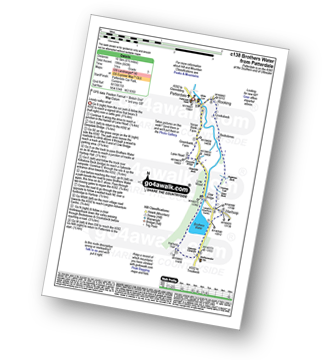
Route Summary:
Patterdale - Noran Bank Farm - Greenbank Farm - Lane Head - Deepdale Bridge - Low Wood - Cow Bridge - Brothers Water - Hartsop Hall - Sykeside - Brothers Water - Hartsop - Eden Beck - Hartsop Fold - Angletarn Beck - Beckstones - Crookabeck - Dubhow - Rooking - Patterdale


|
Vital Statistics:
| Length: | 3 miles (5 km) |
| Ascent: | 922ft (281m) |
| Time: | 2 hrs |
| Grade: | |
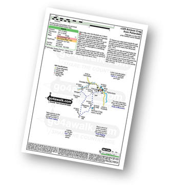

|
Vital Statistics:
| Length: | 3.75 miles (6 km) |
| Ascent: | 1,571ft (479m) |
| Time: | 3 hrs |
| Grade: |  |

Route Summary:
Patterdale - Arnison Crag - Glenamara Park - Birks - Thornhow End - Grisedale Bridge - Patterdale

|
Vital Statistics:
| Length: | 7 miles (11 km) |
| Ascent: | 1,273ft (388m) |
| Time: | 3.75hrs |
| Grade: | |

Route Summary:
Patterdale - Glenamara Park - Braesteads Farm - Elmhow Farm - Grisedale Bridge - Grisedale Beck - Ruthwaite Lodge (Bothy) - Grisedale Beck - Nethermostcove Beck - Grisedale Bridge - Patterdale

|
Vital Statistics:
| Length: | 8.5 miles (13.5 km) |
| Ascent: | 2,552ft (778m) |
| Time: | 6 hrs |
| Grade: |  |
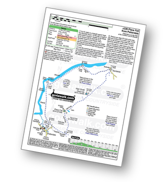
Route Summary:
Patterdale - Rooking - Boredale Hause - Place Fell - High Dodd (Sleet Fell) - Martindale - Sandwick - Long Crag (Ullswater) - Silver Point - Ullswater - Blowick - Rooking - Side Farm - Patterdale

|
Vital Statistics:
| Length: | 9 miles (14.5 km) |
| Ascent: | 2,619ft (798m) |
| Time: | 6 hrs |
| Grade: | |
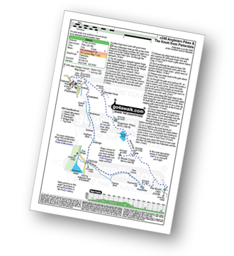
Route Summary:
Patterdale - Side Farm - Boredale Hause - Angletarn Pikes - Angle Tarn (Martindale) - Satura Crag - Brock Crags - Satura Crag - The Knott - Hayeswater Reservoir - Hayeswater Gill - Hartsop - Dubhow - Beckstones - Crookabeck - Rooking - Side Farm - Patterdale

|
Vital Statistics:
| Length: | 8 miles (12.5 km) |
| Ascent: | 2,990ft (911m) |
| Time: | 6 hrs |
| Grade: | |

Route Summary:
Patterdale - Patterdale Church - Grisedale Bridge - Grisedale Beck - Brownend Plantation - Lanty's Tarn - Hole-in-the-Wall - Red Tarn (Helvellyn) - Bleaberry Crag - Low Spying How - High Spying How - Striding Edge (High Spying How) - Helvellyn - Swirral Edge (optional) - Hole-in-the-Wall - Grisedale Beck - Patterdale

|
Vital Statistics:
| Length: | 10 miles (16 km) |
| Ascent: | 3,979ft (1,213m) |
| Time: | 7½ hrs |
| Grade: |  |

Route Summary:
Patterdale - Grisedale Bridge - Ruthwaite Lodge - The Tongue - Dollywaggon Pike - Seat Sandal - Grisedale Tarn - Deepdale Hause - St Sunday Crag - Birks - Patterdale

|
Vital Statistics:
| Length: | 9.75 miles (15.5 km) |
| Ascent: | 3,516ft (1,072m) |
| Time: | 7 hrs |
| Grade: | |

Route Summary:
Patterdale - Arnison Crag - Birks - St Sunday Crag - Deepdale Hause - Cofa Pike - Fairfield - Rydal Head - Hart Crag - Blake Brow - Hartsop Above How - Hoggill Brow - Gale Crag - Bleaberry Knott - Cockley How - Bridgend - Patterdale

|
Vital Statistics:
| Length: | 11.5 miles (18.5 km) |
| Ascent: | 4,582ft (1,396m) |
| Time: | 8.75hrs |
| Grade: |  |

Route Summary:
Patterdale - Grisedale Bridge - Grisedale Beck - Brownends Plantation - Hole-in-the-Wall - Birkhouse Moor - Hole-in-the-Wall - Red Tarn (Helvellyn) - Bleaberry Crag - Low Spying How - High Spying How - Striding Edge (High Spying How) - Helvellyn - Nethermost Pike - High Crag (Helvellyn) - Dollywaggon Pike - Grisedale Tarn - Deepdale Hause - St Sunday Crag - Birks - Patterdale

|
Vital Statistics:
| Length: | 15.5 miles (25 km) |
| Ascent: | 4,293ft (1,308m) |
| Time: | 10 hrs |
| Grade: |  |

Route Summary:
Patterdale - Rooking - Crookabeck - Beckstones - Dubhow - Hartsop - Hayswater Gill - Hayswater - The Knott - Brock Crags - Angle Tarn (Martindale) - Angletarn Pikes - Boredale Hause - Place Fell - High Dodd (Sleet Fell) - Sandwick - Long Crag - Silver Point - Ullswater - Blowick - Rooking - Side Farm - Patterdale

|
Vital Statistics:
| Length: | 13.25 miles (21 km) |
| Ascent: | 5,189ft (1,581m) |
| Time: | 10 hrs |
| Grade: | |

Route Summary:
Patterdale - Grisedale Bridge - Grisedale Beck - Brownend Plantation - Hole-in-the-Wall - Birkhouse Moor - Hole-in-the-Wall - Red Tarn (Helvellyn) - Bleaberry Crag - Low Spying How - High Spying How - Striding Edge (High Spying How) - Helvellyn - Nethermost Pike - High Crag (Helvellyn) - Dollywaggon Pike - Seat Sandal - Grisedale Tarn - St Sunday Crag - Birks - Arnison Crag - Patterdale