All the Mountains, Peaks, Tops and Hills in England, England as a detailed list

England is defined as the whole of the country of England which includes the National Parks of Dartmoor, Exmoor, The Lake District, The Peak District, The North York Moors, Northumberland, The South Downs and The Yorkshire Dales, as well as The Chilterns, The Cotswolds, The Forest of Bowland, The North Peninnes, The Shropshire Hills and The South Peninnes.


If you count only the Deweys there are 180 tops to climb, bag & conquer and the highest point is Sugar Loaf (Horse Head Moor) at 609m (1,999ft).


Wainwright
214/0
Wainwrights
Hewitt
180/0
English
Mountains
Dewey
180/0
English
Deweys
nuttall
254/0
English
Nuttalls
Wainwright Outlying Fell
116/0
Wainwright
Outlying Fells
marilyn
174/0
English
Marilyns
Bridget
534/0
English
Bridgets
Trig Point
487/0
Trig
Points


To see all Mountains, Peaks, Tops and Hills displayed in different ways - see the options in the left-hand column and towards the bottom of this page.


LOG ON and RELOAD this page to show which Mountains, Peaks, Tops and Hills you have already climbed, bagged & conquered [. . . more]


Page 1 of 6    Go to page: 1 2 3 4 5 6


See this list in: Alphabetical Order | Height Order
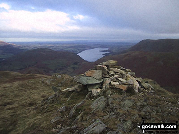
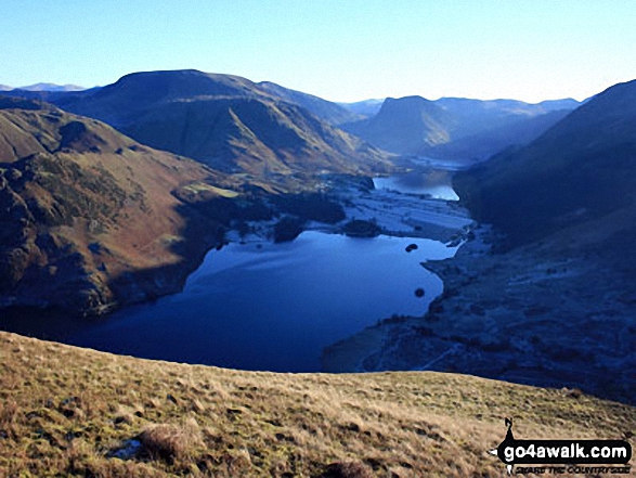
To reverse the order select the link again.


Mountain, Peak, Top or Hill:

Bagged


1. West Nab

500m (1,641ft)

  • Dewey (180th in England, 420th in England & Wales)
  • OS Trig Point

  • To walk, climb & bag West Nab use this easy to follow walk:

    Google Maps Icon
    See the location of West Nab and walks up it on a google Map

    West Nab is on interactive maps:

  • OS Explorer (Orange Covers): OL1
  • OS Landranger (Pink Covers): 110

  • West Nab is on Peak Bagging Map and Hill Tick List:


    2. Cam Rakes (Oughtershaw Moss)

    501m (1,644ft)


    Got a good photo of
    Cam Rakes (Oughtershaw Moss)?

    Send it in and we'll publish it here.

    Photo
    Submission
    Details

  • Dewey (178th in England, 417th in England & Wales)
  • OS Trig Point

  • We hope to have walks that climb & bag Cam Rakes (Oughtershaw Moss) very soon

    Google Maps Icon
    See the location of Cam Rakes (Oughtershaw Moss) and walks up it on a google Map

    Cam Rakes (Oughtershaw Moss) is on interactive maps:

  • OS Explorer (Orange Covers): OL2
  • OS Landranger (Pink Covers): 98

  • Cam Rakes (Oughtershaw Moss) is on Peak Bagging Map and Hill Tick List:


    3. High Dodd (Sleet Fell)

    501m (1,644ft)

  • Dewey (177th in England, 416th in England & Wales)

  • To walk, climb & bag High Dodd (Sleet Fell) use any of these easy to follow walks:

    Google Maps Icon
    See the location of High Dodd (Sleet Fell) and walks up it on a google Map

    High Dodd (Sleet Fell) is on interactive maps:

  • OS Explorer (Orange Covers): OL5
  • OS Landranger (Pink Covers): 90

  • High Dodd (Sleet Fell) is on Peak Bagging Map and Hill Tick List:

    *Version including the walk routes marked on it that you need to follow to Walk all 214 Wainwrights in just 59 walks.


    4. Hungry Law

    501m (1,644ft)


    Got a good photo of
    Hungry Law?

    Send it in and we'll publish it here.

    Photo
    Submission
    Details

  • Dewey (179th in England, 418th in England & Wales)
  • OS Trig Point

  • We hope to have walks that climb & bag Hungry Law very soon

    Google Maps Icon
    See the location of Hungry Law and walks up it on a google Map

    Hungry Law is on interactive maps:

  • OS Explorer (Orange Covers): OL16
  • OS Landranger (Pink Covers): 80

  • A go4awalk.com Peak Bagging Map and Hill Tick List featuring Hungry Law will be available soon.


    5. Shillhope Law

    501m (1,644ft)


    Got a good photo of
    Shillhope Law?

    Send it in and we'll publish it here.

    Photo
    Submission
    Details

  • Dewey (176th in England, 415th in England & Wales)
  • Marilyn (78th in England, 985th in GB)
  • OS Trig Point

  • We hope to have walks that climb & bag Shillhope Law very soon

    Google Maps Icon
    See the location of Shillhope Law and walks up it on a google Map

    Shillhope Law is on interactive maps:

  • OS Explorer (Orange Covers): OL16
  • OS Landranger (Pink Covers): 80

  • A go4awalk.com Peak Bagging Map and Hill Tick List featuring Shillhope Law will be available soon.


    6. Dodd (Skiddaw)

    502m (1,647ft)

  • Wainwright (No. 174)
  • Dewey (175th in England, 408th in England & Wales)

  • To walk, climb & bag Dodd (Skiddaw) use any of these easy to follow walks:

    Google Maps Icon
    See the location of Dodd (Skiddaw) and walks up it on a google Map

    Dodd (Skiddaw) is on interactive maps:

  • OS Explorer (Orange Covers): OL4
  • OS Landranger (Pink Covers): 89 and 90

  • Dodd (Skiddaw) is on Peak Bagging Map and Hill Tick List:

    *Version including the walk routes marked on it that you need to follow to Walk all 214 Wainwrights in just 59 walks.


    7. Combs Head (Combs Moss)

    503m (1,650ft)

  • Dewey (174th in England, 407th in England & Wales)

  • To walk, climb & bag Combs Head (Combs Moss) use this easy to follow walk:

    Google Maps Icon
    See the location of Combs Head (Combs Moss) and walks up it on a google Map

    Combs Head (Combs Moss) is on interactive maps:

  • OS Explorer (Orange Covers): OL24
  • OS Landranger (Pink Covers): 119

  • Combs Head (Combs Moss) is on Peak Bagging Map and Hill Tick List:


    8. Little Mell Fell

    505m (1,657ft)

  • Wainwright (No. 173)
  • Dewey (172nd in England, 398th in England & Wales)
  • Marilyn (77th in England, 980th in GB)
  • OS Trig Point

  • To walk, climb & bag Little Mell Fell use either of these easy to follow walks:

    Google Maps Icon
    See the location of Little Mell Fell and walks up it on a google Map

    Little Mell Fell is on interactive maps:

  • OS Explorer (Orange Covers): OL5
  • OS Landranger (Pink Covers): 90

  • Little Mell Fell is on Peak Bagging Map and Hill Tick List:

    *Version including the walk routes marked on it that you need to follow to Walk all 214 Wainwrights in just 59 walks.


    9. The Roaches

    505m (1,657ft)

  • Dewey (173rd in England, 399th in England & Wales)
  • OS Trig Point

  • To walk, climb & bag The Roaches use any of these easy to follow walks:

    Google Maps Icon
    See the location of The Roaches and walks up it on a google Map

    The Roaches is on interactive maps:

  • OS Explorer (Orange Covers): OL24
  • OS Landranger (Pink Covers): 119

  • The Roaches is on Peak Bagging Map and Hill Tick List:


    10. Shutlingsloe

    506m (1,660ft)

  • Dewey (170th in England, 394th in England & Wales)
  • OS Trig Point

  • To walk, climb & bag Shutlingsloe use either of these easy to follow walks:

    Google Maps Icon
    See the location of Shutlingsloe and walks up it on a google Map

    Shutlingsloe is on interactive maps:

  • OS Explorer (Orange Covers): OL24
  • OS Landranger (Pink Covers): 118

  • Shutlingsloe is on Peak Bagging Map and Hill Tick List:


    11. White Ridge

    506m (1,660ft)


    Got a good photo of
    White Ridge?

    Send it in and we'll publish it here.

    Photo
    Submission
    Details

  • Dewey (171st in England, 395th in England & Wales)

  • We hope to have walks that climb & bag White Ridge very soon

    Google Maps Icon
    See the location of White Ridge and walks up it on a google Map

    White Ridge is on interactive maps:

  • OS Explorer (Orange Covers): OL28
  • OS Landranger (Pink Covers): 191

  • White Ridge is on Peak Bagging Map and Hill Tick List:


    12. Black Edge (Combs Moss)

    507m (1,663ft)

  • Dewey (169th in England, 391st in England & Wales)
  • OS Trig Point

  • To walk, climb & bag Black Edge (Combs Moss) use this easy to follow walk:

    Google Maps Icon
    See the location of Black Edge (Combs Moss) and walks up it on a google Map

    Black Edge (Combs Moss) is on interactive maps:

  • OS Explorer (Orange Covers): OL24
  • OS Landranger (Pink Covers): 119

  • Black Edge (Combs Moss) is on Peak Bagging Map and Hill Tick List:


    13. Cracoe Fell

    507m (1,663ft)

  • Dewey (168th in England, 390th in England & Wales)
  • Marilyn (76th in England, 977th in GB)
  • OS Trig Point

  • To walk, climb & bag Cracoe Fell use this easy to follow walk:

    Google Maps Icon
    See the location of Cracoe Fell and walks up it on a google Map

    Cracoe Fell is on interactive maps:

  • OS Explorer (Orange Covers): OL2
  • OS Landranger (Pink Covers): 103

  • Cracoe Fell is on Peak Bagging Map and Hill Tick List:


    14. Birnie Brae

    508m (1,667ft)


    Got a good photo of
    Birnie Brae?

    Send it in and we'll publish it here.

    Photo
    Submission
    Details

  • Dewey (166th in England, 385th in England & Wales)

  • To walk, climb & bag Birnie Brae use either of these easy to follow walks:

    Google Maps Icon
    See the location of Birnie Brae and walks up it on a google Map

    Birnie Brae is on interactive maps:

  • OS Explorer (Orange Covers): OL16
  • OS Landranger (Pink Covers): 74 and 75

  • A go4awalk.com Peak Bagging Map and Hill Tick List featuring Birnie Brae will be available soon.


    15. Brown Clee Hill (Clee Burf)

    508m (1,667ft)

  • Dewey (165th in England, 381st in England & Wales)

  • To walk, climb & bag Brown Clee Hill (Clee Burf) use this easy to follow walk:

    Google Maps Icon
    See the location of Brown Clee Hill (Clee Burf) and walks up it on a google Map

    Brown Clee Hill (Clee Burf) is on interactive maps:

  • OS Explorer (Orange Covers): 217
  • OS Landranger (Pink Covers): 137

  • Brown Clee Hill (Clee Burf) is on Peak Bagging Map and Hill Tick List:


    16. Brownhart Law

    508m (1,667ft)


    Got a good photo of
    Brownhart Law?

    Send it in and we'll publish it here.

    Photo
    Submission
    Details

  • Dewey (167th in England, 386th in England & Wales)

  • We hope to have walks that climb & bag Brownhart Law very soon

    Google Maps Icon
    See the location of Brownhart Law and walks up it on a google Map

    Brownhart Law is on interactive maps:

  • OS Explorer (Orange Covers): OL16
  • OS Landranger (Pink Covers): 80

  • A go4awalk.com Peak Bagging Map and Hill Tick List featuring Brownhart Law will be available soon.


    17. Hen Comb

    509m (1,670ft)

  • Wainwright (No. 171)
  • Dewey (163rd in England, 374th in England & Wales)

  • To walk, climb & bag Hen Comb use any of these easy to follow walks:

    Google Maps Icon
    See the location of Hen Comb and walks up it on a google Map

    Hen Comb is on interactive maps:

  • OS Explorer (Orange Covers): OL4
  • OS Landranger (Pink Covers): 89

  • Hen Comb is on Peak Bagging Map and Hill Tick List:

    *Version including the walk routes marked on it that you need to follow to Walk all 214 Wainwrights in just 59 walks.


    18. Lowthwaite Fell

    509m (1,670ft)


    Got a good photo of
    Lowthwaite Fell?

    Send it in and we'll publish it here.

    Photo
    Submission
    Details

  • Dewey (164th in England, 376th in England & Wales)

  • To walk, climb & bag Lowthwaite Fell use this easy to follow walk:

    Google Maps Icon
    See the location of Lowthwaite Fell and walks up it on a google Map

    Lowthwaite Fell is on interactive maps:

  • OS Explorer (Orange Covers): OL5
  • OS Landranger (Pink Covers): 90 and 90

  • Lowthwaite Fell is on Peak Bagging Map and Hill Tick List:

    *Version including the walk routes marked on it that you need to follow to Walk all 214 Wainwrights in just 59 walks.


    19. Beda Head (Beda Fell)

    509m (1,671ft)

  • Wainwright (No. 170)
  • Dewey (161st in England, 371st in England & Wales)

  • To walk, climb & bag Beda Head (Beda Fell) use either of these easy to follow walks:

    Google Maps Icon
    See the location of Beda Head (Beda Fell) and walks up it on a google Map

    Beda Head (Beda Fell) is on interactive maps:

  • OS Explorer (Orange Covers): OL5
  • OS Landranger (Pink Covers): 90

  • Beda Head (Beda Fell) is on Peak Bagging Map and Hill Tick List:

    *Version including the walk routes marked on it that you need to follow to Walk all 214 Wainwrights in just 59 walks.


    20. Mellbreak (North Top)

    509m (1,671ft)

  • Dewey (162nd in England, 373rd in England & Wales)
  • OS Trig Point

  • To walk, climb & bag Mellbreak (North Top) use any of these easy to follow walks:

    Google Maps Icon
    See the location of Mellbreak (North Top) and walks up it on a google Map

    Mellbreak (North Top) is on interactive maps:

  • OS Explorer (Orange Covers): OL4
  • OS Landranger (Pink Covers): 89

  • Mellbreak (North Top) is on Peak Bagging Map and Hill Tick List:

    *Version including the walk routes marked on it that you need to follow to Walk all 214 Wainwrights in just 59 walks.


    21. Lint Lands

    510m (1,673ft)


    Got a good photo of
    Lint Lands?

    Send it in and we'll publish it here.

    Photo
    Submission
    Details

  • Dewey (160th in England, 369th in England & Wales)

  • We hope to have walks that climb & bag Lint Lands very soon

    Google Maps Icon
    See the location of Lint Lands and walks up it on a google Map

    Lint Lands is on interactive maps:

  • OS Explorer (Orange Covers): OL16
  • OS Landranger (Pink Covers): 80

  • A go4awalk.com Peak Bagging Map and Hill Tick List featuring Lint Lands will be available soon.


    22. Blaydike Moss

    510m (1,674ft)

  • Dewey (159th in England, 367th in England & Wales)

  • We hope to have walks that climb & bag Blaydike Moss very soon

    Google Maps Icon
    See the location of Blaydike Moss and walks up it on a google Map

    Blaydike Moss is on interactive maps:

  • OS Explorer (Orange Covers): OL2 and OL30
  • OS Landranger (Pink Covers): 98

  • Blaydike Moss is on Peak Bagging Map and Hill Tick List:


    23. Park Fell (Gilderdale Forest)

    511m (1,677ft)


    Got a good photo of
    Park Fell (Gilderdale Forest)?

    Send it in and we'll publish it here.

    Photo
    Submission
    Details

  • Dewey (158th in England, 364th in England & Wales)
  • OS Trig Point

  • We hope to have walks that climb & bag Park Fell (Gilderdale Forest) very soon

    Google Maps Icon
    See the location of Park Fell (Gilderdale Forest) and walks up it on a google Map

    Park Fell (Gilderdale Forest) is on interactive maps:

  • OS Explorer (Orange Covers): OL31
  • OS Landranger (Pink Covers): 86 and 87

  • Park Fell (Gilderdale Forest) is on Peak Bagging Map and Hill Tick List:


    24. Beardown Tors

    512m (1,680ft)


    Got a good photo of
    Beardown Tors?

    Send it in and we'll publish it here.

    Photo
    Submission
    Details

  • Dewey (157th in England, 360th in England & Wales)

  • To walk, climb & bag Beardown Tors use this easy to follow walk:

    Google Maps Icon
    See the location of Beardown Tors and walks up it on a google Map

    Beardown Tors is on interactive maps:

  • OS Explorer (Orange Covers): OL28
  • OS Landranger (Pink Covers): 191

  • Beardown Tors is on Peak Bagging Map and Hill Tick List:


    25. Mellbreak

    512m (1,680ft)

  • Wainwright (No. 168)
  • Dewey (156th in England, 358th in England & Wales)
  • Marilyn (75th in England, 962nd in GB)

  • To walk, climb & bag Mellbreak use any of these easy to follow walks:

    Google Maps Icon
    See the location of Mellbreak and walks up it on a google Map

    Mellbreak is on interactive maps:

  • OS Explorer (Orange Covers): OL4
  • OS Landranger (Pink Covers): 89

  • Mellbreak is on Peak Bagging Map and Hill Tick List:

    *Version including the walk routes marked on it that you need to follow to Walk all 214 Wainwrights in just 59 walks.


    26. Monkside

    513m (1,683ft)


    Got a good photo of
    Monkside?

    Send it in and we'll publish it here.

    Photo
    Submission
    Details

  • Dewey (155th in England, 356th in England & Wales)
  • OS Trig Point

  • We hope to have walks that climb & bag Monkside very soon

    Google Maps Icon
    See the location of Monkside and walks up it on a google Map

    Monkside is on interactive maps:

  • OS Explorer (Orange Covers): OL42
  • OS Landranger (Pink Covers): 80

  • A go4awalk.com Peak Bagging Map and Hill Tick List featuring Monkside will be available soon.


    27. Oliver Hill

    513m (1,684ft)

  • Dewey (154th in England, 354th in England & Wales)

  • To walk, climb & bag Oliver Hill use any of these easy to follow walks:

    Google Maps Icon
    See the location of Oliver Hill and walks up it on a google Map

    Oliver Hill is on interactive maps:

  • OS Explorer (Orange Covers): OL24
  • OS Landranger (Pink Covers): 119

  • Oliver Hill is on Peak Bagging Map and Hill Tick List:


    28. Glendhu Hill

    514m (1,686ft)


    Got a good photo of
    Glendhu Hill?

    Send it in and we'll publish it here.

    Photo
    Submission
    Details

  • Dewey (153rd in England, 352nd in England & Wales)
  • OS Trig Point

  • We hope to have walks that climb & bag Glendhu Hill very soon

    Google Maps Icon
    See the location of Glendhu Hill and walks up it on a google Map

    Glendhu Hill is on interactive maps:

  • OS Explorer (Orange Covers): OL42 and 324
  • OS Landranger (Pink Covers): 80

  • A go4awalk.com Peak Bagging Map and Hill Tick List featuring Glendhu Hill will be available soon.


    29. Great Knipe

    515m (1,690ft)


    Got a good photo of
    Great Knipe?

    Send it in and we'll publish it here.

    Photo
    Submission
    Details

  • Dewey (151st in England, 347th in England & Wales)
  • OS Trig Point

  • We hope to have walks that climb & bag Great Knipe very soon

    Google Maps Icon
    See the location of Great Knipe and walks up it on a google Map

    Great Knipe is on interactive maps:

  • OS Explorer (Orange Covers): OL19
  • OS Landranger (Pink Covers): 91 and 92

  • Great Knipe is on Peak Bagging Map and Hill Tick List:


    30. Ryder's Hill

    515m (1,690ft)


    Got a good photo of
    Ryder's Hill?

    Send it in and we'll publish it here.

    Photo
    Submission
    Details

  • Dewey (152nd in England, 348th in England & Wales)
  • OS Trig Point

  • We hope to have walks that climb & bag Ryder's Hill very soon

    Google Maps Icon
    See the location of Ryder's Hill and walks up it on a google Map

    Ryder's Hill is on interactive maps:

  • OS Explorer (Orange Covers): OL28
  • OS Landranger (Pink Covers): 191

  • Ryder's Hill is on Peak Bagging Map and Hill Tick List:


    Page 1 of 6    Go to page: 1 2 3 4 5 6


    View all 1233 Mountains, Peaks, Tops and Hills in EnglandThe Peak District:


    Is there a Mountain, Peak, Top or Hill missing from the above google map or list?

    Let us know an we will add it to our database.


    Follow go4awalk.com on Twitter Follow go4awalk.com on Facebook


    Home


    Find new Friends to go walking with

    Walk all 214 Wainwrights in just 59 Walks. Download GPS Waypoints - Great Walks you must not miss!

    Walk The Yorkshire Three Peaks Challenge Walk - All the Latest Route Information, GPS Waypoints and Split Times to keep you on Schedule

    Walk The British Three Peaks Challenge Walk - All the Latest Route Information and GPS Waypoints

    See our pick of The Best Walks in The Lake District - Great Walks you must not miss!

    Walk our pick of the Best Lake District Ridge Walks - Great Walks you must not miss!

    Walk our pick of the Best Lake District Walks to do in the rain - Great Walks you must not miss!

    Walk our pick of The Best Walks in Snowdonia - Great Walks you must not miss!

    Walk our pick of The Best Ridge Walks in Wales - Walks you must not miss!

    Walk our pick of The Best Walks in The Brecon Beacons - Great Walks you must not miss!

    Walk our pick of The Best Walks in The Yorkshire Dales - Walks you must not miss!

    Walk our pick of The Best Walks in The Peak District - Walks you must not miss!

    Walk our pick of The Best Walks in The Forest of Bowland - Walks you must not miss!

    Walk our pick of The Best Walks in Shropshire - Walks you must not miss!

    Walk our pick of The Best Walks in Cheshire - Walks you must not miss!

    Walk our pick of The Best Walks in Lancashire - Walks you must not miss!

    Not sure where to walk next? Try Peak Bagging - Great Walks you must not miss!

    Not sure where to walk next? Walk part of a National Trail - Great Walks you must not miss!

    Walks with Downloadable and Uploadable GPS Waypoint Data

    Walking Kit and Gear Tested by Walkers

    Full Site Search